geo.wikisort.org - Mountains
The following sortable table comprises the 401 mountain peaks of greater North America[1] with at least 3000 meters (9843 feet) of elevation and at least 500 meters (1640 feet) of topographic prominence.[2]
The summit of a mountain or hill may be measured in three principal ways:
- The topographic elevation of a summit measures the height of the summit above a geodetic sea level.[3][4]
- The topographic prominence of a summit is a measure of how high the summit rises above its surroundings.[5][4]
- The topographic isolation (or radius of dominance) of a summit measures how far the summit lies from its nearest point of equal elevation.[6]
In greater North America, only Denali exceeds 6000 meters (19,685 feet) elevation. Three major summits exceed 5500 meters (18,045 feet), 11 exceed 5000 meters (16,404 feet), 21 exceed 4500 meters (14,764 feet), 124 exceed 4000 meters (13,123 feet), 277 exceed 3500 meters (11,483 feet), and the following 401 major summits exceed 3000 meters (9843 feet) elevation.
Major 3000-meter summits
Of the 401 major 3000-meter summits of greater North America, 299 are located in the United States (excluding three in Hawaiʻi), 67 in Canada, 28 in México, and eight in Guatemala, four in Greenland, two in Costa Rica, and one each in Panamá and the Dominican Republic. Eight of these peaks lie on the Canada-United States border and one lies on the México-Guatemala border. Additional references and maps for the 200 highest of these major summits can be found on the List of the highest major summits of North America.
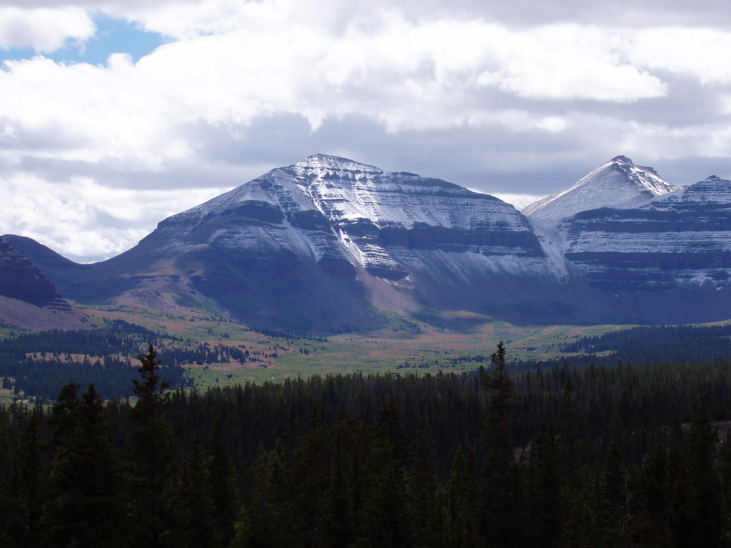
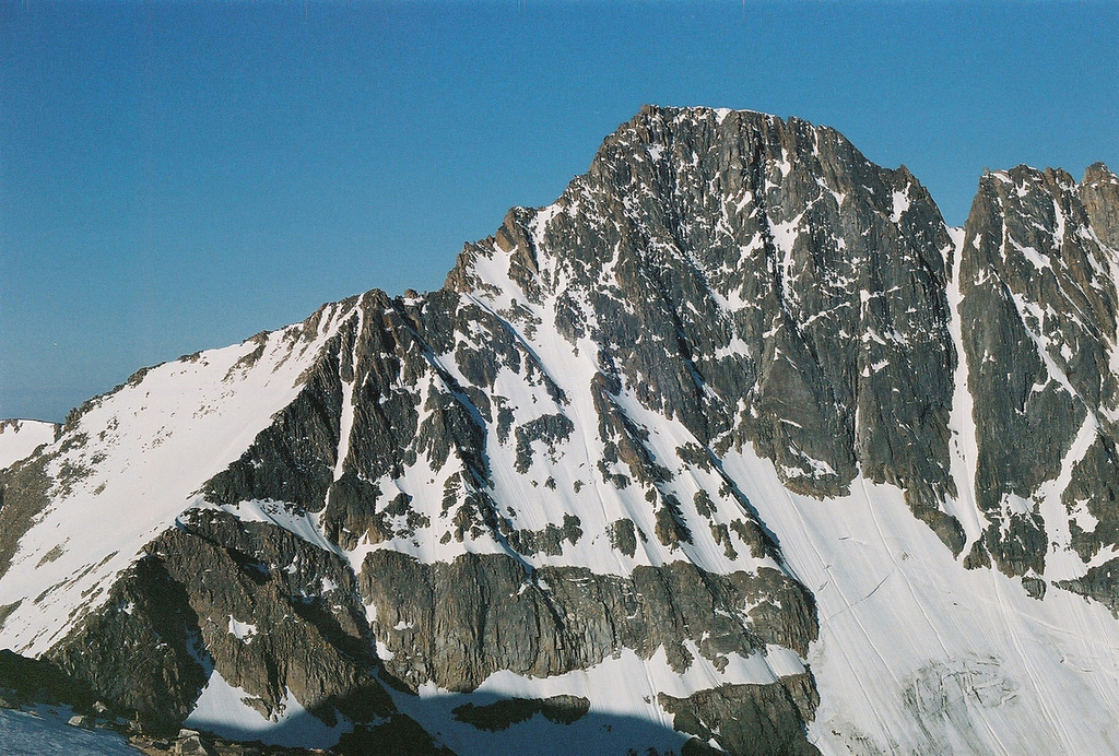
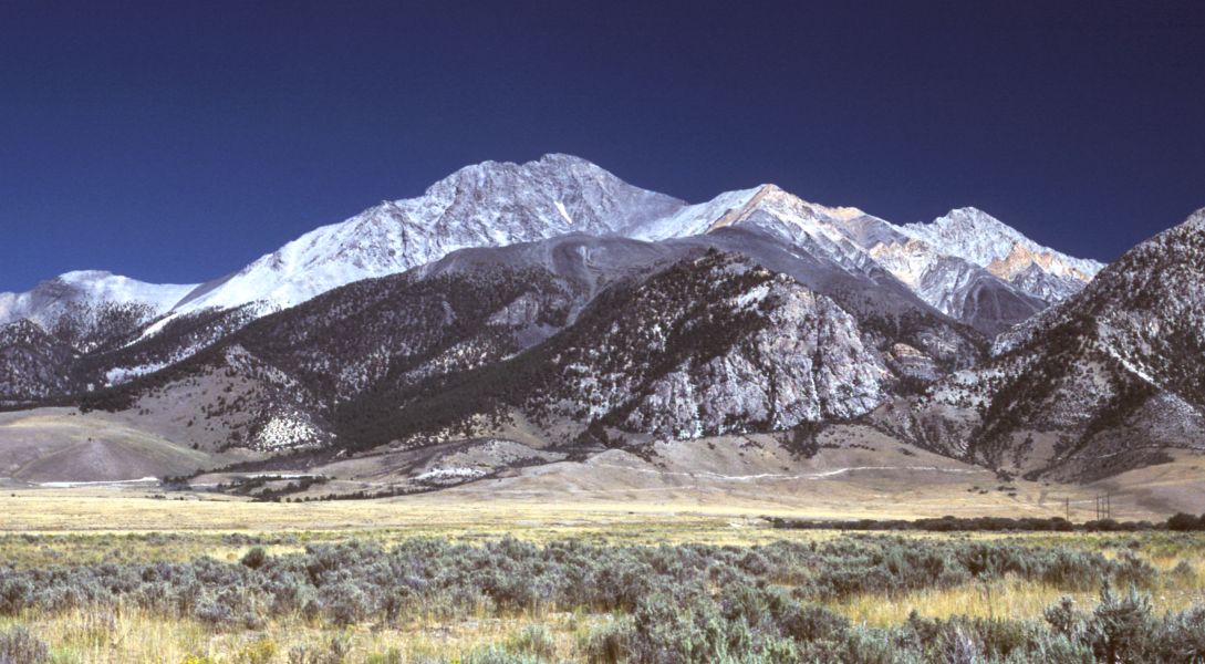
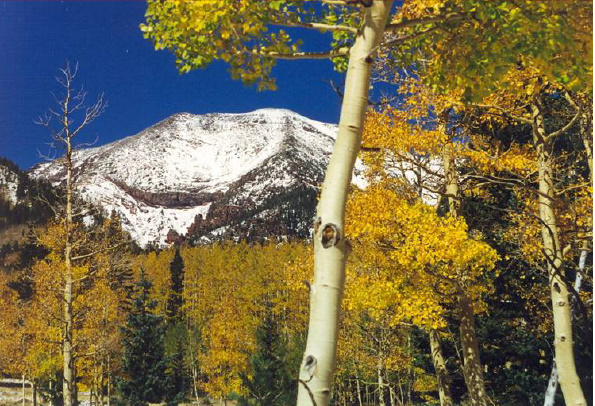
Gallery

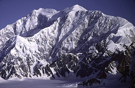 2. Mount Logan in Yukon is the highest summit of Canada.
 3. Pico de Orizaba is the highest summit of México.
 4. Mount Saint Elias is the second highest summit of both Canada and the United States.
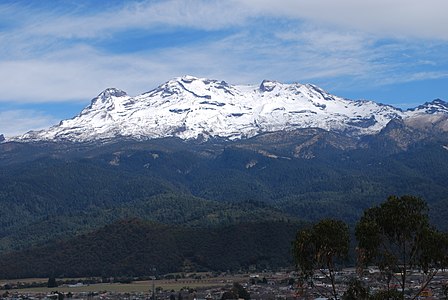
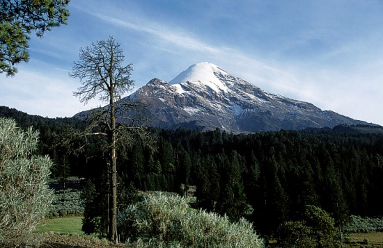
 5. Popocatépetl is the second highest summit of México.
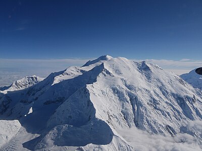 6. Mount Foraker is the second highest major summit of the Alaska Range.
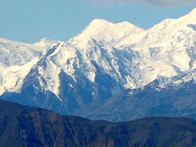
 8. Iztaccihuatl is the third highest summit of México.
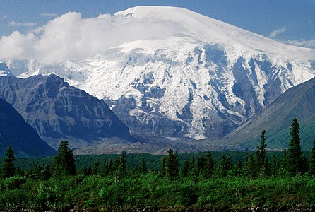
 10. Mount Bona in Alaska is the highest volcano in the United States.
 11. Mount Steele in Yukon is the fifth highest summit of Canada.
 13. Mount Sanford in Alaska is the third highest volcano in the United States.
 17. Nevado de Toluca is the fourth highest summit of México.
 24. Mount Whitney highest summit of the Sierra Nevada and California.

 39. Grays Peak in Colorado is the highest point on the Continental Divide in North America.
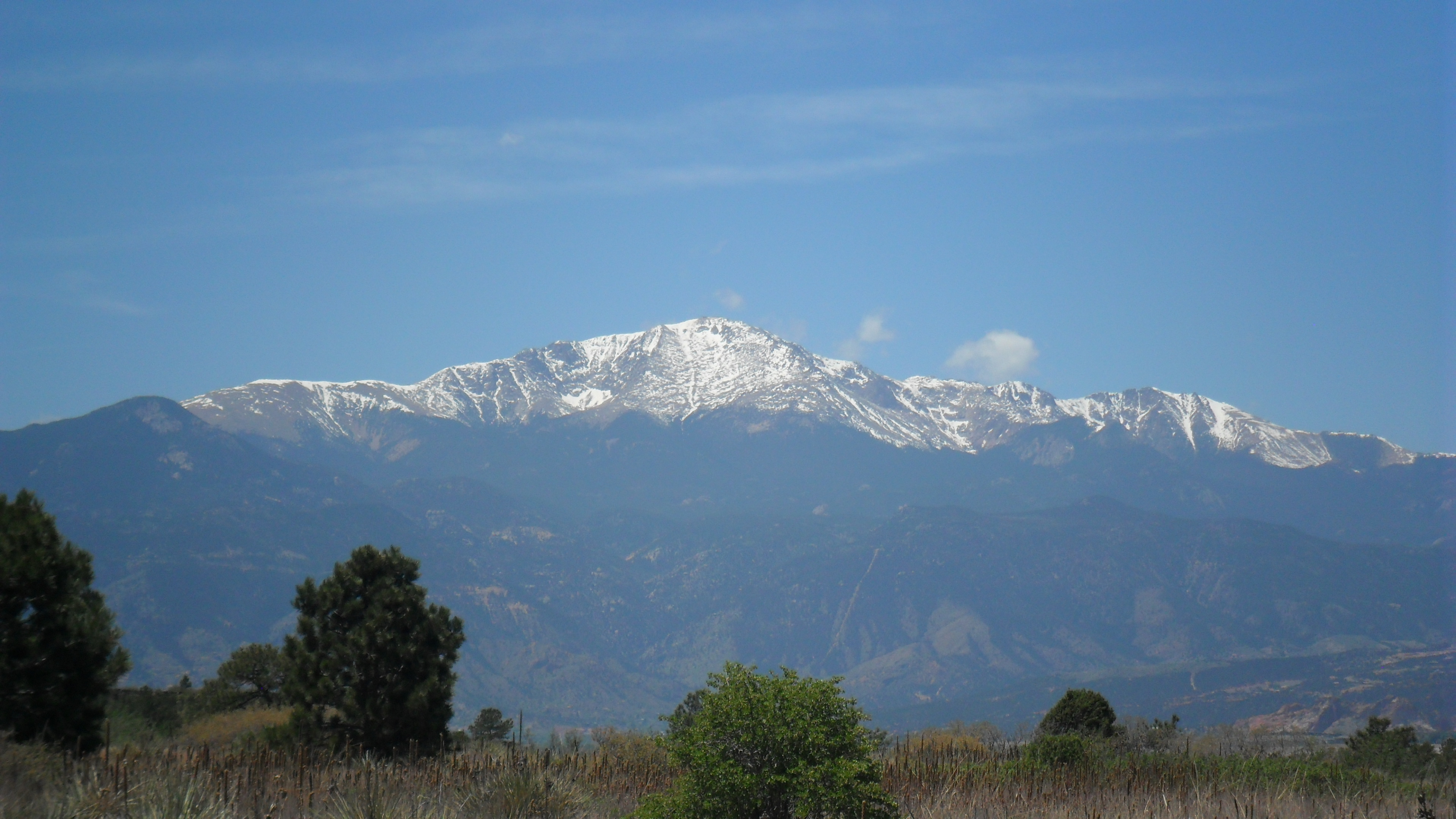
 53. Pikes Peak in Colorado was the inspiration for America the Beautiful.
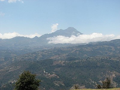 69. Volcán Tajumulco is the highest summit in Guatemala and all of Central America.
 72. Mount Hayes is the highest summit of the eastern Alaska Range.

 93. Kings Peak is the highest summit of the Uinta Range and Utah.
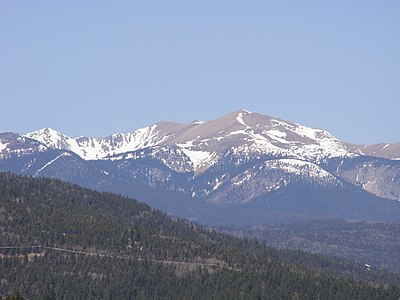 118. Wheeler Peak is the highest summit of New Mexico.
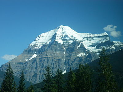
 143. Granite Peak is the highest summit of the Beartooth Range and Montana.
 155. Humphreys Peak is the highest summit of the San Francisco Peaks and Arizona.
 171. Chirripó Grande is the highest summit of Costa Rica.
 218. Gunnbjørn Fjeld is the highest summit of Greenland and all of the Arctic.
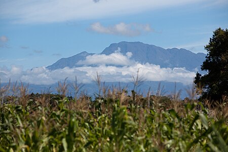 287. Volcán Barú is the highest summit of Panamá.
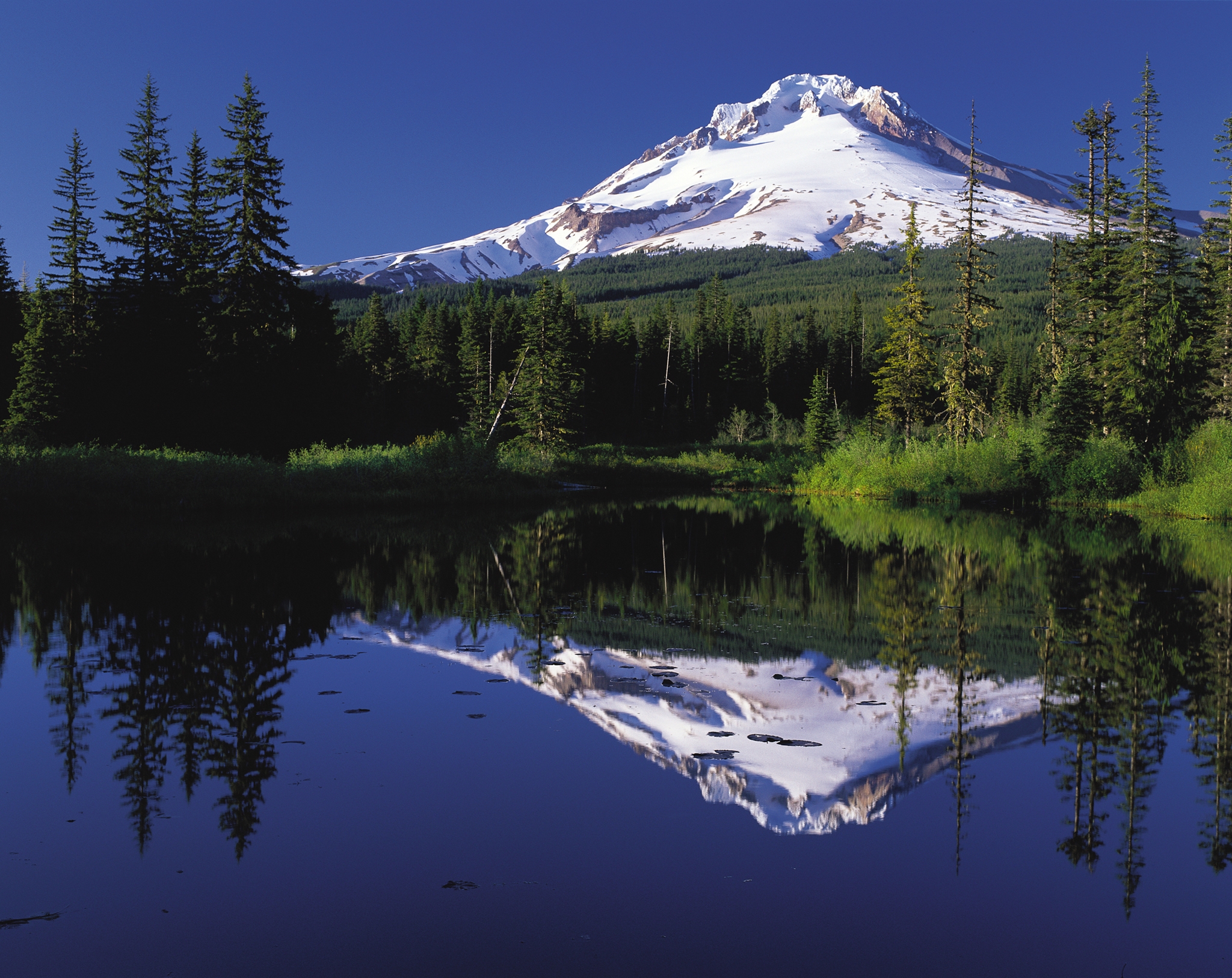
 302. Mount Hood is the highest summit of Oregon.
 377. Redoubt Volcano is the highest summit of the Aleutian Range.
 379. Pico Duarte in the Dominican Republic on Hispaniola is the highest summit in the Caribbean.


See also
- North America
- Geography of North America
- Geology of North America
- Lists of mountain peaks of North America
- List of mountain peaks of North America
- List of the highest major summits of North America
- List of the most prominent summits of North America
- List of the ultra-prominent summits of North America
- List of the most isolated major summits of North America
- List of extreme summits of North America
- List of mountain peaks of Greenland
- List of mountain peaks of Canada
- List of mountain peaks of the Rocky Mountains
- List of mountain peaks of the United States
- List of mountain peaks of México
- List of mountain peaks of Central America
- List of mountain peaks of the Caribbean
- Category:Mountains of North America
- List of mountain peaks of North America
- Physical geography
- Topography
- Topographic elevation
- Topographic prominence
- Topographic isolation
- Topography
Notes
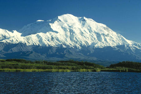
- The summit of Denali is the highest point of the Alaska Range, the State of Alaska, the United States of America, and greater North America. Denali is the third most topographically prominent and third most topographically isolated summit on Earth after Mount Everest and Aconcagua.
- The summit of Mount Logan is the highest point of the Saint Elias Mountains, Yukon, and all of Canada.
- The summit of Pico de Orizaba is the highest point of Estado Libre y Soberano de Puebla, Estado Libre y Soberano de Veracruz de Ignacio de la Llave, and all of México.
- Mount Saint Elias is the second highest major summit of both Canada and the United States.
- Popocatépetl on the border of Puebla is the highest point of both Estado Libre y Soberano de México and Estado Libre y Soberano de Morelos.
- Popocatépetl is the southernmost 5000-meter (16,404-foot) summit of México and greater North America.
- Mount Foraker is the westernmost 5000-meter (16,404-foot) summit of Alaska, the United States, and greater North America.
- The summit of Mount Lucania is the highest point of the northern Saint Elias Mountains.
- Mount Lucania is the northernmost summit of its elevation in Canada.
- Iztaccíhuatl is the northernmost and westernmost 5000-meter (16,404-foot) summit of México.
- The summit of Mount Bona is the highest point of the northwest Saint Elias Mountains. Some maps show an elevation of 16,421 feet (5,005 m),[7] and others indicate 16,550±50 feet (5045±15 meters).[8] Mount Bona may or may not be higher than Mount Steele, whose exact elevation is also uncertain.
- Mount Steele is the northernmost and easternmost 5000-meter (16,404-foot) summit of Canada. Older maps show an elevation of 5,073 metres (16,644 ft),[9] but more recent maps indicate 5,020±20 metres (about 16,470±60 ft).[10] Mount Steele may or may not be higher than Mount Bona, whose exact elevation is also uncertain.
- The summit of Mount Blackburn is the highest point of the Wrangell Mountains.
- Mount Wood is the northernmost summit of its elevation in Canada.
- Mount Vancouver is the easternmost summit of its elevation in Canada.
- Nevado de Toluca is the westernmost summit of its elevation in México.
- Mount Fairweather lies on the international border between Alaska and British Columbia. The peak is the highest point of the Canadian Province of British Columbia and the southernmost and easternmost summit of its elevation in both Canada and the United States.
- Malinche (volcano) on the border of Puebla is the highest point of Estado Libre y Soberano de Tlaxcala.
- La Malinche is the northernmost summit of its elevation in México.
- The summit of Mount Whitney is the highest point of the Sierra Nevada, the State of California, and the contiguous United States.
- Mount Whitney is the southernmost and easternmost summit of its elevation in United States.
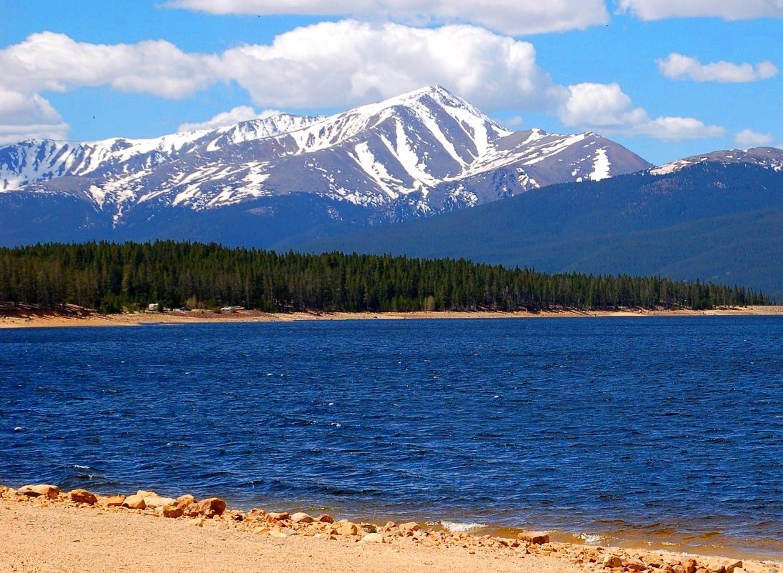
- The summit of Mount Elbert is the highest point of the U.S. State of Colorado, the Rocky Mountains of North America, and the entire Mississippi River drainage basin.
- Mount Massive is the second highest major summit of the Rocky Mountains.
- The elevation of Mount Massive includes an adjustment of +2.087 m (6.85 ft) from NGVD 29 to NAVD 88.
- The summit of Mount Harvard is the highest point of the Collegiate Peaks.
- Mount Harvard is the southernmost and easternmost summit of its elevation in the Rocky Mountains.
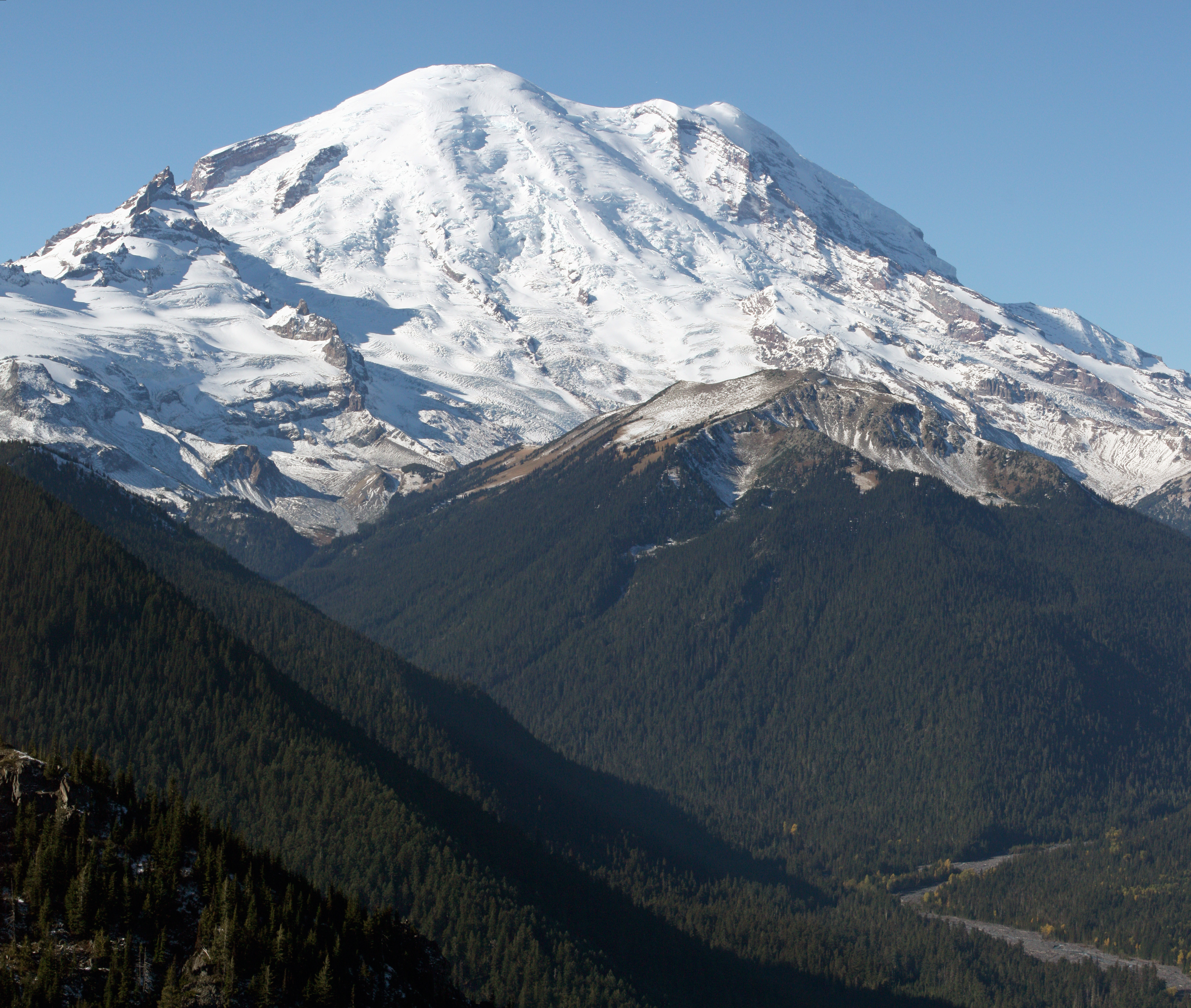
- The summit of Mount Rainier is the highest point of the Cascade Range and the U.S. State of Washington. Mount Rainier is the most prominent summit in the contiguous United States and the fourth most prominent in North America.
- The elevation of Mount Rainier includes an adjustment of +1.914 m (6.28 ft) from NGVD 29 to NAVD 88.
- The elevation of Mount Williamson includes an adjustment of +1.807 m (5.93 ft) from NGVD 29 to NAVD 88.
- The summit of Blanca Peak is the highest point of the Sangre de Cristo Mountains and the entire Rio Grande drainage basin.
- Blanca Peak is the southernmost ultra-prominent summit of the Rocky Mountains.
- The elevation of Blanca Peak includes an adjustment of +1.755 m (5.76 ft) from NGVD 29 to NAVD 88.
- The elevation of La Plata Peak includes an adjustment of +1.983 m (6.51 ft) from NGVD 29 to NAVD 88.
- The summit of Uncompahgre Peak is the highest point of the San Juan Mountains and the entire Gulf of California drainage basin.
- Uncompahgre Peak is the westernmost summit of its elevation in the Rocky Mountains.
- The summit of Crestone Peak is the highest point of the Crestones.
- The elevation of Crestone Peak includes an adjustment of +1.76 m (5.77 ft) from NGVD 29 to NAVD 88.
- The summit of Mount Lincoln is the highest point of the Mosquito Range and the entire Missouri River drainage basin.
- Mount Lincoln is the northernmost summit of its elevation in the Rocky Mountains.
- The summit of Castle Peak is the highest point of the Elk Mountains.
- The summit of Grays Peak is the highest point of the Front Range and the Continental Divide in North America.
- Grays Peak is the northernmost summit of its elevation in the Rocky Mountains.
- The summit of Mount Antero is the highest point of the southern Sawatch Range.
- The summit elevation of Mount Evans includes a vertical offset of +1.798 m (5.9 ft) from the station benchmark.
- The summit of Longs Peak is the highest point of the northern Front Range.
- Longs Peak is the northernmost 14,000-foot (4267-meter) summit of the Rocky Mountains.
- The summit of Mount Wilson is the highest point of the San Miguel Mountains.
- Mount Wilson is the westernmost summit of its elevation in the Rocky Mountains.
- The elevation of Mount Wilson includes an adjustment of +1.899 m (6.23 ft) from NGVD 29 to NAVD 88.
- The summit of White Mountain Peak is the highest point of the White Mountains.
- The summit of North Palisade is the highest point of the Palisades.
- The elevation of North Palisade includes an adjustment of +1.867 m (6.13 ft) from NGVD 29 to NAVD 88.
- The summit of Mount Shasta is the highest point of the southern Cascade Range.
- The summit of Mount Sneffels is the highest point of the Sneffels Range.
- The elevation of Capitol Peak includes an adjustment of +1.991 m (6.53 ft) from NGVD 29 to NAVD 88.
- Pikes Peak is the easternmost 14,000-foot (4267-meter) summit and ultra-prominent summit of the Rocky Mountains. Pikes Peak was the inspiration for the lyrics of America the Beautiful.
- The summit of Windom Peak is the highest point of the Needle Mountains.
- Mount Eolus may be higher than Windom Peak.
- The elevation of Windom Peak includes an adjustment of +1.785 m (5.86 ft) from NGVD 29 to NAVD 88.
- The summit of Culebra Peak is the highest point of the Culebra Range.
- Culebra Peak is the southernmost 14,000-foot (4267-meter) summit of the Rocky Mountains.
- The elevation of Culebra Peak includes an adjustment of +1.74 m (5.71 ft) from NGVD 29 to NAVD 88.
- The summit of San Luis Peak is the highest point of the La Garita Mountains.
- The summit of Mount of the Holy Cross is the highest point of the northern Sawatch Range.
- The summit elevation of Mount of the Holy Cross includes a vertical offset of +0.61 m (2 ft) from the station benchmark.
- The summit of Nevado de Colima is the highest point of Estado Libre y Soberano de Jalisco.
- Nevado de Colima is the northernmost and westernmost 4000-meter (13,123-foot) summit of México.
- The elevation of Mount Humphreys includes an adjustment of +1.842 m (6.04 ft) from NGVD 29 to NAVD 88.
- The elevation of Mount Keith includes an adjustment of +1.795 m (5.89 ft) from NGVD 29 to NAVD 88.
- Mount Strickland is the northernmost summit of its elevation in Canada.
- The summit of Mount Ouray is the highest point of the far southern Sawatch Range.
- The elevation of Vermilion Peak includes an adjustment of +1.827 m (5.99 ft) from NGVD 29 to NAVD 88.
- Avalanche Peak is the northernmost summit of its elevation in Canada.
- The summit of Volcán Tajumulco is the highest point of the Sierra de las Nubes, San Marcos, and all of Republic of Guatemala.
- Volcán Tajumulco is the southernmost and easternmost 4000-meter (13,123-foot) summit of greater North America.
- The elevation of Mount Darwin includes an adjustment of +1.886 m (6.19 ft) from NGVD 29 to NAVD 88.
- The summit of Mount Hayes is the highest point of the Hayes Range.
- Mount Hayes is the northernmost 4000-meter (13,123-foot) summit of Alaska, the United States, and greater North America.
- Cofre de Perote is the easternmost summit of its elevation in México.
- The summit of Gannett Peak is the highest point of the Wind River Range, the U.S. State of Wyoming, and the central Rocky Mountains.
- Gannett Peak is the northernmost and westernmost summit of its elevation in the Rocky Mountains.
- The summit of Mount Kaweah is the highest point of the Great Western Divide.
- Mount Kaweah is the southernmost summit of its elevation in United States.
- The elevation of Mount Kaweah includes an adjustment of +1.652 m (5.42 ft) from NGVD 29 to NAVD 88.
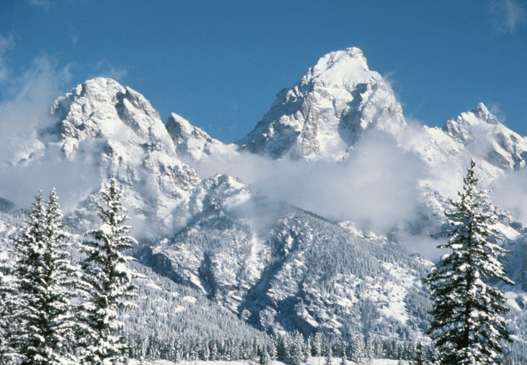
- The summit of Grand Teton is the highest point of the Teton Range.
- Grand Teton is the northernmost and westernmost 4000-meter (13,123-foot) summit of the Rocky Mountains.
- The elevation of Mount Gabb includes an adjustment of +1.958 m (6.42 ft) from NGVD 29 to NAVD 88.
- The elevation of Bald Mountain includes an adjustment of +1.922 m (6.31 ft) from NGVD 29 to NAVD 88.
- The elevation of Mount Oso includes an adjustment of +1.776 m (5.83 ft) from NGVD 29 to NAVD 88.
- The elevation of Mount Tom includes an adjustment of +1.379 m (4.52 ft) from NGVD 29 to NAVD 88.
- The elevation of Bard Peak includes an adjustment of +1.707 m (5.6 ft) from NGVD 29 to NAVD 88.
- West Spanish Peak is the easternmost 4000-meter (13,123-foot) summit of the Rocky Mountains and the United States.
- The elevation of West Spanish Peak includes an adjustment of +1.468 m (4.82 ft) from NGVD 29 to NAVD 88.
- The summit of Mount Powell is the highest point of the Gore Range.
- The elevation of Mount Powell includes an adjustment of +1.771 m (5.81 ft) from NGVD 29 to NAVD 88.
- The summit of Hagues Peak is the highest point of the Mummy Range.
- The elevation of Mount Dubois includes an adjustment of +1.879 m (6.16 ft) from NGVD 29 to NAVD 88.
- The elevation of Tower Mountain includes an adjustment of +1.796 m (5.89 ft) from NGVD 29 to NAVD 88.
- The elevation of Treasure Mountain includes an adjustment of +2.008 m (6.59 ft) from NGVD 29 to NAVD 88.
- The summit of Kings Peak is the highest point of the Uinta Mountains, the U.S. State of Utah, and the western Rocky Mountains.
- The elevation of Kings Peak includes an adjustment of +1.807 m (5.93 ft) from NGVD 29 to NAVD 88.
- The summit of North Arapaho Peak is the highest point of the Indian Peaks.
- The elevation of North Arapaho Peak includes an adjustment of +1.763 m (5.78 ft) from NGVD 29 to NAVD 88.
- The elevation of Mount Pinchot includes an adjustment of +1.81 m (5.94 ft) from NGVD 29 to NAVD 88.
- The elevation of Parry Peak includes an adjustment of +1.763 m (5.78 ft) from NGVD 29 to NAVD 88.
- The summit of Bill Williams Peak is the highest point of the Williams Mountains.
- The elevation of Bill Williams Peak includes an adjustment of +2.044 m (6.71 ft) from NGVD 29 to NAVD 88.
- The elevation of Sultan Mountain includes an adjustment of +1.649 m (5.41 ft) from NGVD 29 to NAVD 88.
- The elevation of Mount Herard includes an adjustment of +1.64 m (5.38 ft) from NGVD 29 to NAVD 88.
- Volcán Tacaná on the international border with Guatemala is the highest point of Estado Libre y Soberano de Chiapas.
- The elevation of West Buffalo Peak includes an adjustment of +1.834 m (6.02 ft) from NGVD 29 to NAVD 88.
- Mount Craig is the northernmost 4000-meter (13,123-foot) summit of Canada.
- The summit of Summit Peak is the highest point of the southern San Juan Mountains.
- Dolores Peak may be higher than Middle Peak.
- The elevation of Middle Peak includes an adjustment of +1.809 m (5.94 ft) from NGVD 29 to NAVD 88.
- The elevation of Antora Peak includes an adjustment of +1.883 m (6.18 ft) from NGVD 29 to NAVD 88.
- The elevation of Henry Mountain includes an adjustment of +2.037 m (6.68 ft) from NGVD 29 to NAVD 88.
- The summit of Hesperus Mountain is the highest point of the La Plata Mountains.
- The elevation of Hesperus Mountain includes an adjustment of +1.65 m (5.41 ft) from NGVD 29 to NAVD 88.
- The elevation of Jacque Peak includes an adjustment of +1.866 m (6.12 ft) from NGVD 29 to NAVD 88.
- The elevation of Bennett Peak includes an adjustment of +1.782 m (5.85 ft) from NGVD 29 to NAVD 88.
- The summit of Wind River Peak is the highest point of the southern Wind River Range.
- The summit of Mount Waddington is the highest point of the Coast Mountains.
- Mount Waddington is the southernmost and easternmost 4000-meter (13,123-foot) summit of Canada.
- The summit of Mount Marcus Baker is the highest point of the Chugach Mountains.
- The summit of Cloud Peak is the highest point of the Bighorn Mountains.
- Cloud Peak is the northernmost 4000-meter (13,123-foot) summit of the Rocky Mountains.
- The summit of Wheeler Peak is the highest point of the Taos Mountains and the U.S. State of New Mexico.
- Wheeler Peak is the southernmost 4000-meter (13,123-foot) summit of the Rocky Mountains.
- The summit of Francs Peak is the highest point of the Absaroka Range.
- The summit of Twilight Peak is the highest point of the West Needle Mountains.
- The elevation of Twilight Peak includes an adjustment of +1.537 m (5.04 ft) from NGVD 29 to NAVD 88.
- The summit of Mount Ritter is the highest point of the Ritter Range.
- The elevation of Mount Ritter includes an adjustment of +1.786 m (5.86 ft) from NGVD 29 to NAVD 88.
- The elevation of Red Slate Mountain includes an adjustment of +1.893 m (6.21 ft) from NGVD 29 to NAVD 88.
- The summit of Truchas Peak is the highest point of the Santa Fe Mountains.
- Truchas Peak is the southernmost summit of its elevation in the Rocky Mountains.
- The summit of Wheeler Peak is the highest point of the Snake Range.
- The summit of West Elk Peak is the highest point of the West Elk Mountains.
- Volcán Acatenango is the southernmost and easternmost summit of its elevation in Central America and greater North America.
- The elevation of Mount Centennial includes an adjustment of +1.814 m (5.95 ft) from NGVD 29 to NAVD 88.
- The summit of Mount Robson is the highest point of the Canadian Rockies.
- Mount Robson is the easternmost summit of its elevation in Canada and the northernmost and westernmost summit of its elevation in the Rocky Mountains.
- The summit of Clark Peak is the highest point of the Medicine Bow Mountains.
- The summit of Mount Richthofen is the highest point of the Never Summer Mountains.
- The elevation of Mount Richthofen includes an adjustment of +1.658 m (5.44 ft) from NGVD 29 to NAVD 88.
- The summit of Cerro Ajusco is the highest point of Distrito Federal de México.
- The summit of Lizard Head Peak is the highest point of the Cirque of the Towers.
- The elevation of Lizard Head Peak includes an adjustment of +1.572 m (5.16 ft) from NGVD 29 to NAVD 88.
- The summit of Granite Peak is the highest point of the Beartooth Mountains and the U.S. State of Montana.
- The elevation of Venado Peak includes an adjustment of +1.65 m (5.41 ft) from NGVD 29 to NAVD 88.
- The summit of Mount Peale is the highest point of the La Sal Mountains and the Colorado Plateau.
- East Spanish Peak is the easternmost 3000-meter (9843-foot) summit of the Rocky Mountains and the United States.
- The elevation of East Spanish Peak includes an adjustment of +1.372 m (4.5 ft) from NGVD 29 to NAVD 88.
- The summit of Borah Peak is the highest point of the Lost River Range and the U.S. State of Idaho.
- The summit of Mount Wood is the highest point of the Granite Range.
- The elevation of Mount Wood includes an adjustment of +1.516 m (4.97 ft) from NGVD 29 to NAVD 88.
- The summit of Humphreys Peak is the highest point of the San Francisco Peaks and the U.S. State of Arizona.
- The elevation of Humphreys Peak includes an adjustment of +1.345 m (4.41 ft) from NGVD 29 to NAVD 88.
- Santa Fe Baldy is the southernmost 3000-meter (9843-foot) summit of the Rocky Mountains.
- The elevation of Gothic Mountain includes an adjustment of +1.936 m (6.35 ft) from NGVD 29 to NAVD 88.
- The summit of Volcán Tancítaro is the highest point of Estado Libre y Soberano de Michoacán de Ocampo.
- Alto Cuchumatanes is the northernmost 3000-meter (9843-foot) summit of Central America.
- Volcán de Colima on the border of Jalisco is the highest point of Estado Libre y Soberano de Colima and the westernmost summit of its elevation in México.
- The elevation of Needham Mountain includes an adjustment of +1.602 m (5.26 ft) from NGVD 29 to NAVD 88.
- The summit of Chirripó Grande is the highest point of the Republic of Costa Rica.
- Chirripó Grande is the southernmost and easternmost summit of its elevation in Central America and greater North America.
- The elevation of Atlantic Peak includes an adjustment of +1.521 m (4.99 ft) from NGVD 29 to NAVD 88.
- The elevation of Specimen Mountain includes an adjustment of +1.614 m (5.3 ft) from NGVD 29 to NAVD 88.
- The summit of Baldy Mountain is the highest point of the Cimarron Range.
- The summit of Knobby Crest is the highest point of the Kenosha Mountains.
- The elevation of Knobby Crest includes an adjustment of +1.595 m (5.23 ft) from NGVD 29 to NAVD 88.
- The summit of Bison Peak is the highest point of the Tarryall Mountains.
- The elevation of Matchless Mountain includes an adjustment of +1.941 m (6.37 ft) from NGVD 29 to NAVD 88.
- The summit of Flat Top Mountain is the highest point of the Flat Tops.
- The summit of Greenhorn Mountain is the highest point of the Wet Mountains.
- The elevation of Elliott Mountain includes an adjustment of +1.709 m (5.61 ft) from NGVD 29 to NAVD 88.
- Mount Deborah is the northernmost summit of its elevation in Alaska, the United States, and greater North America.
- The elevation of Twin Peaks includes an adjustment of +1.717 m (5.63 ft) from NGVD 29 to NAVD 88.
- The summit of Parkview Mountain is the highest point of the Rabbit Ears Range.
- The elevation of Cornwall Mountain includes an adjustment of +1.715 m (5.63 ft) from NGVD 29 to NAVD 88.
- Mount Columbia on the Great Divide between British Columbia and Alberta is the highest point of the Columbia Icefield, the Province of Alberta, and the entire Beaufort Sea Drainage basin.
- The summit of Trout Peak is the highest point of the central Absaroka Range.
- North Twin Peak is the easternmost summit of its elevation in Canada.
- The summit of Cerro San Rafael is the highest point of Sierra Madre Oriental and Estado Libre y Soberano de Coahuila.
- Cerro San Rafael is the northernmost summit of its elevation in México.
- The summit of Cerro El Potosí is the highest point of Estado Libre y Soberano de Nuevo León.
- The summit of Diamond Peak is the highest point of the Lemhi Range.
- The summit of Mount Zirkel is the highest point of the Park Range.
- The elevation of Mount Zirkel includes an adjustment of +1.632 m (5.35 ft) from NGVD 29 to NAVD 88.
- The summit of Delano Peak is the highest point of the Tushar Mountains.
- The summit of Cerro el Nacimiento is the highest point of Sierra Madre del Sur and Estado Libre y Soberano de Oaxaca.
- The elevation of Crested Butte includes an adjustment of +1.94 m (6.36 ft) from NGVD 29 to NAVD 88.
- The summit of Olancha Peak is the highest point of the southern Sierra Nevada.
- The summit of Gunnbjørn Fjeld is the highest point of the Island of Greenland, Kalaallit Nunaat, the Kingdom of Denmark, and the entire Arctic.
- Gunnbjørn Fjeld is the easternmost summit of its elevation in greater North America.
- The elevation of Park Cone includes an adjustment of +1.873 m (6.15 ft) from NGVD 29 to NAVD 88.
- The summit of Ibapah Peak is the highest point of the Deep Creek Range.
- The elevation of Ibapah Peak includes an adjustment of +1.517 m (4.98 ft) from NGVD 29 to NAVD 88.
- The elevation of Glover Peak includes an adjustment of +1.609 m (5.28 ft) from NGVD 29 to NAVD 88.
- The summit of Mount Clemenceau is the highest point of the Clémenceau Icefield.
- The summit of Medicine Bow Peak is the highest point of the Snowy Range.
- The elevation of Mount Zwischen includes an adjustment of +1.481 m (4.86 ft) from NGVD 29 to NAVD 88.
- The summit of Sierra Blanca Peak is the highest point of the Sacramento Mountains.
- The summit of Mount Jefferson is the highest point of the Toquima Range.
- The elevation of Mount Jefferson includes an adjustment of +1.666 m (5.47 ft) from NGVD 29 to NAVD 88.
- Hess Mountain is the northernmost 3000-meter (9843-foot) summit of Alaska and the United States.
- The summit of Cerro Vista is the highest point of the southern Sangre de Cristo Range.
- The summit of Mount Nebo is the highest point of the Wasatch Range.
- The elevation of Mount Nebo includes an adjustment of +1.395 m (4.58 ft) from NGVD 29 to NAVD 88.
- The summit of Charleston Peak is the highest point of the Spring Mountains.
- The summit of North Schell Peak is the highest point of the Schell Creek Range.
- The summit of Mount Alberta is the highest point of the Winston Churchill Range.
- The summit of Mount Forbes is the highest point of the entire Hudson Bay drainage basin.
- Mount Forbes is the easternmost summit of its elevation in Canada.
- Mount Assiniboine is the southernmost and easternmost summit of its elevation in Canada.
- The elevation of Huntsman Ridge includes an adjustment of +1.711 m (5.61 ft) from NGVD 29 to NAVD 88.
- The summit of Castle Peak is the highest point of the White Cloud Mountains.
- The summit of Arc Dome is the highest point of the Toiyabe Range.
- The elevation of Arc Dome includes an adjustment of +1.665 m (5.46 ft) from NGVD 29 to NAVD 88.
- The summit of Mount Timpanogos is the highest point of the central Wasatch Range.
- The summit of Waugh Mountain is the highest point of the South Park Hills.
- The elevation of Waugh Mountain includes an adjustment of +1.702 m (5.58 ft) from NGVD 29 to NAVD 88.
- The elevation of Coal Mountain includes an adjustment of +1.625 m (5.33 ft) from NGVD 29 to NAVD 88.
- The summit of Mount Goodsir is the highest point of the Ottertail Range.
- The summit of Mount Patterson is the highest point of the Sweetwater Range.
- The elevation of Mount Patterson includes an adjustment of +1.734 m (5.69 ft) from NGVD 29 to NAVD 88.
- Mount Russell is the westernmost summit of its elevation in Alaska and greater North America.
- The summit of Monarch Mountain is the highest point of the Monarch Icefield.
- The elevation of Black Mountain includes an adjustment of +1.631 m (5.35 ft) from NGVD 29 to NAVD 88.
- The summit of Cerro Teotepec is the highest point of Estado Libre y Soberano de Guerrero.
- The summit of Mount Temple is the highest point of the Bow Range.
- The elevation of Puma Peak includes an adjustment of +1.513 m (4.96 ft) from NGVD 29 to NAVD 88.
- The elevation of Mount Mestas includes an adjustment of +1.372 m (4.5 ft) from NGVD 29 to NAVD 88.
- The summit of Chicoma Mountain is the highest point of the Jemez Mountains.
- The elevation of Thirtynine Mile Mountain includes an adjustment of +1.584 m (5.2 ft) from NGVD 29 to NAVD 88.
- The summit of Mount Sir Sandford is the highest point of the Columbia Mountains.
- The summit of Mount Sir Wilfrid Laurier is the highest point of the Cariboo Mountains.
- The summit of Mount Ellen is the highest point of the Henry Mountains.
- The elevation of Mount Ellen includes an adjustment of +1.486 m (4.88 ft) from NGVD 29 to NAVD 88.
- The summit of Currant Mountain is the highest point of the White Pine Range.
- The summit of San Gorgonio Mountain is the highest point of the San Bernardino Mountains.
- The elevation of San Gorgonio Mountain includes an adjustment of +1.303 m (4.27 ft) from NGVD 29 to NAVD 88.
- The elevation of Tomichi Dome includes an adjustment of +1.693 m (5.55 ft) from NGVD 29 to NAVD 88.
- The summit of Blair Mountain is the highest point of the White River Plateau.
- The elevation of Blair Mountain includes an adjustment of +1.565 m (5.13 ft) from NGVD 29 to NAVD 88.
- The summit of Mount Farnham is the highest point of the Purcell Mountains.
- Mount Farnham is the southernmost summit of its elevation in Canada.
- The elevation of Twin Sisters Peaks includes an adjustment of +1.388 m (4.55 ft) from NGVD 29 to NAVD 88.
- The summit of Wyoming Peak is the highest point of the Wyoming Range.
- The elevation of Iron Mountain includes an adjustment of +1.436 m (4.71 ft) from NGVD 29 to NAVD 88.
- The summit of Mount Torbert is the highest point of the Tordrillo Mountains.
- Mount Torbert is the westernmost summit of its elevation in Alaska and greater North America.
- The summit of Mount Baldy is the highest point of the White Mountains.
- The summit of Volcán Barú is the highest point of the Republic of Panama.
- Volcán Barú is the southernmost 3000-meter (9843-foot) summit of Central America and greater North America.
- The summit of Ruby Dome is the highest point of the Ruby Mountains.
- The elevation of Ruby Dome includes an adjustment of +1.429 m (4.69 ft) from NGVD 29 to NAVD 88.
- The summit of Abajo Peak is the highest point of the Abajo Mountains.
- The elevation of Marcellina Mountain includes an adjustment of +1.658 m (5.44 ft) from NGVD 29 to NAVD 88.
- The summit of Crater Peak is the highest point of Grand Mesa.
- The summit of Hilgard Peak is the highest point of the Madison Range.
- The elevation of Hilgard Peak includes an adjustment of +1.49 m (4.89 ft) from NGVD 29 to NAVD 88.
- The summit of Cerro El Jabalín is the highest point of the Mexican Plateau.
- The summit of Brian Head is the highest point of the Markagunt Plateau.
- The elevation of Brian Head includes an adjustment of +1.556 m (5.1 ft) from NGVD 29 to NAVD 88.
- The summit of Hole in the Mountain Peak is the highest point of the eastern Humboldt Range.
- The elevation of Hole in the Mountain Peak includes an adjustment of +1.457 m (4.78 ft) from NGVD 29 to NAVD 88.
- The summit of Mount Taylor is the highest point of the northern San Mateo Mountains.
- The elevation of Castle Peak includes an adjustment of +1.575 m (5.17 ft) from NGVD 29 to NAVD 88.
- The summit of Troy Peak is the highest point of the Grant Range.
- The summit of South Tent Mountain is the highest point of the Wasatch Plateau.
- Mount Joffre is the easternmost summit of its elevation in Canada.
- The summit of Mount Hood is the highest point of the Oregon Cascades and the U.S. State of Oregon.
- The summit of Crazy Peak is the highest point of the Crazy Mountains.
- The elevation of Crazy Peak includes an adjustment of +1.421 m (4.66 ft) from NGVD 29 to NAVD 88.
- The elevation of Hardscrabble Mountain includes an adjustment of +1.612 m (5.29 ft) from NGVD 29 to NAVD 88.
- The summit of Tweedy Mountain is the highest point of the Pioneer Mountains.
- The elevation of Tweedy Mountain includes an adjustment of +1.598 m (5.24 ft) from NGVD 29 to NAVD 88.
- Whitehorn Mountain is the northernmost and westernmost summit of its elevation in the Rocky Mountains.
- The elevation of Cochetopa Dome includes an adjustment of +1.804 m (5.92 ft) from NGVD 29 to NAVD 88.
- The summit of Waucoba Mountain is the highest point of the Inyo Mountains.
- The summit of Glass Mountain is the highest point of the Glass Mountain Ridge.
- Mont Forel is the southernmost and westernmost summit of its elevation in Greenland.
- The elevation of Keynot Peak includes an adjustment of +1.347 m (4.42 ft) from NGVD 29 to NAVD 88.
- The summit of Cerro El Zamorano is the highest point of both Estado Libre y Soberano de Guanajuato and Estado Libre y Soberano de Querétaro.
- The summit of Telescope Peak is the highest point of the Panamint Range.
- The elevation of Mammoth Mountain includes an adjustment of +1.766 m (5.79 ft) from NGVD 29 to NAVD 88.
- The summit of Deseret Peak is the highest point of the Stansbury Mountains.
- The summit of Mount Fryatt is the highest point of the Hooker Icefield.
- The elevation of Laramie Mountains High Point includes an adjustment of +1.415 m (4.64 ft) from NGVD 29 to NAVD 88.
- Mount Harrison is the southernmost and easternmost 3000-meter (9843-foot) summit of Canada.
- The summit of Cerro Gordo is the highest point of the Sierra Madre Occidental and Estado Libre y Soberano de Durango.
- Cerro Gordo is the westernmost summit of its elevation in México.
- Ejnar Mikkelsen Fjeld is the easternmost 3000-meter (9843-foot) summit of Greenland and greater North America.
- The summit of Freel Peak is the highest point of the Carson Range.
- The summit of Sand Mountain North is the highest point of the Elkhead Mountains.
- The elevation of Sand Mountain North includes an adjustment of +1.502 m (4.93 ft) from NGVD 29 to NAVD 88.
- Mount Chown is the northernmost and westernmost summit of its elevation in the Rocky Mountains.
- The elevation of Black Mountain includes an adjustment of +1.537 m (5.04 ft) from NGVD 29 to NAVD 88.
- The summit of Cerro Mohinora is the highest point of Estado Libre y Soberano de Chihuahua.
- Cerro Mohinora is the northernmost and westernmost summit of its elevation in México.
- The elevation of Sleepy Cat Peak includes an adjustment of +1.471 m (4.83 ft) from NGVD 29 to NAVD 88.
- The summit of Matterhorn is the highest point of the Jarbidge Mountains.
- The elevation of Matterhorn includes an adjustment of +1.429 m (4.69 ft) from NGVD 29 to NAVD 88.
- The summit of San Jacinto Peak is the highest point of the San Jacinto Mountains.
- The summit of Mount Queen Bess is the highest point of the Homathko Icefield.
- The summit of West Goat Peak is the highest point of the Anaconda Range.
- The elevation of West Goat Peak includes an adjustment of +1.52 m (4.99 ft) from NGVD 29 to NAVD 88.
- The summit of South Baldy is the highest point of the Magdalena Mountains.
- The summit of Mount Baker is the highest point of the northern Cascade Range.
- The elevation of Mount Baker includes an adjustment of +1.43 m (4.69 ft) from NGVD 29 to NAVD 88.
- The summit of Mount Sir Donald is the highest point of the Sir Donald Range.
- The summit of Thompson Peak is the highest point of the Sawtooth Range.
- The summit of Mount Miller is the highest point of Barkley Ridge.
- Mount Sir Alexander is the northernmost and westernmost 3000-meter (9843-foot) summit and ultra-prominent summit of the Rocky Mountains.
- The summit of Mount Monashee is the highest point of the Monashee Mountains.
- The summit of Mount Graham is the highest point of the Pinaleño Mountains.
- The summit of Pilot Peak is the highest point of the Pilot Range.
- The summit of Good Hope Mountain is the highest point of the Bugaboos.
- The summit of Homer Youngs Peak is the highest point of the West Big Hole Mountains.
- The elevation of Homer Youngs Peak includes an adjustment of +1.483 m (4.87 ft) from NGVD 29 to NAVD 88.
- The summit of Flat Top Mountain is the highest point of the Oquirrh Mountains.
- The elevation of Flat Top Mountain includes an adjustment of +1.329 m (4.36 ft) from NGVD 29 to NAVD 88.
- The apex of the Greenland Ice Sheet is the northernmost 3000-meter (9843-foot) summit of Greenland and greater North America.
- The summit of Hollowtop Mountain is the highest point of the Tobacco Root Mountains.
- The elevation of Hollowtop Mountain includes an adjustment of +1.486 m (4.88 ft) from NGVD 29 to NAVD 88.
- The summit of Sunset Peak is the highest point of the Snowcrest Range.
- The elevation of Sunset Peak includes an adjustment of +1.553 m (5.1 ft) from NGVD 29 to NAVD 88.
- The elevation of Glacier Peak includes an adjustment of +1.492 m (4.9 ft) from NGVD 29 to NAVD 88.
- The summit of Mount Steller is the highest point of Waxell Ridge.
- The elevation of Mount Jefferson includes an adjustment of +1.388 m (4.55 ft) from NGVD 29 to NAVD 88.
- The summit of Cerro El Refugio is the highest point of Estado Libre y Soberano de Zacatecas.
- Mount Ida is the northernmost 3000-meter (9843-foot) summit and ultra-prominent summit of the Rocky Mountains.
- The summit of Mount Cleveland is the highest point of the Lewis Range.
- The summit of Cerro Grande is the highest point of Estado Libre y Soberano de San Luis Potosí.
- The summit of Razorback Mountain is the highest point of the Niut Range.
- The summit of Monmouth Mountain is the highest point of the Lillooet Icefield.
- The summit of Mount Kimball is the highest point of the Delta Range.
- The summit of Cache Peak is the highest point of the Albion Range.
- The elevation of Columbus Mountain includes an adjustment of +1.378 m (4.52 ft) from NGVD 29 to NAVD 88.
- The summit of Table Mountain is the highest point of the Highland Mountains.
- The elevation of Table Mountain includes an adjustment of +1.467 m (4.81 ft) from NGVD 29 to NAVD 88.
- The summit of Redoubt Volcano is the highest point of the Chigmit Mountains.
- Redoubt Volcano is the westernmost summit of its elevation in Alaska and greater North America.
- The elevation of Mount Regan (Idaho) includes an adjustment of +1.587 m (5.21 ft) from NGVD 29 to NAVD 88.
- The summit of Pico Duarte is the highest point of the Dominican Republic, the Island of Hispaniola, and all islands of the Caribbean Sea.
- The summit of Trapper Peak is the highest point of the central Bitterroot Range.
- The elevation of Trapper Peak includes an adjustment of +1.367 m (4.48 ft) from NGVD 29 to NAVD 88.
- The summit of Picacho del Diablo is the highest point of Sierra de San Pedro Mártir and the Baja California Peninsula.
- Picacho del Diablo is the northernmost and westernmost 3000-meter (9843-foot) summit and ultra-prominent summit of México.
- The summit of Mount Cooper is the highest point of the Goat Range.
- The summit of Mount Ratz is the highest point of the Boundary Ranges.
- The summit of Kintla Peak is the highest point of the Livingston Range.
- The elevation of Kintla Peak includes an adjustment of +1.413 m (4.64 ft) from NGVD 29 to NAVD 88.
- The summit of Ferris Mountain is the highest point of the Ferris Mountains.
- The summit of Mount San Antonio is the highest point of the San Gabriel Mountains.
- The elevation of Mount San Antonio includes an adjustment of +1.214 m (3.98 ft) from NGVD 29 to NAVD 88.
- Iliamna Volcano is the westernmost 3000-meter (9843-foot) summit of Alaska and greater North America.
- The summit of Ute Peak is the highest point of Ute Mountain.
- The summit of Naomi Peak is the highest point of the Bear River Mountains.
- The elevation of Horse Mountain includes an adjustment of +1.461 m (4.79 ft) from NGVD 29 to NAVD 88.
- The summit of Sierra Fría is the highest point of Estado Libre y Soberano de Aguascalientes.
- The summit of Hayford Peak is the highest point of the Sheep Range.
- The summit of Ulysses Mountain is the highest point of the Far Northern Rockies.
- Ulysses Mountain is the northernmost 3000-metre (9843-foot) summit of the Rocky Mountains.
- The summit of Eagle Peak is the highest point of the Warner Mountains.
- The summit of Sacajawea Peak is the highest point of the Wallowa Mountains and the Columbia Plateau.
- The elevation of Sacajawea Peak includes an adjustment of +1.56 m (5.12 ft) from NGVD 29 to NAVD 88.
References
- This article defines greater North America as the portion of the continental landmass of the Americas extending westward and northward from the Isthmus of Panama plus the ocean islands surrounding that landmass. This article defines the ocean islands of greater North America to include the coastal islands of North America, the islands of the Caribbean Sea, the Lucayan Archipelago, the islands of Greenland (Kalaallit Nunaat), the islands of Canada, and the islands of Alaska. The Hawaiian Islands are not included because they are considered part of Oceania.
- This article defines a significant summit as a summit with at least 100 meters (328.1 feet) of topographic prominence, and a major summit as a summit with at least 500 meters (1640 feet) of topographic prominence. All summits in this article have at least 500 meters of topographic prominence. An ultra-prominent summit is a summit with at least 1500 meters (4921 feet) of topographic prominence.
- All elevations in the 48 states of the contiguous United States include an elevation adjustment from the National Geodetic Vertical Datum of 1929 (NGVD 29) to the North American Vertical Datum of 1988 (NAVD 88). For further information, please see this United States National Geodetic Survey note.
- If the elevation or prominence of a summit is calculated as a range of values, the arithmetic mean is shown.
- The topographic prominence of a summit is the topographic elevation difference between the summit and its highest or key col to a higher summit. The summit may be near its key col or quite far away. The key col for Denali in Alaska is the Isthmus of Rivas in Nicaragua, 7642 kilometers (4749 miles) away.
- The topographic isolation of a summit is the great-circle distance to its nearest point of equal elevation.
- 1:250,000 Sheet "Mc Carthy, Alaska", US Geological Survey, 1960
- 1:63,360 Sheet "Mc Carthy (B-2), Alaska", US Geological Survey, 1959
- 1:250,000 Sheet 115G & 115F, "Kluane Lake", Department of Mines and Technical Surveys (Canada), 1961
- 1:50,000 Sheet 115F/1, "Mount Steele", Department of Energy, Mines and Resources (Canada), 1987
- "MT BLACKBURN". Datasheet for NGS Station UV4136. U.S. National Geodetic Survey.
- "WHITNEY". Datasheet for NGS Station GT1811. U.S. National Geodetic Survey.
- "BOUNDARY POINT 180". Datasheet for NGS Station UV3032. U.S. National Geodetic Survey.
- "MOUNT ELBERT". Datasheet for NGS Station KL0637. U.S. National Geodetic Survey.
- "MOUNT MASSIVE CAIRN". Datasheet for NGS Station KL0640. U.S. National Geodetic Survey.
- "HARVARD". Datasheet for NGS Station JL0879. U.S. National Geodetic Survey.
- "UNCOMPAHGRE". Datasheet for NGS Station JL0798. U.S. National Geodetic Survey.
- "MT LINCOLN". Datasheet for NGS Station KL0627. U.S. National Geodetic Survey.
- "CASTLE PK". Datasheet for NGS Station KL0659. U.S. National Geodetic Survey.
- "GRAYS PEAK". Datasheet for NGS Station KK2036. U.S. National Geodetic Survey.
- "MT ANTERO". Datasheet for NGS Station JL0883. U.S. National Geodetic Survey.
- "EVANS". Datasheet for NGS Station KK2030. U.S. National Geodetic Survey.
- "LONGS PEAK". Datasheet for NGS Station LL1346. U.S. National Geodetic Survey.
- "WHITE MOUNTAIN PEAK". Datasheet for NGS Station HR2559. U.S. National Geodetic Survey.
- "NORTH PALISADE". Datasheet for NGS Station HR2629. U.S. National Geodetic Survey.
- "PRINCETON". Datasheet for NGS Station JL0886. U.S. National Geodetic Survey.
- "YALE". Datasheet for NGS Station JL0889. U.S. National Geodetic Survey.
- "MT SHASTA". Datasheet for NGS Station MX1016. U.S. National Geodetic Survey.
- "MAROON PEAK". Datasheet for NGS Station KL0805. U.S. National Geodetic Survey.
- "SNEFFLES". Datasheet for NGS Station JL0826. U.S. National Geodetic Survey.
- "CAPITOL PK". Datasheet for NGS Station KL0688. U.S. National Geodetic Survey.
- "PIKES PEAK". Datasheet for NGS Station JK1242. U.S. National Geodetic Survey.
- "HANDIES". Datasheet for NGS Station HL0635. U.S. National Geodetic Survey.
- "SAN LUIS PEAK CAIRN". Datasheet for NGS Station HL0570. U.S. National Geodetic Survey.
- "MT HOLY CROSS ET". Datasheet for NGS Station KL0649. U.S. National Geodetic Survey.
- "GRIZZLY". Datasheet for NGS Station KL0800. U.S. National Geodetic Survey.
- "MT HUMPHREYS". Datasheet for NGS Station HR2626. U.S. National Geodetic Survey.
- "MT KEITH". Datasheet for NGS Station GT1807. U.S. National Geodetic Survey.
- "MOUNT OURAY RESET". Datasheet for NGS Station JL0672. U.S. National Geodetic Survey.
- "REGAL MOUNTAIN". Datasheet for NGS Station UV4133. U.S. National Geodetic Survey.
- "MT DARWIN". Datasheet for NGS Station HR2631. U.S. National Geodetic Survey.
- "SILVERHEELS ET". Datasheet for NGS Station KL0629. U.S. National Geodetic Survey.
- "PYRAMID". Datasheet for NGS Station HL0589. U.S. National Geodetic Survey.
- "GANNETT PEAK CAIRN". Datasheet for NGS Station OW0356. U.S. National Geodetic Survey.
- "GRAND TETON". Datasheet for NGS Station OX0838. U.S. National Geodetic Survey.
- "MORGAN". Datasheet for NGS Station HR2627. U.S. National Geodetic Survey.
- "MT JACKSON ET". Datasheet for NGS Station KL0650. U.S. National Geodetic Survey.
- "MT TOM LOOKOUT TOWER". Datasheet for NGS Station HR2770. U.S. National Geodetic Survey.
- "HAGUE RM". Datasheet for NGS Station LL1350. U.S. National Geodetic Survey.
- "NORTH ARAPAHOE PEAK CAIRN". Datasheet for NGS Station LL1357. U.S. National Geodetic Survey.
- "BUFFALO WEST PEAK CAIRN". Datasheet for NGS Station JL0653. U.S. National Geodetic Survey.
- "SUMMIT". Datasheet for NGS Station HL0503. U.S. National Geodetic Survey.
- "WIND". Datasheet for NGS Station NS0274. U.S. National Geodetic Survey.
- "CONEJOS". Datasheet for NGS Station HL0502. U.S. National Geodetic Survey.
- "CLOUD PEAK". Datasheet for NGS Station PW0524. U.S. National Geodetic Survey.
- "WHEELER". Datasheet for NGS Station GM0779. U.S. National Geodetic Survey.
- "FRANCS PK 2". Datasheet for NGS Station OW0325. U.S. National Geodetic Survey.
- "S RIVER". Datasheet for NGS Station HL0558. U.S. National Geodetic Survey.
- "RED SLATE MOUNTAIN". Datasheet for NGS Station HR2690. U.S. National Geodetic Survey.
- "LYELL 2". Datasheet for NGS Station HR2884. U.S. National Geodetic Survey.
- "TWIN". Datasheet for NGS Station JK1305. U.S. National Geodetic Survey.
- "TRUCHAS". Datasheet for NGS Station FN0666. U.S. National Geodetic Survey.
- "WHEELER PEAK". Datasheet for NGS Station JP0339. U.S. National Geodetic Survey.
- "MOUNT DANA". Datasheet for NGS Station HR2738. U.S. National Geodetic Survey.
- "WEST ELK D". Datasheet for NGS Station JL0755. U.S. National Geodetic Survey.
- "CLARK". Datasheet for NGS Station LL1388. U.S. National Geodetic Survey.
- "GRANITE PEAK". Datasheet for NGS Station QW0616. U.S. National Geodetic Survey.
- "CHAIR D". Datasheet for NGS Station KL0696. U.S. National Geodetic Survey.
- "MOUNT PEALE". Datasheet for NGS Station JM0496. U.S. National Geodetic Survey.
- "GUNNISON D". Datasheet for NGS Station JL0762. U.S. National Geodetic Survey.
- "EAST SPANISH PEAK CAIRN". Datasheet for NGS Station HK0488. U.S. National Geodetic Survey.
- "BEAUTY RESET". Datasheet for NGS Station PZ0770. U.S. National Geodetic Survey.
- "MOUNT CONNESS". Datasheet for NGS Station HR2743. U.S. National Geodetic Survey.
- "SANTA FE BALDY". Datasheet for NGS Station FN0726. U.S. National Geodetic Survey.
- "PLATEAU". Datasheet for NGS Station QW0613. U.S. National Geodetic Survey.
- "LONE CONE". Datasheet for NGS Station HM0489. U.S. National Geodetic Survey.
- "MT MORAN ET". Datasheet for NGS Station OX0854. U.S. National Geodetic Survey.
- "CUERVO". Datasheet for NGS Station GM0770. U.S. National Geodetic Survey.
- "GRAHAM". Datasheet for NGS Station HL0620. U.S. National Geodetic Survey.
- "WHETSTONE MTN CAIRN". Datasheet for NGS Station JL0732. U.S. National Geodetic Survey.
- "BALDY MTN". Datasheet for NGS Station GM0775. U.S. National Geodetic Survey.
- "EAST BECKWITH". Datasheet for NGS Station JL0741. U.S. National Geodetic Survey.
- "BISON". Datasheet for NGS Station KK1966. U.S. National Geodetic Survey.
- "ANTHRACITE". Datasheet for NGS Station JL0739. U.S. National Geodetic Survey.
- "FLATTOP". Datasheet for NGS Station LM0694. U.S. National Geodetic Survey.
- "MT NYSTROM". Datasheet for NGS Station NS0271. U.S. National Geodetic Survey.
- "GREENHORN MTN". Datasheet for NGS Station HK0512. U.S. National Geodetic Survey.
- "CARTER". Datasheet for NGS Station PX0432. U.S. National Geodetic Survey.
- "PARKVIEW MOUNTAIN". Datasheet for NGS Station LM0574. U.S. National Geodetic Survey.
- "MOUNT ADAMS". Datasheet for NGS Station SB1004. U.S. National Geodetic Survey.
- "TROUT". Datasheet for NGS Station PX0457. U.S. National Geodetic Survey.
- "DIAMOND RESET". Datasheet for NGS Station PZ0750. U.S. National Geodetic Survey.
- "DELANO PEAK M 5". Datasheet for NGS Station JO0502. U.S. National Geodetic Survey.
- "YOUNTS". Datasheet for NGS Station OW0379. U.S. National Geodetic Survey.
- "SAWTOOTH". Datasheet for NGS Station JL0697. U.S. National Geodetic Survey.
- "OLANCHA". Datasheet for NGS Station GT1820. U.S. National Geodetic Survey.
- "CARBON". Datasheet for NGS Station JL0738. U.S. National Geodetic Survey.
- "MT MORIAH". Datasheet for NGS Station KP0314. U.S. National Geodetic Survey.
- "MT GUERO". Datasheet for NGS Station JL0894. U.S. National Geodetic Survey.
- "RUEDI". Datasheet for NGS Station KL0811. U.S. National Geodetic Survey.
- "CHALK". Datasheet for NGS Station HL0510. U.S. National Geodetic Survey.
- "MEDICINE BOW". Datasheet for NGS Station MP0546. U.S. National Geodetic Survey.
- "LITTLE CONE". Datasheet for NGS Station HM0486. U.S. National Geodetic Survey.
- "SIERRA BLANCA". Datasheet for NGS Station DR1010. U.S. National Geodetic Survey.
- "MT BROOKS". Datasheet for NGS Station TT6450. U.S. National Geodetic Survey.
- "CERRO". Datasheet for NGS Station GM0798. U.S. National Geodetic Survey.
- "CHARLESTON". Datasheet for NGS Station GR1965. U.S. National Geodetic Survey.
- "NORTH SHELL". Datasheet for NGS Station KP0332. U.S. National Geodetic Survey.
- "BUFFALO". Datasheet for NGS Station LM0590. U.S. National Geodetic Survey.
- "CASTLE". Datasheet for NGS Station QA0732. U.S. National Geodetic Survey.
- "TIMPANOGOS". Datasheet for NGS Station LO0769. U.S. National Geodetic Survey.
- "WILLIAMS". Datasheet for NGS Station KL0783. U.S. National Geodetic Survey.
- "LANGLEY". Datasheet for NGS Station GN0677. U.S. National Geodetic Survey.
- "CURRANT MT". Datasheet for NGS Station JP0700. U.S. National Geodetic Survey.
- "ELK". Datasheet for NGS Station LM0582. U.S. National Geodetic Survey.
- "WYOMING PEAK". Datasheet for NGS Station NT0655. U.S. National Geodetic Survey.
- "BALDY". Datasheet for NGS Station DT0788. U.S. National Geodetic Survey.
- "RUBY DOME CAIRN". Datasheet for NGS Station LQ0693. U.S. National Geodetic Survey.
- "ABAJO PEAK". Datasheet for NGS Station HM0536. U.S. National Geodetic Survey.
- "CRATER PK". Datasheet for NGS Station KL0706. U.S. National Geodetic Survey.
- "TAYLOR". Datasheet for NGS Station FO1614. U.S. National Geodetic Survey.
- "WHITE PINE RESET". Datasheet for NGS Station JP0387. U.S. National Geodetic Survey.
- "SOUTH TENT". Datasheet for NGS Station KN0397. U.S. National Geodetic Survey.
- "MOUNT HOOD HIGHEST POINT". Datasheet for NGS Station RC2244. U.S. National Geodetic Survey.
- "TWEEDY MTN SOUTH PEAK". Datasheet for NGS Station QY0549. U.S. National Geodetic Survey.
- "WAUCOBA". Datasheet for NGS Station HR2612. U.S. National Geodetic Survey.
- "GLASS MOUNTAIN". Datasheet for NGS Station HR2673. U.S. National Geodetic Survey.
- "NORTH MAM". Datasheet for NGS Station KL0716. U.S. National Geodetic Survey.
- "TELESCOPE". Datasheet for NGS Station GS0799. U.S. National Geodetic Survey.
- "FREEL PEAK". Datasheet for NGS Station JR1221. U.S. National Geodetic Survey.
- "SPRUCE MTN". Datasheet for NGS Station KL0703. U.S. National Geodetic Survey.
- "SAN JACINTO". Datasheet for NGS Station DX5119. U.S. National Geodetic Survey.
- "SOUTH". Datasheet for NGS Station DS1463. U.S. National Geodetic Survey.
- "GOAT". Datasheet for NGS Station QA0805. U.S. National Geodetic Survey.
- "GRAHAM". Datasheet for NGS Station CY1235. U.S. National Geodetic Survey.
- "PILOT PEAK". Datasheet for NGS Station MT0738. U.S. National Geodetic Survey.
- "GLACIER PEAK". Datasheet for NGS Station TQ0506. U.S. National Geodetic Survey.
- "MOUNT JEFFERSON". Datasheet for NGS Station QD1739. U.S. National Geodetic Survey.
- "CLEVELAND". Datasheet for NGS Station TM1009. U.S. National Geodetic Survey.
- "LASSEN". Datasheet for NGS Station LT0688. U.S. National Geodetic Survey.
- "GREEN". Datasheet for NGS Station KK1978. U.S. National Geodetic Survey.
- "SOUTH SISTER". Datasheet for NGS Station QD1872. U.S. National Geodetic Survey.
- "CACHE". Datasheet for NGS Station NU1721. U.S. National Geodetic Survey.
- "LARAMIE PEAK". Datasheet for NGS Station NQ0621. U.S. National Geodetic Survey.
- "TABLE MTN". Datasheet for NGS Station QY0501. U.S. National Geodetic Survey.
- "STIMSON". Datasheet for NGS Station TM0942. U.S. National Geodetic Survey.
- "FERRIS". Datasheet for NGS Station NR0432. U.S. National Geodetic Survey.
- "UTE". Datasheet for NGS Station HM0511. U.S. National Geodetic Survey.
- "NAOMI". Datasheet for NGS Station MR0721. U.S. National Geodetic Survey.
- "HAYFORD". Datasheet for NGS Station GR1917. U.S. National Geodetic Survey.
- "EAGLE PEAK CAIRN 1931". Datasheet for NGS Station MW0748. U.S. National Geodetic Survey.
External links
 Definitions from Wiktionary
 Media from Commons
 News from Wikinews
 Quotations from Wikiquote
 Texts from Wikisource
 Textbooks from Wikibooks
 Resources from Wikiversity
- Natural Resources Canada (NRC)
- United States Geological Survey (USGS)
- United States National Geodetic Survey (NGS)
- Instituto Nacional de Estadística, Geografía e Informática (INEGI)
- Bivouac.com
- Peakbagger.com
- Peaklist.org
- Peakware.com
- Summitpost.org
Другой контент может иметь иную лицензию. Перед использованием материалов сайта WikiSort.org внимательно изучите правила лицензирования конкретных элементов наполнения сайта.
WikiSort.org - проект по пересортировке и дополнению контента Википедии