geo.wikisort.org - Mountains
The Alaska Range is a relatively narrow, 600-mile-long (950 km) mountain range in the southcentral region of the U.S. state of Alaska, from Lake Clark at its southwest end[1] to the White River in Canada's Yukon Territory in the southeast. The highest mountain in North America, Denali, is in the Alaska Range. It is part of the American Cordillera.
| Alaska Range | |
|---|---|
 Mount Hunter, Mount Huntington and other rugged peaks of the Alaska Range near Denali | |
| Highest point | |
| Peak | Denali |
| Elevation | 20,343 ft (6,201 m) |
| Coordinates | 63°04′10″N 151°00′26″W |
| Geography | |

| |
| Country | United States |
| State | Alaska |
| Borders on | Pacific Coast Ranges |
The Alaska range is one of the higher ranges in the world after the Himalayas and the Andes.
Description and history


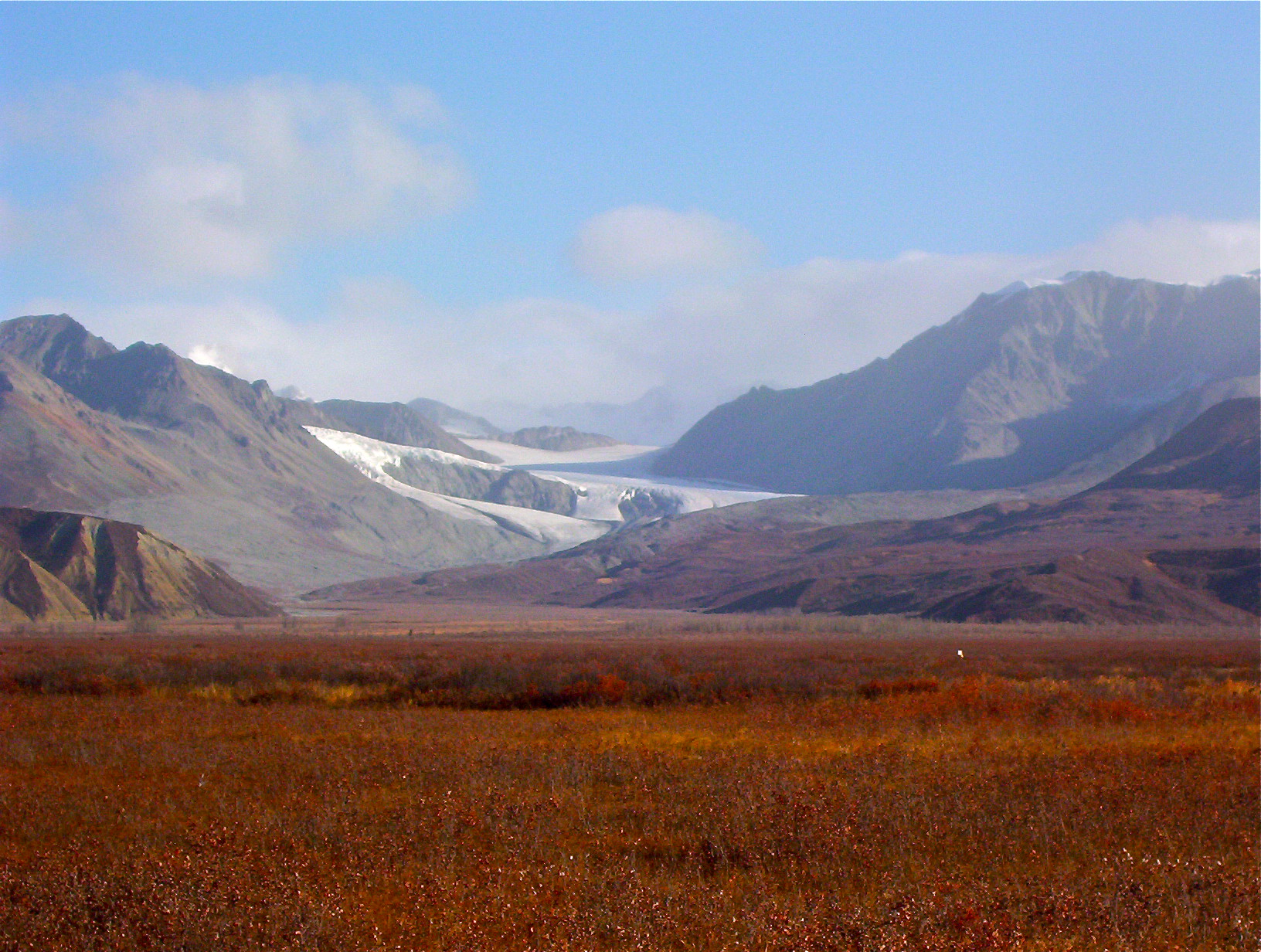
The range forms a generally east–west arc with its northernmost part in the center, and from there trending southwest towards the Alaska Peninsula and the Aleutian Islands, and trending southeast into British Columbia and the Pacific Coast Ranges. The mountains act as a high barrier to the flow of moist air from the Gulf of Alaska northwards, and thus have some of the harshest weather in the world. The heavy snowfall also contributes to a number of large glaciers, including the Cantwell, Castner, Black Rapids, Susitna, Yanert, Muldrow, Eldridge, Ruth, Tokositna, and Kahiltna Glaciers. Four major rivers cross the Alaska Range, including the Delta and Nenana Rivers in the center of the range and the Nabesna and Chisana Rivers to the east.

The range is part of the Pacific Ring of Fire, and the Denali Fault that runs along its southern edge is responsible for many major earthquakes. Mount Spurr is a stratovolcano located at the northeastern end of the Aleutian Volcanic Arc which has two vents, the summit and nearby Crater Peak.
Parts of the Alaska Range are protected within Wrangell-St. Elias National Park and Preserve, Denali National Park and Preserve, and Lake Clark National Park and Preserve. The George Parks Highway from Anchorage to Fairbanks, the Richardson Highway from Valdez to Fairbanks, and the Tok Cut-Off from Gulkana Junction to Tok, Alaska pass through low parts of the range. The Alaska Pipeline parallels the Richardson Highway.
Naming history
The name "Alaskan Range" appears to have been first applied to these mountains in 1869 by naturalist W. H. Dall. The name eventually became "Alaska Range" through local use. In 1849 Constantin Grewingk applied the name "Tschigmit" to this mountain range. A map made by the General Land Office in 1869 calls the southwestern part of the Alaska Range the "Chigmit Mountains" and the northeastern part the "Beaver Mountains".[2] However, the Chigmit Mountains are now considered part of the Aleutian Range.
Major peaks

- Denali (20,310 ft/ 6,190.5 m)
- Mount Foraker (17,400 ft/ 5,304 m)
- Mount Hunter (14,573 ft/ 4,442 m)
- Mount Hayes (13,832 ft/ 4,216 m)
- Mount Silverthrone (13,218 ft/ 4,029 m)
- Mount Moffit (13,020 ft/ 3,970 m)
- Mount Deborah (12,339 ft/ 3,761 m)
- Mount Huntington (12,240 ft/ 3,730 m)
- Mount Brooks (11,890 ft/ 3,624 m)
- Mount Russell (11,670 ft/ 3,557 m)
Subranges (from west to east)

- Neacola Mountains[1]
- Revelation Mountains
- Teocalli Mountains
- Kichatna Mountains
- Central Alaska Range/Denali Massif
- Eastern Alaska Range/Hayes Range
- Delta Mountains
- Mentasta Mountains
- Nutzotin Mountains
Documented wilderness traverses of Alaska Range

- Mentasta Lake to Kitchatna Mountains (1981): Scott Woolums, George Beilstein, Steve Eck, and Larry Coxen by skis: first traverse. 375 miles (604 km) in 45 days.[3]
- Canada to Lake Clark (1996): Roman Dial, Carl Tobin, and Paul Adkins by mountain bike and packraft: first full-length traverse. 775 miles (1,247 km) in 42 days.[4]
- Tok to Lake Clark (1996): Kevin Armstrong, Doug Woody, and Jeff Ottmers by snowshoe, foot, and packraft: first foot traverse. 620 miles (1,000 km) in 90 days.[5]
- Lake Clark to Mentasta Lake (2016): Gavin McClurg by paraglider and foot: first vol-biv (fly/camp) traverse. 466 miles (750 km) in 37 days.[6]
- Cantwell/Yakutat to Unimak Island (2020): Quoc Nguyen and Dan Binde by foot and packraft. 2,500 miles (4,023 km) in 120 days.[7]
See also
References
- Sources differ as to the exact delineation of the Alaska Range. The Board on Geographic Names entry is inconsistent; part of it designates Iliamna Lake as the southwestern end, and part of the entry has the range ending at the Telaquana and Neacola Rivers. Other sources identify Lake Clark, in between those two, as the endpoint. This also means that the status of the Neacola Mountains is unclear: it is usually identified as the northernmost subrange of the Aleutian Range, but it could also be considered the southernmost part of the Alaska Range.
- Name history from the Board on Geographic Names entry for the Alaska Range.
- American Alpine Journal (1982), Vol. 24. Pages 137-138
- "A Wild Ride," National Geographic Magazine (1997), Vol. 191. Pages 118-131
- American Alpine Journal (1997), Vol. 39. Pages 169-170
- Cross Country Magazine, Vol 171. Pages 52-52. Red Bull Media House Films "Under the Midnight Sun"
- "Hikers Cover 2,500 Miles to Reach Southernmost Portion on Unimak Island" (PDF).
{{cite news}}: CS1 maint: url-status (link)
Further reading
- Churkin, M., Jr., and C. Carter. (1996). Stratigraphy, structure, and graptolites of an Ordovician and Silurian sequence in the Terra Cotta Mountains, Alaska Range, Alaska [U.S. Geological Survey Professional Paper 1555]. Washington, D.C.: U.S. Department of the Interior, U.S. Geological Survey.
Authority control | |
|---|---|
| General | |
| National libraries | |
На других языках
[de] Alaskakette
Die Alaskakette (englisch Alaska Range) ist die südliche Hauptkette der Kordilleren in Alaska. Sie bildet einen Bogen von der Alaska-Halbinsel im Südwesten, wo sie bei den Chigmit Mountains in die Alëutenkette (englisch Aleutian Range) übergeht, bis etwa zur Grenze zum kanadischen Territorium Yukon im Osten, wo sie mit den Wrangell Mountains in die zu den nordamerikanischen Coast Mountains gehörende Eliaskette übergeht. Ihre maximale Ausdehnung beträgt rund 800 km.[1] Im Gegensatz zu den beiden vorgenannten Gebirgen wird die Alaskakette nicht zu den pazifischen Küstengebirgen gezählt.- [en] Alaska Range
[es] Cordillera de Alaska
La cordillera de Alaska (en inglés: Alaska Range) es un sistema montañoso relativamente estrecho, de 650 km de largo, en la parte centro-sur de Alaska (Estados Unidos), desde el lago Clark en su extremo sur[1] hasta el río White en el territorio del Yukón en Canadá en el sudeste. La montaña más alta de Norteamérica, el Denali (6194 m) está situado en esta cordillera.[fr] Chaîne d'Alaska
La chaîne d’Alaska (Alaska Range en anglais) est une chaîne de montagnes s'étendant sur environ 650 kilomètres, du Sud de l’Alaska au Nord-Ouest du Canada. Elle représente la plus haute chaîne de l’Amérique du Nord, notamment avec le Denali, anciennement mont McKinley, point culminant du sous-continent. Sa disposition est celle d’un arc est-ouest. Elle fait partie du système de la ceinture de feu du Pacifique.[it] Catena dell'Alaska
La Catena dell'Alaska (Alaska Range) è una catena montuosa situata nella regione centro-meridionale dello Stato americano dell'Alaska. In questo gruppo montuoso è presente la montagna più alta del Nord America, il Monte Denali (.mw-parser-output .geo-default,.mw-parser-output .geo-dms,.mw-parser-output .geo-dec{display:inline}.mw-parser-output .geo-nondefault,.mw-parser-output .geo-multi-punct{display:none}.mw-parser-output .latitude,.mw-parser-output .longitude{white-space:nowrap}.mw-parser-output .geo{}body.skin-vector .mw-parser-output #coordinates{font-size:85%;line-height:1.5em;position:absolute;right:0;top:0;white-space:nowrap}63°04′10″N 151°00′21″W).[ru] Аляскинский хребет
Аля́скинский хребе́т (англ. Alaska Range) — относительно узкий горный хребет длиной около 1000 км[2] на Аляске (США). Высочайшая вершина Северной Америки — гора Денали — находится на Аляскинском хребте. Часть хребта расположена на территории Юкон.Другой контент может иметь иную лицензию. Перед использованием материалов сайта WikiSort.org внимательно изучите правила лицензирования конкретных элементов наполнения сайта.
WikiSort.org - проект по пересортировке и дополнению контента Википедии