geo.wikisort.org - Mountains
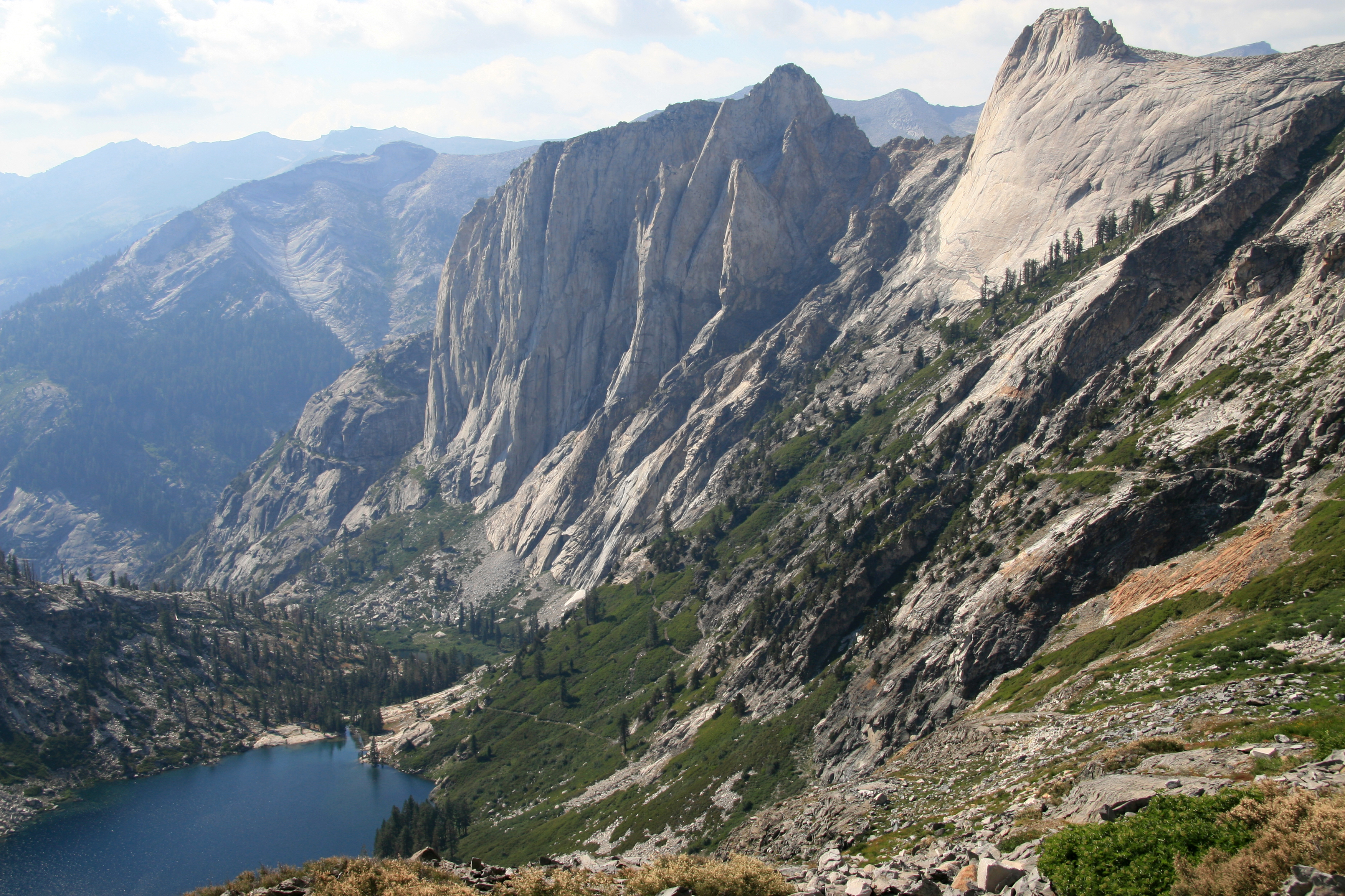
The Great Western Divide is a Sierra Nevada mountain range that forms part of the border between the Kings Canyon and Sequoia National Parks. Some of the summits of the Great Western Divide reach well over 13,000 feet (3,962 m). The High Sierra Trail crosses the range at Kaweah Gap from Sequoia National Park.
| Great Western Divide | |
|---|---|
 Great Western Divide from Mount Kaweah | |
| Highest point | |
| Peak | Mount Kaweah, Kaweah Peaks Ridge |
| Elevation | 13,807 ft (4,208 m) NAVD 88[1] |
| Coordinates | 36°31′35″N 118°28′41″W[2] |
| Geography | |
 Great Western Divide | |
| Country | United States |
| State | California |
| County | Tulare |
| Parent range | Sierra Nevada |
| Topo map | USGS Mount Kaweah |
The divide separates the watersheds of the Kaweah, Kern and Kings rivers. The divide includes the Kaweah Peaks Ridge.[1]
List of peaks

References
- "Great Western Divide". Peakbagger.com. Retrieved 2010-06-02.
- "Great Western Divide". Geographic Names Information System. United States Geological Survey. Retrieved 2010-06-03.
Sequoia National Park | |
|---|---|
| Landmarks and attractions |
|
| People |
|
| Nearby municipalities |
|
| Additional information |
|
| |
Kings Canyon National Park | |
|---|---|
| Landmarks and attractions |
|
| People |
|
| Nearby municipalities | |
| Additional information |
|
Authority control | |
|---|---|
| General |
|
| National libraries | |
Текст в блоке "Читать" взят с сайта "Википедия" и доступен по лицензии Creative Commons Attribution-ShareAlike; в отдельных случаях могут действовать дополнительные условия.
Другой контент может иметь иную лицензию. Перед использованием материалов сайта WikiSort.org внимательно изучите правила лицензирования конкретных элементов наполнения сайта.
Другой контент может иметь иную лицензию. Перед использованием материалов сайта WikiSort.org внимательно изучите правила лицензирования конкретных элементов наполнения сайта.
2019-2026
WikiSort.org - проект по пересортировке и дополнению контента Википедии
WikiSort.org - проект по пересортировке и дополнению контента Википедии