geo.wikisort.org - Mountains
Mount Agassiz, at 13,899 feet (4,236 m), is one of the twenty highest peaks of California. It is the northernmost and easiest to climb of the major Palisades summits.[6] This peak is not to be confused with the 9967 ft peak by the same name in Desolation Wilderness, also in the California Sierra.
| Mount Agassiz | |
|---|---|
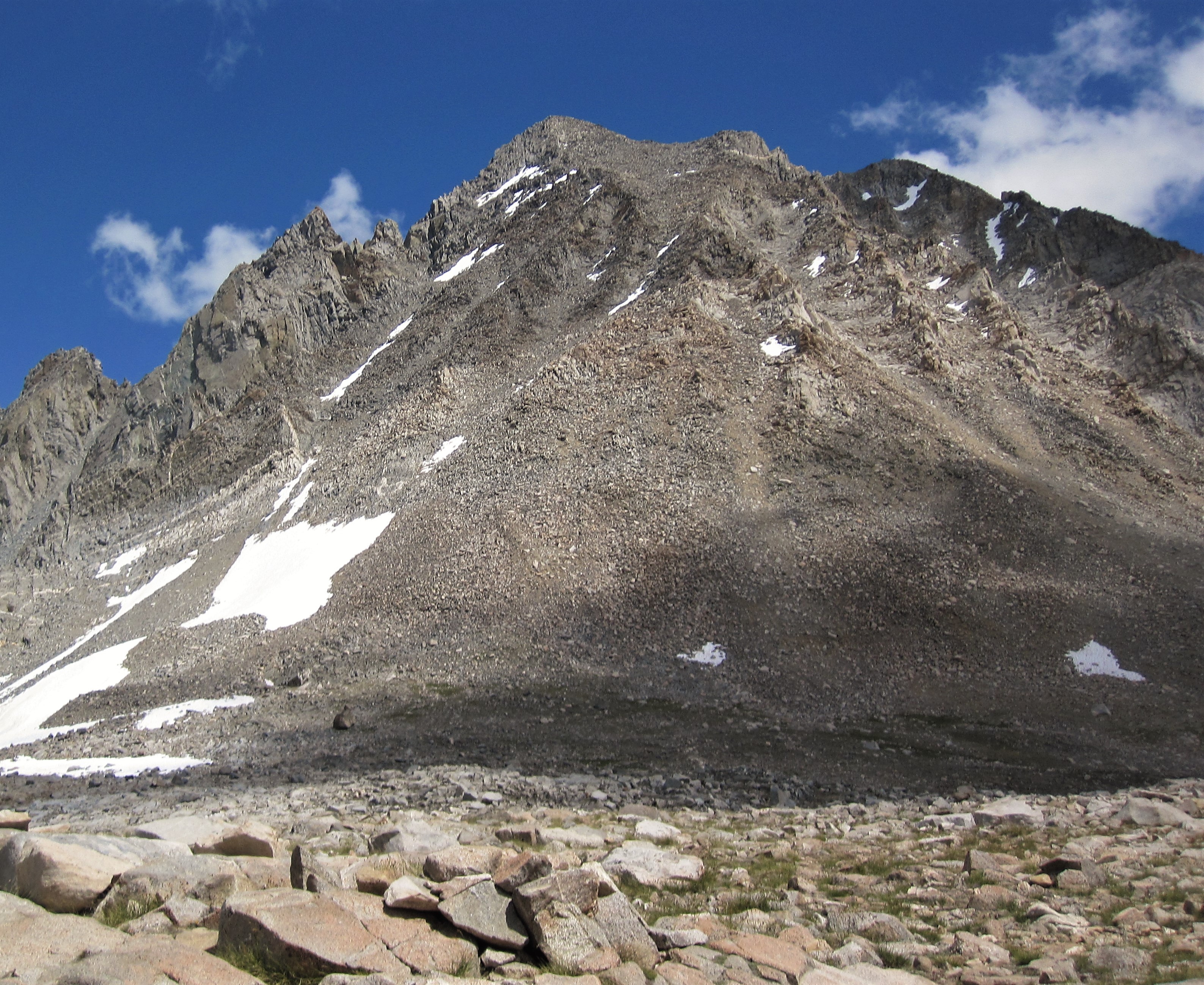
 Mount Agassiz from Bishop Pass Trail. | |
| Highest point | |
| Elevation | 13,899 ft (4,236 m) NAVD 88[1] |
| Prominence | 893 ft (272 m)[1] |
| Parent peak | North Palisade[2] |
| Listing | |
| Coordinates | 37°06′43″N 118°31′51″W[5] |
| Geography | |
 Mount Agassiz  Mount Agassiz | |
| Location | Fresno and Inyo counties, California, U.S. |
| Parent range | Palisades, Sierra Nevada |
| Topo map | USGS North Palisade |
| Climbing | |
| First ascent | August 30, 1925 by Norman Clyde[6] |
| Easiest route | West slope, scramble, (class 2)[6] |
Geography
Agassiz is at the north end of the Palisades in the eastern Sierra Nevada, near Bishop Pass. It stands on the boundary between Kings Canyon National Park and Inyo National Forest, and Fresno and Inyo counties.[5]
History
In 1879, Lilbourne Winchell named it Agassiz Needle for Harvard University professor of zoology and geology Louis Agassiz.[7] Later, the USGS recognized it by its current name.
The peak is named after Swiss-American scientist Louis Agassiz.[8][9] The name Agassiz Needle was originally applied to another nearby peak in 1879, likely Mount Winchell, but at some point the name moved to the current peak.[9]
Climbing
There are three major routes to Agassiz's summit. The easiest is the west slope, both for its non-technical ascent and proximity to the Bishop Pass Trail. From South Lake, the trail climbs gently to Bishop Pass, and the summit route begins there. An attempt to ascend from the west via a chute can lead off route, to areas requiring more technical mountaineering skills and equipment.
Another class 2 scrambling route is the southeast face by way of the south ridge, from Agassiz Col.
A more technical route is the northeast face, which requires class 4 climbing. Norman Clyde established it by following a canyon, couloir and arête from Fifth Lake.[6]
See also
- Mountain peaks of California
- Palisades of the Sierra Nevada
References
- "Mount Agassiz, California". Peakbagger.com. Retrieved 2007-08-18.
- "Key Col for Mount Agassiz". Peakbagger.com. Retrieved 2016-03-23.
- "Sierra Peaks Section List" (PDF). Angeles Chapter, Sierra Club. Retrieved 2011-06-06.
- "Western States Climbers Qualifying Peak List". Climber.org. Retrieved 2016-03-24.
- "Mount Agassiz". Geographic Names Information System. United States Geological Survey, United States Department of the Interior. Retrieved 2021-11-23.
- Secor, R.J. (2009). The High Sierra Peaks, Passes, and Trails (3rd ed.). Seattle: The Mountaineers. pp. 261–262. ISBN 978-0898869712.
- Farquhar, Francis P. (1926). Place Names of the High Sierra. San Francisco: Sierra Club. Retrieved 2010-07-22.
- William Bright; Erwin Gustav Gudde (1998). 1500 California place names: their origin and meaning. University of California Press. p. 10. ISBN 978-0-520-21271-8. Retrieved 2012-01-20.
- Gudde, Erwin G. (1949). California Place Names. Berkeley: Univ. of California Press. p. 3.
External links
- "Mount Agassiz". SummitPost.org. Retrieved 2007-08-18.
| Mountains |
| |||||||||||
|---|---|---|---|---|---|---|---|---|---|---|---|---|
| Passes |
| |||||||||||
| Rivers | ||||||||||||
| Lakes | ||||||||||||
| Protected areas |
| |||||||||||
| Communities | ||||||||||||
| Ski areas |
| |||||||||||
| Trails |
| |||||||||||

На других языках
- [en] Mount Agassiz (California)
[fr] Mont Agassiz
Le mont Agassiz (en anglais : Mount Agassiz) est un sommet de la Sierra Nevada, aux États-Unis. Il culmine à 4 235 mètres d'altitude à la limite des comtés de Fresno et d'Inyo, en Californie. Il se trouve également à la frontière du parc national de Kings Canyon et de la forêt nationale d'Inyo, respectivement dans la Sequoia-Kings Canyon Wilderness et la John Muir Wilderness.Другой контент может иметь иную лицензию. Перед использованием материалов сайта WikiSort.org внимательно изучите правила лицензирования конкретных элементов наполнения сайта.
WikiSort.org - проект по пересортировке и дополнению контента Википедии