geo.wikisort.org - Mountains
Mount Ritter is the highest mountain in Madera County, California, in the Western United States, at an elevation of 13,149 feet (4,008 m). It is also the highest and most prominent peak of its namesake, the Ritter Range, a subrange of the Sierra Nevada in the Ansel Adams Wilderness of the Inyo and Sierra National Forests. Mount Ritter is the 15th highest mountain peak in California with at least 500 meters of topographic prominence.
| Mount Ritter | |
|---|---|
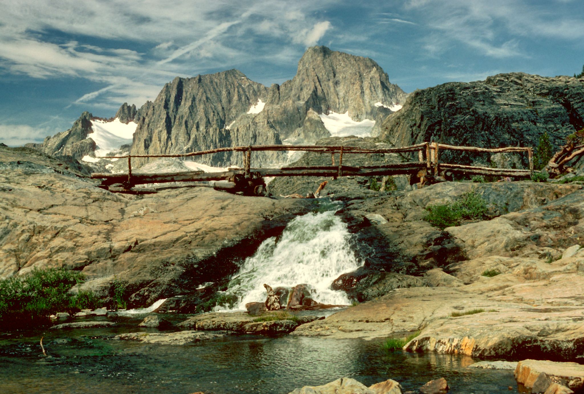 Mount Ritter (on the left) from the John Muir Trail | |
| Highest point | |
| Elevation | 13,149 ft (4,008 m) NAVD 88[1] |
| Prominence | 3,957 ft (1,206 m)[1] |
| Parent peak | Red Slate Mountain[1] |
| Listing |
|
| Coordinates | 37°41′22″N 119°11′57″W[3] |
| Geography | |
| Location | Ansel Adams Wilderness, Madera County, California, U.S. |
| Parent range | Ritter Range, Sierra Nevada |
| Topo map | USGS Mount Ritter |
| Geology | |
| Age of rock | Cretaceous |
| Mountain type | Metavolcanic rock |
| Climbing | |
| First ascent | 1872 by John Muir[4] |
| Easiest route | Snow/rock scramble |
Geography
Mount Ritter is made of strikingly dark rock and is quite prominent due to its height and isolation.[1] It is in the middle of the Ritter Range, which includes neighboring Banner Peak and the Minarets. The prominent and memorable shape of the Ritter–Banner pair is visible from high elevations far to the north and south in the Sierra Nevada.
Mount Ritter was named by Josiah Whitney, chief of the California Geological Survey, for Carl Ritter, who had been a teacher of his when he was a student in Berlin during the 1840s.[5]
See also
References
- "Mount Ritter, California". Peakbagger.com. Retrieved 2009-08-09.
- "Sierra Peaks Section List" (PDF). Angeles Chapter, Sierra Club. Retrieved 2009-08-09.
- "Mount Ritter". Geographic Names Information System. United States Geological Survey. Retrieved 2009-08-09.
- Muir, John. "The Mountains of California". Retrieved 2009-08-09.
- Browning, Peter (1986). Place Names of the Sierra Nevada. Berkeley: Wilderness Press. p. 183. ISBN 0-89997-047-8.
External links
 Media related to Mount Ritter at Wikimedia Commons
- "Mount Ritter". SummitPost.org. Retrieved 2016-10-29.
- "Aerial View of Ritter, Banner, and Surrounding Peaks". Retrieved 2011-06-01.
Sacramento (capital) | ||
| Topics |
|  |
| Regions |
| |
| Metro regions |
| |
| Counties |
| |
| Most populous cities | ||
| Mountains |
| |||||||||||
|---|---|---|---|---|---|---|---|---|---|---|---|---|
| Passes |
| |||||||||||
| Rivers | ||||||||||||
| Lakes | ||||||||||||
| Protected areas |
| |||||||||||
| Communities |
| |||||||||||
| Ski areas |
| |||||||||||
| Trails |
| |||||||||||

This Madera County, California-related article is a stub. You can help Wikipedia by expanding it. |
На других языках
[de] Mount Ritter
Mount Ritter ist ein 4.010 Meter hoher Berg in der Sierra Nevada im US-Bundesstaat Kalifornien. Er besteht aus bemerkenswert dunklem Gestein und erscheint als höchster Berg in einem Umkreis von 48 Kilometern sehr auffallend. Wie Banner Peak und The Minarets ist Mount Ritter Teil der Ritter Range.- [en] Mount Ritter
[fr] Mont Ritter
Le mont Ritter (en anglais : Mount Ritter) est un sommet de la Sierra Nevada, aux États-Unis. Il culmine à 4 006 mètres d'altitude dans le comté de Madera, en Californie. Il est protégé au sein de l'Ansel Adams Wilderness à la frontière entre la forêt nationale d'Inyo et la forêt nationale de Sierra.Другой контент может иметь иную лицензию. Перед использованием материалов сайта WikiSort.org внимательно изучите правила лицензирования конкретных элементов наполнения сайта.
WikiSort.org - проект по пересортировке и дополнению контента Википедии