geo.wikisort.org - Mountains
White Mountain Peak (or simply White Mountain), at 14,252-foot (4,344 m), is the highest peak in the White Mountains of California, the highest peak in Mono County, and the third highest peak in the state after Mount Whitney and Mount Williamson.
| White Mountain Peak | |
|---|---|
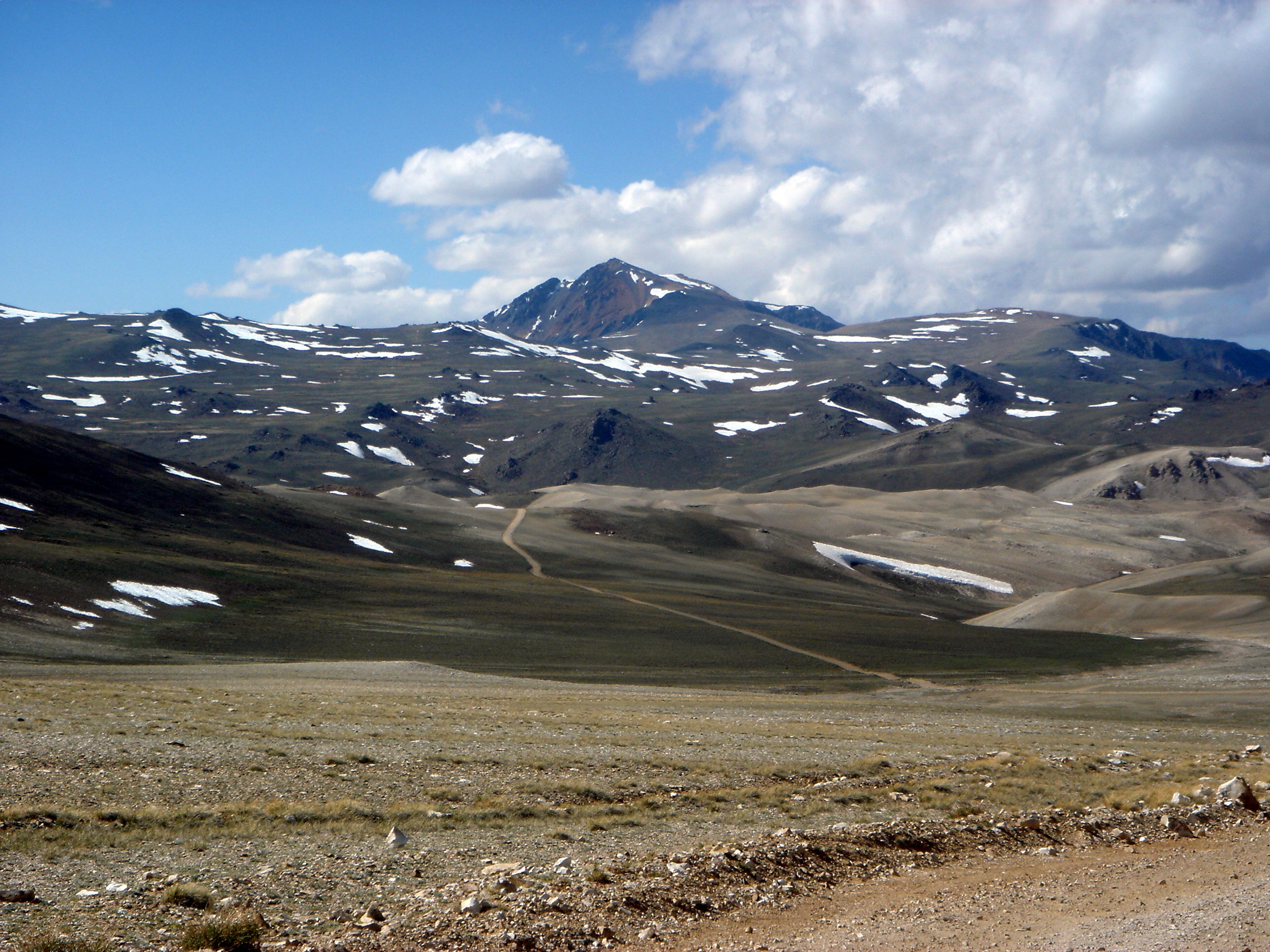 White Mountain Peak from trail, June 2004 | |
| Highest point | |
| Elevation | 14,252 ft (4,344 m) NAVD 88[1] |
| Prominence | 7,196 ft (2,193 m)[2] |
| Parent peak | Mount Whitney[3] |
| Isolation | 67.4 mi (108.5 km)[2] |
| Listing |
|
| Coordinates | 37°38′03″N 118°15′20″W[1] |
| Geography | |
 White Mountain Peak Location in California  White Mountain Peak White Mountain Peak (the United States) | |
| Location | Mono County, California, U.S. |
| Parent range | White Mountains |
| Topo map | USGS White Mountain Peak |
| Geology | |
| Mountain type | Igneous Rock |
| Climbing | |
| Easiest route | Road hike |
It is the fourteenth most topographically prominent peak in the contiguous United States.[4] White Mountain Peak is one of only two fourteeners (peaks above 14,000 feet) in California that are not in the Sierra Nevada, the other being Mount Shasta at the far northern end of the state in the Cascade Range. It is the only fourteener in the contiguous United States that is not in the Rocky Mountains, the Cascade Range, or the Sierra Nevada.
Research Station
The University of California operates the White Mountain Research Center, comprising three high altitude research stations, on the mountain: Crooked Creek Station at 10,200 feet (3,100 m), Barcroft Station at 12,470 feet (3,800 m), and a small hut at the summit. The effects of altitude on physiology are studied at the Barcroft Station and summit hut.[5]
Climbing

There is a winding dirt road leading to the summit station that is usually cleared of snow between late June and September. Access is restricted to hikers only by a locked gate about 2 miles before Barcroft Station, but White Mountain Research Station usually opens this locked gate at 11,680 feet (3,560 m) once each year. Open gate days are typically held on a Sunday in the summer season.[6]
The round-trip hike from the gate to the summit is about 14 miles (23 km) with less than 2,600 feet (800 m) of vertical gain. However, there are two different dips in the trail of about 250 feet each, adding up to a total elevation gain during the roundtrip of over 3500 feet. The open gate shaves about 4 miles (6 km) and 790 feet (240 m) of gain off the round trip. This route is popular with mountain bikers.
While the peak is arguably California's easiest fourteener via the jeep road, it features more strenuous climbs such as its western ridge, an 8,150-foot (2,500 m) climb out of Owens Valley via a steep ridge from the end of a rough road. The peak is rarely approached from the north where it is guarded by a narrow arête or knife-edge ridge. A better nontechnical alternative to the jeep road would be to drive as far as possible up Leidy Canyon from Fish Lake Valley, then take a graded cattle trail up the broad ridge to Perry Aiken Flat.
From the flats it is an easy traverse south into the cirque of the North Fork, North Branch of Perry Aiken Creek. A moderate scramble up the ridge between the North Branch and the larger cirque of the main North Fork leads to the easier upper slopes of the peak. While the peak does not require technical climbing skills, it still poses a serious challenge to hikers because of the high altitude.
Climate
The summit and the weather station at 12,470 feet (3,800 m) has an alpine tundra climate (Köppen climate classification: ET). Winters are extremely severe, with the peak receiving upwards of 13 feet (400 cm) of snow annually.
| Climate data for White Mountain, California (Station Elevation 12,470ft) | |||||||||||||
|---|---|---|---|---|---|---|---|---|---|---|---|---|---|
| Month | Jan | Feb | Mar | Apr | May | Jun | Jul | Aug | Sep | Oct | Nov | Dec | Year |
| Record high °F (°C) | 47 (8) |
52 (11) |
46 (8) |
50 (10) |
59 (15) |
66 (19) |
72 (22) |
73 (23) |
61 (16) |
69 (21) |
50 (10) |
48 (9) |
73 (23) |
| Average high °F (°C) | 22.9 (−5.1) |
23.0 (−5.0) |
24.3 (−4.3) |
28.3 (−2.1) |
36.3 (2.4) |
46.3 (7.9) |
54.2 (12.3) |
53.0 (11.7) |
47.6 (8.7) |
39.9 (4.4) |
30.9 (−0.6) |
25.4 (−3.7) |
36.0 (2.2) |
| Daily mean °F (°C) | 15.2 (−9.3) |
14.8 (−9.6) |
15.6 (−9.1) |
19.1 (−7.2) |
27.5 (−2.5) |
37.5 (3.1) |
45.3 (7.4) |
44.4 (6.9) |
38.8 (3.8) |
31.4 (−0.3) |
22.8 (−5.1) |
17.6 (−8.0) |
27.5 (−2.5) |
| Average low °F (°C) | 7.4 (−13.7) |
6.6 (−14.1) |
6.8 (−14.0) |
9.9 (−12.3) |
18.7 (−7.4) |
28.7 (−1.8) |
36.4 (2.4) |
35.5 (1.9) |
30.0 (−1.1) |
22.9 (−5.1) |
14.7 (−9.6) |
9.7 (−12.4) |
18.9 (−7.3) |
| Record low °F (°C) | −25 (−32) |
−21 (−29) |
−35 (−37) |
−30 (−34) |
−15 (−26) |
2 (−17) |
12 (−11) |
13 (−11) |
−5 (−21) |
−20 (−29) |
−28 (−33) |
−30 (−34) |
−35 (−37) |
| Average precipitation inches (mm) | 2.00 (51) |
1.70 (43) |
2.17 (55) |
1.88 (48) |
1.98 (50) |
0.82 (21) |
1.09 (28) |
1.11 (28) |
0.87 (22) |
1.02 (26) |
1.22 (31) |
2.60 (66) |
18.47 (469) |
| Average snowfall inches (cm) | 20.2 (51) |
19.5 (50) |
19.5 (50) |
20.8 (53) |
21.5 (55) |
7.0 (18) |
1.3 (3.3) |
1.0 (2.5) |
3.5 (8.9) |
10.9 (28) |
13.1 (33) |
20.3 (52) |
158.5 (403) |
| Source 1: The Western Regional Climate Center[7] | |||||||||||||
| Source 2: https://wrcc.dri.edu/cgi-bin/cliGCStT.pl?cawhit | |||||||||||||

See also
 Media related to White Mountain Peak at Wikimedia Commons
- List of mountain peaks of California
- List of highest points in California by county
- List of Ultras of the United States
References
- "White Mountain Peak". NGS Data Sheet. National Geodetic Survey, National Oceanic and Atmospheric Administration, United States Department of Commerce. Retrieved January 5, 2016.
- "White Mountain Peak, California". Peakbagger.com. Retrieved January 5, 2016.
- "Adobe Hills West". Peakbagger.com. Retrieved May 20, 2016.
- "USA Lower 48 Top 100 Peaks by Prominence". Peakbagger.com. Retrieved March 30, 2012.
- "White Mountain Research Center Summit Hut". White Mountain Research Center. University of California. Retrieved September 4, 2018.
- "Community Outreach". White Mountain Research Center. University of California. Retrieved September 4, 2018.
- "Seasonal Temperature and Precipitation Information". Western Regional Climate Center. Retrieved April 9, 2013.
External links
- "White Mountain Peak". Geographic Names Information System. United States Geological Survey, United States Department of the Interior.
- "White Mountain Peak". SummitPost.org.
- "White Mountain Research Station". University of California.
- "White Mountain Peak". Timberline Trails.
- White Mountain Research Station. Administrative Files RSS 2308. Special Collections & Archives, UC San Diego Library.
На других языках
- [en] White Mountain Peak
[fr] Pic White Mountain
Le pic White Mountain, en anglais : White Mountain Peak, est un sommet culminant à 4 342 mètres d'altitude dans le centre est de la Californie, à l'Ouest des États-Unis. C'est le point culminant des montagnes Blanches. Il est constitué de roches sédimentaires. Il est probablement occupé depuis la Préhistoire par des Amérindiens. Le sommet est coiffé par une station de recherche de l'Université de Californie. Une piste permet de gravir la montagne, ce qui rend le sommet facile d'accès. La montagne est protégée par la forêt nationale d'Inyo.[ru] Уайт-Маунтин-Пик
Уайт-Маунтин-Пик[2] (англ. White Mountain Peak) — горная вершина в системе Белых гор.Другой контент может иметь иную лицензию. Перед использованием материалов сайта WikiSort.org внимательно изучите правила лицензирования конкретных элементов наполнения сайта.
WikiSort.org - проект по пересортировке и дополнению контента Википедии