geo.wikisort.org - Mountains
Pic la Selle (Kreyòl: Pik Lasel), also called Morne La Selle, is the highest peak in Haiti with a height of 2,680 metres (8,793 ft) above sea level.[2] The mountain is part of the Chaîne de la Selle mountain range. It is located in the Ouest administrative department.
| Pic la Selle | |
|---|---|
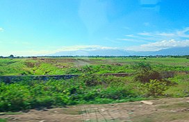
 Pic la Selle, seen from the Cul-de-Sac plain | |
| Highest point | |
| Elevation | 2,680 m (8,790 ft)[1] |
| Prominence | 2,650 m (8,690 ft)[1] |
| Listing |
|
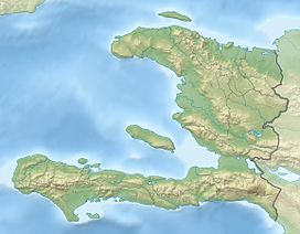
| Coordinates | 18°22′N 71°59′W[1] |
| Geography | |
| Location | Haiti |
| Parent range | Chaîne de la Selle |
References
- "Pic la Selle, Haiti". Peakbagger.com. Retrieved 2013-02-16.
- "Caribbean Area". Peakbagger.com. Retrieved 2014-03-01.
External links
На других языках
[de] Pic la Selle
Der Pic la Selle (auch: Morne La Selle) ist mit 2674 m der höchste Berg Haitis und der vierthöchste Berg der Karibik. Er liegt in der Chaîne de la Selle, etwa 40 km ostsüdöstlich der Hauptstadt Port-au-Prince, und ist Teil des La Visite National Parks.- [en] Pic la Selle
[fr] Pic la Selle
Le pic la Selle (en créole haïtien : Pik Lasel) est une montagne située dans la chaîne de la Selle en Haïti, sur l'île d'Hispaniola. C'est le point culminant du pays avec 2 680 m d'altitude, dépassant le sommet du pic de Macaya qui s'élève à 2 347 m dans le massif de la Hotte.[it] Pic la Selle
Il Pic la Selle è una montagna di Haiti situata nel Dipartimento dell'Ovest. Con la sua altitudine di 2680 metri s.l.m., rappresenta il punto più elevato del territorio di Haiti.Текст в блоке "Читать" взят с сайта "Википедия" и доступен по лицензии Creative Commons Attribution-ShareAlike; в отдельных случаях могут действовать дополнительные условия.
Другой контент может иметь иную лицензию. Перед использованием материалов сайта WikiSort.org внимательно изучите правила лицензирования конкретных элементов наполнения сайта.
Другой контент может иметь иную лицензию. Перед использованием материалов сайта WikiSort.org внимательно изучите правила лицензирования конкретных элементов наполнения сайта.
2019-2025
WikiSort.org - проект по пересортировке и дополнению контента Википедии
WikiSort.org - проект по пересортировке и дополнению контента Википедии
