geo.wikisort.org - Mountains
Picacho del Diablo ('Devil's Peak') is the highest peak on the Baja California peninsula, measuring 3,096 metres (10,157 ft). It is alternately called Cerro de la Encantada, meaning 'Hill of the Enchanted'[2] or 'Hill of the Bewitched'. The peak is located in the Sierra de San Pedro Mártir, a part of the Peninsular Ranges in the Mexican state of Baja California.
| Picacho del Diablo | |
|---|---|
| Cerro de la Encantada | |
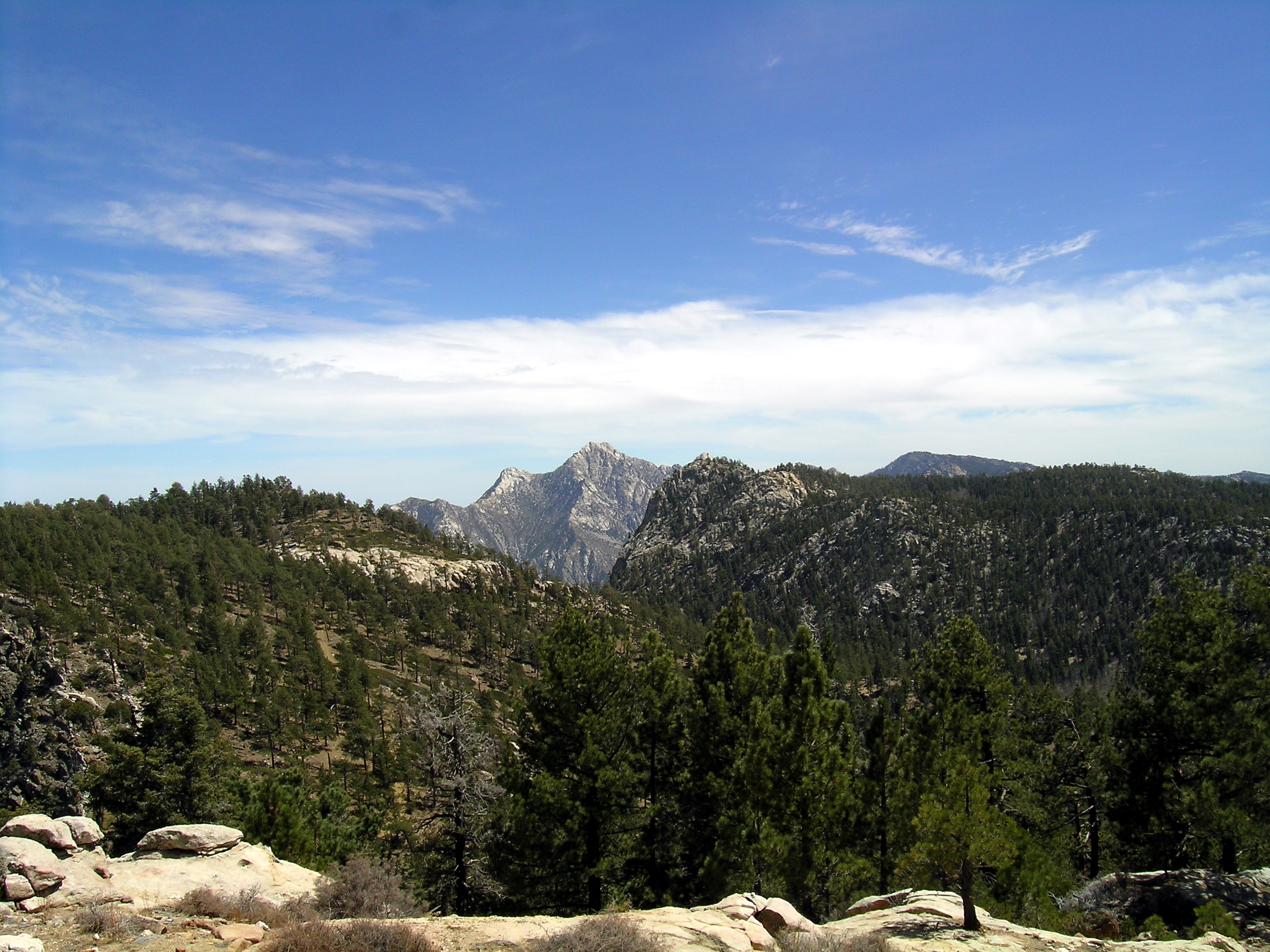 Picacho del Diablo as seen from the National Astronomical Observatory of Mexico | |
| Highest point | |
| Elevation | 3,096 m (10,157 ft) |
| Prominence | 2,115 m (6,939 ft)[1] |
| Listing |
|
| Coordinates | 30°59′27″N 115°22′30″W[3] |
| Naming | |
| English translation | Devil's Peak |
| Language of name | Spanish |
| Geography | |
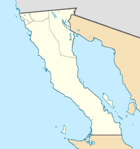 Picacho del Diablo Location in Mexico  Picacho del Diablo Picacho del Diablo (Mexico) | |
| Location | Sierra de San Pedro Mártir National Park, Mexicali Municipality, Baja California, Mexico |
| Parent range | Sierra San Pedro Mártir |
| Topo map | H11B45 San Rafael |
| Climbing | |
| Easiest route | class 3 scramble |
Climate
The peak has either a cold-summer Mediterranean climate (Csc) or a Mediterranean-influenced subarctic climate (Dsc)in the Köppen climate classification depending whether the threshold for those climates is considered 0°C or -3°C .[4][verification needed]
| Climate data for Picacho del Diablo Peak (1961–1990) | |||||||||||||
|---|---|---|---|---|---|---|---|---|---|---|---|---|---|
| Month | Jan | Feb | Mar | Apr | May | Jun | Jul | Aug | Sep | Oct | Nov | Dec | Year |
| Average high °C (°F) | 4.9 (40.8) |
4.5 (40.1) |
3.9 (39.0) |
6.4 (43.5) |
10.1 (50.2) |
16.4 (61.5) |
19.7 (67.5) |
18.5 (65.3) |
16.5 (61.7) |
12.0 (53.6) |
7.2 (45.0) |
5.7 (42.3) |
10.48 (50.86) |
| Daily mean °C (°F) | 0.3 (32.5) |
0.0 (32.0) |
−0.9 (30.4) |
0.8 (33.4) |
4.2 (39.6) |
9.5 (49.1) |
13.0 (55.4) |
12.1 (53.8) |
10.3 (50.5) |
6.6 (43.9) |
2.2 (36.0) |
1.1 (34.0) |
4.9 (40.8) |
| Average low °C (°F) | −4.3 (24.3) |
−4.6 (23.7) |
−5.8 (21.6) |
−4.7 (23.5) |
−1.8 (28.8) |
2.6 (36.7) |
6.4 (43.5) |
5.6 (42.1) |
4.0 (39.2) |
1.3 (34.3) |
−2.8 (27.0) |
−3.5 (25.7) |
−0.6 (30.9) |
| Average precipitation mm (inches) | 189 (7.4) |
144 (5.7) |
169 (6.7) |
11 (0.4) |
9 (0.4) |
3 (0.1) |
61 (2.4) |
55 (2.2) |
50 (2.0) |
20 (0.8) |
59 (2.3) |
80 (3.1) |
850 (33.5) |
| Source: climatewna.com[4] | |||||||||||||
See also
- List of mountains in Mexico
- Mountain peaks of North America
- List of Ultras of Mexico
References
- "Picacho del Diablo". Peakbagger.com. Archived from the original on 2020-09-08. Retrieved 8 September 2020.
- "Desert Peaks Section Peaks List" (PDF). Sierra Club Angeles Chapter. May 2020. Archived (PDF) from the original on 2020-09-08. Retrieved 8 September 2020.
- Martin, Andy (26 March 2011). "Mexico Ultras". Peaklist.org. Archived from the original on 2012-11-14. Retrieved 22 October 2012.
- "ClimateNA_Map". www.climatewna.com. University of British Columbia. 2019. Retrieved 2019-05-18.
{{cite web}}: CS1 maint: url-status (link)
| Authority control: National libraries |
|---|
This article about a location in the Mexican state of Baja California is a stub. You can help Wikipedia by expanding it. |
На других языках
- [en] Picacho del Diablo
[es] Cerro de La Encantada (México)
El cerro de La Encantada o picacho del diablo de aproximadamente 3090 msnm es la trigésima quinta montaña más alta de México, y la más alta de toda la península de Baja California. Es parte de la sierra de San Pedro Mártir y administrativamente se encuentra en los límites del municipio de San Felipe, Baja California y de las delegaciones de Punta Colonet, en Ensenada, Baja California.[nota 1][ru] Пикачо-де-Дьябло
Пикачо-де-Дьябло, или Серро-де-ла-Энкантада (исп. Picacho del Diablo, Cerro de la Encantada, «Пик дьявола» или «Холм заколдованных») — гора на полуострове Калифорния в штате Нижняя Калифорния (Мексика). Пик расположен в горной цепи Сьерра-де-Сан-Педро-Мартир. Самая высокая вершина Нижней Калифорнии и 35-я вершина Мексики.Текст в блоке "Читать" взят с сайта "Википедия" и доступен по лицензии Creative Commons Attribution-ShareAlike; в отдельных случаях могут действовать дополнительные условия.
Другой контент может иметь иную лицензию. Перед использованием материалов сайта WikiSort.org внимательно изучите правила лицензирования конкретных элементов наполнения сайта.
Другой контент может иметь иную лицензию. Перед использованием материалов сайта WikiSort.org внимательно изучите правила лицензирования конкретных элементов наполнения сайта.
2019-2026
WikiSort.org - проект по пересортировке и дополнению контента Википедии
WikiSort.org - проект по пересортировке и дополнению контента Википедии