geo.wikisort.org - Mountains
Sierra de San Pedro Mártir (Kiliwa: ʔxaal haq, English: mountains of Saint Peter the Martyr) is a mountain range located within southern Ensenada Municipality and southern Baja California state, of northwestern Mexico.
It is a major mountain range in the long Peninsular Ranges System, that extends from Southern California down the Baja California Peninsula into Baja California Sur state.[1]
Geography
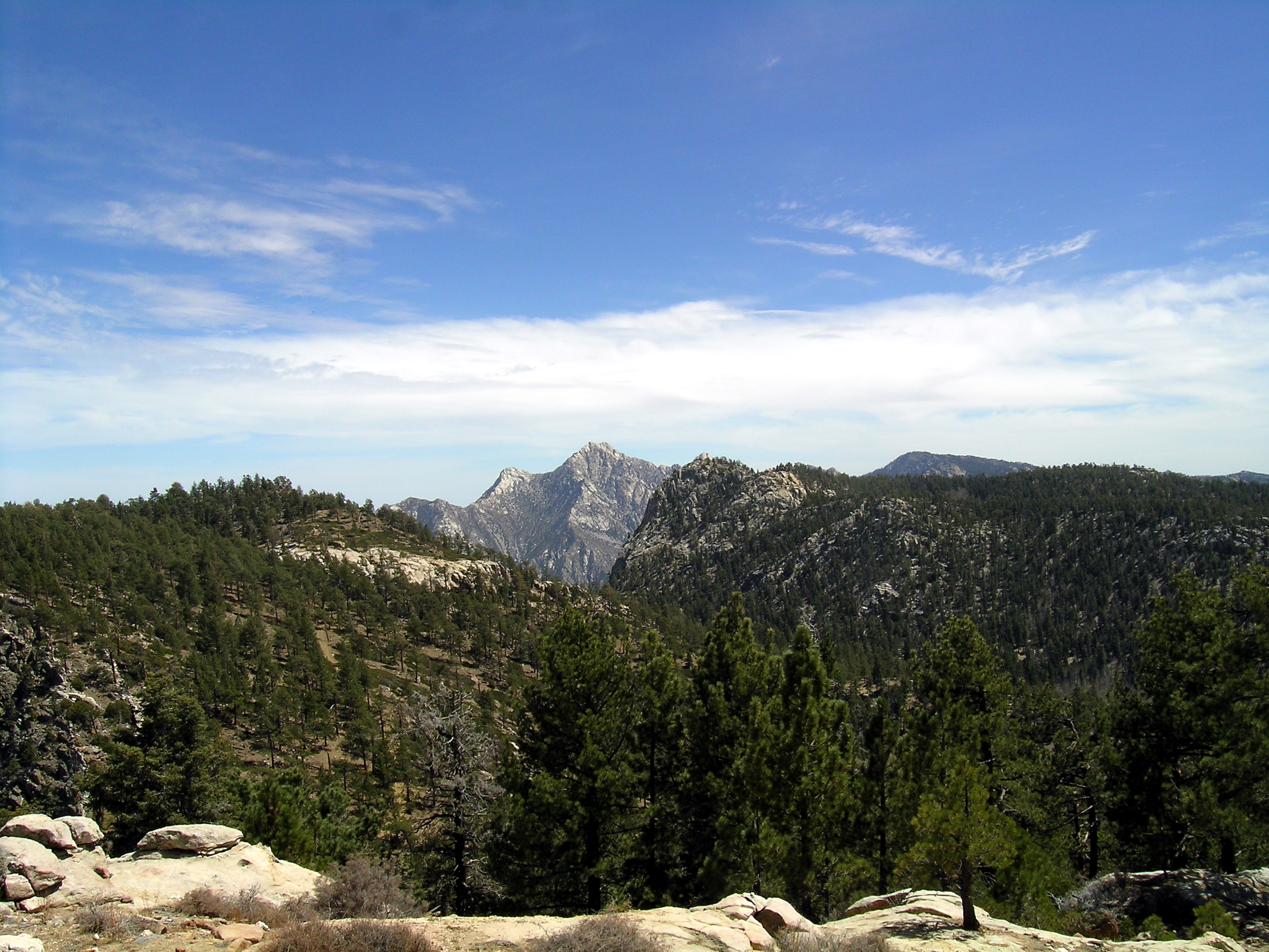
The range's highest peak is Picacho del Diablo at 3,096 m (10,157 ft) in elevation. Also known as Cerro de la Encantada (Enchanted Mountain) and Picacho la Providencia (Providence Peak), it is the highest point in Baja California state and of the entire Baja California Peninsula.[2]
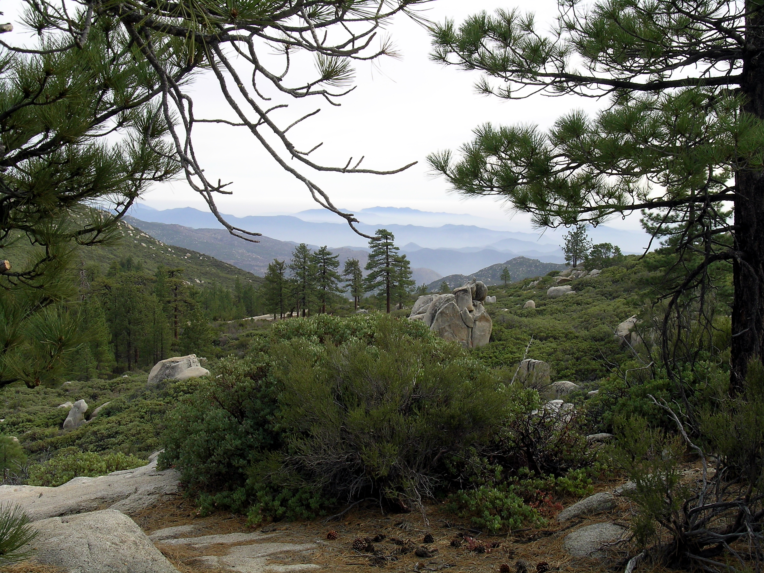
The range is a drainage divide that demarcates the drainages flowing west into the Pacific Ocean or east into the Gulf of California for this section of the Baja California Peninsula. Snow is usually present at the highest elevations in the winter.
The Sierra de Juárez are on the north, and Sierra de San Francisco are on the south, both are also part of the Peninsular Ranges System.

Features
- Parque Nacional Sierra de San Pedro Mártir
Parque Nacional Sierra de San Pedro Mártir protects an area of 650 km2 (250 sq mi) in the Sierra de San Pedro Mártir. It was established by presidential decree in 1974, and the first of two national parks to be established on the Baja California Peninsula. The second is Parque Nacional Constitución de 1857 to the north, in the Sierra de Juárez and also in Baja California state.
- National Astronomical Observatory
The National Astronomical Observatory is located at an elevation of 2,830 m (9,280 ft) in the range. The astronomical complex was built in 1975. It has several large telescopes, the largest of which is 2.12 m (83 in) in diameter. The observatory's site takes advantage of the high elevation, along with typically clear skies, low relative humidity, low atmospheric pollution, low light pollution, and low levels of radio interference.
The range was a site considered for construction of the Thirty Meter Telescope, now tentatively planned for a controversial site on Mauna Kea in Hawaii.
In 1889, there was a gold rush in the Santa Clara mountains about 100 kilometres (60 mi) southeast of Ensenada.[3]
Ecology

- Flora
Sierra de San Pedro Mártir has a very similar flora to the Sierra de Juárez on the north. Higher elevations have Sierra Juarez and San Pedro Martir pine-oak forests ecoregion flora, which are surrounded at lower elevations by California chaparral and woodlands ecoregion flora, and at lowest elevations by the Baja California Desert ecoregion flora.
The flora is distinct from that of 'mainland' Mexico across the Gulf of California to the east, and shares many species with the Laguna Mountains and Cuyamaca Mountains, also Peninsular Ranges, in San Diego County, California. Typical conifer species include white fir, sugar pine and Jeffrey pine.[4] The canyons of the lower eastern Sierra de Pedro Mártir are the southern range demarcation of natural California fan palm (Washingtonia filifera) distribution.[5] Arizona cypress (Cupressus arizonica) can be found with Canyon live oaks (Quercus chrysolepis) and California fan palms.
- Fauna
Baja California rainbow trout (Oncorhynchus mykiss nelsoni) are native to the headwaters of Rio Santo Domingo in the Sierra San Pedro Martir. Desert bighorn sheep also live in the range
California condors, zoo-bred from the San Diego Zoo Safari Park condor program, were reintroduced into the Sierra San Pedro Martir in 1987, the first time seen in the range since 1937. Each year, a small group of young California condors are selected from the pool of birds being bred by the Los Angeles Zoo, San Diego Zoo Safari Park, Oregon Zoo, and The Peregrine Fund for release to the wild. Annual releases range from four to seven zoo-bred birds.[6]
See also
- Flora of Baja California
- Mountain ranges of Baja California
- Peninsular Ranges topics
- Sierra Juarez and San Pedro Martir pine-oak forests ecoregion
References
- World Wildlife Fund, ed. (2001). "Sierra Juarez and Sierra Pedro Martir Pine-oak Forests". WildWorld Ecoregion Profile. National Geographic Society. Archived from the original on 2010-03-08.
- Moon Travel Guides: "Parque Nacional Sierra San Pedro Mártir in Baja, Mexico"
- FLANIGAN, SYLVIA K. (Winter 1980). Thomas L. Scharf (ed.). "THE BAJA CALIFORNIA GOLD RUSH OF 1889". The Journal of San Diego History. SAN DIEGO HISTORICAL SOCIETY QUARTERLY. 26 (1).
- Skelton, George (2020-09-21). "Column: To study wildfire prevention, Berkeley experts are looking to Baja. Newsom should too". Los Angeles Times. Retrieved 2020-09-22.
- C. Michael Hogan. 2009. California Fan Palm: Washingtonia filifera Archived 2009-09-30 at the Wayback Machine GlobalTwitcher.com, ed. Nicklas Stromberg
- EndExtinction.org: "Condors in the Sierra de San Pedro Mártir, Baja California, Mexico" . accessed 03.09.2016.
External links
- Official Parque Nacional Sierra de San Pedro Mártir website—(in Spanish)
- National Astronomical Observatory website—(in Spanish)
- Rancho Meling, 100 años de tradición—(in Spanish)
| Authority control |
|
|---|
На других языках
[de] Sierra de San Pedro Mártir
Die Sierra de San Pedro Mártir ist eine Gebirgskette im mexikanischen Bundesstaat Baja California, die von Nord nach Süd verläuft. Das Gebirge erstreckt sich auf einer Fläche von 12.416 km². Die Nord-Süd-Ausdehnung ist 152 km, die Ost-West-Ausdehnung 143 km. Der höchste Punkt der Gebirgskette ist der Picacho del Diablo (3096 m), auch Cerro de la Encantada genannt, der zugleich der höchste Punkt des Bundesstaates und der ganzen Halbinsel Niederkalifornien ist.- [en] Sierra de San Pedro Mártir
[es] Sierra de San Pedro Mártir
La Sierra de San Pedro Mártir es la denominación que se le da a una cadena montañosa norteamericana que corre de norte a sur parte de la zona centro-norte del estado mexicano de Baja California. El punto más alto es la elevación conocida como el Picacho la Providencia, Picacho del Diablo o Cerro de la Encantada, con una altitud de 3096 msnm (metros sobre el nivel del mar). Esta montaña es el punto más elevado en todo el estado. Se suelen presentar constantes nevadas en estas altitudes en los meses de invierno e incluso hasta en mayo y junio desde los 2700 msnm.[fr] Sierra de San Pedro Mártir
La sierra de San Pedro Mártir (littéralement, en français, « chaîne de Saint Pierre Martyr ») est une chaîne de montagnes qui s'étend du nord au sud le long de la partie médiane du nord-ouest de la Basse-Californie au Mexique. Son point culminant est Picacho del Diablo (3 096 m), ou cerro de la Encantada, également point culminant de l'ensemble de la péninsule de Basse-Californie.[ru] Сьерра-де-Сан-Педро-Мартир
Сьерра-де-Сан-Педро-Мартир (исп. Sierra de San Pedro Mártir) — горный массив, который тянется с севера на юг вдоль средней части северо-западной Нижней Калифорнии в Мексике. Самая высокая точка горной системы — пик Пикачо-де-Дьябло (3096 м), или Серро-де-ла-Энкантада, также самая высокая точка во всем полуострове Калифорния[1].Другой контент может иметь иную лицензию. Перед использованием материалов сайта WikiSort.org внимательно изучите правила лицензирования конкретных элементов наполнения сайта.
WikiSort.org - проект по пересортировке и дополнению контента Википедии