geo.wikisort.org - Mountains
Mount Jarvis is an eroded shield volcano in the Wrangell Mountains of eastern Alaska. It is located in Wrangell-Saint Elias National Park about 10 miles (16 km) east of the summit of Mount Wrangell. The mountain sits at the northeastern edge of the massive ice-covered shield of Wrangell, rising nearly 5,000 feet (1,500 m) above it in a spectacular series of cliffs and icefalls.
| Mount Jarvis | |
|---|---|
 Mount Jarvis from the northeast | |
| Highest point | |
| Elevation | 13,421 ft (4,091 m)[1] |
| Prominence | 4,721 ft (1,439 m)[1] |
| Isolation | 18 km (11 mi) |
| Listing |
|
| Coordinates | 62°01′24″N 143°36′59″W[2] |
| Naming | |
| Etymology | David H. Jarvis |
| Geography | |
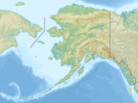
 Mount Jarvis Wrangell – St. Elias National Park and Preserve, Alaska, U.S. | |
| Parent range | Wrangell Mountains |
| Topo map | USGS Nabesna A-6 |
| Geology | |
| Age of rock | 1.7 – 1.0 million years |
| Mountain type | Eroded shield volcano |
| Last eruption | Dacite flow, 1.0 million years ago |
| Climbing | |
| Easiest route | Glacier climb |
When seen from above, Mount Jarvis is distinctly dumbbell-shaped, with two prominent peaks connected by a narrower ridge. The mountain's main summit is 13,421 feet (4,091 m), making it one of numerous thirteeners (peaks between 13,000 and 13,999 feet in elevation) in Alaska. The second summit is located about 3 miles (5 km) to the north-northwest, reaching 13,025 feet (3,970 m) with over 725 feet (221 m) of prominence above the connecting saddle,[3] thus qualifying it as an independent peak on the list of thirteeners as well. The entire summit area including both peaks and the ridge is covered in glacial ice. The steep, rocky eastern and western faces of Mount Jarvis form headwalls above the cirques of the Jacksina Glacier and Copper Glacier, which flow northward out of the Wrangell Mountains.
Mount Jarvis was named in 1903 by F. C. Schrader, a USGS geologist, for Lt. David H. Jarvis of the U. S. Revenue Cutter Service,[2] who led the Overland Relief Expedition to aid a whaling fleet trapped in Arctic Ocean ice off Point Barrow in 1897–98.
See also
References
- "Mount Jarvis, Alaska". Peakbagger.com. Retrieved 2009-01-22.
- "Mount Jarvis". Geographic Names Information System. United States Geological Survey. Retrieved 2012-12-05.
- "Mount Jarvis-North Peak, Alaska". Peakbagger.com. Retrieved 2009-01-22.
- Richter, Donald H.; Rosenkrans, Danny S.; Steigerwald, Margaret J. (1995). Guide to the Volcanoes of the Western Wrangell Mountains, Alaska. USGS Bulletin 2072.
- Winkler, Gary R. (2000). A Geologic Guide to Wrangell—Saint Elias National Park and Preserve, Alaska: A Tectonic Collage of Northbound Terranes. USGS Professional Paper 1616. ISBN 0-607-92676-7.
- Richter, Donald H.; Preller, Cindi C.; Labay, Keith A.; Shew, Nora B. (2006). Geologic Map of the Wrangell-Saint Elias National Park and Preserve, Alaska. USGS Scientific Investigations Map 2877.
External links
- "Jarvis". Global Volcanism Program. Smithsonian Institution. Retrieved 2021-06-28.
На других языках
[de] Mount Jarvis
Der Mount Jarvis ist ein 4091 m hoher Schichtvulkan in den Wrangell Mountains in Alaska, etwa 90 km von der Grenze zum kanadischen Territorium Yukon entfernt.- [en] Mount Jarvis
Другой контент может иметь иную лицензию. Перед использованием материалов сайта WikiSort.org внимательно изучите правила лицензирования конкретных элементов наполнения сайта.
WikiSort.org - проект по пересортировке и дополнению контента Википедии
