geo.wikisort.org - Mountains
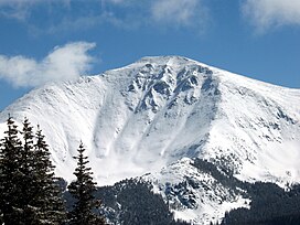
Parry Peak, elevation 13,397 ft (4,083 m), is a summit in the Front Range of central Colorado. The peak is on the continental divide southeast of Winter Park in the Arapahoe National Forest. The name honors Charles Christopher Parry, a botanist who made extensive studies of the Colorado mountain flora in the 1860s. It is one of the 637 thirteeners (peaks over 13,000 ft elevation) in the state of Colorado and lies along the Continental Divide Trail.
| Parry Peak | |
|---|---|
 View of Parry Peak from Mary Jane Mountain | |
| Highest point | |
| Elevation | 13,397 ft (4,083 m)[1][2] |
| Prominence | 1,720 ft (524 m)[2] |
| Isolation | 9.46 mi (15.22 km)[2] |
| Listing | |
| Coordinates | 39°50′17″N 105°42′48″W[3] |
| Naming | |
| Etymology | Charles Christopher Parry |
| Geography | |
 Parry Peak Colorado | |
| Location | Clear Creek and Grand counties, Colorado, U.S.[3] |
| Parent range | Front Range[2] |
| Topo map | USGS 7.5' map Empire, Colorado |
Parry Peak is also the highest peak of the James Group of the Front Range of Colorado.
See also
References
- The elevation of Parry Peak includes an adjustment of +1.763 m (+5.78 ft) from NGVD 29 to NAVD 88.
- "Parry Peak, Colorado". Peakbagger.com. Retrieved October 21, 2014.
- "Parry Peak". Geographic Names Information System. United States Geological Survey. Retrieved October 21, 2014.
External links
- Parry Peak on 13ers.com
- Parry Peak on listsofjohn.com
- Parry Peak on peakery.com
- Parry Peak on summitpost.org
На других языках
[de] Parry Peak
Der Parry Peak ist ein Berg in den Rocky Mountains im US-Bundesstaat Colorado. Er liegt etwa 80 km westlich von Denver und ist der höchste Punkt des Wanderweges Continental Divide Trail.- [en] Parry Peak
Текст в блоке "Читать" взят с сайта "Википедия" и доступен по лицензии Creative Commons Attribution-ShareAlike; в отдельных случаях могут действовать дополнительные условия.
Другой контент может иметь иную лицензию. Перед использованием материалов сайта WikiSort.org внимательно изучите правила лицензирования конкретных элементов наполнения сайта.
Другой контент может иметь иную лицензию. Перед использованием материалов сайта WikiSort.org внимательно изучите правила лицензирования конкретных элементов наполнения сайта.
2019-2025
WikiSort.org - проект по пересортировке и дополнению контента Википедии
WikiSort.org - проект по пересортировке и дополнению контента Википедии
