geo.wikisort.org - Mountains
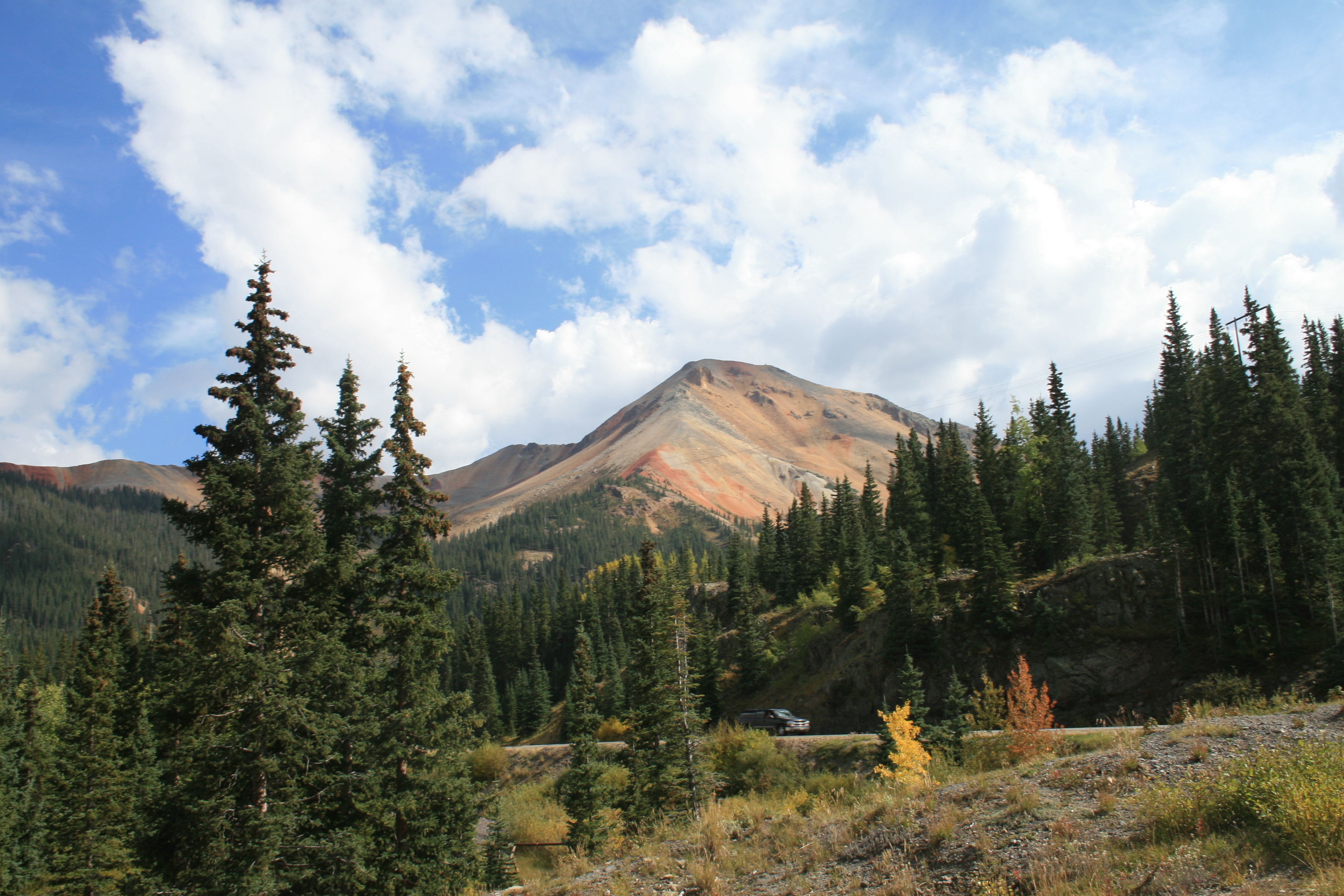
Red Mountain is a set of three peaks in the San Juan Mountains of western Colorado in the United States, about 5 miles south of Ouray. The mountains get their name from the reddish iron ore rocks that cover the surface. Several other peaks in the San Juan Mountains likewise have prominent reddish coloration from iron ore and are also called "Red Mountain".
| Red Mountain Number 3 | |
|---|---|
 Red Mountain Number 3 | |
| Highest point | |
| Elevation | 12,896 ft (3,931 m)[1] |
| Coordinates | 37°54′06″N 107°41′21″W[2] |
| Geography | |
 Red Mountain Number 3 Colorado | |
| Location | Ouray and San Juan counties, Colorado, United States[2] |
| Parent range | San Juan Mountains |
| Topo map | USGS 7.5' topographic map Ironton, Colorado[2] |
| Red Mountain Number 1 | |
|---|---|
 Red Mountain Number 1 | |
| Highest point | |
| Elevation | 12,598 ft (3,840 m)[3] |
| Coordinates | 37°54′37″N 107°39′44″W[4] |
| Geography | |
| Location | Ouray and San Juan counties, Colorado, United States[4] |
| Red Mountain Number 2 | |
|---|---|
 Red Mountain Number 2 | |
| Highest point | |
| Elevation | 12,225 ft (3,726 m)[5] |
| Coordinates | 37°54′46″N 107°40′57″W[6] |
| Geography | |
| Location | Ouray County, Colorado, U.S.[6] |
Nearby Red Mountain Pass is named after Red Mountain, and the ghost town mining camp of Red Mountain Town is located around Red Mountain.
Red Mountain Town
Following sporadic settling of the region in the 1870s, a series of permanent mining towns were founded in what became known as the Red Mountain Mining District. Among these was Red Mountain Town, which was founded following discoveries of silver in 1882.[7][8] Other communities in the area included Ironton and Guston, which were eventually connected with the larger towns of Silverton and Ouray via the Silverton Railroad and later the Million Dollar Highway.
Gallery
 West aspect, from Imogene Pass
 Red Mountain Number 3 with the ghost town of Red Mountain.
 Red Mountain reflected in Crystal Lake


See also
- List of Colorado mountain ranges
- List of Colorado mountain summits
- List of Colorado county high points
References
- The elevation of Red Mountain Number 3 includes an adjustment of +1.801 m (+5.91 ft) from NGVD 29 to NAVD 88.
- "Red Mountain Number 3". Geographic Names Information System. United States Geological Survey. Retrieved November 6, 2014.
- The elevation of Red Mountain Number 1 includes an adjustment of +1.826 m (+5.99 ft) from NGVD 29 to NAVD 88.
- "Red Mountain Number 1". Geographic Names Information System. United States Geological Survey. Retrieved November 6, 2014.
- The elevation of Red Mountain Number 2 includes an adjustment of +1.803 m (+5.92 ft) from NGVD 29 to NAVD 88.
- "Red Mountain Number 2". Geographic Names Information System. United States Geological Survey. Retrieved November 6, 2014.
- Underwood, Todd (July 2000). "Red Mountain Town". Ghosttowns.com. Retrieved 8 March 2021.
- "Red Mountain Town, Colorado". Western Mining History. Retrieved 8 March 2021.
| Federal |
| ||||||||||||||||||||||||||||||||
|---|---|---|---|---|---|---|---|---|---|---|---|---|---|---|---|---|---|---|---|---|---|---|---|---|---|---|---|---|---|---|---|---|---|
| State |
| ||||||||||||||||||||||||||||||||
| Trails |
| ||||||||||||||||||||||||||||||||
Colorado Department of Natural Resources (web) | |||||||||||||||||||||||||||||||||
 Definitions from Wiktionary
 Media from Commons
 News from Wikinews
 Quotations from Wikiquote
 Texts from Wikisource
 Textbooks from Wikibooks
 Resources from Wikiversity
This Colorado state location article is a stub. You can help Wikipedia by expanding it. |
Другой контент может иметь иную лицензию. Перед использованием материалов сайта WikiSort.org внимательно изучите правила лицензирования конкретных элементов наполнения сайта.
WikiSort.org - проект по пересортировке и дополнению контента Википедии