geo.wikisort.org - Mountains
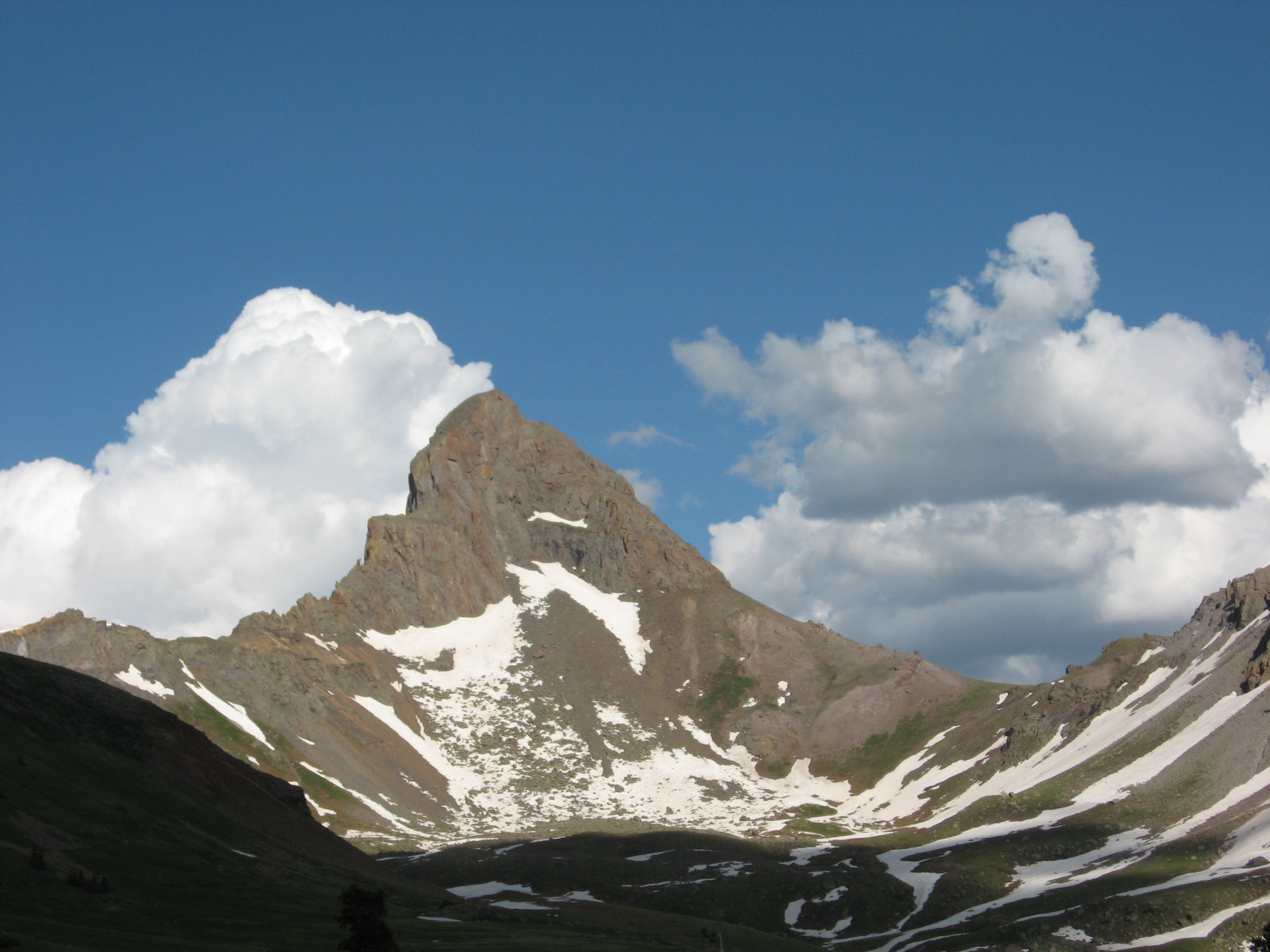
Wetterhorn Peak (German: Wetterhorn, literally Weather Horn) is a fourteen thousand foot mountain peak in the U.S. state of Colorado. It is located in the Uncompahgre Wilderness of the northern San Juan Mountains, in northwestern Hinsdale County and southeastern Ouray County, 9 miles (14 km) east of the town of Ouray. It lies 2.75 mi (4.4 km) west of Uncompahgre Peak.
| Wetterhorn Peak | |
|---|---|
 | |
| Highest point | |
| Elevation | 14,021 ft (4,274 m)[1][2] |
| Prominence | 1,635 ft (498 m)[2] |
| Parent peak | Uncompahgre Peak[2] |
| Isolation | 2.77 mi (4.46 km)[2] |
| Listing | Colorado Fourteener 50th |
| Coordinates | 38°03′38″N 107°30′39″W[3] |
| Naming | |
| English translation | Weather Peak |
| Language of name | German |
| Geography | |
 Wetterhorn Peak Colorado | |
| Location | Hinsdale and Ouray counties, Colorado, United States[3] |
| Parent range | San Juan Mountains[2] |
| Topo map | USGS 7.5' topographic map Wetterhorn Peak, Colorado[3] |
| Climbing | |
| First ascent | 1906 by George Barnard, C. Smedley, W. P. Smedley, D. Utter (first recorded ascent)[2][4] |
| Easiest route | Southeast ridge: exposed scramble, class 3/4[4][5] |
Wetterhorn Peak, and its neighbor Matterhorn Peak, 13,590 ft (4,142 m), are named after the Wetterhorn and the Matterhorn, two famous peaks in the Swiss Alps. Both Colorado peaks are pointed rock spires (hence resembling their namesake peaks), whose shapes contrast with the broad bulk of the higher Uncompahgre Peak.[5]
The first recorded ascent of the peak was made in 1906 by George Barnard, C. Smedley, W. P. Smedley, and D. Utter,[2] but a previous ascent by miners working in the area in the 19th century is likely.[4]
The standard, and only common, route on Wetterhorn Peak is the southeast ridge, which is accessed via the Matterhorn Creek drainage on the south side of the mountain. The trailhead is on the Henson Creek Road, accessible from Lake City. The route involves 3,535 ft (1,077 m) of ascent from the trailhead and some exposed scrambling (Class 3/4) on the ridge itself. The nearby east face is considered a high-quality advanced snow climb or extreme ski descent.[5]
See also
References
- The elevation of Wetterhorn Peak includes an adjustment of +1.903 m (+6.24 ft) from NGVD 29 to NAVD 88.
- "Wetterhorn Peak, Colorado". Peakbagger.com. Retrieved October 23, 2014.
- "Wetterhorn Peak". Geographic Names Information System. United States Geological Survey. Retrieved October 23, 2014.
- "Wetterhorn Peak". Summitpost.
- Louis W. Dawson II. Dawson's Guide to Colorado's Fourteeners, Volume 2. Blue Clover Press. pp. 115–121. ISBN 0-9628867-2-6.
External links
 Definitions from Wiktionary
 Media from Commons
 News from Wikinews
 Quotations from Wikiquote
 Texts from Wikisource
 Textbooks from Wikibooks
 Resources from Wikiversity
|
Denver (capital) | ||
| Topics |
|  |
| Society |
| |
| Cities |
| |
| Counties |
| |
| Regions |
| |
This Colorado state location article is a stub. You can help Wikipedia by expanding it. |
На других языках
[de] Wetterhorn Peak
Wetterhorn Peak (englisch für Wetterhorn-Spitze) ist ein Berg im Südwesten Colorados, USA. Er ist Teil der Uncompahgre Wilderness Area in den San Juan Mountains und liegt auf der Grenze zwischen den Countys Hinsdale und Ouray. Etwa vier Kilometer östlich erhebt sich der 4361 Meter hohe Uncompahgre Peak. Wetterhorn Peak hat eine Schartenhöhe von 498 Metern.[4]- [en] Wetterhorn Peak
[fr] Pic Wetterhorn
Le pic Wetterhorn, en anglais Wetterhorn Peak, est un sommet montagneux américain à la frontière du comté de Hinsdale et du comté d'Ouray, au Colorado. Il culmine à 4 272 mètres d'altitude dans les monts San Juan. Il est protégé au sein de la forêt nationale d'Uncompahgre et de l'Uncompahgre Wilderness.[ru] Веттерхорн-Пик
Веттерхорн-Пик (англ. Wetterhorn Peak) — гора в штате Колорадо, США. Она расположена в районе охраняемой природной территории Uncompahgre Wilderness, в северной части гор Сан-Хуан, округ Хинсдэйл (англ. Hinsdale County), в 14 км восточнее города Оурэй (англ. Ouray).Другой контент может иметь иную лицензию. Перед использованием материалов сайта WikiSort.org внимательно изучите правила лицензирования конкретных элементов наполнения сайта.
WikiSort.org - проект по пересортировке и дополнению контента Википедии