geo.wikisort.org - Mountains
Laramie Peak Is the highest and most prominent peak in the Laramie Range of Wyoming. With a peak elevation of 10,275 feet (3,132 m),[2] it is the only peak in the Laramie Range to exceed an elevation of 10,000 feet (3,000 m). It can be seen from great distances from both sides of the Laramie Range including from around 100 miles (160 km) away at the top of the Scotts Bluff National Monument in Nebraska and in the Wyoming towns of Wheatland, Douglas, Rock River, and immediately outside the cities of Laramie and Cheyenne.
| Laramie Peak | |
|---|---|
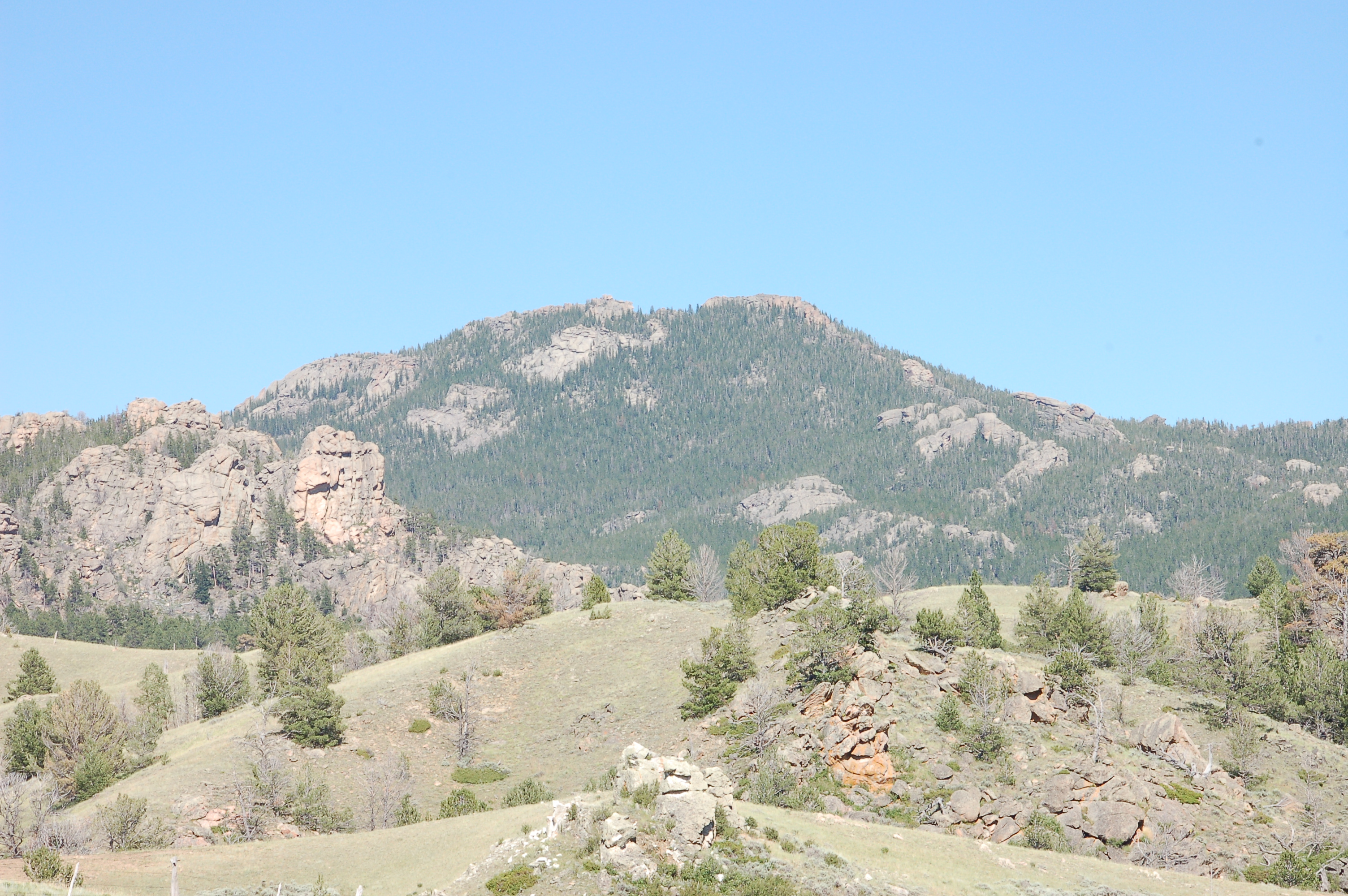 Southern face of Laramie Peak | |
| Highest point | |
| Elevation | 10,275 ft (3,132 m)[1] |
| Prominence | 3,312 ft (1,009 m)[1] |
| Coordinates | 42°16′04″N 105°26′31″W |
| Geography | |
| Location | Albany County, Wyoming, U.S. |
| Parent range | Laramie Range |
| Topo map | USGS Laramie Peak |
Name
The mountain was named for Jacques La Ramee, a French-Canadian fur trader who lived in the area in the 1820s and who was found dead at the Laramie River.[3]
History

Laramie Peak was an important landmark for the settlers on the Oregon Trail and the Mormon Trail. After reaching Scotts Bluff the top of the hill was visible at the horizon. For more than one week the hill guided the people on the track and signal the end of the relatively flat part of the way, reaching the Rocky Mountains[4]
Mark Twain wrote 1871 in his book Roughing It about the hill: "We passed Fort Laramie in the night, and on the seventh morning out we found ourselves in the Black Hills, with Laramie Peak at our elbow (apparently) looming vast and solitary -- a deep, dark, rich indigo blue in hue, so portentously did the old colossus frown under his beetling brows of storm-cloud. He was thirty or forty miles away, in reality, but he only seemed removed a little beyond the low ridge at our right."[5]
Usage


A trail starting at the Friend Park Campground leads over a distance of about 5 Miles to the top of the hill. It rises from 7200 feet elevation to 10276 feet. On top, several antennas, containers for transmitters and a helicopter platform are installed.
See also
References
- "Laramie Peak, Wyoming". Peakbagger.com. Retrieved May 8, 2018.
- "National Geodetic Survey Data Sheet - Laramie Peak (PID:NQ0621)". National Geodetic Survey. Retrieved 2009-03-28.
- "Archived copy". Archived from the original on 2010-06-24. Retrieved 2010-02-21.
{{cite web}}: CS1 maint: archived copy as title (link) The Legendary Jacques La Ramee - An Interpretation of “Hearsay Evidence” of the Life and Death of Jacques LaRamee (engl.) - "Laramie Peak". wyoshpo.state.wy.us. Retrieved 13 April 2018.
- "Roughing It - Chapter IX". Archived from the original on 2012-07-08. Retrieved 2010-02-21. Mark Twain, 1871, Roughing It, Chapter 9
External links
 Definitions from Wiktionary
 Media from Commons
 News from Wikinews
 Quotations from Wikiquote
 Texts from Wikisource
 Textbooks from Wikibooks
 Resources from Wikiversity
State of Wyoming | |
|---|---|
Cheyenne (capital) | |
| Topics |
|
| Society |
|
| Regions |
|
| Cities | |
| Counties | |
Authority control | |
|---|---|
| General |
|
| National libraries | |
| Other |
|
This article about a location in Wyoming is a stub. You can help Wikipedia by expanding it. |
На других языках
[de] Laramie Peak
Der Laramie Peak ist ein prominenter Berg im Osten von Wyoming im County Albany in den USA und liegt im nördlichen Teil des Medicine Bow National Forest. Er ist mit 3.132 Metern[1] der höchste Punkt der Gebirgskette der Laramie Mountains, die zu den Rocky Mountains gehören. Der Berg befindet sich im Besitz des Staates.- [en] Laramie Peak
Другой контент может иметь иную лицензию. Перед использованием материалов сайта WikiSort.org внимательно изучите правила лицензирования конкретных элементов наполнения сайта.
WikiSort.org - проект по пересортировке и дополнению контента Википедии