geo.wikisort.org - Mountains
Buck Mountain (elevation: 11,943 feet (3,640 m)) is a mountain located in the Teton Range, Grand Teton National Park, Wyoming, immediately southeast of Grand Teton.[3]
| Buck Mountain | |
|---|---|
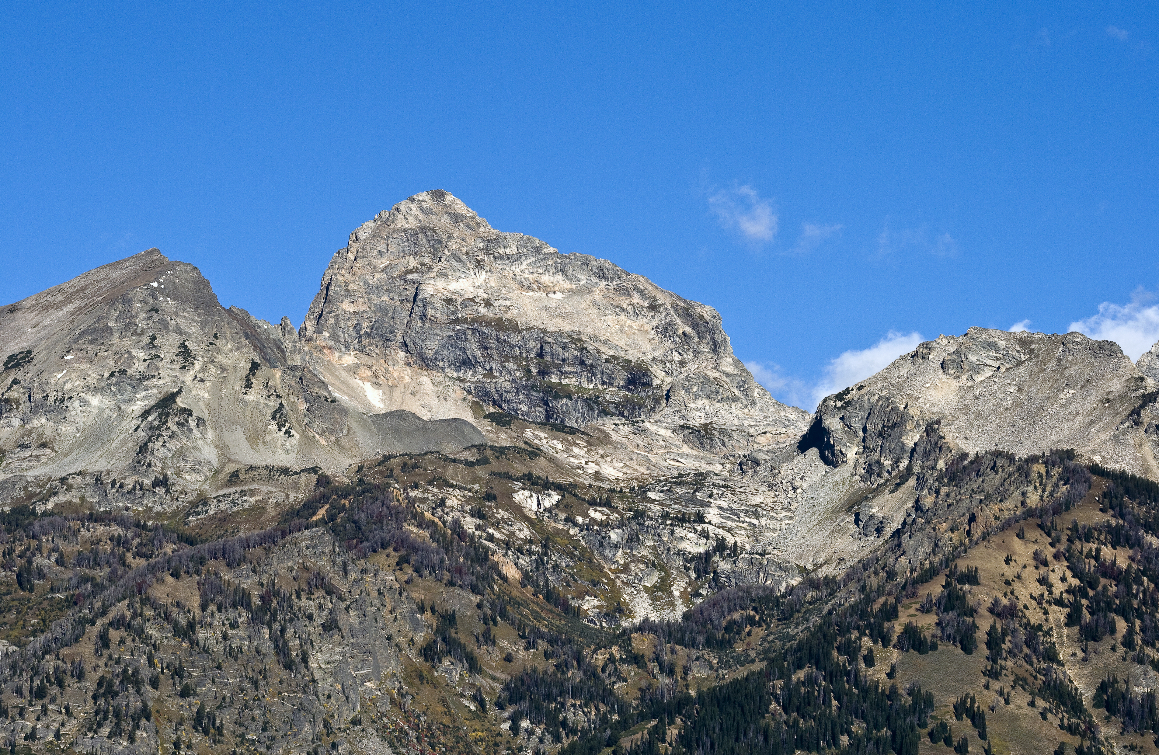
 Buck Mountain from Teton Point turnout | |
| Highest point | |
| Elevation | 11,943 ft (3,640 m)[1] |
| Prominence | 1,298 ft (396 m)[1] |
| Coordinates | 43°41′22″N 110°49′10″W[2] |
| Geography | |
 Buck Mountain Location in Wyoming  Buck Mountain Location in the United States | |
| Location | Grand Teton National Park, Teton County, Wyoming, U.S. |
| Parent range | Teton Range |
| Topo map | USGS Grand Teton |
| Climbing | |
| First ascent | Bannon/Buck (August 21, 1898) |
| Easiest route | Scramble/Technical class 3 to 5.8 |

Description
The mountain is the highest summit south of Garnet Canyon and is easily seen from most vantage points in Jackson Hole. Views from the summit offer excellent views of the Cathedral Group to the north.[1] The west slopes of the summit tower are along the Alaska Basin Trail and extend into Caribou-Targhee National Forest and the Jedediah Smith Wilderness, which is the location of Alaska Basin, a popular wilderness camping area for backpackers. Timberline Lake is located on the eastern flanks of the peak.
History
The first documented summiting by people of European descent was on August 21, 1898 by T.M. Bannon and George Buck, only ten days after Grand Teton was first climbed by another party.[4] Bannon later became the first person to climb Borah Peak, the tallest mountain in the state of Idaho.
References
- "Buck Mountain, Wyoming". Peakbagger.com. Retrieved 2011-05-28.
- "Buck Mountain". Geographic Names Information System. United States Geological Survey. Retrieved 2011-05-28.
- Grand Teton, WY (Map). TopoQwest (United States Geological Survey Maps). Retrieved 2011-05-28.
- "Buck Mountain". SummitPost.org. Retrieved 2011-05-09.
На других языках
[de] Buck Mountain (Wyoming)
Der Buck Mountain ist ein 3639 m hoher Berg in der Teton Range in den Rocky Mountains. Er ist der höchste Berg der Teton Range südlich des Garnet Canyons und ist von nahezu allen Aussichtspunkten im Tal von Jackson Hole gut zu sehen.[2] Er befindet sich im Teton County im Bundesstaat Wyoming und der Gipfel befindet sich innerhalb des Grand-Teton-Nationalpark.[3][4]- [en] Buck Mountain (Wyoming)
[fr] Buck Mountain
Buck Mountain est un sommet du comté de Teton, au Wyoming, dans l'Ouest des États-Unis. Il culmine à 3 639 mètres d'altitude dans la chaîne Teton. Il est protégé au sein du parc national de Grand Teton.Другой контент может иметь иную лицензию. Перед использованием материалов сайта WikiSort.org внимательно изучите правила лицензирования конкретных элементов наполнения сайта.
WikiSort.org - проект по пересортировке и дополнению контента Википедии