geo.wikisort.org - Mountains
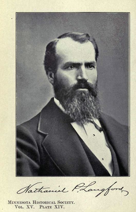
Mount Langford el. 10,623 feet (3,238 m) is a mountain peak in the Absaroka Range in Yellowstone National Park. The peak is named for Nathaniel P. Langford,[2] the first superintendent of Yellowstone and a leader of the Washburn–Langford–Doane Expedition to Yellowstone in 1870. The expedition and Langford's subsequent promotion in Scribner's helped in the creation of the park in 1872.
| Mount Langford | |
|---|---|
 1977 | |
| Highest point | |
| Elevation | 10,623 ft (3,238 m)[1] |
| Coordinates | 44°24′25″N 110°06′37″W[1] |
| Geography | |
 Mount Langford Yellowstone National Park, Park County, Wyoming | |
| Parent range | Absaroka Range |
| Topo map | Plenty Coups Peak |
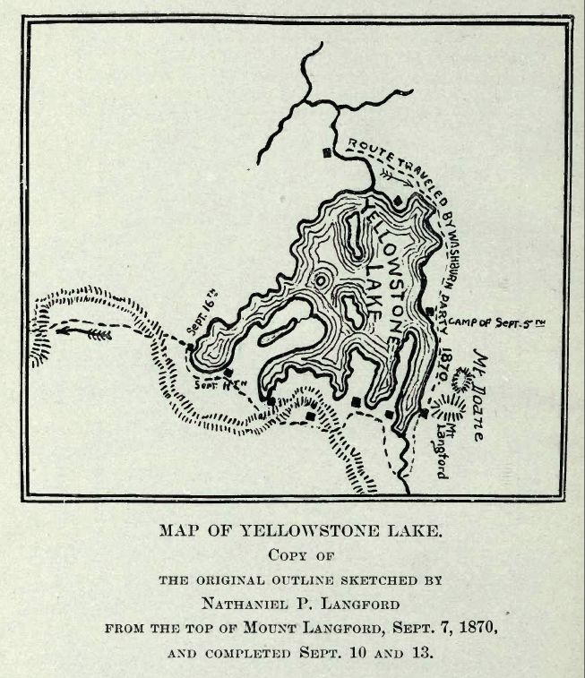
On September 7, 1870 the Washburn expedition was camped along the southwestern shore of Yellowstone Lake. That day Langford and Lt. Gustavus Cheyney Doane chose to ascend a nearby peak. From that peak, Langford sketched the first reasonably accurate map of Yellowstone Lake. Upon their return to camp, Henry D. Washburn named the peak they ascended and a nearby secondary peak: Mount Langford and Mount Doane.[3] They are annotated on the map Langford sketched. Langford described the summit with these words:
The view from the summit of this mountain, for wild and rugged grandeur, is surpassed by none I ever before saw. The Yellowstone basin and the Wind river mountains were spread out before us like a map. On the south the eye followed the source of the Yellowstone above the lake, until, twenty-five miles away, it was lost in an immense canon, beyond which two immense jets of vapor rose to a height of probably three hundred feet, indicating that there were other and perhaps greater wonders than those embraced in our prescribed limit of exploration. On the north the outlet of the lake and the steam from the mud geyser and mud volcano were distinctly visible, while on the southeast the view followed to the horizon a succession of lofty peaks and ridges at least thirty miles in width, whose jagged slopes were filled with yawning caverns, pine-embowered recesses and beetling precipices, some hundreds and some thousands of feet in height ... Lieutenant Doane and I were somewhat fatigued with our climb of four hours' duration, and we refreshed ourselves with such creature comforts as we found on the summit; but, although we attained the "crest," we did not discern any "free and generous spirit," save that which we saw "through a glass darkly."
— Nathaniel P. Langford, 1870[4]
During the Hayden Geological Survey of 1871, Hayden, for unknown reasons, moved the names of Mount Langford and Doane to peaks farther north. The original Mount Langford remained unnamed until 1885 when Arnold Hague named it Colter Peak.
See also
- Mountains and mountain ranges of Yellowstone National Park
Notes
- "Mount Langford". Geographic Names Information System. United States Geological Survey.
- Gannett, Henry (1905). The Origin of Certain Place Names in the United States. U.S. Government Printing Office. p. 181.
- Whittlesey, Lee (1988). Yellowstone Place Names. Helena, MT: Montana Historical Society Press. p. 106. ISBN 0-917298-15-2.
- Langford, Nathaniel Pitt (1905). The Discovery of Yellowstone Park; Diary of the Washburn Expedition to the Yellowstone and Firehole Rivers in the Year 1870. St. Paul, MN: Frank Jay Haynes. pp. 59–61.
Yellowstone National Park – Lake and environs | ||
|---|---|---|
Historic structures and other attractions in the Yellowstone Lake, West Thumb, South and East Entrance areas | ||
| Structures and History |
|  |
| West Thumb Geyser Basin |
| |
| Geography and Geology |
| |
| ||
Cheyenne (capital) | ||
| Topics |
|  Seal of Wyoming |
| Society |
| |
| Regions |
| |
| Cities |
| |
| Counties | ||
На других языках
[de] Mount Langford
Der Mount Langford ist ein Berggipfel im südöstlichen Teil des Yellowstone-Nationalparks im US-Bundesstaat Wyoming. Sein Gipfel hat eine Höhe von 3285 m. Er befindet sich wenige Kilometer nordwestlich des höchsten Berges im Park, dem Eagle Peak, und ist Teil der Absaroka-Bergkette in den Rocky Mountains.[1] Benannt wurde er nach Nathaniel P. Langford, dem ersten Superintendent des Yellowstone-Nationalparks und Teilnehmer der Washburn-Langford-Doane Expedition zum Yellowstone im Jahr 1870. Ursprünglich hieß der heutige Colter Peak wenige Kilometer südlich Mount Langford, während der Hayden-Expedition von 1871 verlegte Hayden jedoch aus unbekannten Gründen die Namen von Mount Langford und Mount Doane auf Gipfel weiter nördlich. Der ursprüngliche Mount Langford wurde 1885 von Arnold Hague in Colter Peak umbenannt.[2][3]- [en] Mount Langford
[fr] Mont Langford
Le mont Langford est un sommet de la chaîne Absaroka situé dans le parc national de Yellowstone aux États-Unis.Другой контент может иметь иную лицензию. Перед использованием материалов сайта WikiSort.org внимательно изучите правила лицензирования конкретных элементов наполнения сайта.
WikiSort.org - проект по пересортировке и дополнению контента Википедии