geo.wikisort.org - Mountains
Sheep Mountain (11,244 feet (3,427 m)) is located in the U.S. state of Wyoming.[3] Sheep Mountain forms a 5-mile (8 km) long ridge in the Gros Ventre Range and is easily seen from Jackson Hole. The town of Jackson is 13 miles (21 km) southwest of the peak. The southern end of Sheep Mountain is above the tree line and consists of rocky cliffs that are referred to as the "Sleeping Indian" due to their appearance as viewed from Jackson Hole. Sheep Mountain is in the Gros Ventre Wilderness of Bridger–Teton National Forest. At the northern end of Sheep Mountain is the location of the Gros Ventre landslide.
| Sheep Mountain | |
|---|---|
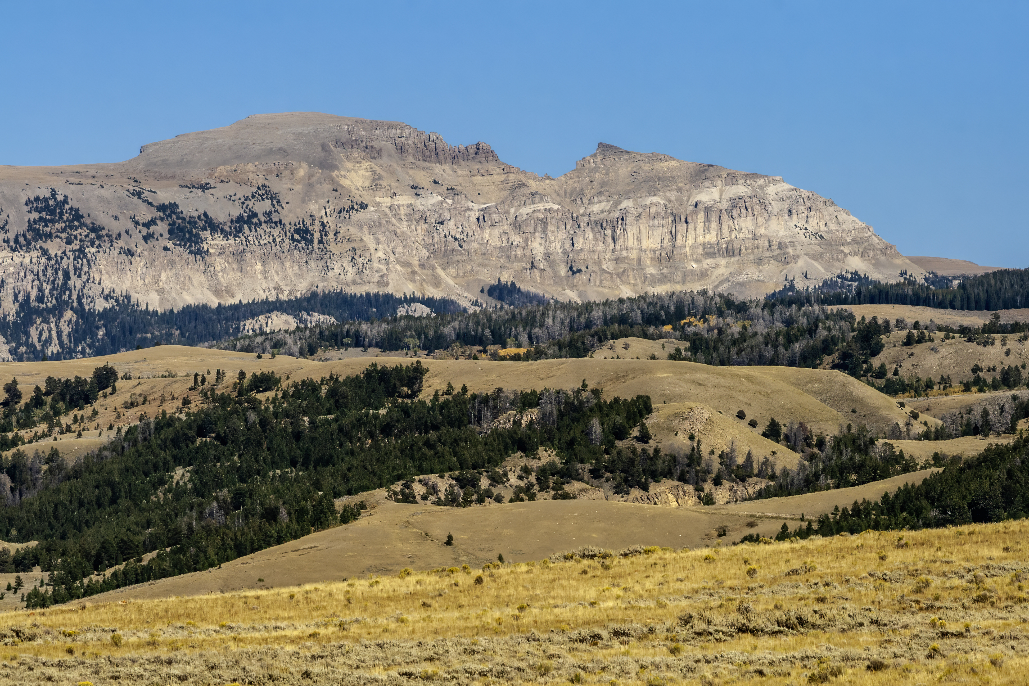 The "Sleeping Indian" on Sheep Mountain as viewed from Jackson Hole | |
| Highest point | |
| Elevation | 11,244 ft (3,427 m)[1] |
| Prominence | 1,122 ft (342 m)[1] |
| Coordinates | 43°32′38″N 110°31′28″W[2] |
| Geography | |
 Sheep Mountain Teton County, Wyoming, U.S. | |
| Parent range | Gros Ventre Range |
| Topo map | USGS Blue Miner Lake, WY |
In 1996, a U.S. Air Force C-130 cargo plane carrying an automobile and equipment outbound from Jackson Hole crashed into Sheep Mountain, killing a U.S. Secret Service agent and eight Air Force personnel. The cargo plane was transporting equipment to another destination after U.S. President Bill Clinton and his family had vacationed in Jackson Hole the previous week.[4]
References
- "Sheep Mountain, Wyoming". Peakbagger.com. Retrieved 2010-11-21.
- "Sheep Mountain". Geographic Names Information System. United States Geological Survey, United States Department of the Interior. Retrieved 2010-11-22.
- "Blue Miner Lake, WY" (Map). TopoQuest (USGS Quad). Retrieved 2010-11-21.
- Weiner, Tim (August 19, 1996). "9 Die in Crash of C-130 Carrying Clinton Cargo". The New York Times. Retrieved 2013-07-03.
This article about a location in Wyoming is a stub. You can help Wikipedia by expanding it. |
На других языках
[de] Sheep Mountain (Teton County, Wyoming)
Der Sheep Mountain ist ein 3426 m hoher Berg im US-Bundesstaat Wyoming und der sechsthöchste Gipfel der Gros Ventre Range in den Rocky Mountains. Der Sheep Mountain bildet einen 8 km langen Grat in der Gros Ventre Range und ist von Jackson Hole aus gut zu sehen. Die Stadt Jackson, Wyoming liegt 21 km südwestlich des Gipfels. Das südliche Ende des Sheep Mountain liegt oberhalb der Baumgrenze und besteht aus felsigen Klippen, die aufgrund ihres Aussehens von Jackson Hole aus als "Schlafender Indianer" bezeichnet werden. Der Sheep Mountain liegt in der Gros Ventre Wilderness des Bridger-Teton National Forest.[1][2]- [en] Sheep Mountain (Teton County, Wyoming)
Другой контент может иметь иную лицензию. Перед использованием материалов сайта WikiSort.org внимательно изучите правила лицензирования конкретных элементов наполнения сайта.
WikiSort.org - проект по пересортировке и дополнению контента Википедии