geo.wikisort.org - Mountains
Hoyt Peak is a 10,506 feet (3,202 m) summit located on the shared border of Yellowstone National Park and North Absaroka Wilderness, in Park County, Wyoming.[3]
| Hoyt Peak | |
|---|---|
 West aspect, from Avalanche Peak trail | |
| Highest point | |
| Elevation | 10,506 ft (3,202 m)[1] |
| Prominence | 626 ft (191 m)[1] |
| Parent peak | Avalanche Peak (10,568 ft)[2] |
| Isolation | 1.07 mi (1.72 km)[2] |
| Coordinates | 44°28′37″N 110°07′38″W[3] |
| Naming | |
| Etymology | John Wesley Hoyt |
| Geography | |
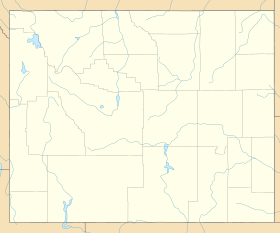 Hoyt Peak Location in Wyoming  Hoyt Peak Hoyt Peak (the United States) | |
| Location | Yellowstone National Park Park County, Wyoming, U.S. |
| Parent range | Absaroka Range Rocky Mountains |
| Topo map | USGS Sylvan Lake |
| Climbing | |
| Easiest route | class 2[2] |
It was named for John Wesley Hoyt (1831–1912), third Governor of Wyoming Territory.[4] The mountain's name was officially adopted in 1895 by the United States Board on Geographic Names.[3]
Sylvan Pass forms the low point of the saddle between Hoyt Peak and Top Notch Peak.
Climate
According to the Köppen climate classification system, Hoyt Peak is located in a subarctic climate zone with long, cold, snowy winters, and mild summers.[5] Winter temperatures can drop below −10 °F with wind chill factors below −30 °F.
See also
References
- "Hoyt Peak, Wyoming". Peakbagger.com. Retrieved 2021-11-12.
- "Hoyt Peak - 10,500' WY". listsofjohn.com. Retrieved 2021-11-12.
- "Hoyt Peak". Geographic Names Information System. United States Geological Survey. Retrieved 2021-11-12.
- Gannett, Henry (1905). The Origin of Certain Place Names in the United States. Govt. Print. Off. pp. 162.
- Peel, M. C.; Finlayson, B. L.; McMahon, T. A. (2007). "Updated world map of the Köppen−Geiger climate classification". Hydrol. Earth Syst. Sci. 11. ISSN 1027-5606.
External links
- Weather forecast: Hoyt Peak
This article about a location in Wyoming is a stub. You can help Wikipedia by expanding it. |
На других языках
[de] Hoyt Peak
Der Hoyt Peak ist ein Berggipfel im Yellowstone-Nationalpark im nordwestlichen Teil des US-Bundesstaates Wyoming. Sein Gipfel hat eine Höhe von 3202 m. Er befindet sich wenige Kilometer östlich des East Entrance des Yellowstone-Nationalparks, bildet die Grenze des Parks zum Shoshone National Forest und ist Teil der Absaroka-Bergkette in den Rocky Mountains. Aufgrund seiner Lage nördlich des US Highway 14/16/20 gehört er zu den bekannteren Gipfeln des Parks, wird aber nicht so häufig bestiegen wie der nordwestlich gelegene Avalanche Peak.[1]- [en] Hoyt Peak
Другой контент может иметь иную лицензию. Перед использованием материалов сайта WikiSort.org внимательно изучите правила лицензирования конкретных элементов наполнения сайта.
WikiSort.org - проект по пересортировке и дополнению контента Википедии