geo.wikisort.org - Mountains
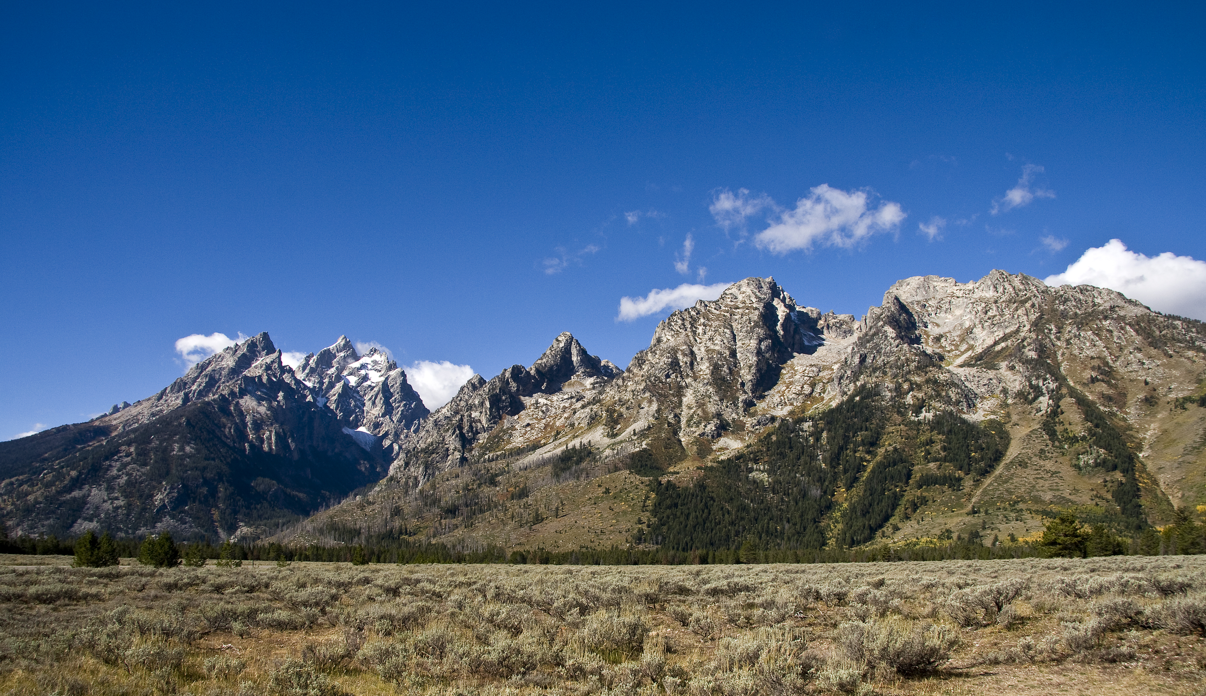
Mount Saint John, height 11,435 feet (3,485 m), is located in the Teton Range, Grand Teton National Park, Wyoming, northwest of Jenny Lake.[3] The mountain towers above the northwest shore of Jenny Lake, and along with Symmetry Spire and Rockchuck Peak, form a massif which looms to the north above Cascade Canyon. The scenic Lake of the Crags, a cirque lake or tarn, is located immediately south of the summit and is accessed by way of Hanging Canyon.
| Mount Saint John | |
|---|---|
 Mount Saint John | |
| Highest point | |
| Elevation | 11,435 ft (3,485 m) NAVD 88[1] |
| Prominence | 1,350 ft (410 m)[1] |
| Coordinates | 43°46′55″N 110°46′24″W[2] |
| Geography | |
 Mount Saint John Location in Wyoming  Mount Saint John Location in the United States | |
| Location | Grand Teton National Park, Teton County, Wyoming, U.S. |
| Parent range | Teton Range |
| Topo map | USGS Mount Moran |
| Climbing | |
| First ascent | Fryxell/Smith 1929 |
| Easiest route | Scramble |
References
- "Mount Saint John, Wyoming". Peakbagger.com. Retrieved 2011-05-28.
- "Mount Saint John". Geographic Names Information System. United States Geological Survey, United States Department of the Interior. Retrieved 2011-05-28.
- Mount Moran, WY (Map). TopoQwest (United States Geological Survey Maps). Retrieved 2011-05-28.
This article about a location in Wyoming is a stub. You can help Wikipedia by expanding it. |
На других языках
[de] Mount Saint John (Wyoming)
Der Mount Saint John ist ein Berg im Grand-Teton Nationalpark im Westen des US-Bundesstaates Wyoming.[1] Er hat eine Höhe von 3484 m und ist Teil der Teton Range in den Rocky Mountains.[2] Er erhebt sich unmittelbar westlich der Seen String Lake und Jenny Lake und liegt südlich des Paintbrush Canyons und nördlich des Hanging Canyons. Im Hanging Canyon liegt der kleine Bergsee Lake of the Crags. Der Rockchuck Peak liegt 800 m nördlich des Mount Saint John, Symmetry Spire rund 1 km südöstlich und Rock of Ages rund 1 km südlich.[3] Der Berg ist von nahezu allen Punkten im Tal Jackson Hole aus sichtbar, da er sich direkt über die Hochebene erhebt und ähnlich wie Grand Teton oder Mount Moran die Teton Range flankiert. Der Gipfel des Mount Saint John kann über einen unmarkierten Weg durch den Hanging Canyon erreicht werden.[4]- [en] Mount Saint John
Текст в блоке "Читать" взят с сайта "Википедия" и доступен по лицензии Creative Commons Attribution-ShareAlike; в отдельных случаях могут действовать дополнительные условия.
Другой контент может иметь иную лицензию. Перед использованием материалов сайта WikiSort.org внимательно изучите правила лицензирования конкретных элементов наполнения сайта.
Другой контент может иметь иную лицензию. Перед использованием материалов сайта WikiSort.org внимательно изучите правила лицензирования конкретных элементов наполнения сайта.
2019-2026
WikiSort.org - проект по пересортировке и дополнению контента Википедии
WikiSort.org - проект по пересортировке и дополнению контента Википедии