 Mount Nebo (left of center) aerial view from the south, with Utah Lake and the rest of the Wasatch Range in the background and the Great Salt Lake on the far left horizon
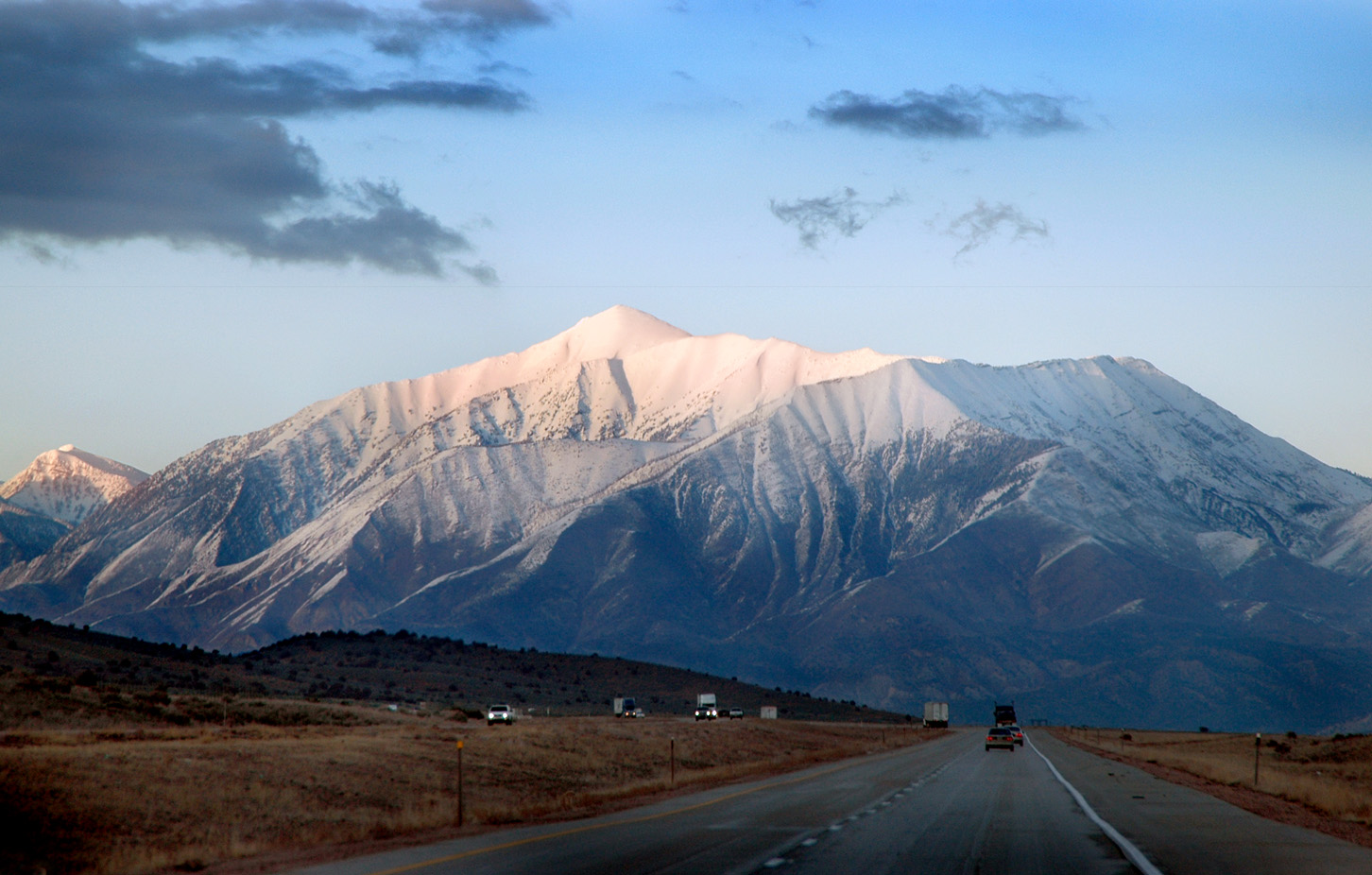
 Mount Nebo eastern side during winter
 Panorama of Mount Nebo, 2007
geo.wikisort.org - Mountains
Mount Nebo is the southernmost and highest mountain in the Wasatch Range of Utah, in the United States, and the centerpiece of the Mount Nebo Wilderness, inside the Uinta National Forest. It is named after the biblical Mount Nebo,[4] overlooking Israel from the east of the Jordan river, which is said to be the place of Moses' death.
This article needs additional citations for verification. (February 2013) |
| Mount Nebo | |
|---|---|
 Mount Nebo, February 2005 | |
| Highest point | |
| Elevation | 11,933 ft (3,637 m) NAVD 88[1] |
| Prominence | 5,488 ft (1,673 m)[1] |
| Isolation | 75.57 mi (121.62 km)[1] |
| Listing |
|
| Coordinates | 39°49′18″N 111°45′36″W[3] |
| Geography | |
 Mount Nebo Location in Utah | |
| Location | Juab / Utah counties, Utah, U.S. |
| Parent range | Wasatch Range |
| Topo map | USGS Mona |
| Climbing | |
| First ascent | 1869 |
| Easiest route | Hike |
Mount Nebo has two summits: the northern summit reaches 11,933 feet (3,637 m), and the southern summit reaches 11,882 feet (3,622 m). Early surveys placed the southern peak as the highest, but the mountain was resurveyed in the 1970s and the northern peak was found to be higher. It is the high point of Utah County.[6]
Mount Nebo is an "ultra", one of 128 ultra-prominent peaks in the United States having more than 1,500 metres (4,900 ft) of topographic prominence. The mountain is typically partially or completely covered in snow from mid-October until July. Nearby towns include Payson, Nephi, and Provo.
A substantial trail leads to the south summit, accessible from starting points on the east or west of the mountain. Another trail accesses the north summit, starting northeast of the mountain. A "bench trail" runs along the mountain's east side from north to south at roughly 9,000 feet elevation. Although strenuous, all of these trails are popular with hikers; many are dangerous places for horseback riders. One old-time local rider warns: "There's dead horses in every canyon on that mountain!"[7]
The Mount Nebo Scenic Byway is a federally designated National Scenic Byway which departs I-15 at Payson and travels south through the Mount Nebo Wilderness, climbing to over 9,000 feet before rejoining the interstate at Nephi. The route features panoramic views of Mount Nebo, the Utah Valley, and Utah Lake far below. There are numerous trailheads along the route for the hiking enthusiast, including a short walk to the "Devil's Kitchen", an area that has been described as a "mini Bryce Canyon".


See also
- List of Ultras of the United States
References
- "Mount Nebo, Utah". Peakbagger.com. Retrieved 2016-04-19.
- "Utah County High Points". Peakbagger.com. Retrieved 2016-04-18.
- "Mount Nebo". Geographic Names Information System. United States Geological Survey, United States Department of the Interior. Retrieved 2016-04-19.
- Van Atta, Dale (Jan 22, 1977). "You name it - there's a town for it". The Deseret News. pp. W6. Retrieved 18 October 2015.
- "Utah County Peaks: Tallest in Each of the State's 29 Counties".
- "Field Guide: The Peaks of the Wasatch Mountains". 31 October 2019.
External links
Wikimedia Commons has media related to Mount Nebo (Utah).
- Mt. Nebo. SummitPost.
- Mount Nebo, Utah. Peakbagger.
Authority control | |
|---|---|
| General |
|
| National libraries | |
This article about a location in Utah is a stub. You can help Wikipedia by expanding it. |
На других языках
[de] Mount Nebo (Utah)
Der Mount Nebo ist mit einer Höhe von 3637 Meter der höchste Gipfel der Wasatchkette (engl. Wasatch Range) im US-Bundesstaat Utah.[1] Die Wasatchkette ist Teil der Rocky Mountains.- [en] Mount Nebo (Utah)
[fr] Mont Nebo (Utah)
Le mont Nebo est une montagne des États-Unis qui s'élève à 3 636 m d'altitude. C'est le sommet le plus haut et le plus méridional de la chaîne Wasatch dans l'Utah.[ru] Нибо (гора, Юта)
Нибо — горная вершина на хребте Уосатч, расположенная в штате Юта, США. Высота горы — 3637 метров.Текст в блоке "Читать" взят с сайта "Википедия" и доступен по лицензии Creative Commons Attribution-ShareAlike; в отдельных случаях могут действовать дополнительные условия.
Другой контент может иметь иную лицензию. Перед использованием материалов сайта WikiSort.org внимательно изучите правила лицензирования конкретных элементов наполнения сайта.
Другой контент может иметь иную лицензию. Перед использованием материалов сайта WikiSort.org внимательно изучите правила лицензирования конкретных элементов наполнения сайта.
2019-2026
WikiSort.org - проект по пересортировке и дополнению контента Википедии
WikiSort.org - проект по пересортировке и дополнению контента Википедии