geo.wikisort.org - Mountains
Kamakou (Hawaiian: [kəməˈkow]) is the highest peak on the island of Molokai, at 4,961 feet (1,512 m). It is part of the extinct East Molokai shield volcano, which comprises the east side of the island.[2] Kamakou is located within the 2,774 acres (11.23 km2; 4.334 sq mi) Molokai Forest Reserve,[3] estimated to contain more than 250 rare native Hawaiian plants, many of which exist only in this part of the world.[4] Rare birds can also be found, with two examples being the olomaʻo (Molokai thrush) and kākāwahie (Molokai creeper). Monthly tours are held by The Nature Conservancy.[5]
| Kamakou | |
|---|---|
 Eastern Molokai with a portion of Kamakou and Molokai Forest Reserve | |
| Highest point | |
| Elevation | 4,961 ft (1,512 m)[1] |
| Prominence | 4,961 ft (1,512 m) |
| Listing | US most prominent peaks 127th |
| Coordinates | 21°6′23″N 156°52′06″W |
| Naming | |
| Language of name | Hawaiian |
| Geography | |
 Kamakou Hawaii 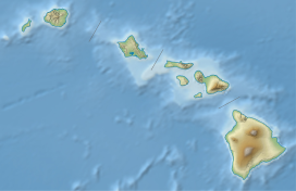 Kamakou Kamakou (Hawaii) | |
| Location | Molokai, Hawaii, U.S. |
| Parent range | Hawaiian Islands |
| Topo map | USGS |
| Geology | |
| Mountain type | Shield volcano (extinct) |
| Volcanic arc/belt | Hawaiian–Emperor seamount chain |
See also
- List of mountain peaks of the United States
- List of volcanoes of the United States
- List of Ultras of Oceania
- List of Ultras of the United States
- Hawaii hotspot
- Evolution of Hawaiian volcanoes
- Hawaiian–Emperor seamount chain
References
- Daniel Harrington. "Moloka'i: Cultural/Historical Sites and Attractions". Hawaiian Encyclopedia. Mutual Publishing. Retrieved June 7, 2012.
- Giant Landslides of the Hawaiian Islands - University of Hawaii, Hilo
- Molokai Forest Reserve — Department of Land and Natural Resources
- Kamakou Preserve, Molokai | GoHawaii.com
- Ed Misaki-Safeguarding Moloka‘i | The Nature Conservancy
This Hawaiʻi state location article is a stub. You can help Wikipedia by expanding it. |
На других языках
[de] Mauna Kamakou
Der Mauna Kamakou ist ein Vulkan und mit 1515 m die höchste Erhebung auf der Ostseite der hawaiischen Insel Molokaʻi. Hier befindet sich auch die Kamakou Preserve.[1]- [en] Kamakou
Текст в блоке "Читать" взят с сайта "Википедия" и доступен по лицензии Creative Commons Attribution-ShareAlike; в отдельных случаях могут действовать дополнительные условия.
Другой контент может иметь иную лицензию. Перед использованием материалов сайта WikiSort.org внимательно изучите правила лицензирования конкретных элементов наполнения сайта.
Другой контент может иметь иную лицензию. Перед использованием материалов сайта WikiSort.org внимательно изучите правила лицензирования конкретных элементов наполнения сайта.
2019-2026
WikiSort.org - проект по пересортировке и дополнению контента Википедии
WikiSort.org - проект по пересортировке и дополнению контента Википедии