geo.wikisort.org - Mountains
Mount Mitchell, known in Cherokee as Attakulla,[3] is the highest peak of the Appalachian Mountains and the highest peak in mainland eastern North America. It is located near Burnsville in Yancey County, North Carolina; in the Black Mountain subrange of the Appalachians, about 19 miles (31 km) northeast of Asheville. It is protected by Mount Mitchell State Park and surrounded by the Pisgah National Forest. Mount Mitchell's elevation is 6,684 feet (2,037 m) above sea level.[1]
| Mount Mitchell | |
|---|---|
 Mount Mitchell, viewed from Mount Craig | |
| Highest point | |
| Elevation | 6,684 ft (2,037 m)[1] |
| Prominence | 6,089 ft (1,856 m)[1] |
| Isolation | 1,189 miles (1,914 km) |
| Listing |
|
| Coordinates | 35°45′53″N 82°15′54″W[2] |
| Geography | |
 Mount Mitchell North Carolina, U.S.  Mount Mitchell Mount Mitchell (the United States) | |
| Location | Yancey County, North Carolina, United States |
| Parent range | Appalachian Mountains |
| Topo map | USGS Mount Mitchell |
| Climbing | |
| Easiest route | Hike |
Geography

The peak is the highest mountain in the United States east of the Mississippi River,[4][5] and the highest in all of eastern North America south of the Arctic Cordillera. The nearest higher peaks are in the Black Hills of South Dakota and the highland foothills of Colorado. The mountain's topographic isolation is calculated from the nearest discernible single higher point: Lone Butte, which is 1,189 miles (1,913 km) away in southeastern Colorado.[6]
History
The Cherokee people, who long occupied this area as part of their homeland, called the mountain Attakulla.[7]
European-American settlers first called the mountain Black Dome for its rounded shape. They later named it after Elisha Mitchell, a professor at the University of North Carolina, who first explored the Black Mountain region in 1835. He determined that the height of the range exceeded by several hundred feet that of Mount Washington in New Hampshire. The latter had been commonly thought at the time to be the highest point in the United States east of the Rocky Mountains. Mitchell fell to his death at nearby Mitchell Falls in 1857, where he had returned to verify his earlier measurements.[citation needed]
A 4.6-mile (7.4 km) road (NC 128) connects the scenic Blue Ridge Parkway to a parking lot where a steep paved 980-foot (300 m) trail leads through a conifer forest to the summit. The 40-foot (12 m) stone observation tower on the summit was torn down in late 2006. A new observation deck was constructed and opened to visitors in January 2009.[8]
Description
Mount Mitchell was formed during the Precambrian when marine deposits were metamorphosed into gneiss and schist. These metasedimentary rocks were later uplifted during the Alleghenian orogeny.[9] The soils are well drained, dark brown and stony with fine-earth material ranging in texture from sandy clay loam to loam or sandy loam; Burton and Craggey are the most common series around the summit.[10]
Environment
This section needs additional citations for verification. (August 2022) |
| Mount Mitchell | ||||||||||||||||||||||||||||||||||||||||||||||||||||||||||||
|---|---|---|---|---|---|---|---|---|---|---|---|---|---|---|---|---|---|---|---|---|---|---|---|---|---|---|---|---|---|---|---|---|---|---|---|---|---|---|---|---|---|---|---|---|---|---|---|---|---|---|---|---|---|---|---|---|---|---|---|---|
| Climate chart (explanation) | ||||||||||||||||||||||||||||||||||||||||||||||||||||||||||||
| ||||||||||||||||||||||||||||||||||||||||||||||||||||||||||||
| ||||||||||||||||||||||||||||||||||||||||||||||||||||||||||||
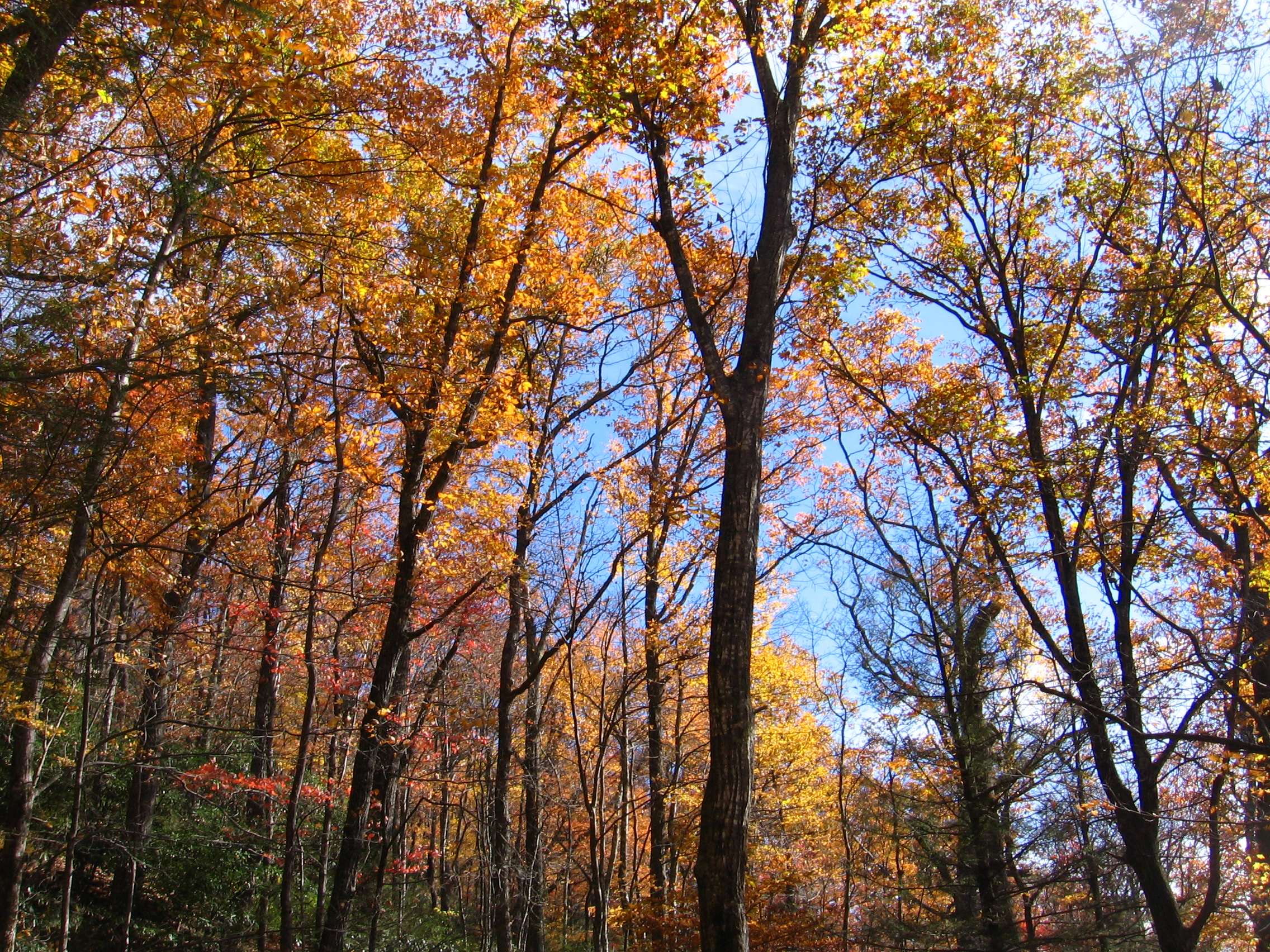
The mountain's summit is coated in a dense stand of Southern Appalachian spruce-fir forest, which consists primarily of two evergreen species—the red spruce and the Fraser fir. Most of the mature Fraser firs, however, were killed off by the non-native Balsam woolly adelgid in the latter half of the 20th century. The high elevations expose plant life to high levels of pollution, including acid precipitation in the form of rain, snow, and fog. These acids damage the red spruce trees in part by releasing natural metals from the soil, such as aluminum, and by leaching important minerals. To what extent this pollution harms the high-altitude ecosystem is debatable.[12]
While the mountain is still mostly lush and green in the summer, many dead Fraser fir trunks can be seen due to these serious problems. Reducing air pollution is a difficult issue, as the pollutants are often carried by air to this area from long distances. Sources can be local or hundreds of miles or kilometers away, requiring cooperation from as far away as the Midwest.
Wildflowers are abundant all summer long. Young fir and spruce trees do well in the subalpine climate, and their cones feed the birds along with wild blueberry and blackberry shrubs.
The second highest point in eastern North America, Mount Craig at 6,647 feet (2,026 m), is roughly a mile to the north of Mount Mitchell.
Climate
The summit area of Mount Mitchell is marked by a warm-summer humid continental climate (Köppen Dfb), with mild summers and long, moderately cold winters, being more similar to southeastern Canada than the southeastern U.S. The monthly daily average temperature ranges from 25.1 °F (−3.8 °C) in January to 59.6 °F (15.3 °C) in July. The coldest temperature ever recorded in the state occurred there on January 21, 1985 when it fell to −34 °F (−36.7 °C), during a severe cold spell that brought freezing temperatures as far south as Miami. It is also the coldest average reporting station in the state at 42.9 °F (6.1 °C), well below any other station.[13]
Unlike the lower elevations in the surrounding regions, heavy snows often fall from December to March, with 50 inches (1.27 m) accumulating in the Great Blizzard of 1993 and 33 inches (0.84 m) in the January 2016 blizzard.[14][13] Due to the high elevation, precipitation is heavy and reliable year-round, averaging 81.09 inches (2,060 mm) for the year, with no month receiving less than 5 in (127 mm) of average precipitation. The summit is often windy, with recorded gusts of up to 178 mph (286 km/h).[15]
Mount Mitchell recorded a new state record of 139.94 inches (3,554.5 mm) of precipitation in 2018, which is also the highest total rainfall recorded during a calendar year anywhere east of the Cascade Range in the Contiguous United States.[16]
| Climate data for Mount Mitchell (1991–2020 normals, records 1980–present) | |||||||||||||
|---|---|---|---|---|---|---|---|---|---|---|---|---|---|
| Month | Jan | Feb | Mar | Apr | May | Jun | Jul | Aug | Sep | Oct | Nov | Dec | Year |
| Record high °F (°C) | 61 (16) |
62 (17) |
73 (23) |
73 (23) |
78 (26) |
79 (26) |
80 (27) |
81 (27) |
77 (25) |
73 (23) |
67 (19) |
64 (18) |
81 (27) |
| Average high °F (°C) | 33.5 (0.8) |
35.5 (1.9) |
41.0 (5.0) |
50.2 (10.1) |
57.8 (14.3) |
63.8 (17.7) |
66.8 (19.3) |
66.0 (18.9) |
61.4 (16.3) |
53.6 (12.0) |
44.8 (7.1) |
37.7 (3.2) |
51.0 (10.6) |
| Daily mean °F (°C) | 25.1 (−3.8) |
27.0 (−2.8) |
32.3 (0.2) |
41.1 (5.1) |
49.5 (9.7) |
56.3 (13.5) |
59.6 (15.3) |
58.6 (14.8) |
53.8 (12.1) |
45.2 (7.3) |
36.2 (2.3) |
29.6 (−1.3) |
42.9 (6.1) |
| Average low °F (°C) | 16.7 (−8.5) |
18.5 (−7.5) |
23.6 (−4.7) |
32.0 (0.0) |
41.3 (5.2) |
48.7 (9.3) |
52.3 (11.3) |
51.2 (10.7) |
46.2 (7.9) |
36.9 (2.7) |
27.6 (−2.4) |
21.4 (−5.9) |
34.7 (1.5) |
| Record low °F (°C) | −34 (−37) |
−20 (−29) |
−11 (−24) |
1 (−17) |
14 (−10) |
28 (−2) |
38 (3) |
32 (0) |
23 (−5) |
13 (−11) |
−2 (−19) |
−19 (−28) |
−34 (−37) |
| Average precipitation inches (mm) | 7.47 (190) |
5.62 (143) |
7.22 (183) |
6.52 (166) |
6.08 (154) |
5.46 (139) |
6.92 (176) |
7.69 (195) |
8.76 (223) |
6.29 (160) |
6.17 (157) |
6.89 (175) |
81.09 (2,060) |
| Average snowfall inches (cm) | 19.2 (49) |
18.6 (47) |
18.5 (47) |
7.1 (18) |
1.4 (3.6) |
0.0 (0.0) |
0.0 (0.0) |
0.0 (0.0) |
0.0 (0.0) |
0.7 (1.8) |
3.9 (9.9) |
19.7 (50) |
89.1 (226) |
| Average precipitation days (≥ 0.01 in) | 14.1 | 12.4 | 14.1 | 12.6 | 14.2 | 16.1 | 17.8 | 16.1 | 12.7 | 10.3 | 10.4 | 13.1 | 163.9 |
| Average snowy days (≥ 0.1 in) | 6.4 | 6.5 | 4.9 | 2.5 | 0.3 | 0.0 | 0.0 | 0.0 | 0.0 | 0.4 | 2.0 | 5.2 | 28.2 |
| Source: NOAA[17][11] | |||||||||||||
See also
- List of mountains in North Carolina
- Mountains-to-Sea Trail
- Assault on Mount Mitchell, bicycling endurance
References
- "Mount Mitchell, North Carolina". Peakbagger.com. Retrieved 2008-12-28.
- "Mount Mitchell". Geographic Names Information System. United States Geological Survey, United States Department of the Interior. Retrieved 2008-12-28.
- Bradford, Erin (2019-12-05). "North Carolina Gazetteer". NCpedia. Retrieved 2020-11-22.
- Davis, Donald E.; Colten, Craig E.; Nelson, Megan Kate; Saikku, Mikko; Allen, Barbara L. (2006). Southern United States: An Environmental History. ABC-CLIO. p. 261. ISBN 9781851097807. Retrieved 22 April 2019.
- "Mount Mitchell State Park | NC State Parks". www.ncparks.gov. State of North Carolina. Retrieved 22 April 2019.
- "Topographic isolation". 3 February 2019 – via Wikipedia.
- Bradford, Erin (2019-12-05). "North Carolina Gazetteer". NCpedia. Retrieved 2020-11-22.
- "Mount Mitchell State Park". North Carolina State Parks. Retrieved 2008-12-28.
- Timothy Silver (2003). Mount Mitchell and the Black Mountains: An Environmental History of the Highest Peaks in Eastern America. Univ of North Carolina Press. ISBN 978-0-8078-5423-5.
- SoilWeb, University of California-Davis California Soil Resource Lab, Natural Resources Conservation Service. Accessed: 11 January 2016.
- "Station: MT Mitchell, NC". U.S. Climate Normals 2020: U.S. Monthly Climate Normals (1991-2020). National Oceanic and Atmospheric Administration. Retrieved May 11, 2021.
- Steve Nash, Blue Ridge 2020: An Owner's Manual (Chapel Hill, N.C.: University of North Carolina Press, 1999), pp. 25-28, 61-63.
- "Extreme Weather Records". State Climate Office of North Carolina. Archived from the original on 2007-05-12. Retrieved 2007-03-27.
- Dale Neal, "Mount Mitchell Digs Out From Record 66 Inches of Snow," USA Today, 25 January 2016.
- "Mount Mitchell Webcam Activated" (PDF). The Steward. North Carolina Division of Parks and Recreation. August 2003. p. 3. Retrieved 2010-01-06.
- Livingston, Ian (2019-12-05). "In 2018, 94 inches of rain deluged Sperryville, Va., setting a state record". Washington Post. ISSN 0190-8286. Retrieved 2019-12-08.
- "NowData – NOAA Online Weather Data". National Oceanic and Atmospheric Administration. Retrieved May 11, 2021.
External links
Highest natural points of U.S. states and additional U.S. areas | ||
|---|---|---|
| ||
| Additional U.S. areas |
| |
Authority control | |
|---|---|
| General |
|
| National libraries | |
На других языках
[de] Mount Mitchell
Der Mount Mitchell im US-Bundesstaat North Carolina ist mit 2037 Metern (6684 Fuß) der höchste Berg der Appalachen und Namensgeber des gleichnamigen Parks. Nebenbei ist er der höchste Punkt östlich des Mississippi in Nordamerika und wird vom Appalachian Trail überquert.- [en] Mount Mitchell
[fr] Mont Mitchell
Le mont Mitchell (Mount Mitchell) avec ses 2 037 mètres est le plus haut sommet de la chaîne de montagnes des Appalaches. Situé dans l’État de la Caroline du Nord aux États-Unis, il était le plus haut sommet du pays jusqu’en 1845 lorsque l’État du Texas a rejoint le pays. Il est situé à proximité de la ville de Burnsville dans le comté de Yancey. Le mont fait partie du parc d'État de Mount Mitchell.[it] Monte Mitchell
Il Monte Mitchell (2.038 m s.l.m.) è una montagna situata negli Stati Uniti d'America, la più alta della catena degli Appalachi e dello Stato della Carolina del Nord.[ru] Митчелл (гора)
Митчелл (англ. Mount Mitchell) — гора в штате Северная Каролина, США, является наивысшей точкой Аппалачей. Её высота над уровнем моря — 2037 м, относительная высота (превышение) — 1856 м.[1] Это высочайшая точка США восточнее Миссисипи.Другой контент может иметь иную лицензию. Перед использованием материалов сайта WikiSort.org внимательно изучите правила лицензирования конкретных элементов наполнения сайта.
WikiSort.org - проект по пересортировке и дополнению контента Википедии