geo.wikisort.org - Mountains
Black Mountain is the highest mountain peak in the Commonwealth of Kentucky, United States, with a summit elevation of 4,145 feet (1,263 m) [2] above mean sea level and a top-to-bottom height of over 2,500 feet (760 m). The summit is located at approximately 36°54′51″N 82°53′38″W in Harlan County, Kentucky near the Virginia border, just above the towns of Lynch, Kentucky and Appalachia, Virginia. It is alternatively known as Katahrin's Mountain, and is about 500 feet (150 m) taller than any other mountain in Kentucky.
| Black Mountain | |
|---|---|
| Katahrin's Mountain[1] | |
 Black Mountain, April 2010 | |
| Highest point | |
| Elevation | 4,145 ft (1,263 m)[2] |
| Prominence | 1,905 ft (581 m)[3] |
| Listing | U.S. state high point 27th |
| Coordinates | 36°54′51″N 82°53′38″W |
| Geography | |
 Black Mountain Harlan County, Kentucky, U.S. | |
| Parent range | Cumberland Mountains |
| Topo map | USGS Benham |
| Climbing | |
| First ascent | unknown |
| Easiest route | Hike |
Description
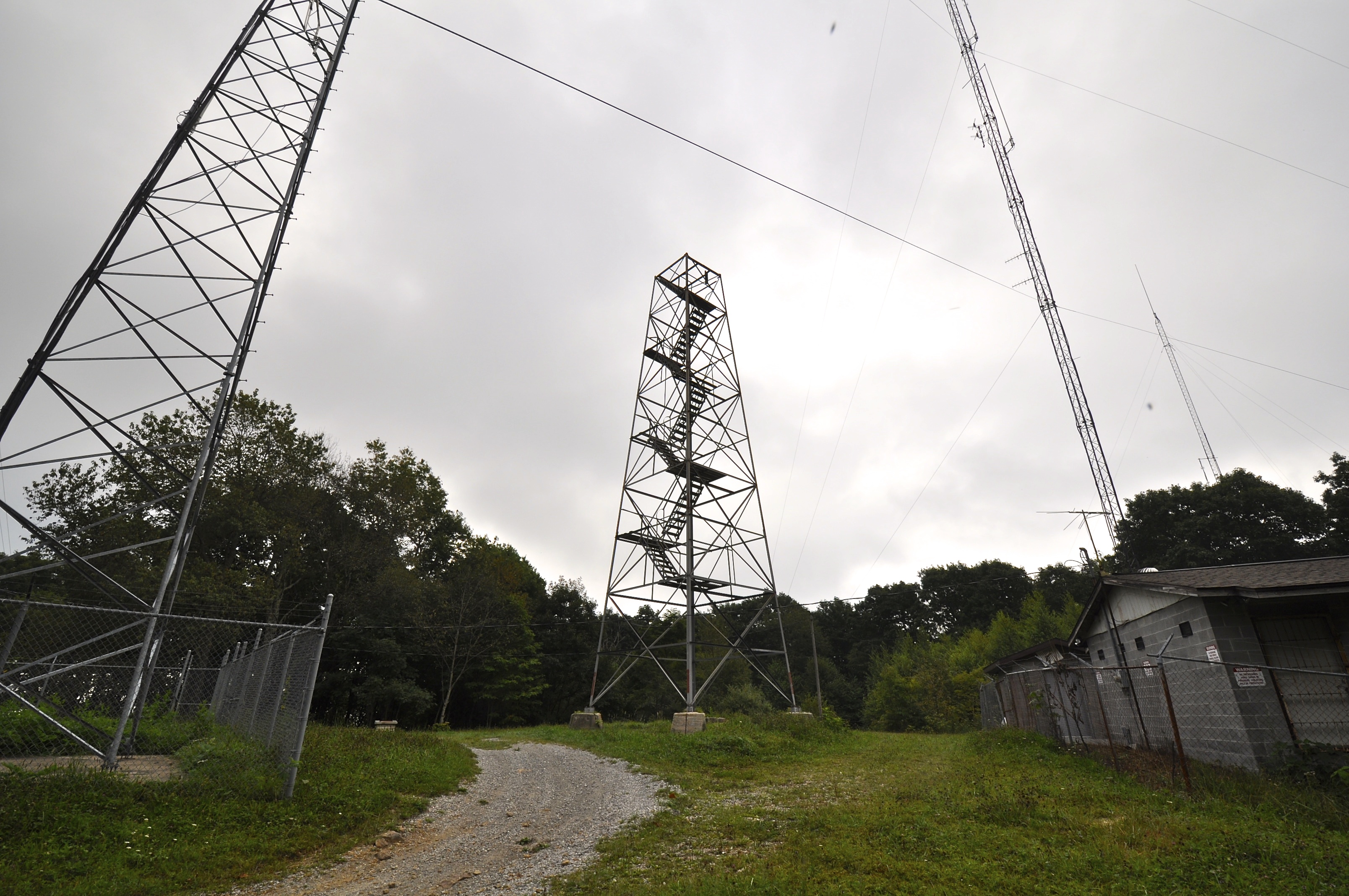

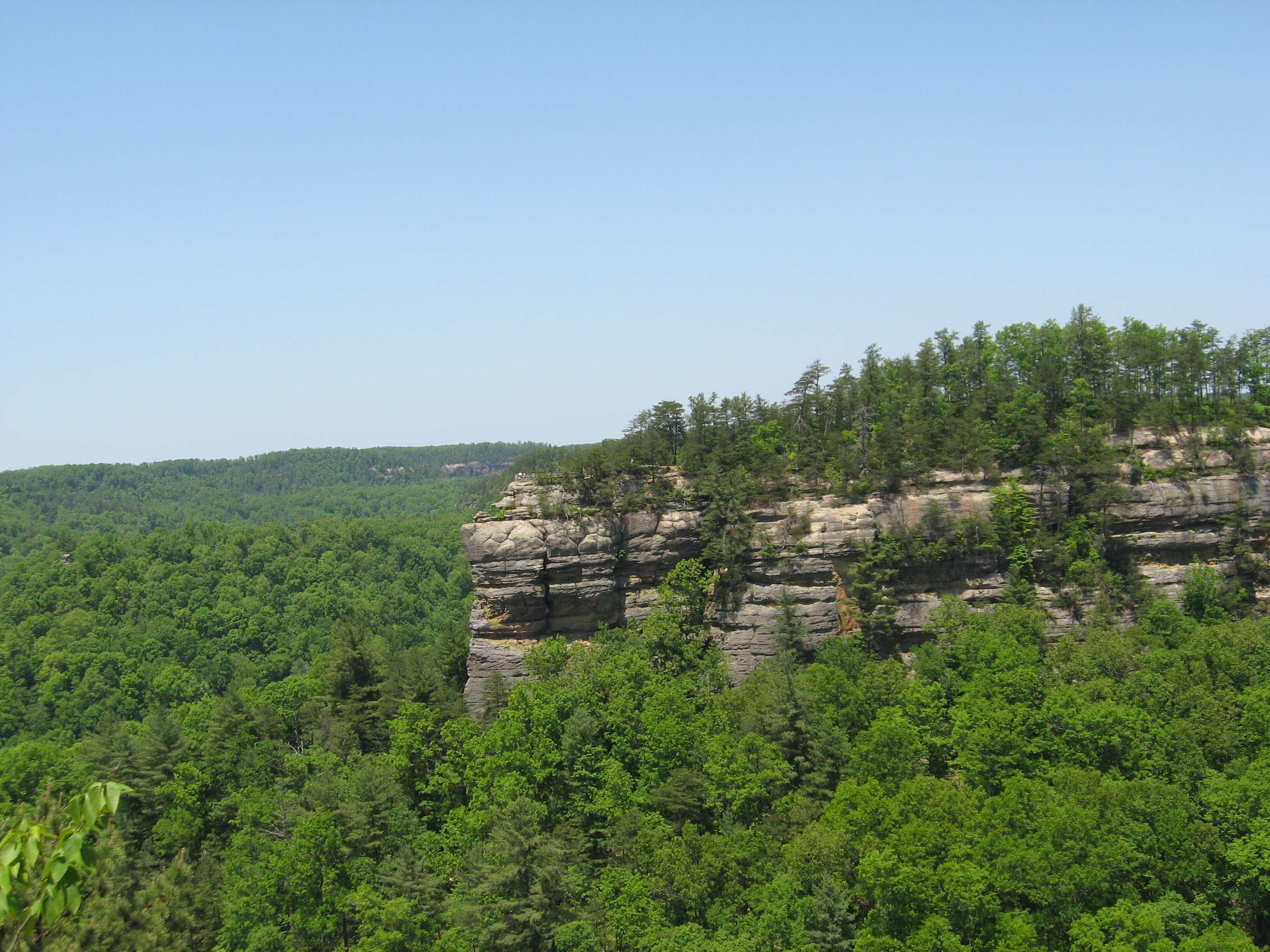
Route 160 east of Lynch and west of Appalachia crosses the mountain. The summit is reached by a narrow road that turns off to the right (coming from Lynch or to the left, if coming from Appalachia) at the Kentucky-Virginia line (the gap that is the highest part of Route 160) and leads past a Federal Aviation Administration radar dome. There is a one lane dirt road to the left not far past the radar dome that leads to the summit. The summit is marked with an abandoned metal fire lookout tower (the cab and wooden steps are missing from the tower). There are also multiple radio towers along with transmitter buildings around the summit and a National Geodetic Survey benchmark is located on a large rock over the hill to the left of the fire tower. This benchmark is 6 feet (1.8 m) below the highest point;[2] a second is directly under the old lookout tower, marking the latest survey of the highest natural point.
The FAA Radar dome is nearby, but below the summit. Trees on both sides of the radar dome have been cleared, so views of other mountains are visible. On a clear day the Great Smoky Mountains on the Tennessee and North Carolina border are clearly visible.
Black Mountain's history is intimately tied to the coal mining of the surrounding region. Lynch, Kentucky, was once one of the largest coal mining towns in the nation. In 1998, Jericol Mining, Inc., petitioned to use mountaintop removal methods in the area of Black Mountain. Though the summit itself was not directly threatened, many people protested this action due to the peak's status as the state's highest point. In 1999, Kentucky purchased mineral and timber rights to the summit and prevented future large scale mining. Coal companies have alleged that mined coal veins converge beneath the summit of Black Mountain and that the summit is prone to collapse.
A coal company named Penn Virginia Resources of Radnor, Pennsylvania formerly owned the summit, but allowed public access with the completion of a waiver. Now, however, the Commonwealth of Kentucky owns the land and no waiver is required.[4]
Ecology
Black Mountain is one of the few sites in Kentucky supporting a Northern Hardwood Forest at higher elevations. Numerous rare plants and animals are found here, including Black Bear, Red Elderberry and Hobblebush. Like many areas of Northern Hardwood Forest in the Southern Appalachia, fires swept through the mountain after intense logging. Black Mountain has a documented fire that occurred in the fall of 1896.[5]
See also
- List of mountains of Kentucky
- List of U.S. states by elevation
References
- "ON THE RECORD: Brad Paisley and Guns N' Roses song 'November Rain'". Rapid City Journal Media Group.
- "Science In Your Backyard: Kentucky" U.S. Department of the Interior | U.S. Geological Survey, July 3, 2006, retrieved August 25, 2006
- "Kentucky 50 Finest Mountains". www.peaklist.org.
- "New Address for Black Mountain, Kentucky Waiver". highpointers.org. February 5, 2010. Archived from the original on May 10, 2013. Retrieved April 16, 2013.
- Clark, Thomas Dionysius (2004). The Greening of the South: The Recovery of Land and Forest (New Perspectives on the South), p. 47. University Press of Kentucky. ISBN 0-8131-9082-7.
External links
 Media related to Black Mountain (Kentucky) at Wikimedia Commons
- Required waiver for summit access Note: The waiver has a drawing that shows the elevation of Black Mountain as 4,139 feet (1,262 m). As shown on the USGS website, this is incorrect. The correct elevation is 4,145 feet (1,263 m) at the summit. A USGS benchmark is located on a large rock over the hill at 4,139 feet (1,262 m), but it is not on the summit. The summit is apparently under the old fire lookout tower.
- Black Mountain Recreation Park
Mountains of Kentucky | |
|---|---|
Highest natural points of U.S. states and additional U.S. areas | ||
|---|---|---|
| ||
| Additional U.S. areas |
| |
Visitor attractions of the Eastern Kentucky Coalfield | ||||||||
|---|---|---|---|---|---|---|---|---|
| Parks |
|      | ||||||
| Museums |
| |||||||
| Forests |
| |||||||
| Reservoirs | ||||||||
| Natural features |
| |||||||
| Miscellaneous |
| |||||||
На других языках
[de] Black Mountain (Kentucky)
Der Black Mountain ist mit 1263 m der höchste Berg des US-Bundesstaats Kentucky[1]. Er befindet sich im Harlan County im Südosten des Bundesstaates nahe der Grenze zu Virginia und ist Teil der Cumberland Mountains, einem Gebirgszug der Appalachen. Der Black Mountain hat die Form eines langgestreckten, bewaldeten Bergrückens. Der Gipfel selbst ist im nordöstlichen Bereich des Berges und durch eine Straße leicht erreichbar. Am Gipfel befinden sich einige Sendemasten, etwas unterhalb eine Radarkuppel der Federal Aviation Administration.- [en] Black Mountain (Kentucky)
[fr] Black Mountain (Kentucky)
Black Mountain est un sommet s'élevant à 1 262 mètres d'altitude dans le comté de Harlan et constituant plus point culminant du Kentucky, aux États-Unis. Il a une hauteur d'environ de 750 mètres. Il se trouve près de la frontière avec la Virginie, juste au-dessus des villes de Lynch (Kentucky) et d'Appalachia (Virginie). Il est environ 150 m plus haut que toute autre montagne du Kentucky[réf. nécessaire].Другой контент может иметь иную лицензию. Перед использованием материалов сайта WikiSort.org внимательно изучите правила лицензирования конкретных элементов наполнения сайта.
WikiSort.org - проект по пересортировке и дополнению контента Википедии