geo.wikisort.org - Mountains
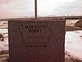
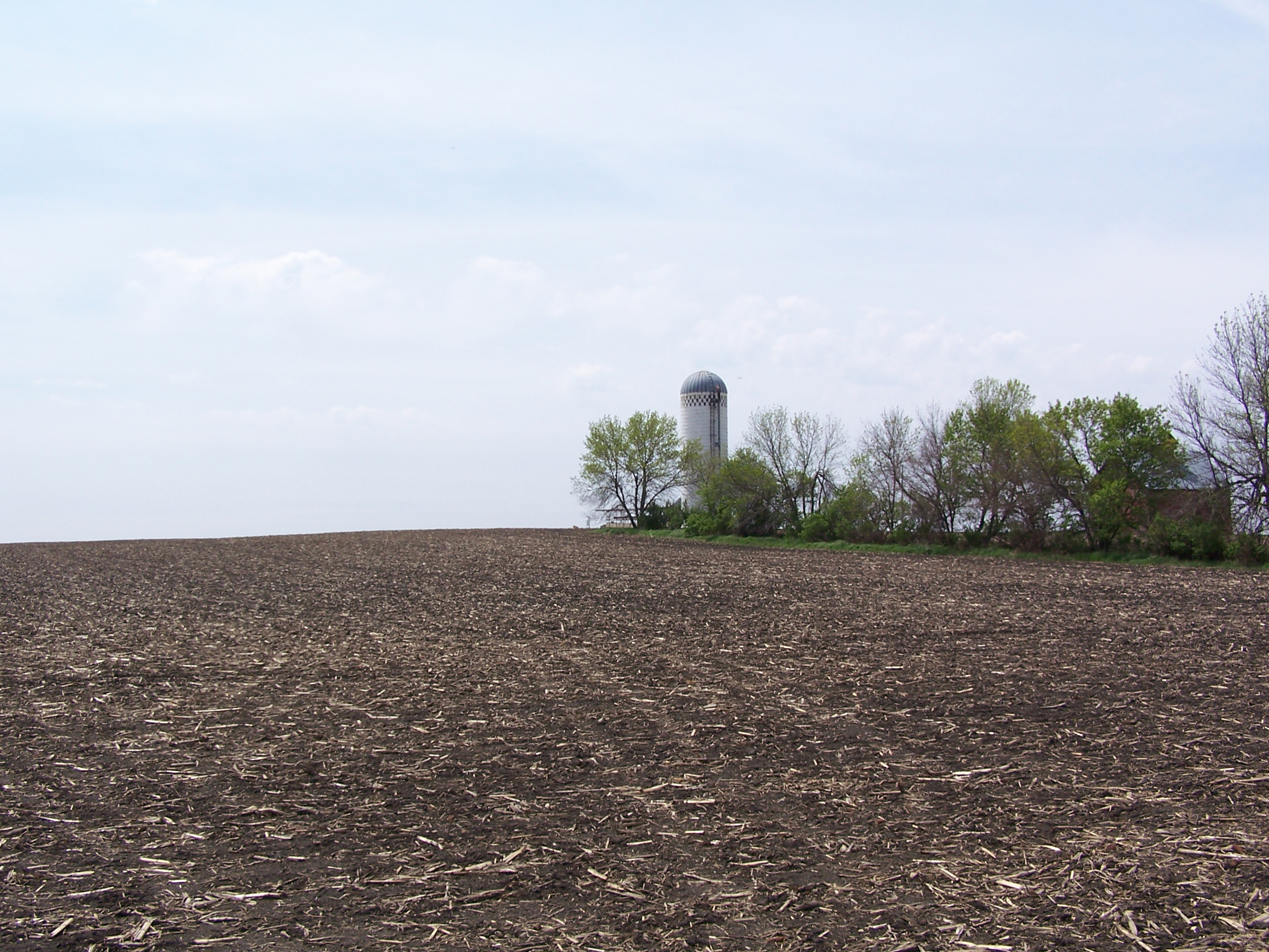
Hawkeye Point is the highest natural point in Iowa at 1,670 feet (510 m).[1] It is approximately 4.5 miles (7.2 km) north of Sibley on the eastern side of SR 60 and approximately 3.5 miles (5.6 km) south of the Iowa-Minnesota state border. The high ground lies 100 feet (30 m) due south of an old silo.
| Hawkeye Point | |
|---|---|
 Mosaic marking the highest natural point in the state of Iowa. | |
| Highest point | |
| Elevation | 1,670 ft (510 m)[1] |
| Prominence | 40 ft (12 m)[2] |
| Listing | U.S. state high point 42nd |
| Coordinates | 43°27′36″N 95°42′32″W[1] |
| Geography | |
 Hawkeye Point Iowa | |
| Location | Osceola County, Iowa, US |
| Topo map | USGS Sibley East |
| Climbing | |
| Easiest route | Walk |
The land that includes the highpoint was donated by the Sterler family, who worked this land for many decades, to Osceola County with the stipulation that the land be turned into a park. Osceola County, through its Economic Development Commission and Hawkeye Point Committee, has removed a few structures that were deemed to be hazardous to public safety including the old hog feed bunker at the highpoint site and a few small barns. They have erected an informational kiosk which highlights the family and the county and features a display of license plates from the 50 states sent in over the years to the Sterlers.
The county purchased approximately 6 acres (2.4 ha) of surrounding land including the old family farm house, which is being used as office space for the county. There are a flagpole, picnic bench, tile mosaic, several granite markers, and five tall posts with signs pointing to the other 49 state highpoints, each with the correct distance noted. The local 4-H group and high school youths contributed a great deal to this effort. The Hawkeye Point Commission also recently purchased a wooded plot of land of about 7 acres (28,000 m2) on the north side of the county road abutting the property with the intent to turn it into a campground.
The Highpointers Foundation, a non-profit charity set up to benefit privately owned state highpoints, has provided much of the funding for the renovations at Hawkeye Point.[3][4]
 Granite Marker
 Hawkeye Point is roughly at the site of the silo.
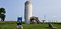 Silo with observation deck
 Museum barn
 Signposts listing distances to other state high points
 State license plate display


See also
- Outline of Iowa
- Index of Iowa-related articles
- List of U.S. states by elevation
References
- "Hawkeye Point". Geographic Names Information System. United States Geological Survey. Retrieved 2008-12-21.
- "Hawkeye Point, Iowa". Peakbagger.com. Retrieved 2008-12-21.
- "Osceola County Inks Deal to Buy Hawkeye Point". HighPointers.org. Archived from the original on 2010-10-10. Retrieved 2008-12-21.
- Mrs. Sterler, former co-owner of property: Telephone interview, 2008-06-08.
External links
- "Hawkeye Point". SummitPost.org.
- Highpointers Foundation
Highest natural points of U.S. states and additional U.S. areas | ||
|---|---|---|
| ||
| Additional U.S. areas |
| |
На других языках
[de] Hawkeye Point
Der 509 Meter hohe Hawkeye Point ist die höchste Erhebung des US-Bundesstaates Iowa. Die Erhebung befindet sich im Osceola County nahe der Grenze zu Minnesota. Das gesamte Areal rund um Hawkeye Point wird landwirtschaftlich genutzt, nicht zuletzt deshalb befindet sich auf seinem Gipfel ein Getreidesilo. Der höchste Punkt Iowas ist aber auch mit einem Markierungsstein und sogar einem Gipfelbuch ausgestattet.[1] Der Hügel erhebt sich gerade einmal 20 Meter aus seinem Umland.- [en] Hawkeye Point
[fr] Hawkeye Point
Hawkeye Point est un sommet situé près de Sibley, dans le comté d'Osceola, en Iowa, aux États-Unis.Другой контент может иметь иную лицензию. Перед использованием материалов сайта WikiSort.org внимательно изучите правила лицензирования конкретных элементов наполнения сайта.
WikiSort.org - проект по пересортировке и дополнению контента Википедии