geo.wikisort.org - Mountains
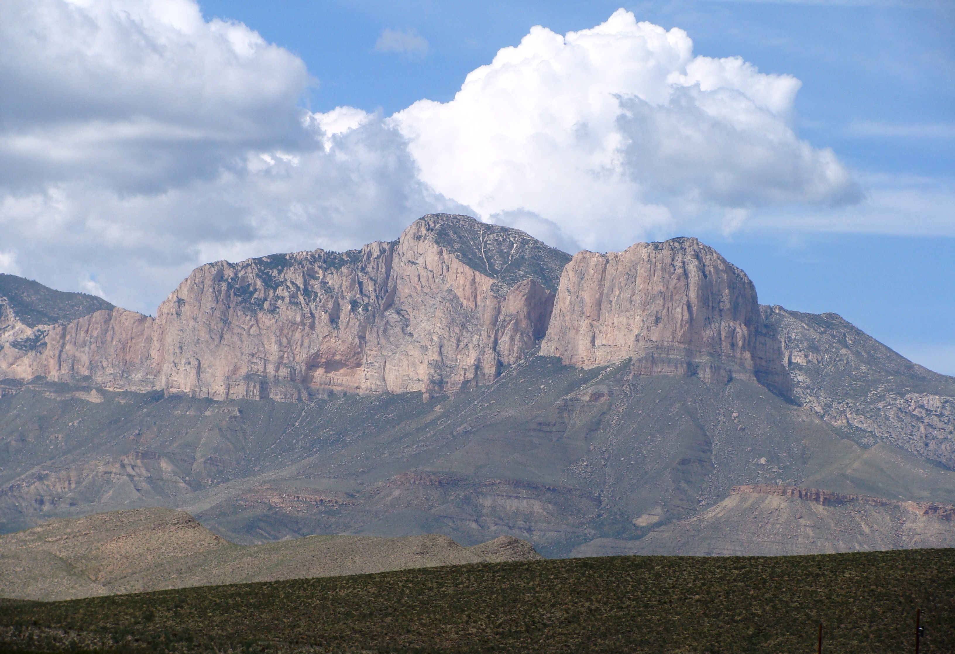
Guadalupe Peak, also known as Signal Peak,[3] is the highest natural point in Texas,[4] with an elevation of 8,751 feet (2,667 m) above sea level.[1] It is located in Guadalupe Mountains National Park, and is part of the Guadalupe Mountains range in southeastern New Mexico and West Texas. The mountain is about 90 miles (140 km) east of El Paso and about 50 miles (80 km) southwest of Carlsbad, New Mexico. The peak rises more than 3,000 feet (910 m) above the arid floor of the Chihuahuan Desert.
| Guadalupe Peak | |
|---|---|
 | |
| Highest point | |
| Elevation | 8,751 ft (2,667 m) NAVD 88[1] |
| Prominence | 3,029 ft (923 m)[2] |
| Listing | State high point 14th |
| Coordinates | 31°53′29″N 104°51′39″W[1] |
| Geography | |
 Guadalupe Peak Location of Guadalupe Peak in Texas | |
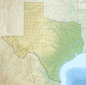
| Location | Culberson County, Texas, U.S. |
| Parent range | Guadalupe Mountains |
| Topo map | USGS Guadalupe Peak |
Trail and summit
The peak can be climbed by a maintained stony trail (4.25 miles or 6.8 kilometers each way) with a 3,000 feet elevation gain at any time of the year.[5] The trail is part of the network of hiking trails in the surrounding national park.
A stainless steel pyramid marks the summit. It was erected by American Airlines in 1958 to commemorate the 100th anniversary of the Butterfield Overland Mail, a stagecoach route that passed south of the mountain. One side of the pyramid has the American Airlines logo. The second side displays a U.S. Postal Service tribute to the Pony Express Riders of the Butterfield Stage. The third side displays a compass with the logo of the Boy Scouts of America.

Gallery
 View west from top of peak.
 Salt Flats from summit.
 Guadalupe Mountains in sunset.
 Hiking trail up the peak.
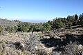 High elevation (8100 ft) campground near summit.
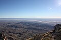 Culberson County, Texas, from the summit.
 The pyramid at the summit.


See also
- List of mountain peaks of North America
- List of mountain peaks of the United States
- List of U.S. states by elevation
- List of mountain peaks of the United States
References
- "El Capitan". NGS Data Sheet. National Geodetic Survey, National Oceanic and Atmospheric Administration, United States Department of Commerce. Retrieved 2001-05-24.
- "Guadalupe Peak, Texas". Peakbagger.com. Retrieved 2001-05-24.
- "GUADALUPE PEAK". Handbook of Texas Online. Texas State Historical Association. 15 June 2010. Retrieved 7 April 2015.
- "Elevations and Distances in the United States". United States Geological Survey. April 29, 2005. Archived from the original on January 16, 2008. Retrieved 2009-03-28.
- "Guadalupe Mountains: Guadalupe Peak Hike" (PDF). National Park Service. Retrieved 12 May 2015.
External links
 Definitions from Wiktionary
 Media from Commons
 News from Wikinews
 Quotations from Wikiquote
 Texts from Wikisource
 Textbooks from Wikibooks
 Resources from Wikiversity
- "Guadalupe Mountains National Park". National Park Service. Retrieved 2011-05-21.
- "Guadalupe Peak". Geographic Names Information System. United States Geological Survey, United States Department of the Interior. Retrieved 2001-05-24.
- "Guadalupe Peak". SummitPost.org. Retrieved 2011-05-21.
- "Guadalupe Peak Trip Report". High-Powered Planet. Retrieved 2011-11-14.
Highest natural points of U.S. states and additional U.S. areas | ||
|---|---|---|
| ||
| Additional U.S. areas |
| |
Austin (capital) | ||
| Topics |
|  Seal of Texas |
| Society |
| |
| Regions |
| |
| Metropolitan areas |
| |
| Counties | See: List of counties in Texas | |
На других языках
[de] Guadalupe Peak
Der Guadalupe Peak (teilweise auch gelistet als Signal Peak) ist mit 2667 m der höchste Berg von Texas und der gleichnamigen Guadalupe Mountains.- [en] Guadalupe Peak
[es] Pico Guadalupe
El pico Guadalupe es, con 2667 metros, el punto más alto de Texas, en Estados Unidos. Forma parte de la cordillera de la sierra de Guadalupe que son un parque nacional del país y están localizadas en el sureste del estado de Nuevo México y en el oeste de Texas.[fr] Pic Guadalupe
Le pic Guadalupe (Guadalupe Peak en anglais) est le point culminant du Texas. Il se situe dans le parc national des Guadalupe Mountains et fait partie des montagnes Guadalupe qui s'étend du sud-est du Nouveau-Mexique à l'ouest du Texas. Il surplombe le désert de Chihuahua.[it] Guadalupe Peak
Guadalupe Peak è la montagna più elevata del Texas. Si trova nel Parco nazionale dei Monti Guadalupe e fa parte della catena dei Monti Guadalupe che si estendono dal sud-est dello stato del Nuovo Messico all'ovest del Texas. La vetta s'affaccia sul deserto di Chihuahua.[ru] Гуадалупе-Пик
Гуадалу́пе-Пик (англ. Guadalupe Peak[2]) — гора, находящаяся на территории национального парка Гуадалупе-Маунтинс в Техасе (США). Также известна под названием Сигнал-Пик (англ. Signal Peak)[3]. Высота горы составляет 2667 м[1][4][5] (по другим данным — 2664 м[2]). Её вершина является высшей точкой Техаса[2].Другой контент может иметь иную лицензию. Перед использованием материалов сайта WikiSort.org внимательно изучите правила лицензирования конкретных элементов наполнения сайта.
WikiSort.org - проект по пересортировке и дополнению контента Википедии