geo.wikisort.org - Mountains
Hoosier Hill is the highest natural point in the U.S. state of Indiana with a claimed elevation of 1,257 feet (383 meters) above sea level. Hoosier Hill's claimed elevation is based on SRTM digital elevation data which is now considered to be outdated. Using newer elevation tools such as USGS's 3DEP, the top of Hoosier Hill is more like 1,255.48 feet (382.67 meters) above sea level.[3] Hoosier Hill is in the rural area of Franklin Township, Wayne County to the northwest of Bethel. The nearest intersection to the high point is Elliot Road and County Line Road. The nearest major landmark is Interstate 70 and Richmond 11 miles (17.5 km) to the south.
| Hoosier Hill | |
|---|---|
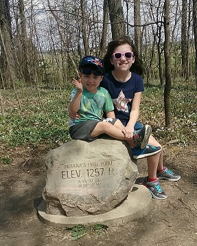
 The "summit" of Hoosier Hill, the highest point in Indiana, June 2018. | |
| Highest point | |
| Elevation | 1,257 ft (383 m)[1] |
| Prominence | 297 ft (91 m)[2] |
| Listing | U.S. state high point 44th |
| Coordinates | 40°0′04.39″N 84°50′55.28″W |
| Naming | |
| Pronunciation | /ˈhuːʒər/ |
| Geography | |
 Hoosier Hill Indiana | |
| Location | Wayne County, Indiana, United States |
| Topo map | USGS Spartanburg |
| Climbing | |
| Easiest route | Drive |
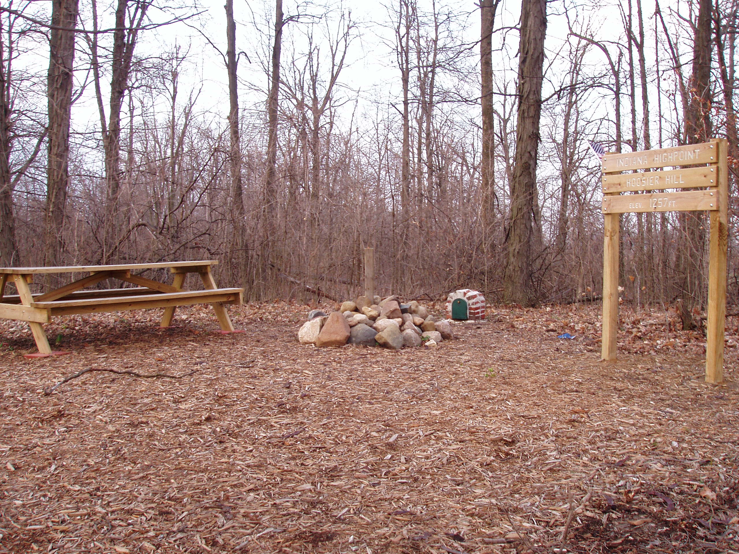
Hoosier Hill sits on private property owned by Kim E. Goble. The high point sits in a forested area surrounded by farmland. In 2005, an Eagle Scout candidate named Kyle Cummings (Troop 820 from Lakeside Park, Kentucky), in cooperation with the property owner, built a trail, sign and picnic area at the high point.[4]
Geologically, the hill sits in the Dearborn Upland, an area of high terrain in southeast Indiana that sits on top of the geologic structure known as the Cincinnati Arch. However, Hoosier Hill is located in a portion of the upland buried underneath glacial debris known as the Tipton Till Plain. As a result, while the average elevation of this upland region is 1100±100 feet above sea level, the topographic relief is gentle where the "hill" is no more than 30 feet higher than the surrounding landscape of gently rolling farmland. While the high topography seen at Brown County State Park, which sits in the Norman Upland in south central Indiana, can be mistaken to be a high point (where relief is 400–500 feet from valley to hilltop), the elevations of hilltops ranges from 800 to 1050 feet.
A.H. Marshall was the first person to successfully climb each U.S. state highpoint. He completed the task in 1936 after standing atop Hoosier Hill.[5]
According to the local government, the wooden sign with the words, "INDIANA'S HIGHEST POINT" would frequently be stolen,[6] so in 2016 the wooden sign was permanently replaced by an engraved boulder.

See also
Hoosier Hill
- Outline of Indiana
- Index of Indiana-related articles
- List of U.S. states by elevation
- Sand Hill, Indiana's second highest named point
- Weed Patch Hill, Indiana's third highest named point
References
- SRTM
- "Hoosier Hill, Indiana". Peakbagger.com. Retrieved 2008-12-17.
- "Pinnacle of Indiana in Wayne County". WayNet. Retrieved 2 June 2014.
- "Kyle Cummings Eagle Project Transforms Indiana's Hoosier Hill". HighPointers.org. Archived from the original on 2010-11-02. Retrieved 2008-12-17.
- "First to climb 48 state high points, Arthur H. Marshall blazed a path that few choose to follow". Oregon Live. Retrieved 2014-02-15.
- "Example of stolen/replaced sign".
External links
- "Landscapes of Indiana". Indiana Geological Survey. Retrieved 2009-02-17.
Highest natural points of U.S. states and additional U.S. areas | ||
|---|---|---|
| ||
| Additional U.S. areas |
| |
This Wayne County, Indiana location article is a stub. You can help Wikipedia by expanding it. |
На других языках
[de] Hoosier Hill
Der Hoosier Hill ist mit seinen 383 Metern die höchste natürliche Erhebung des Wayne County und des amerikanischen US-Bundesstaates Indiana. Er befindet sich im Dearborn Upland, einem Hügelland im Osten Indianas. Im Jahre 2005 wurde eine Picknick-Stelle errichtet und der höchste Punkt wurde erstmals gekennzeichnet. Das Gebiet, auf welchem sich Hoosier Hill befindet, steht bis heute unter Privatbesitz.- [en] Hoosier Hill
[es] Hoosier Hill
Hoosier Hill es el punto más alto en el estado de Indiana, con sus 383 metros de altitud. Se ubica en un área rural del Condado de Wayne, al noroeste de Bethel, Indiana.[fr] Hoosier Hill
Hoosier Hill est un sommet situé près de Franklin Township, dans le comté de Wayne en Indiana, aux États-Unis.Другой контент может иметь иную лицензию. Перед использованием материалов сайта WikiSort.org внимательно изучите правила лицензирования конкретных элементов наполнения сайта.
WikiSort.org - проект по пересортировке и дополнению контента Википедии