geo.wikisort.org - Mountains
Sand Hill (1070+ feet or 326+ m) is the second highest named summit in the U.S. state of Indiana. It is located in northeastern Wayne Township in Noble County, approximately two and a half miles southeast of the town of South Milford. A burial ground known as Weston Chapel Cemetery is on the southeastern face of the hill.
| Sand Hill | |
|---|---|
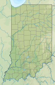 Sand Hill Location in Indiana | |
| Highest point | |
| Elevation | 1070+ ft (326+ m)[1] |
| Coordinates | 41°30′51″N 85°13′30″W[2] |
| Geography | |
| Location | Noble County, Indiana, United States |
| Topo map | USGS Stroh |
The highest summit in Indiana is Hoosier Hill in Wayne County (1,257 feet or 383 metres)[3]
Notes
- "Sand Hill, Indiana". Peakbagger.com. Retrieved 2014-03-15.
- "Sand Hill". Geographic Names Information System. United States Geological Survey. Retrieved 2014-03-15.
- Slayden, Greg. "Indiana County High Points". Peakbagger.com. Retrieved 22 May 2011.
This Noble County, Indiana location article is a stub. You can help Wikipedia by expanding it. |
Текст в блоке "Читать" взят с сайта "Википедия" и доступен по лицензии Creative Commons Attribution-ShareAlike; в отдельных случаях могут действовать дополнительные условия.
Другой контент может иметь иную лицензию. Перед использованием материалов сайта WikiSort.org внимательно изучите правила лицензирования конкретных элементов наполнения сайта.
Другой контент может иметь иную лицензию. Перед использованием материалов сайта WikiSort.org внимательно изучите правила лицензирования конкретных элементов наполнения сайта.
2019-2025
WikiSort.org - проект по пересортировке и дополнению контента Википедии
WikiSort.org - проект по пересортировке и дополнению контента Википедии