geo.wikisort.org - Island
Melville Island[1] (French: Île Melville[citation needed]; Inuktitut: ᐃᓗᓪᓕᖅ, Ilulliq[citation needed]) is an uninhabited island of the Arctic Archipelago with an area of 42,149 km2 (16,274 sq mi). It is the 33rd largest island in the world and Canada's eighth largest island.
 NASA satellite photograph of Melville Island | |
 | |
 Melville Island  Melville Island  Melville Island | |
| Etymology | The Viscount Melville |
|---|---|
| Geography | |
| Location | Canadian Arctic |
| Coordinates | 75°30′02″N 111°30′09″W[1] |
| Archipelago | Queen Elizabeth Islands |
| Adjacent bodies of water |
|
| Area | 42,149 km2 (16,274 sq mi) |
| Area rank | 33rd |
| Length | 341 km (211.9 mi) |
| Width | 210–292 km (130–181 mi) |
| Highest elevation | 762 m (2500 ft) |
| Administration | |
Canada | |
| Territories | Northwest Territories, Nunavut |
| Regions | Qikiqtaaluk, Inuvik |
| Demographics | |
| Population | 0 (uninhabited) (2022) |
Mountains on Melville Island, some of the largest in the western Canadian Arctic, reach heights of 750 m (2,460 ft). There are two subnational pene-exclaves that lie west of the 110th meridian and form part of the Northwest Territories. These can only be reached by land from Nunavut or boat from the Northwest Territories.
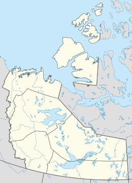
Melville Island is shared by the Northwest Territories, which is responsible for the western half of the island, and Nunavut, which is responsible for the eastern half. The border runs along the 110th meridian west.
Geography
The island has little or no vegetation. Where continuous vegetation occurs, it usually consists of hummocks of mosses, lichens, grasses, and sedges. The only woody species, the dwarf willow, grows as a dense twisted mat crawling along the ground.
A diverse animal population exists: polar bear, Peary caribou, muskox, northern collared lemming, Arctic wolf, Arctic fox, Arctic hare, and ermine (stoat) are common. A 2003 sighting of a grizzly bear and grizzly tracks by an expedition from the University of Alberta represent the most northerly reports of grizzly bears ever recorded.[2]
Melville Island is one of two major breeding grounds for the brant goose. DNA analysis and field observations suggest that these birds may be distinct from other brant stocks.[3][4] Numbering 4,000–8,000 birds, this could be one of the rarest goose stocks in the world.
History
The first documented European to visit Melville Island was the British explorer, Sir William Parry, in 1819. He was forced to spend the winter at what is now called "Winter Harbour," until 1 August 1820, owing to freeze-up of the sea.[5]
The island is named for Robert Dundas, 2nd Viscount Melville, who was First Sea Lord at the time. In the search for Franklin's lost expedition, its east coast was explored as far as Bradford Point by Abraham Bradford in 1851, while its north and west coasts were surveyed by Francis Leopold McClintock, Richard Vesey Hamilton, and George Henry Richards in 1853.[6][7][8]
On January 30, 1920, The Pioche Record reported that Icelandic explorer Vilhjalmur Stefansson discovered a lost cache from the 1853 McClintock expedition on Melville Island. Clothing and food from the cache was in excellent condition despite the harsh arctic conditions.[9]
In 1930, a large sandstone rock marking Parry's 1819 wintering site at Winter Harbour, approximately five point five metres (18 ft) long and three metres (10 ft) high, was designated a National Historic Site of Canada.[10]
Fossil fuel deposits
Melville has surfaced as a candidate for natural gas deposits. The island was believed to have deposits of coal and oil shale since the first half of the 20th century.[11][12] The first Canadian Arctic island exploratory well was spudded in 1961 at Winter Harbour.[13][14][15][16]
It drilled Lower Paleozoic strata to a total depth of 3,823 metres (12,543 ft). In the 1970s, the northern portion of the island on the east side of the Sabine Peninsula proved to contain a major gas field, known as Drake Point. The lease was owned by Panarctic Oils, a joint operation with the Canadian Government.
See also
- Desert island
- List of islands
Footnotes
- Coordinates are located on the NWT side. "Melville Island". Geographical Names Data Base. Natural Resources Canada.
- Doupé, Jonathan P.; England, John H.; Furze, M.; Paetkau, David (2007). "Most Northerly Observation of a Grizzly Bear (Ursus arctos) in Canada: Photographic and DNA Evidence from Melville Island, Northwest Territories". Arctic. 60 (3): 271–276. doi:10.14430/arctic219.
- "Brant Geese | Beauty of Birds". www.beautyofbirds.com. Retrieved September 26, 2019.
- "birds, bird photos, bird photographs, butterflies, dragonflies, dragonfly, butterfly". www.martinreid.com. Retrieved September 26, 2019.
- Parry, W. E. (1821). Journal of a voyage for the discovery of a North-West passage from the Atlantic to the Pacific: performed in the years 1819–20. London: John Murray.
- M'Dougall, G. F. (1857). The eventful voyage of H.M. discovery ship "Resolute" to the Arctic regions, in search of Sir John Franklin and the missing crews of H.M. discovery ships "Erebus" and "Terror," 1852, 1853, 1854. London: Longman.
- Murphy, D. (2004). The Arctic Fox: Francis Leopold McClintock, discoverer of the fate of Franklin. Toronto: Dundurn Press.
- Savours, A. (1999). The Search for the North West Passage. New York: St. Marten's Press.
- The Pioche Record, January 30, 1920, p. 3.
- Parry's Rock Wintering Site. Canadian Register of Historic Places. Retrieved 22 October 2013.
- "Canadian Arctic Islands" (PDF). Archived from the original (PDF) on 21 July 2011. Retrieved 21 June 2010.
The Kanguk Formation, a basinal bituminous shale, was deposited from the Turonian to the Maastrichtian
- Edwards, D. M. (27 July 1938). "Treasure of the Arctic: vast stores of fuels and precious metals in icebound areas". Christian Science Monitor.
- "History of the Canadian Oil Industry". Geo-Help Inc. Retrieved 21 June 2010.
- "Canada's Arctic". Government of Alberta. Retrieved 21 June 2010.
The first Arctic Island well was drilled in 1961–62 by Dome Petroleum on Melville Island. Other wells followed on Cornwallis and Bathurst Islands. Although wells were abandoned, Melville Island was the site of further significant gas discoveries. Panarctic Petroleum, made up of industry and government initiatives, found gas at Drake Point on Melville Island in 1969.
- "Rediscovering High Arctic riches". Vancouver Sun. 28 October 2008. Archived from the original on 8 November 2012. Retrieved 21 June 2010.
Panarctic had discovered a huge gas field at Drake Point on Melville Island in 1968. It was so big it took 14 wells to delineate.
-
"Riches beckon, but the risks are high". Saskatoon Star-Phoenix. 18 August 2008. Archived from the original on 13 May 2012. Retrieved 21 June 2010.
When the federal government issued a call for bids to explore the islands of the High Arctic last year, no one stepped to the plate. Several companies discovered oil and gas fields around Melville Island in the 1970s, but eventually abandoned the projects due to high costs.
- "50 Year Old Cache Found". The Pioche Record. Pioche, Lincoln, Nevada: L.H. Beeson. January 30, 1920. pp. 1–8. ISSN 2472-176X. OCLC 13457885. Retrieved February 1, 2020.
Further reading
- Arctic Pilot Project (Canada), Environmental Statement: Melville Island Components, Calgary: Arctic Pilot Project, 1979
- Barnett, D.; et al. Terrain Characterization and Evaluation An Example from Eastern Melville Island, Paper (Geological Survey of Canada), 76–23, Ottawa: Energy, Mines and Resources Canada, 1977, ISBN 0-660-00812-2
- Buchanan, R.; et al. Survey of the Marine Environment of Bridport Inlet, Melville Island, Calgary: Pallister Resource Management Ltd, 1980
- Christie, R.; et al. eds. The Geology of Melville Island, Arctic Canada, Ottawa: Geological Survey of Canada, 1994, ISBN 0-660-14982-6
- Spector, A.; et al. A Gravity Survey of the Melville Island Ice Caps, Canada Dominion Observatory Contributions, 07:7, 1967
- Hodgson, D. Quaternary Geology of Western Melville Island, Northwest Territories, Ottawa: Geological Survey of Canada, 1992, ISBN 0-660-13809-3
- Hotzel, C. Terrain Disturbance on the Christopher Formation, Melville Island, NWT, Ottawa: Carleton University, Dept. of Geography, 1973
- McGregor, D.; et al. Middle Devonian Miospores from the Cape De Bray, Weatherall, and Hecla Bay Formations of Northeastern Melville Island, Canadian Arctic, Ottawa: Energy, Mines and Resources Canada, 1982, ISBN 0-660-11084-9
- Shea, I.; et al. Deadman's Melville Island & Its Burial Ground, Tantallon: Glen Margaret Pub, 2005, ISBN 0-920427-68-5
- Shearer, D. Modern and Early Holocene Arctic Deltas, Melville Island, N.W.T., Canada, s.l.: s.n., 1974
- Steen, O.; et al. Landscape Survey Eastern Melville Island, N.W.T, Calgary: R.M. Hardy & Associates, 1978
- Thomas, D.; et al. Range types and their relative use by Peary caribou and muskoxen on Melville Island, NWT, Edmonton: Environment Canada, Canadian Wildlife Service, 1999
- Trettin, H.; et al. Lower Triassic Tar Sands of Northwestern Melville Island, Arctic Archipelago, Ottawa: Dept. of Energy, Mines and Resources, 1966
External links
- Melville Island in the Atlas of Canada - Toporama; Natural Resources Canada
- Salt Dome "Craters" on Melville Island at NASA Earth Observatory
- Environment Canada Field Projects: Geese and Swans
| 100,000 km2 (39,000 sq mi) and greater |
| |
|---|---|---|
| 20,000–99,999 km2 (7,722–38,610 sq mi) |
| |
Authority control | |
|---|---|
| General | |
| National libraries | |
| Other |
|
На других языках
[de] Melville-Insel (Kanada)
Melville Island (englisch) oder Île Melville (französisch) ist eine unbewohnte Insel im Kanadisch-Arktischen Archipel und gehört westlich des 110. Längengrades zu den Nordwest-Territorien und östlich davon zum kanadischen Territorium Nunavut.- [en] Melville Island (Northwest Territories and Nunavut)
[es] Isla Melville
La isla Melville es una gran isla deshabitada del Archipiélago ártico canadiense. Administrativamente, la isla está dividida en dos: la parte occidental pertenece a los Territorios del Noroeste y la parte oriental al territorio autónomo de Nunavut.[fr] Île Melville (Nunavut et les Territoires du Nord-Ouest)
L'île Melville est une île située dans le passage du Nord-Ouest, au nord des îles Victoria et Banks, à l'ouest de l'île Bathurst et à l'est-sud-est de l'île Prince Patrick. L'île fait partie des îles de la Reine-Élisabeth. Sa superficie est de 42 149 km², soit une taille légèrement plus élevée que la Suisse.[it] Isola di Melville
L’isola di Melville è un'isola situata nell'Arcipelago artico canadese e amministrativamente è divisa territori canadesi di Nunavut (per la parte orientale) e Territori del Nord-Ovest (per la parte occidentale).[ru] Мелвилл (остров, Канада)
Ме́лвилл (англ. Melville Island) — остров в Канаде. При площади 42 149 км² — крупнейший остров архипелага Парри в составе Канадского Арктического архипелага. Административно разделён между Нунавутом (регион Кикиктани) и Северо-Западными территориями.Другой контент может иметь иную лицензию. Перед использованием материалов сайта WikiSort.org внимательно изучите правила лицензирования конкретных элементов наполнения сайта.
WikiSort.org - проект по пересортировке и дополнению контента Википедии