geo.wikisort.org - Island
Bathurst Island is one of the Queen Elizabeth Islands in Nunavut, Canada. It is a member of the Arctic Archipelago. The area of the island is estimated at 16,042 km2 (6,194 sq mi),[1] 115 to 117 mi (185 to 188 km) long and from 63 mi (101 km) to 72 mi (116 km) to 92.9 mi (149.5 km) wide, making it the 54th largest island in the world and Canada's 13th largest island. It is uninhabited.
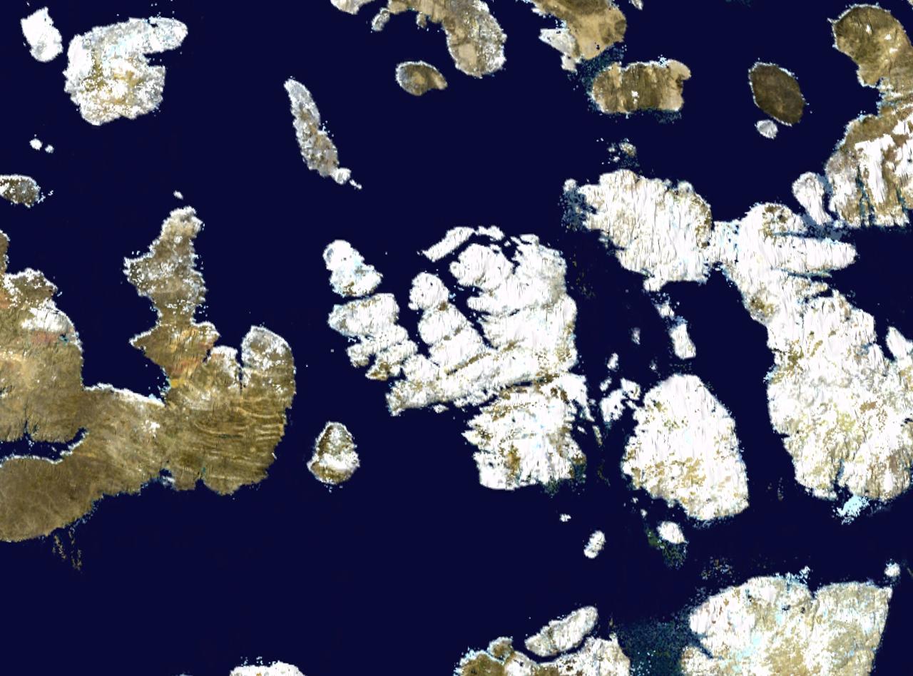 NASA satellite photo montage of Bathurst Island at centre. Viscount Melville Sound, part of the Northwest Passage, adjoins it to the south. | |
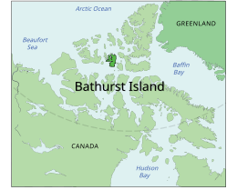 Location of Bathurst Island | |
 Bathurst Island  Bathurst Island | |
| Geography | |
|---|---|
| Location | Northern Canada |
| Coordinates | 75°46′N 099°47′W |
| Archipelago | Queen Elizabeth Islands Arctic Archipelago |
| Area | 16,042 km2 (6,194 sq mi) |
| Area rank | 54th |
| Length | 117 mi (188 km) |
| Width | 63–94 mi (101–151 km) |
| Administration | |
Canada | |
| Territory | Nunavut |
| Demographics | |
| Population | 0 |
The island is low-lying with few parts higher than 330 m (1,083 ft) in elevation. The highest point is 412 m (1,352 ft) at Stokes Mountain in the Stokes Range. This in turn forms part of the Arctic Cordillera mountain system. Good soil conditions produce abundant vegetation and support a more prolific wildlife population than other Arctic islands.
The island contains both the International Biological Program site Polar Bear Pass and Qausuittuq National Park.
History
The island was first inhabited by Independence I culture native peoples around 2000 BC. They were followed by Independence II, Pre-Dorset, and Dorset cultures. Brooman Point Village[2] on the eastern coast of Bathurst Island was the site of Thule native tribes around AD 1000, conceivably during a warmer climate episode. No modern Inuit resided there at the time of European discovery in the 1800s. But Inuit people in the region likely knew of its abundant wildlife, and possibly travelled there on hunting trips. William Edward Parry was the first European to discover the island in 1819, charting its southern coast.[3] It was named for Henry Bathurst, 3rd Earl Bathurst, British Secretary of State for War and the Colonies 1812–1827. Robert Dawes Aldrich charted much of its west coast in 1851, while George Henry Richards and Sherard Osborn charted its north coast in 1853.[4][5]
The Earth's North Magnetic Pole tracked northwards across Bathurst and Seymour Islands during the 1960s and 1970s. The Canadian National Museum of Natural Sciences, led by renowned Arctic biologist Stewart D. Macdonald, Curator of Vertebrate Ethology, established a permanent High Arctic Research Station there in 1973. Located on the Goodsir River in Polar Bear Pass, the station was staffed seasonally until the 1980s.
References
- "Atlas of Canada". Atlas.nrcan.gc.ca. 12 August 2009. Archived from the original on 22 January 2013. Retrieved 30 August 2010.
- Robert McGhee. Brooman Point Village. The Canadian Encyclopedia. Retrieved 26 August 2019.
- Parry, William Edward (1821). Journal of a voyage for the discovery of a North-West passage from the Atlantic to the Pacific: performed in the years 1819-20. London: John Murray.
William Edward Parry 1819.
- Mills, William James (2003). Exploring polar frontiers: a historical encyclopedia. Santa Barbara: ABC-CLIO. ISBN 9781576074220.
- M'Dougall, George F. (1857). The eventful voyage of H.M. discovery ship "Resolute" to the Arctic regions, in search of Sir John Franklin and the missing crews of H.M. discovery ships "Erebus" and "Terror," 1852, 1853, 1854. London: Longman, Brown, Green, Longmans, & Roberts. p. 452.
The Eventful Voyages of HMS Resolute.
Further reading
- Anglin, Carolyn Diane, and John Christopher Harrison. Mineral and Energy Resource Assessment of Bathurst Island Area, Nunavut Parts of NTS 68G, 68H, 69B and 79A. [Ottawa]: Geological Survey of Canada, 1999.
- Blake, Weston. Preliminary Account of the Glacial History of Bathurst Island, Arctic Archipelago. Ottawa: Department of Mines and Technical Surveys, 1964.
- Danks, H. V. Arthropods of Polar Bear Pass, Bathurst Island, Arctic Canada. Syllogeus, no. 25. Ottawa: National Museum of Natural Sciences, National Museums of Canada, 1980.
- Freeman, Milton M. R., and Linda M. Hackman. Bathurst Island NWT A Test Case of Canada's Northern Policy. Canadian Public Policy, Vol.1,No.3, Summer. 1975.
- Givelet, N, F Roos-Barraclough, M E Goodsite, and W Shotyk. 2003. "A 6,000-Years Record of Atmospheric Mercury Accumulation in the High Arctic from Peat Deposits on Bathurst Island, Nunavut, Canada". Journal De Physique. IV, Colloque : JP. 107: 545.
- Hueber, F. M. Early Devonian Plants from Bathurst Island, District of Franklin. Ottawa: Energy, Mines and Resources Canada, 1971.
- Kerr, J. William. Geology of Bathurst Island Group and Byam Martin Island, Arctic Canada (Operation Bathurst Island). Ottawa: Dept. of Energy, Mines and Resources, 1974.
- F.F. Slaney & Company. Peary Caribou and Muskoxen and Panarctic's Seismic Operations on Bathurst Island, N.W.T. 1974. Vancouver: F.F. Slaney & Co. Ltd, 1975.
- Taylor, William Ewart, and Robert McGhee. Deblicquy, a Thule Culture Site on Bathurst Island, N.W.T., Canada. Mercury series. Ottawa: National Museums of Canada, 1981.
External links
Authority control | |
|---|---|
| General |
|
| National libraries | |
На других языках
[de] Bathurst Island (Kanada)
Bathurst Island ist eine zur Gruppe der Königin-Elisabeth-Inseln gehörende Insel im kanadischen Territorium Nunavut.- [en] Bathurst Island (Nunavut)
[es] Isla de Bathurst (Canadá)
La isla de Bathurst es una isla canadiense deshabitada que forma parte del archipiélago de las islas de la Reina Isabel. Administrativamente, pertenece al territorio autónomo de Nunavut.[fr] Île Bathurst (Canada)
L'île Bathurst[1] (Bathurst Island) ou île de Bathurst est une île de l'archipel arctique canadien d'une superficie de 16 042 km², située dans le territoire du Nunavut.[it] Isola Bathurst (Canada)
L'isola Bathurst è una delle isole Regina Elisabetta nel territorio di Nunavut, in Canada (arcipelago artico canadese). L'area dell'isola è di circa 16.042 km², il che la rende la 54ª isola più grande del mondo e la 13° del Canada. È completamente disabitata.[ru] Батерст (остров, Канада)
Ба́терст (Батёрст, англ. Bathurst Island) — один из островов Канадского Арктического архипелага. Относится к группе островов Королевы Елизаветы и расположен в регионе Кикиктани канадской территории Нунавут, западнее островов Девон и Корнуоллис.Другой контент может иметь иную лицензию. Перед использованием материалов сайта WikiSort.org внимательно изучите правила лицензирования конкретных элементов наполнения сайта.
WikiSort.org - проект по пересортировке и дополнению контента Википедии