geo.wikisort.org - Island
Île Vanier is one of the Canadian arctic islands in Nunavut, Canada. Located at 76°10'N 103°15'W, it has an area of 1,126 km2 (435 sq mi). It has length of 53 kilometres (33 mi) and width of 35 kilometres (22 mi). To the north, across the Arnott Strait, is Cameron Island, and to the south, across the Pearse Strait, is Massey Island.
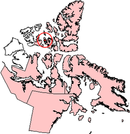 Île Vanier, Nunavut. | |
 Île Vanier  Île Vanier | |
| Geography | |
|---|---|
| Location | Northern Canada |
| Coordinates | 76°10′N 103°15′W |
| Archipelago | Queen Elizabeth Islands Arctic Archipelago |
| Area | 1,126 km2 (435 sq mi) |
| Length | 53 km (32.9 mi) |
| Width | 35 km (21.7 mi) |
| Administration | |
Canada | |
| Territory | Nunavut |
| Demographics | |
| Population | 0 |
The first known sighting of the island was by Robert Dawes Aldrich in 1851,[1] but its insular nature wasn't proven until the 1950s.
Adam Range reaches elevations in excess of 220 meters.
References
- Mills, William James (2003). Exploring polar frontiers: a historical encyclopedia. Santa Barbara: ABC-CLIO. ISBN 9781576074220.
External links
- Vanier Island in the Atlas of Canada - Toporama; Natural Resources Canada
This Qikiqtaaluk Region, Nunavut location article is a stub. You can help Wikipedia by expanding it. |
На других языках
[de] Île Vanier
Die Île Vanier (englisch Vanier Island) gehört zu den Königin-Elisabeth-Inseln im kanadischen Territorium Nunavut. Die Insel hat eine Fläche von 1126 km². Sie liegt zwischen Cameron Island im Norden und ist von dieser durch die vier Kilometer breite Arnott Strait getrennt, und Massey Island im Süden, durch die zwei Kilometer breite Pearse Strait getrennt.- [en] Île Vanier
[fr] Île Vanier
L'Île Vanier (en anglais île Vanier) est une petite île de l'archipel arctique canadien dans le territoire du Nunavut, Canada (76° 10′ N, 103° 15′ O), portant le nom du gouverneur général Georges Vanier[1].[it] Isola Vanier
L'isola Vanier è una piccola isola dell'arcipelago artico canadese, appartenente al territorio del Nunavut, in Canada.[ru] Ванье (остров)
Ванье (фр. Île Vanier) — остров Канадского Арктического архипелага. Также входит в группу Острова Королевы Елизаветы и в группу островов Архипелаг Парри. В настоящее время остров необитаем (2012).Текст в блоке "Читать" взят с сайта "Википедия" и доступен по лицензии Creative Commons Attribution-ShareAlike; в отдельных случаях могут действовать дополнительные условия.
Другой контент может иметь иную лицензию. Перед использованием материалов сайта WikiSort.org внимательно изучите правила лицензирования конкретных элементов наполнения сайта.
Другой контент может иметь иную лицензию. Перед использованием материалов сайта WikiSort.org внимательно изучите правила лицензирования конкретных элементов наполнения сайта.
2019-2026
WikiSort.org - проект по пересортировке и дополнению контента Википедии
WikiSort.org - проект по пересортировке и дополнению контента Википедии