geo.wikisort.org - Island
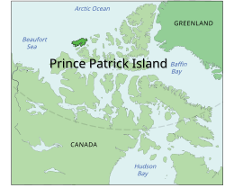
A member of the Arctic Archipelago, Prince Patrick Island is the westernmost of the Queen Elizabeth Islands in the Northwest Territories of Canada, lying northwest of Melville Island. The area of Prince Patrick Island is 15,848 km2 (6,119 sq mi),[3] making it the 55th largest island in the world and Canada's 14th largest island. It has historically been icebound all year, making it one of the least accessible parts of Canada. Located at the entrance of the M'Clure Strait, Prince Patrick Island is uninhabited.
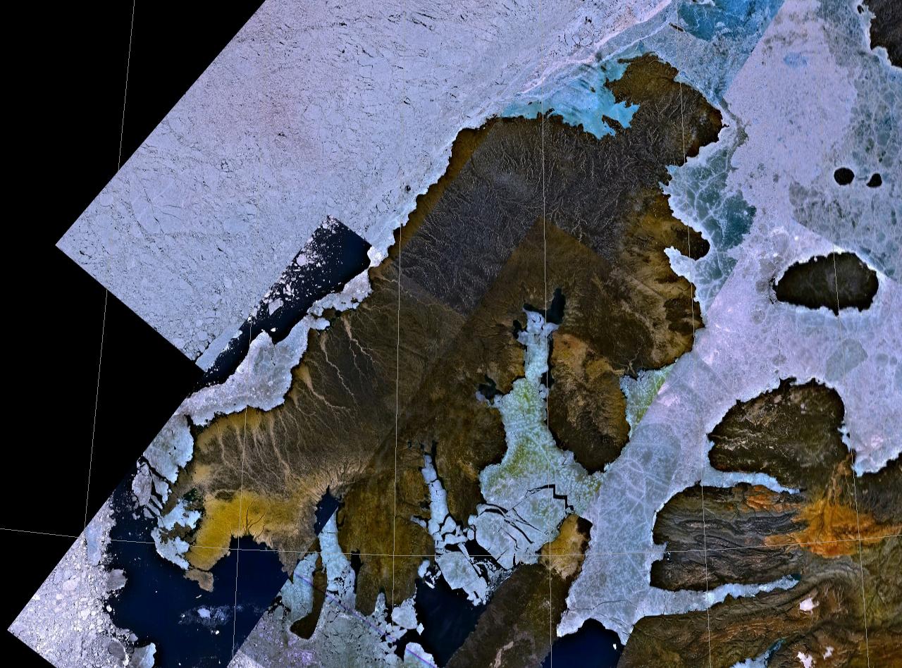
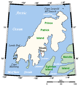 Prince Patrick Island, showing the Mould Bay weather station | |
 | |
 Prince Patrick Island  Prince Patrick Island | |
| Geography | |
|---|---|
| Location | Northern Canada |
| Coordinates | 76°45′02″N 119°30′12″W[1] |
| Archipelago | Queen Elizabeth Islands Arctic Archipelago |
| Area | 15,848 km2 (6,119 sq mi) |
| Area rank | 55th |
| Highest elevation | 279 m (915 ft) |
| Highest point | unnamed |
| Administration | |
Canada | |
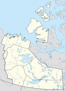
| Territory | Northwest Territories |
| Demographics | |
| Population | Uninhabited |
The first known sighting of the island was in 1853 by the Irish naval officer George Mecham, when it was explored by him and his fellow Irish explorer Francis Leopold McClintock in the spring of that year during the Edward Belcher expedition.[4] Much later, it was named for Prince Arthur William Patrick, Duke of Connaught, who was Governor General of Canada from 1911 to 1916.
The island rises to only about 279 m (915 ft),[5] and the area is seismically active.
Weather Station
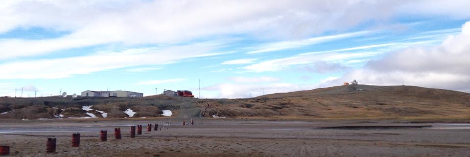

A High Arctic Weather Station ("HAWS") and associated airstrip called Mould Bay were opened in 1948 as part of a joint Canada-US military effort to support a weather station network. Regular weather observations began on May 14, 1948. It had a temporary staff of between 10 and 40 people. Staff size normally increased during summer months, when the station was resupplied from the south.
During the period of US National Weather Service participation, the site was known as a Joint Arctic Weather Station ("JAWS"). Executive officers alternated between Canadians and their US counterparts. US participation ended in 1972. The station was closed in 1997, owing to budget cuts. It was replaced with an automated weather station at a new location on the airstrip, downhill from the central buildings and observatory. The last manned weather observations were taken on March 31, 1997, ending the continuous weather record of 1948–1997.
The buildings still stand, but as of 2017, most have deteriorated to an unrepairable state.[6] The station represented the only known long-term human settlement of the Island.
Climate
Mould Bay has a Polar climate (ET) with cool, intermittent summers and long, severely cold winters. September is the snowiest month of the year, averaging 18.5 cm (7.3 in) of snowfall.
| Climate data for Mould Bay Airport, 1981–2010 normals, extremes 1948–present | |||||||||||||
|---|---|---|---|---|---|---|---|---|---|---|---|---|---|
| Month | Jan | Feb | Mar | Apr | May | Jun | Jul | Aug | Sep | Oct | Nov | Dec | Year |
| Record high °C (°F) | −5.3 (22.5) |
−4.9 (23.2) |
−6.7 (19.9) |
−0.5 (31.1) |
6.3 (43.3) |
18.0 (64.4) |
22.7 (72.9) |
16.3 (61.3) |
7.8 (46.0) |
2.5 (36.5) |
−1.7 (28.9) |
−2.6 (27.3) |
22.7 (72.9) |
| Average high °C (°F) | −29.4 (−20.9) |
−30.0 (−22.0) |
−27.6 (−17.7) |
−19.1 (−2.4) |
−7.4 (18.7) |
2.9 (37.2) |
6.7 (44.1) |
3.0 (37.4) |
−3.8 (25.2) |
−14.1 (6.6) |
−23.1 (−9.6) |
−27.0 (−16.6) |
−14.1 (6.6) |
| Daily mean °C (°F) | −33.1 (−27.6) |
−33.9 (−29.0) |
−31.4 (−24.5) |
−23.0 (−9.4) |
−10.4 (13.3) |
0.6 (33.1) |
4.0 (39.2) |
0.9 (33.6) |
−6.2 (20.8) |
−17.7 (0.1) |
−26.6 (−15.9) |
−30.5 (−22.9) |
−17.3 (0.9) |
| Average low °C (°F) | −36.9 (−34.4) |
−37.6 (−35.7) |
−34.9 (−30.8) |
−26.8 (−16.2) |
−13.5 (7.7) |
−1.7 (28.9) |
1.2 (34.2) |
−1.3 (29.7) |
−8.5 (16.7) |
−21.3 (−6.3) |
−30.2 (−22.4) |
−34.0 (−29.2) |
−20.4 (−4.7) |
| Record low °C (°F) | −52.2 (−62.0) |
−53.9 (−65.0) |
−54.7 (−66.5) |
−46.1 (−51.0) |
−29.6 (−21.3) |
−14.4 (6.1) |
−3.9 (25.0) |
−13.5 (7.7) |
−26.1 (−15.0) |
−38.9 (−38.0) |
−44.4 (−47.9) |
−52.8 (−63.0) |
−54.7 (−66.5) |
| Record low wind chill | −72.8 | −72.0 | −70.1 | −60.5 | −39.2 | −22.5 | −10.8 | −17.3 | −35.0 | −52.3 | −57.9 | −68.8 | −72.8 |
| Average precipitation mm (inches) | 4.5 (0.18) |
4.6 (0.18) |
4.2 (0.17) |
3.4 (0.13) |
10.8 (0.43) |
9.8 (0.39) |
13.8 (0.54) |
23.8 (0.94) |
18.1 (0.71) |
12.9 (0.51) |
6.7 (0.26) |
4.5 (0.18) |
117.2 (4.61) |
| Average rainfall mm (inches) | 0.0 (0.0) |
0.0 (0.0) |
0.0 (0.0) |
0.0 (0.0) |
0.0 (0.0) |
3.6 (0.14) |
10.0 (0.39) |
11.7 (0.46) |
2.2 (0.09) |
0.0 (0.0) |
0.0 (0.0) |
0.0 (0.0) |
27.5 (1.08) |
| Average snowfall cm (inches) | 5.4 (2.1) |
5.8 (2.3) |
5.1 (2.0) |
4.7 (1.9) |
15.0 (5.9) |
6.6 (2.6) |
3.8 (1.5) |
12.9 (5.1) |
18.5 (7.3) |
16.1 (6.3) |
9.0 (3.5) |
6.3 (2.5) |
109.2 (43.0) |
| Average precipitation days (≥ 0.2 mm) | 6.1 | 6.6 | 6.4 | 4.9 | 10.1 | 6.3 | 9.0 | 13.3 | 12.8 | 11.6 | 9.6 | 6.9 | 103.6 |
| Average rainy days (≥ 0.2 mm) | 0.0 | 0.0 | 0.0 | 0.0 | 0.0 | 2.9 | 7.8 | 6.2 | 1.1 | 0.0 | 0.0 | 0.0 | 18.0 |
| Average snowy days (≥ 0.2 cm) | 6.6 | 6.9 | 6.8 | 5.8 | 12.2 | 4.2 | 3.4 | 8.9 | 12.5 | 12.2 | 10.0 | 7.1 | 96.5 |
| Average relative humidity (%) | 69.5 | 67.4 | 64.6 | 73.2 | 82.0 | 81.3 | 79.6 | 84.8 | 88.2 | 80.3 | 73.3 | 69.6 | 76.1 |
| Mean monthly sunshine hours | 0.0 | 0.0 | 97.9 | 287.5 | 267.9 | 297.2 | 254.1 | 121.0 | 49.6 | 15.5 | 0.0 | 0.0 | 1,390.5 |
| Percent possible sunshine | 0.0 | 0.0 | 27.8 | 49.9 | 36.0 | 41.3 | 34.2 | 17.4 | 11.6 | 6.9 | 0.0 | 0.0 | 25.0 |
| Source: Environment and Climate Change Canada[7][8][9][10][11] | |||||||||||||
In popular culture
Prince Patrick Island is the setting for a work of fiction, the novel The Lost Ones (1961) by Ian Cameron (Donald G. Payne). It was filmed as the Walt Disney Pictures film The Island at the Top of the World in 1974. The novel tells of a lost colony of Vikings living in a lost valley in the island, which, thanks to the volcanoes on the island, is warm and habitable.
References
- "Prince Patrick Island". Geographical Names Data Base. Natural Resources Canada.
- "Prince Patrick Island". Geographical Names Data Base. Natural Resources Canada.
- Prince Patrick Island Archived 2013-01-22 at the Wayback Machine at the Atlas of Canada
- M'Dougall, George F. (1857). The eventful voyage of H.M. discovery ship "Resolute" to the Arctic regions, in search of Sir John Franklin and the missing crews of H.M. discovery ships "Erebus" and "Terror," 1852, 1853, 1854. London: Longman, Brown, Green, Longmans, & Roberts. p. 452.
The Eventful Voyages of HMS Resolute.
- Prince Patrick Island High Point, Northwest Territories
- See Mould Bay photographs[dead link] for types of construction.
- "Mould Bay A". Canadian Climate Normals 1981–2010. Environment and Climate Change Canada. Climate ID: 2502700. Archived from the original (CSV (3069 KB)) on 2020-03-13. Retrieved 2014-01-09.
- "July 2001". Canadian Climate Data. Environment and Climate Change Canada. Retrieved 14 May 2016.
- "June 2012". Canadian Climate Data. Environment and Climate Change Canada. Retrieved 14 May 2016.
- "August 2011". Canadian Climate Data. Environment and Climate Change Canada. Retrieved 14 May 2016.
- "Daily Data Report for March 2017". Government of Canada. Retrieved 10 March 2017.
Further reading
- Frebold, Hans. Fauna, Age and Correlation of the Jurassic Rocks of Prince Patrick Island. Ottawa: E. Cloutier, Queen's printer, 1957.
- Harrison, J. C., and T. A. Brent. Basins and fold belts of Prince Patrick Island and adjacent areas, Canadian Arctic Islands. [Ottawa]: Geological Survey of Canada, 2005. ISBN 0-660-19008-7
- Miller, F. L. Peary Caribou and Muskoxen on Prince Patrick Island, Eglinton Island, and Emerald Isle, Northwest Territories, July 1986. [Edmonton]: Canadian Wildlife Service, 1987. ISBN 0-662-15652-8
- Pissart, A. The Pingos of Prince Patrick Island (760N - 1200W). Ottawa: National Research Council of Canada, 1970.
- Tedrow, John C. F., P. F. Bruggemann, and Grant Fontain Walton. Soils of Prince Patrick Island. Research paper (Arctic Institute of North America), no. 44. Washington: Arctic Institute of North America, 1968.
External links
- Prince Patrick Island in the Atlas of Canada - Toporama; Natural Resources Canada
- Prince Patrick Island Archived 2019-09-16 at the Wayback Machine on the Canada's Arctic website.
Authority control | |
|---|---|
| General |
|
| National libraries | |
На других языках
[de] Prince Patrick Island
Die Prince Patrick Island ist die westlichste Insel der Königin-Elisabeth-Inseln und liegt in den Nordwest-Territorien Kanadas. Die unbewohnte Insel ist 240 km lang, 30–80 km breit und nur 150–200 m hoch. Sie hat eine Fläche von 15.848 km²[1] und nimmt damit unter den größten Inseln Kanadas Platz 14, unter den größten Inseln der Erde Platz 55 ein.- [en] Prince Patrick Island
[es] Isla del Príncipe Patrick
La isla del Príncipe Patrick es isla más occidental del archipiélago de las islas de la Reina Isabel. Administrativamente, pertenece a los Territorios del Noroeste, Canadá.[fr] Île du Prince-Patrick
L’île du Prince-Patrick, située dans le passage du Nord-Ouest, est l’île la plus occidentale des îles de la Reine-Élisabeth, dans l'archipel arctique canadien. Son littoral nord-ouest borde directement l'océan Arctique. L'île appartient aux Territoires du Nord-Ouest, un territoire du Canada. Elle a été explorée pour la première fois en 1853, puis nommée en l’honneur du prince Arthur William Patrick, duc de Connaught, qui était gouverneur général du Canada de 1911 à 1916. La superficie de l’île est de 15 848 km2, faisant d'elle la 55e plus grande île au monde et la 14e plus grande île du Canada. Elle se trouve dans une zone sismique. Elle est inhabitée.[it] Isola del Principe Patrizio
L’isola del Principe Patrizio[1] (in inglese Prince Patrick Island) appartiene all'arcipelago artico canadese, ed è la più occidentale delle isole Regina Elisabetta nel territorio canadese dei Territori del Nord-Ovest. L'isola ha una superficie di 15.848 km², il che la rende la 55ª isola più grande del mondo e la 14ª del Canada. È coperta dai ghiacci per tutto l'anno, il che la rende una delle regioni più inaccessibili del Canada.[ru] Принс-Патрик
Принс-Патрик (англ. Prince Patrick Island) — остров в составе Канадского Арктического архипелага, принадлежит Канаде, самый западный из группы островов Королевы Елизаветы, относится к Северо-западным территориям Канады. Остров Принс-Патрик необитаем (2012).Другой контент может иметь иную лицензию. Перед использованием материалов сайта WikiSort.org внимательно изучите правила лицензирования конкретных элементов наполнения сайта.
WikiSort.org - проект по пересортировке и дополнению контента Википедии