geo.wikisort.org - Island
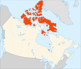
The Arctic Archipelago, also known as the Canadian Arctic Archipelago, is an archipelago lying to the north of the Canadian continental mainland, excluding Greenland (an autonomous territory of Denmark).
 Polar projection map of the Arctic Archipelago | |
 | |
| Geography | |
|---|---|
| Location | Northern Canada |
| Coordinates | 75°N 90°W |
| Total islands | 36,563 |
| Major islands | Baffin Island, Victoria Island, Ellesmere Island |
| Area | 1,407,770[1] km2 (543,540 sq mi) |
| Administration | |
Canada | |
| Territories and province | Nunavut Northwest Territories Yukon Newfoundland and Labrador |
| Largest settlement | Iqaluit, Nunavut (pop. 7,429[2]) |
| Demographics | |
| Population | 23,073 (2021[3][4]) |
| Pop. density | 0.0098/km2 (0.0254/sq mi) |
Situated in the northern extremity of North America and covering about 1,424,500 km2 (550,000 sq mi), this group of 36,563 islands, surrounded by the Arctic Ocean, comprises much of Northern Canada, predominately Nunavut and the Northwest Territories.[5] The archipelago is showing some effects of climate change,[6][7] with some computer estimates determining that melting there will contribute 3.5 cm (1.4 in) to the rise in sea levels by 2100.[8]
History
Around 2500 BCE, the first humans, the Paleo-Eskimos, arrived in the archipelago from the Canadian mainland. Between 1000–1500 CE, they were replaced by the Thule people, who are the ancestors of today's Inuit.
British claims on the islands, the British Arctic Territories, were based on the explorations in the 1570s by Martin Frobisher. Canadian sovereignty was originally (1870–80) only over island portions that drained into Foxe Basin, Hudson Bay and Hudson Strait. Canadian sovereignty over the islands was established by 1880 when Britain transferred them to Canada.[9] The District of Franklin – established in 1895 – comprised almost all of the archipelago. The district was dissolved upon the creation of Nunavut in 1999. Canada claims all the waterways of the Northwest Passage as Canadian Internal Waters; however, the United States and most other maritime countries view these as international waters.[10] Disagreement over the passages' status has raised Canadian concerns about environmental enforcement, national security, and general sovereignty. East of Ellesmere Island, in the Nares Strait, lies Hans Island, ownership of which is now shared between Canada and Denmark, after a decades-long dispute.[11][12][13]
Geography


The archipelago extends some 2,400 km (1,500 mi) longitudinally and 1,900 km (1,200 mi) from the mainland to Cape Columbia, the northernmost point on Ellesmere Island. It is bounded on the west by the Beaufort Sea; on the northwest by the Arctic Ocean; on the east by Greenland, Baffin Bay and Davis Strait; and on the south by Hudson Bay and the Canadian mainland. The various islands are separated from each other and the continental mainland by a series of waterways collectively known as the Northwest Passage. Two large peninsulas, Boothia and Melville, extend northward from the mainland. The northernmost cluster of islands, including Ellesmere Island, is known as the Queen Elizabeth Islands and was formerly the Parry Islands.
The archipelago consists of 36,563 islands, of which 94 are classified as major islands, being larger than 130 km2 (50 sq mi), and cover a total area of 1,400,000 km2 (540,000 sq mi).[14] The islands of the archipelago over 10,000 km2 (3,900 sq mi), in order of descending area, are:
| Name | Location* | Area | Area rank | Population (2021) | |
|---|---|---|---|---|---|
| World | Canada | ||||
| Baffin Island | NU | 507,451 km2 (195,928 sq mi) | 5 | 1 | 13,039[2][3] |
| Victoria Island | NT, NU | 217,291 km2 (83,897 sq mi) | 8 | 2 | 2,168[3][4] |
| Ellesmere Island | NU | 196,236 km2 (75,767 sq mi) | 10 | 3 | 144[3] |
| Banks Island | NT | 70,028 km2 (27,038 sq mi) | 24 | 5 | 104[4] |
| Devon Island | NU | 55,247 km2 (21,331 sq mi) | 27 | 6 | 0 |
| Axel Heiberg Island | NU | 43,178 km2 (16,671 sq mi) | 32 | 7 | 0 |
| Melville Island | NT, NU | 42,149 km2 (16,274 sq mi) | 33 | 8 | 0 |
| Southampton Island | NU | 41,214 km2 (15,913 sq mi) | 34 | 9 | 1,038[3] |
| Prince of Wales Island | NU | 33,339 km2 (12,872 sq mi) | 40 | 10 | 0 |
| Somerset Island | NU | 24,786 km2 (9,570 sq mi) | 46 | 12 | 0 |
| Bathurst Island | NU | 16,042 km2 (6,194 sq mi) | 54 | 13 | 0 |
| Prince Patrick Island | NT | 15,848 km2 (6,119 sq mi) | 55 | 14 | 0 |
| King William Island | NU | 13,111 km2 (5,062 sq mi) | 61 | 15 | 1,349[3] |
| Ellef Ringnes Island | NU | 11,295 km2 (4,361 sq mi) | 69 | 16 | 0 |
| Bylot Island | NU | 11,067 km2 (4,273 sq mi) | 72 | 17 | 0 |
* NT = Northwest Territories, NU = Nunavut
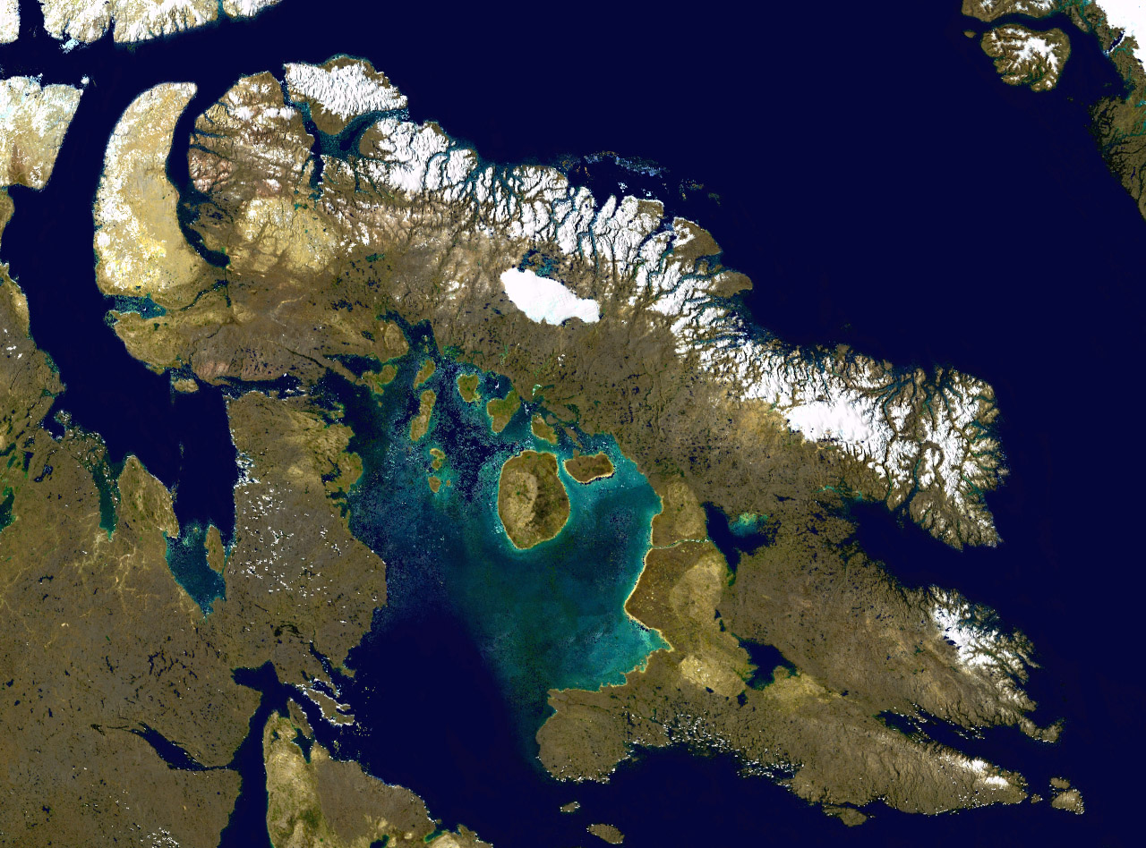
After Greenland, the archipelago is the world's largest high-Arctic land area. The climate of the islands is Arctic, and the terrain consists of tundra except in mountainous regions. Most of the islands are uninhabited; human settlement is extremely thin and scattered, being mainly coastal Inuit settlements on the southern islands.
Map with links to islands

Islands not on map
- Beecheymap 62
- Broughtonmap 63 (population: 593[3])
- Dorsetmap 64 (population: 1,396[3])
- Duke of Yorkmap 65
- East Penmap 66
- Flahertymap 67 (population: 1,010[3])
- Haig-Thomasmap 68
- Hansmap 69
- Herschelmap 70
- Igloolikmap 71 (population: 2,049[3])
- Killiniqmap 72
- Ottawamap 73
- Prince Leopoldmap 74
- Qikiqtaryuaq (formerly Jenny Lind Island)map 75
- Skraelingmap 76
- Trodeleymap 77
- Umingmalik (formerly Gateshead Island)map 78
- Westonmap 79
Communities
| Community | Island | Region, territory | Population[3][4] |
|---|---|---|---|
| Arctic Bay | Baffin Island | Qikiqtaaluk, NU | 944 |
| Clyde River | Baffin Island | Qikiqtaaluk, NU | 1,181 |
| Iqaluit | Baffin Island | Qikiqtaaluk, NU | 7,429 |
| Kimmirut | Baffin Island | Qikiqtaaluk, NU | 426 |
| Pangnirtung | Baffin Island | Qikiqtaaluk, NU | 1,504 |
| Pond Inlet | Baffin Island | Qikiqtaaluk, NU | 1,555 |
| Sachs Harbour | Banks Island | Inuvik, NT | 104 |
| Qikiqtarjuaq | Broughton Island | Qikiqtaaluk, NU | 593 |
| Resolute | Cornwallis Island | Qikiqtaaluk, NU | 183 |
| Kinngait | Dorset Island | Qikiqtaaluk, NU | 1,396 |
| Grise Fiord | Ellesmere Island | Qikiqtaaluk, NU | 144 |
| Sanikiluaq | Flaherty Island | Qikiqtaaluk, NU | 1,010 |
| Igloolik | Igloolik Island | Qikiqtaaluk, NU | 2,049 |
| Gjoa Haven | King William Island | Kitikmeot, NU | 1,349 |
| Coral Harbour | Southampton Island | Kivalliq, NU | 1,038 |
| Cambridge Bay | Victoria Island | Kitikmeot, NU | 1,760 |
| Ulukhaktok | Victoria Island | Inuvik, NT | 408 |
| Total | 23,073 |
Populated islands
Of the more than 36,000 islands, only 11 are populated. Baffin Island, the largest, also has the largest population of 13,309.[2][3] The population accounts for 67.37 per cent of the 19,355 people in the Qikiqtaaluk Region, 56.51 per cent of the population of the Arctic Archipelago, and 35.38 per cent of the population of Nunavut.[2][3][4]
| Island | Population[2][3][4] | Area[1][15][16] (km2) |
Area (sq mi) |
Density (km2) |
Density (sq mi) |
|---|---|---|---|---|---|
| Baffin Island | 13,039 | 507,451 | 315,315 | 0.026 | 0.067 |
| Banks Island | 104 | 70,028 | 43,513 | 0.001 | 0.004 |
| Broughton Island | 593 | 127.6 | 79.3 | 4.647 | 12.037 |
| Cornwallis Island | 183 | 6,995 | 4,346 | 0.026 | 0.068 |
| Dorset Island | 1,396 | 21 | 8 | 174.500 | 67.375 |
| Ellesmere Island | 144 | 196,236 | 121,935 | 0.001 | 0.002 |
| Flaherty Island | 1,010 | 1,585 | 985 | 0.637 | 1.650 |
| Igloolik Island | 2,049 | 114.5 | 71.1 | 17.895 | 46.348 |
| King William Island | 1,349 | 13,111 | 8,147 | 0.103 | 0.266 |
| Southampton Island | 1,038 | 41,214 | 25,609 | 0.103 | 0.266 |
| Victoria Island | 2,168 | 217,291 | 135,018 | 0.010 | 0.026 |
Mapping
- ^map 1 King Christian Island, 77°45′N 102°00′W
- ^map 2 Borden Island, 78°33′N 111°10′W
- ^map 3 Lougheed Island, 77°24′N 105°15′W
- ^map 4 Brock Island, 77°51′N 114°27′W
- ^map 5 Mackenzie King Island, 77°43′N 111°57′W
- ^map 6 Helena Island, 76°40′N 101°00′W
- ^map 7 Cameron Island, 77°48′N 101°51′W
- ^map 8 Emerald Isle, 76°48′N 114°07′W
- ^map 9 Prince Patrick Island, 76°45′N 119°30′W
- ^map 10 Île Vanier, 76°10′N 103°15′W
- ^map 11 Eglinton Island, 75°46′N 118°27′W
- ^map 12 Alexander Island, 75°52′N 102°37′W
- ^map 13 Bathurst Island, 75°46′N 099°47′W
- ^map 14 Melville Island, 75°30′N 111°30′W
- ^map 15 Byam Martin Island, 75°12′N 104°17′W
- ^map 16 Banks Island, 73°00′N 121°30′W
- ^map 17 Stefansson Island, 73°30′N 105°30′W
- ^map 18 Russell Island, 74°00′N 098°25′W
- ^map 19 Prince of Wales Island, 72°36′N 098°32′W
- ^map 20 Prescott Island, 73°03′N 096°49′W
- ^map 21 Somerset Island, 73°15′N 093°30′W
- ^map 22 Victoria Island, 71°00′N 110°00′W
- ^map 23 King William Island, 68°58′N 097°14′W
- ^map 24 Matty Island, 69°28′N 095°40′W
- ^map 25 Wales Island, 68°01′N 086°40′W
- ^map 26 Belcher Islands, 56°20′N 079°30′W
- ^map 27 Long Island, 54°52′N 079°25′W
- ^map 28 Akimiski Island, 53°00′N 081°20′W
- ^map 29 Charlton Island, 52°00′N 079°26′W
- ^map 30 Ellesmere Island, 79°49′N 078°00′W
- ^map 31 Meighen Island, 79°59′N 099°30′W
- ^map 32 Axel Heiberg Island, 79°26′N 090°46′W
- ^map 33 Ellef Ringnes Island, 78°37′N 101°56′W
- ^map 34 Amund Ringnes Island, 78°19′N 096°25′W
- ^map 35 Cornwall Island, 77°37′N 094°52′W
- ^map 36 Graham Island, 77°26′N 090°30′W
- ^map 37 North Kent Island, 76°40′N 090°15′W
- ^map 38 Baillie-Hamilton Island, 75°53′N 094°35′W
- ^map 39 Little Cornwallis Island, 75°30′N 096°30′W
- ^map 40 Cornwallis Island, 75°05′N 095°00′W
- ^map 41 Devon Island, 75°15′N 088°00′W
- ^map 42 Bylot Island, 73°13′N 078°34′W
- ^map 43 Baffin Island, 69°00′N 072°00′W
- ^map 44 Jens Munk Island, 69°40′N 079°40′W
- ^map 45 Koch Island, 69°35′N 078°20′W
- ^map 46 Bray Island, 69°20′N 077°00′W
- ^map 47 Rowley Island, 69°05′N 078°52′W
- ^map 48 Foley Island, 68°30′N 075°00′W
- ^map 49 Air Force Island, 67°58′N 074°05′W
- ^map 50 Prince Charles Island, 67°45′N 076°00′W
- ^map 51 Vansittart Island, 65°50′N 084°00′W
- ^map 52 White Island, 65°46′N 084°53′W
- ^map 53 Southampton Island, 64°30′N 084°30′W
- ^map 54 Resolution Island, 61°35′N 065°00′W
- ^map 55 Loks Land Island, 62°26′N 064°38′W
- ^map 56 Akpatok Island, 60°25′N 068°08′W
- ^map 57 Big Island, 62°43′N 070°43′W
- ^map 58 Salisbury Island, 63°35′N 077°00′W
- ^map 59 Nottingham Island, 63°17′N 077°55′W
- ^map 60 Mansel Island, 62°00′N 079°50′W
- ^map 61 Coats Island, 62°35′N 082°45′W
- ^map 62 Beechey Island, 74°43′N 091°51′W
- ^map 63 Broughton Island, 67°34′N 063°54′W[17]
- ^map 64 Dorset Island, 64°12′N 76°32′W[18]
- ^map 65 Duke of York Archipelago, 68°15′N 112°30′W
- ^map 66 East Pen Island, 56°45′N 088°40′W
- ^map 67 Flaherty Island, 56°14′N 079°17′W[19]
- ^map 68 Haig-Thomas Island, 78°15′N 094°30′W
- ^map 69 Hans Island, 80°49′N 066°27′W
- ^map 70 Herschel Island, 69°35′N 139°04′W
- ^map 71 Igloolik Island, 69°23′N 081°40′W[20]
- ^map 72 Killiniq Island, 60°22′N 064°37′W
- ^map 73 Ottawa Islands, 59°34′N 080°16′W
- ^map 74 Prince Leopold Island, 74°01′N 090°04′W
- ^map 75 Jenny Lind Island, 68°43′N 101°58′W
- ^map 76 Skraeling Island, 78°55′N 075°40′W
- ^map 77 Trodely Island, 52°14′N 079°26′W
- ^map 78 Gateshead Island, 70°35′N 100°25′W
- ^map 79 Weston Island, 52°32′N 079°35′W
See also
- Last Ice Area
- List of Canadian islands by area
- List of islands of Canada
References
- "Atlas of Canada – Sea Islands". Atlas.nrcan.gc.ca. 12 August 2009. Archived from the original on 22 January 2013. Retrieved 12 May 2019.
- "Population and dwelling counts: Canada, provinces and territories, and census subdivisions (municipalities), Nunavut". Statistics Canada. 9 February 2022. Retrieved 19 February 2022.
- "Population and dwelling counts: Canada, provinces and territories, and census subdivisions (municipalities), Nunavut". Statistics Canada. 9 February 2022. Retrieved 19 February 2022.
- "Population and dwelling counts: Canada, provinces and territories, and census subdivisions (municipalities), Northwest Territories". Statistics Canada. 9 February 2022. Retrieved 18 February 2022.
- Marsh, James H., ed. 1988. "Arctic Archipelago" The Canadian Encyclopedia. Toronto: Hurtig Publishers.
- Thinning of the Arctic Sea-Ice Cover
- Arctic sea ice decline: Faster than forecast
- Wayman, Erin. "Canada's ice shrinking rapidly". Science News.
- "Canada". World Statesmen. Retrieved 30 June 2016.
- "Northwest Passage gets political name change". Edmonton Journal. Archived from the original on 21 January 2016 – via Canada.com.
- Levin, Dan (7 November 2016). "Canada and Denmark Fight Over Island With Whisky and Schnapps". The New York Times. ISSN 0362-4331. Retrieved 26 September 2019.
- Bender, Jeremy. "2 countries have been fighting over an uninhabited island by leaving each other bottles of alcohol for over 3 decades". Business Insider. Retrieved 26 September 2019.
- Hopper, Tristin (13 June 2022). "Canada to get new land border with Denmark as decades-long Hans Island dispute ends". National Post. Retrieved 18 June 2022.
- Arctic Archipelago
- "Islands By Land Area". Islands.unep.ch. Retrieved 27 May 2022.
- "Sector13.HudsonStrait" (PDF). National Geospatial Intelligence Agency. pollux.nss.nima.mil. pp. 14–15. Archived from the original (PDF) on 24 October 2004. Retrieved 27 May 2022.
- "Broughton Island". Geographical Names Data Base. Natural Resources Canada.
- "Dorset Island". Geographical Names Data Base. Natural Resources Canada.
- "Flaherty Island". Geographical Names Data Base. Natural Resources Canada.
- "Igloolik Island". Geographical Names Data Base. Natural Resources Canada.
Further reading
- Aiken, S.G., M.J. Dallwitz, L.L. Consaul, et al. Flora of the Canadian Arctic Archipelago: Descriptions, Illustrations, Identification, and Information Retrieval[CD]. Ottawa: NRC Research Press; Ottawa: Canadian Museum of Nature, 2007. ISBN 978-0-660-19727-2.
- Aiken, S. G., Laurie Lynn Consaul, and M. J. Dallwitz. Grasses of the Canadian Arctic Archipelago. Ottawa: Research Division, Canadian Museum of Nature, 1995.
- Balkwill, H.R.; Embry, Ashton F. Arctic Geology and Geophysics: Proceedings of the Third International Symposium on Arctic Geology (Hardcover). Canadian Society of Petroleum Geologists. ISBN 0-920230-19-9.
- Bouchard, Giselle. Freshwater Diatom Biogeography of the Canadian Arctic Archipelago. Ottawa: Library and Archives Canada, 2005. ISBN 0-494-01424-5
- Brown, Roger James Evan. Permafrost in the Canadian Arctic Archipelago. National Research Council of Canada, Division of Building Research, 1972.
- Cota GF, LW Cooper, DA Darby, and IL Larsen. 2006. "Unexpectedly High Radioactivity Burdens in Ice-Rafted Sediments from the Canadian Arctic Archipelago". The Science of the Total Environment. 366, no. 1: 253–61.
- Dunphy, Michael. Validation of a modelling system for tides in the Canadian Arctic Archipelago. Canadian technical report of hydrography and ocean sciences, 243. Dartmouth, N.S.: Fisheries and Oceans Canada, 2005.
- Glass, Donald J.; Embry, Ashton F.; McMillan, N. J. Devonian of the World: Proceedings of the Second International Symposium on the Devonian System (Hardcover). Calgary, Canada: Canadian Society of Petroleum Geologists. ISBN 0-920230-47-4.
- Hamilton, Paul B., Konrad Gajewski, David E. Atkinson, and David R.S. Lean. 2001. "Physical and Chemical Limnology of 204 Lakes from the Canadian Arctic Archipelago". Hydrobiologia. 457, no. 1/3: 133–148.
- Mi︠a︡rss, Tiĭu, Mark V. H. Wilson, and R. Thorsteinsson. Silurian and Lower Devonian Thelodonts and Putative Chondrichthyans from the Canadian Arctic Archipelago. Special papers in palaeontology, no. 75. London: Palaeontological Association, 2006. ISBN 0-901702-99-4
- Michel, C Ingram, R G, and L R Harris. 2006. "Variability in Oceanographic and Ecological Processes in the Canadian Arctic Archipelago". Progress in Oceanography. 71, no. 2: 379.
- Porsild, A.E. The Vascular Plants of the Western Canadian Arctic Archipelago. Ottawa: E. Cloutier, Queen's printer, 1955.
- Rae, R. W. Climate of the Canadian Arctic Archipelago. Toronto: Canada Dept. of Transport, 1951.
- Thorsteinsson, R., and Ulrich Mayr. The Sedimentary Rocks of Devon Island, Canadian Arctic Archipelago. Ottawa, Canada: Geological Survey of Canada, 1987. ISBN 0-660-12319-3
- Van der Baaren, Augustine, and S. J. Prinsenberg. Geostrophic transport estimates from the Canadian Arctic Archipelago. Dartmouth, N.S.: Ocean Sciences Division, Maritimes Region, Fisheries and Oceans Canada, Bedford Institute of Oceanography, 2002.
Geography of the provinces and territories of Canada | |
|---|---|
| National |
|
| Provinces |
|
| Territories |
|
| See also | |
| |
Arctic topics | |
|---|---|
| History |
|
| Government |
|
| Geography |
|
| Geology |
|
| Regions |
|
| Climate |
|
| Fauna |
|
| Flora |
|
| Culture |
|
| Economy |
|
| Transport |
|
| |
Authority control | |
|---|---|
| General |
|
| National libraries | |
На других языках
[de] Kanadisch-arktischer Archipel
Der kanadisch-arktische Archipel ist die nördliche Inselwelt von Kanada. Er liegt im Norden von Kanada und grenzt an Grönland. Der im arktischen Ozean gelegene Archipel weist eine Bevölkerung von knapp 17.000 Bewohnern – vorwiegend Inuit – auf. Von ihnen leben rund 11.000 auf der größten Insel, Baffin Island, und dort wiederum zum größten Teil (6.700 Einwohner) in Iqaluit.- [en] Arctic Archipelago
[es] Archipiélago Ártico Canadiense
El archipiélago Ártico Canadiense, a veces llamado simplemente archipiélago Ártico, es un archipiélago de Canadá situado en el extremo norte del continente americano. Con una superficie de alrededor de 1 424 500 km², comprende una gran parte del norte de Canadá, que administrativamente pertenece a Nunavut y parte a los Territorios del Noroeste. Comprende 36 563 islas, y tres de sus islas —isla Ellesmere, isla Victoria e isla de Baffin— están entre las diez mayores del mundo.[fr] Archipel Arctique
L'archipel Arctique, (en anglais : Arctic Archipelago) parfois appelé archipel arctique canadien, est un archipel canadien situé à l'extrême nord du continent américain. D'une superficie d'environ 1 424 500 km2, il regroupe 36 563 îles, couvrant une grande partie du Nord canadien, soit la majeure partie du Nunavut et une partie des Territoires du Nord-Ouest.[it] Arcipelago artico canadese
L'arcipelago artico canadese, anche conosciuto come arcipelago artico è un arcipelago a nord del Canada, nel Mar Glaciale Artico. Si trova all'estremità nord del Nord America e copre un'area di 1.424.500 km²: questo gruppo di 36.563 isole comprende i territori del Nunavut, parte del Territori del Nord-Ovest e dello Yukon.[ru] Канадский Арктический архипелаг
Канадский Арктический архипелаг (англ. Canadian Arctic Archipelago, фр. Archipel arctique canadien, в Канаде известен как Арктический архипелаг) — один из крупнейших в мире архипелагов (36,5 тысяч островов общей площадью порядка 1,4 млн км²), расположенный к северу от материковой Канады.Другой контент может иметь иную лицензию. Перед использованием материалов сайта WikiSort.org внимательно изучите правила лицензирования конкретных элементов наполнения сайта.
WikiSort.org - проект по пересортировке и дополнению контента Википедии