geo.wikisort.org - Island
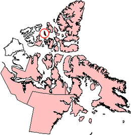
Lougheed Island is one of the uninhabited islands of the Arctic Archipelago in the Qikiqtaaluk Region, Nunavut. It measures 1,312 km2 (507 sq mi) in size. It is relatively isolated compared to other Canadian Arctic islands, and is located in the Arctic Ocean, halfway between Ellef Ringnes Island to the northeast and Melville Island to the southwest. It is part of the Findlay Group.

 Lougheed Island, Nunavut | |
 Lougheed Island  Lougheed Island | |
| Geography | |
|---|---|
| Location | Arctic Ocean |
| Coordinates | 77°24′N 105°15′W |
| Archipelago | Findlay Group Queen Elizabeth Islands Arctic Archipelago |
| Area | 1,312 km2 (507 sq mi) |
| Length | 78 km (48.5 mi) |
| Width | 23 km (14.3 mi) |
| Administration | |
Canada | |
| Territory | Nunavut |
| Region | Qikiqtaaluk |
| Demographics | |
| Population | Uninhabited |
History
The first known sighting of the island was in 1916 by Vilhjalmur Stefansson, during his Canadian Arctic Expedition.[1]
The island is named for Canadian businessperson and politician James Alexander Lougheed.
On April 14, 1993, Environment Canada revoked a permit issued to Panarctic Oils Ltd. to dispose of 400 tonnes of scrap metal in the ocean off Lougheed Island. The decision was taken in response to concerns expressed by residents of Grise Fiord, Resolute, Arctic Bay and Pond Inlet. Instead of disposing of the material at sea, a research project was initiated to evaluate the environmental impact of stockpiling scrap metal on Lougheed Island.
In 1994, Larry Newitt of the Geological Survey of Canada and Charles Barton of the Australian Geological Survey Organization established a temporary magnetic observatory on Lougheed Island, close to the predicted position of the North Magnetic Pole, in order to monitor short-term fluctuations of the Earth's magnetic field.[2]
References
- Stefansson, Vilhjalmur (1922). The Friendly Arctic: The Story of Five Years in Polar Regions. New York: Macmillan.
- Newitt, Larry. "Tracking the North Magnetic Pol". uni-muenchen.de. Archived from the original on 2008-02-15. Retrieved 2008-05-18.
External links
- Lougheed Island in the Atlas of Canada - Toporama; Natural Resources Canada
Authority control | |
|---|---|
| General |
|
| National libraries | |
На других языках
[de] Lougheed Island
Lougheed Island ist eine der Königin-Elisabeth-Inseln. Sie liegt im kanadischen Territorium Nunavut.- [en] Lougheed Island
[es] Isla Lougheed
Isla Lougheed (Lougheed Island) es una de las islas del archipiélago ártico canadiense, perteneciente al grupo de Islas de la Reina Isabel, y administrativamente al territorio de Nunavut.[fr] Île Lougheed
L'île Lougheed (en anglais : Lougheed Island) est une île située dans le Centre-Ouest des îles de la Reine-Élisabeth, au nord-est de l'île Melville dans le territoire du Nunavut au Canada. L'île est un désert rocheux inhabité d'une superficie de 1 308 km2[1]. Elle fait partie du groupe de Findlay.[it] Isola Lougheed
L'isola Lougheed è un'isola del Canada.[ru] Лохид (остров)
Лохид (англ. Lougheed Island) — остров Канадского Арктического архипелага. Относится к Островам Королевы Елизаветы и к группе островов Свердруп. В настоящее время остров необитаем (2012).Другой контент может иметь иную лицензию. Перед использованием материалов сайта WikiSort.org внимательно изучите правила лицензирования конкретных элементов наполнения сайта.
WikiSort.org - проект по пересортировке и дополнению контента Википедии