geo.wikisort.org - Island
Borden Island is an uninhabited, low-lying island in the Queen Elizabeth Islands of northern Canada.[1]
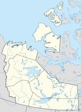
 Borden Island, Northwest Territories and Nunavut | |
 Borden Island  Borden Island  Borden Island | |
| Geography | |
|---|---|
| Location | Northern Canada |
| Coordinates | 78°30′03″N 111°13′12″W |
| Archipelago | Queen Elizabeth Islands Arctic Archipelago |
| Area | 2,795 km2 (1,079 sq mi) |
| Length | 94 km (58.4 mi) |
| Width | 82 km (51 mi) |
| Administration | |
Canada | |
| Territory | Nunavut; Northwest Territories |
| Demographics | |
| Population | Uninhabited |
Some features and history
With an area of 2,795 km2 (1,079 sq mi) in size, 93.9 kilometres (58.3 mi) long and 82 kilometres (51 mi) wide, Borden is the 171st largest island in the world, and Canada's 30th largest island. It lies north of Mackenzie King Island and is similarly split between the Northwest Territories (larger portion) and Nunavut, with the border running along the 110th meridian west.[2]
The first known sighting of the island was by Vilhjalmur Stefansson in 1916, it was originally described as a single landmass.[3] However, in 1947, during an aerial survey by the Royal Canadian Air Force the island was found to be two islands divided by Wilkins Strait.[4]
Naming
The island is named for Robert Borden, Prime Minister of Canada 1911–1920.[5]
References
- "Borden Island". www.thecanadianencyclopedia.ca. The Canadian Encyclopedia. Retrieved September 19, 2021.
- "Mackenzie King Island | The Canadian Encyclopedia". www.thecanadianencyclopedia.ca. Retrieved September 19, 2021.
- Stefansson, Vilhjalmur (1922). The Friendly Arctic: The Story of Five Years in Polar Regions. New York: Macmillan.
- Thomson, Don W., Skyview Canada: A Story of Aerial Photography in Canada, R.B.W. Ltd: Ottawa, Canada, 1975, p. 130
- "Canadian Leaders - Sir Robert Borden". Canada and the First World War. Retrieved September 19, 2021.
Further reading
- Geological Survey of Canada, John Adams, and Heather Penney. The 1956 June 3 Arctic Margin Earthquake Off Borden Island, Northwest Territories. Open file (Geological Survey of Canada), 2693. 1993.

External links
На других языках
[de] Borden Island
Borden Island gehört zu den Königin-Elisabeth-Inseln Kanadas und liegt im Westen des Kanadisch-Arktischen Archipels. Der größere, westliche Teil gehört zu den Nordwest-Territorien, nur ein kleiner östlicher Teil zum kanadischen Territorium Nunavut.- [en] Borden Island
[es] Isla Borden
La isla Borden (en inglés, Borden Island) es una pequeña isla deshabitada del Archipiélago ártico canadiense. Administrativamente, la isla está dividida en dos: la parte occidental, casi la totalidad de la isla, pertenece a los Territorios del Noroeste mientras que una muy pequeña parte, el extremo oriental, pertenece al territorio autónomo de Nunavut. El límite entre estos dos territorios canadienses sobre la isla Borden discurre a lo largo del meridiano 110 oeste.[fr] Île Borden
L'île Borden est une île inhabitée située dans l'archipel arctique canadien dans les îles de la Reine-Elisabeth dans le Nord du Canada. Elle a une superficie de 2 795 km2 ; ce qui en fait la 172e plus grande île au monde et la 30e plus grande île au Canada. La majeure partie de l'île fait partie des Territoires du Nord-Ouest et son extrémité est fait partie du Nunavut. La frontière suit le 110e méridien ouest.[it] Isola di Borden
L'isola di Borden fa parte dell'arcipelago delle isole Regina Elisabetta nel Canada del nord. L'isola è completamente disabitata ed ha una superficie di 2.795 km², il che la rende la 172ª isola al mondo in ordine di grandezza e la 30ª isola canadese. Si trova a nord dell'isola Mackenzie King e come quest'ultima è divisa tra 2 territori canadesi: la porzione più grande appartiene ai Territori del Nord-Ovest, il resto al territorio di Nunavut.[ru] Борден (остров)
Борден (англ. Borden Island) — остров Канадского Арктического архипелага. В настоящее время остров необитаем (2012).Другой контент может иметь иную лицензию. Перед использованием материалов сайта WikiSort.org внимательно изучите правила лицензирования конкретных элементов наполнения сайта.
WikiSort.org - проект по пересортировке и дополнению контента Википедии