geo.wikisort.org - Island
Blacklead Island[4] is a Baffin Island offshore islet located in the Arctic Archipelago in Nunavut's Qikiqtaaluk Region. It lies in Cumberland Sound, northwest of Kikiktaluk Island, approximately 5 km (3.1 mi) from Harrison Point and 10 km (6.2 mi) from Niante Harbour.
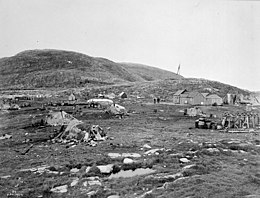
 Whaling station on Blacklead Island, 1903 | |
 Blacklead Island  Blacklead Island | |
| Geography | |
|---|---|
| Location | Cumberland Sound |
| Coordinates | 64°59′N 66°12′W[1] |
| Archipelago | Arctic Archipelago |
| Area | 2 km2 (0.77 sq mi) |
| Coastline | 7 km (4.3 mi) |
| Administration | |
Canada | |
| Territory | Nunavut |
| Region | Qikiqtaaluk |
| Demographics | |
| Population | Uninhabited |
National Historic Site of Canada | |
| Official name | Blacklead Island Whaling Station National Historic Site of Canada |
| Designated | 1985 |
| Source: Atlas of Canada[3] | |
History

The island had been used by the Inuit for whaling. Later used by Europeans, it was known as the Blacklead Island Whaling Station, and was designated a National Historic Site of Canada in 1985.[5][6][7] In 1894 the whaling station was purchased by Mr. C. Noble and offered to Edmund Peck as an Anglican mission.[8][9]
References
- "Blacklead Island". Geographical Names Data Base. Natural Resources Canada.
- "Blacklead Island". Geographical Names Data Base. Natural Resources Canada.
- "Blacklead Island at the Atlas of Canada". Archived from the original on 2012-09-28. Retrieved 2009-03-28.
- "Blacklead Island". The Columbia Gazetteer of North America. bartleby.com. 2000. Archived from the original on 2008-11-18. Retrieved 2008-09-18.
- Blacklead Island Whaling Station National Historic Site of Canada. Canadian Register of Historic Places. Retrieved 29 October 2013 .
- National Historic Sites of Canada System Plan
- National Historic Sites of Canada System Plan map Archived 2006-05-29 at the Wayback Machine
- Edmund Peck (Uqammaq), 1850-1924
- The Life and Work of E. J. Peck Among the Eskimos by the Rev. Arthur Lewis, M.A.
На других языках
[de] Blacklead Island
Blacklead Island (Inuktitut Uummannarjuaq, „wie das Herz eines großen Meeressäugetiers“) ist eine unbewohnte Insel in der Qikiqtaaluk Region von Nunavut, Kanada. Ihre ehemalige Walfangstation besitzt seit 1985 den Status einer National Historic Site of Canada.[1]- [en] Blacklead Island
Текст в блоке "Читать" взят с сайта "Википедия" и доступен по лицензии Creative Commons Attribution-ShareAlike; в отдельных случаях могут действовать дополнительные условия.
Другой контент может иметь иную лицензию. Перед использованием материалов сайта WikiSort.org внимательно изучите правила лицензирования конкретных элементов наполнения сайта.
Другой контент может иметь иную лицензию. Перед использованием материалов сайта WikiSort.org внимательно изучите правила лицензирования конкретных элементов наполнения сайта.
2019-2025
WikiSort.org - проект по пересортировке и дополнению контента Википедии
WikiSort.org - проект по пересортировке и дополнению контента Википедии