geo.wikisort.org - Island
Alexander Island is one of the Canadian arctic islands located in Nunavut, Canada. It lies south of Massey Island and Île Marc (across Boyer Strait), and north of Bathurst Island (across Pell Inlet). Located at 75°52'N 102°37'W it has an area of 484 km2 (187 sq mi), 42.8 kilometres (26.6 mi) long and 19 kilometres (12 mi) wide.[1]
 Alexander Island, Nunavut | |
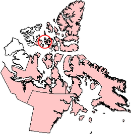
 Alexander Island Location in Nunavut  Alexander Island Location in Canada | |
| Geography | |
|---|---|
| Location | Northern Canada |
| Coordinates | 75°52′N 102°37′W |
| Archipelago | Queen Elizabeth Islands Arctic Archipelago |
| Area | 484 km2 (187 sq mi) |
| Length | 43 km (26.7 mi) |
| Width | 19 km (11.8 mi) |
| Administration | |
Canada | |
| Territory | Nunavut |
| Demographics | |
| Population | Uninhabited |
References
- "The Atlas of Canada - Sea Islands". Natural Resources Canada. Archived from the original on 2010-07-02. Retrieved 2011-05-05.
External links
- Alexander Island in the Atlas of Canada - Toporama; Natural Resources Canada
This Qikiqtaaluk Region, Nunavut location article is a stub. You can help Wikipedia by expanding it. |
На других языках
[de] Alexander Island (Nunavut)
Alexander Island ist eine unbewohnte Insel im Territorium Nunavut, Kanada. Sie gehört zur Bathurst-Island-Gruppe der Königin-Elisabeth-Inseln im Nordpolarmeer. Von ihren Nachbarinseln Massey Island und Bathurst Island wird sie durch die Boyer Strait bzw. das Pell Inlet getrennt. Bei einer Länge von 43 km hat Alexander Island eine Fläche von 484 km².[1]- [en] Alexander Island (Nunavut)
[fr] Île Alexander
L'île Alexander (Alexander Island) est une île de l'archipel arctique canadien.[it] Isola Alexander (Canada)
L'isola Alexander è un'isola appartenente all'arcipelago artico canadese, nel territorio di Nunavut.[ru] Александер (остров)
Алекса́ндер (англ. Alexander Island) — остров Канадского Арктического архипелага. Также входит в группу Острова Королевы Елизаветы и в группу островов Архипелаг Парри. В настоящее время остров необитаем (2012).Текст в блоке "Читать" взят с сайта "Википедия" и доступен по лицензии Creative Commons Attribution-ShareAlike; в отдельных случаях могут действовать дополнительные условия.
Другой контент может иметь иную лицензию. Перед использованием материалов сайта WikiSort.org внимательно изучите правила лицензирования конкретных элементов наполнения сайта.
Другой контент может иметь иную лицензию. Перед использованием материалов сайта WikiSort.org внимательно изучите правила лицензирования конкретных элементов наполнения сайта.
2019-2025
WikiSort.org - проект по пересортировке и дополнению контента Википедии
WikiSort.org - проект по пересортировке и дополнению контента Википедии