geo.wikisort.org - Island
Bylot Island[pronunciation?] lies off the northern end of Baffin Island in Nunavut Territory, Canada. Eclipse Sound to the southeast and Navy Board Inlet to the southwest separate it from Baffin Island. Parry Channel lies to its northwest. At 11,067 km2 (4,273 sq mi) it is ranked 71st largest island in the world and Canada's 17th largest island. The island measures 180 km (110 mi) east to west and 110 km (68 mi) north to south and is one of the largest uninhabited islands in the world. While there are no permanent settlements on this Canadian Arctic island, Inuit from Pond Inlet and elsewhere regularly travel to Bylot Island. An Inuit seasonal hunting camp is located southwest of Cape Graham Moore.
 July 2012 NASA satellite photograph of Bylot Island | |
 | |
 Bylot  Bylot | |
| Geography | |
|---|---|
| Location | Lancaster Sound |
| Coordinates | 73°16′N 78°30′W |
| Archipelago | Arctic Archipelago |
| Area | 11,067 km2 (4,273 sq mi) |
| Area rank | 72nd |
| Highest elevation | 1,951 m (6401 ft) |
| Highest point | Angilaaq Mountain |
| Administration | |
Canada | |
| Territory | Nunavut |
| Region | Qikiqtaaluk |
| Demographics | |
| Population | Uninhabited |
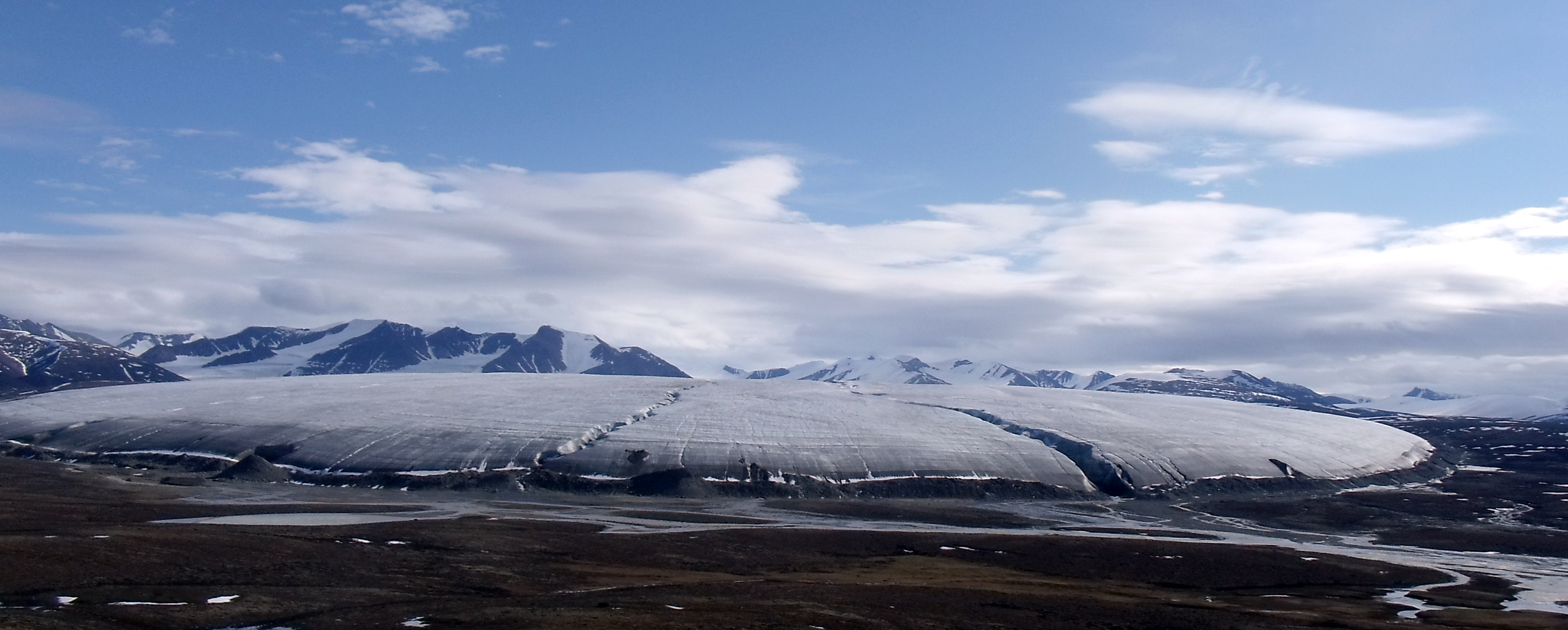
The island's mountains are part of the Byam Martin Mountains, which is part of the Baffin Mountains of the Arctic Cordillera. In addition to Angilaaq Mountain, Malik Mountain, Mount St. Hans, and Mount Thule are notable. Tay Bay is on the west coast. Vertical cliffs along the coastline are made up of Precambrian dolomite. There are numerous glaciers. The western shore faces Navy Board Inlet. The island's north shore, facing Lancaster Sound, is a polar bear maternity den area.[1] Beluga, bowhead whale, harp seal, narwhal, and ringed seal frequent the area.
The island is named for the Arctic explorer Robert Bylot, who was the first European to sight it in 1616.[2] The whaling captain William Adams was the first to prove the island's insular nature in 1872.[3]
In the 2000s, Baffinland Iron Mines Corporation, began to develop a tote road from its Mary River Mine, and harbour infrastructure in Milne Bay—a small, shallow arm of at the confluence of Eclipse Sound and Navy Board Inlet which separates Bylot Island from Baffin Island.[4][5] Milne Inlet flows in a southerly direction from Navy Board Inlet at the confluence of Eclipse Sound.
Protected areas
Almost all of the island is located within Sirmilik National Park, harbouring large populations of thick-billed murres, black-legged kittiwakes and greater snow geese. The eastern area of the island is federally designated as the Bylot Island Migratory Bird Sanctuary.[6] Three areas are classified as Canadian Important Bird Areas: Cape Graham Moore, Cape Hay, and the Southwest Bylot plain.[1][7][8]
Cultural references
In 2010, a painting of Bylot Island titled "Bylot Island I" by Lawren Harris, one of the Group of Seven mid-century Canadian artists, was sold at auction for $2.8 million, one of the highest prices ever paid for a work by a Canadian artist.[9]
References
- "Cape Hay". bsc-eoc.org. Archived from the original on 2011-06-12. Retrieved 2009-04-23.
- Markham, Clements (1881). The voyages of William Baffin, 1612-1622. London: Hakluyt Society.
William Baffin.
- Mills, William James (2003). Exploring polar frontiers: a historical encyclopedia. Santa Barbara: ABC-CLIO.
- Klein, Greg (November 8, 2015). "Baffinland Iron Mines sets high Arctic high volume shipping record". Resource clips. Retrieved November 10, 2015.
- Gedeon, Julie (March 2, 2009). "Floating wharf gets around lack of Arctic infrastructure". Canadian Sailings. Arctic Shipping Special Report. Archived from the original on November 13, 2010.
- "NU site 23 - Cape Graham Moore" (PDF). ngps.nt.ca. Retrieved 2009-04-23.[permanent dead link]
- "Southwest Bylot". birdscanada.org. Archived from the original on 2011-07-25. Retrieved 2009-09-08.
- "NU068". bsc-eoc.org. Archived from the original on 2011-06-12. Retrieved 2009-04-23.
- "Lawren Harris painting sells for $2.8-million". www.theglobeandmail.com. Retrieved 2010-05-27.
Further reading
- Audet, Benoît; Gauthier, Gilles; and Lévesque, Esther (2007); "Feeding Ecology of Greater Snow Goose Goslings in Mesic Tundra on Bylot Island, Nunavut, Canada", The Condor. 109, no. 2: 361
- Drury, W. H.; and Drury, Mary B.; The Bylot Island Expedition, [Lincoln, Mass.]: Massachusetts Audubon Society, 1955
- Falconer, G.; Glaciers of Northern Baffin and Bylot Islands, NWT, Ottawa: Geographical Branch, Dept. of Mines and Technical Surveys, 1962
- Fortier, Daniel; Allard, Michel; and Shur, Yuri (2007); "Observation of Rapid Drainage System Development by Thermal Erosion of Ice Wedges on Bylot Island, Arctic Archipelago", Permafrost and Periglacial Processes, 18, no. 3: 229
- Hofmann, H. J.; and Jackson, G. D.; Shale-Facies Microfossils from the Proterozoic Bylot Supergroup, Baffin Island, Canada. [Tulsa, OK]: Paleontological Society, 1994
- Klassen, R. A.; Quaternary Geology and Glacial History of Bylot Island, Northwest Territories, Ottawa, Canada: Geological Survey of Canada, 1993, ISBN 0-660-14989-3
- Scherman, Katharine (1956); Spring on an Arctic Island. Travel literature of a research trip to Bylot Island in 1954.
- Tilman, W. H. (1966); Mostly Mischief. An account of a crossing of Bylot Island in 1963.
External links
- Bylot Island in the Atlas of Canada - Toporama; Natural Resources Canada
| Wikimedia Commons has media related to Bylot Island. |
Authority control | |
|---|---|
| General |
|
| National libraries | |
| Other | |
На других языках
[de] Bylot-Insel
Die Bylot-Insel, Teil des Sirmilik-Nationalparks, ist unmittelbar gegenüber dem Nordende der Baffininsel im kanadischen Territorium Nunavut gelegen und von dieser im Süden durch den Pond-Meeresarm, im Südwesten durch den Eclipse-Sund und im Westen durch den Navy-Board-Meeresarm getrennt. An ihrer Nordostseite treffen die Ozeanströmungen der Baffin Bay und des Lancastersunds zusammen. Mit einer Fläche von 11.067 km² ist sie die siebzehntgrößte Insel Kanadas[1] und die einundsiebziggrößte Insel der Erde.- [en] Bylot Island
[es] Isla Bylot
La isla Bylot (en inglés, Bylot Island) es una isla del archipiélago Ártico Canadiense situada en del extremo norte de la isla de Baffin, en el territorio de Nunavut. Con una superficie de 11 067 km², ocupa el puesto 71.º de las islas mayores del mundo y el 17º de las islas mayores de Canadá. Aunque no existen asentamientos permanentes en la isla, los inuit de Pond Inlet y otros lugares viajan regularmente a ella.[fr] Île Bylot
L'île Bylot, en anglais Bylot Island, est une île du Canada située dans le passage du Nord-Ouest et faisant partie de l'archipel arctique canadien. Elle est nommée d'après l'explorateur arctique Robert Bylot.[it] Isola di Bylot
L'isola di Bylot è un'isola dell'arcipelago artico canadese, situata all'estremità settentrionale dell'isola di Baffin, nel Territorio di Nunavut, in Canada. Si estende per 11.067 km², ed è pertanto la 71ª isola maggiore del mondo e la 17° del Canada. La cima più elevata è il Monte Angilaaq che s'innalza a 1.951 metri sul livello del mare. Non ci sono insediamenti permanenti sull'isola, ma vi si possono trovare Inuit di passaggio.[ru] Байлот
Байлот (англ. Bylot Island, фр. Île Bylot) — остров Канадского Арктического архипелага, находящийся близ северо-восточного побережья Баффиновой Земли, административно относится к региону Кикиктани провинции Нунавут.Другой контент может иметь иную лицензию. Перед использованием материалов сайта WikiSort.org внимательно изучите правила лицензирования конкретных элементов наполнения сайта.
WikiSort.org - проект по пересортировке и дополнению контента Википедии