geo.wikisort.org - Sea
Milne Bay is a large bay in Milne Bay Province, south-eastern Papua New Guinea. More than 35 kilometres (22 miles) long and over 15 kilometres (9 miles) wide, Milne Bay is a sheltered deep-water harbor accessible via Ward Hunt Strait. It is surrounded by the heavily wooded Stirling Range to the north and south, and on the northern shore, a narrow coastal strip, soggy with sago and mangrove swamps.[1] The bay is named after Sir Alexander Milne.
| Milne Bay | |
|---|---|
 Location of Milne Bay | |
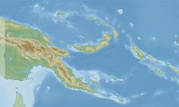 Milne Bay | |
| Location | Milne Bay Province |
| Coordinates | 10°22′00″S 150°30′00″E |
| Type | Bay |
| Ocean/sea sources | Solomon Sea |
| Basin countries | Papua New Guinea |
| Max. length | 35 km (22 mi) |
| Max. width | 15 km (9.3 mi) |
| Surface area | 202.7 square miles (525 km2) |
| Settlements | Alotau |
History
- Surveyed by Luis Vaez de Torres in July 1606.[2][3]: 29
- Surveyed by Captain Owen Stanley, R.N. F.R.S. in 1850.[4]
World War II

During World War II, the area was the site of the Battle of Milne Bay in 1942 and by late 1943 it became the major support base, Naval Base Milne Bay, for the New Guinea campaign through the development of Finschhafen as an advanced base after that area was secured in the Huon Peninsula campaign. By January 1944 about 140 vessels were in harbor due to congestion at the facilities. Congestion was relieved by opening of a port at Finschhafen and extensive improvements at Milne Bay.[5] Malaria was a major problem in New Guinea and Milne Bay was particularly hard hit with incidents of the disease hitting at a rate of 4,000 cases per 1,000 troops per year and estimated 12,000 man-days a month lost time.[6]
There were three planes ditched off the island in 1943, a P-38H Lightning, a P-38F Lightning, and a B-24D Liberator "The Leila Belle" (MIA).[7]
21st Century
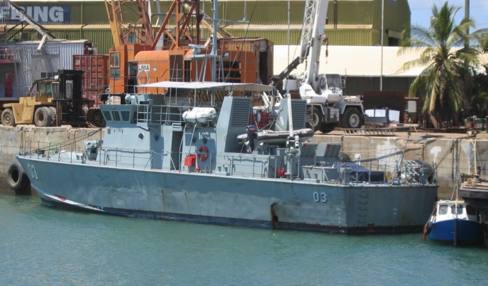
The HMPNGS Seeadler fired upon a Vietnamese fishing vessel on December 23, 2016.[8] Her captain died, and the poacher sank.
See also
- Battle of Buna–Gona
- Milne Force
- Operation Lilliput
Gallery
 Milne Bay seen from space.
 Milne Bay from Alotau.
 Treehouse, in 1884-1885
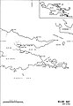 Map of the bay


Footnotes
- James, Karl. "General Clowes of Milne Bay". Retrieved 4 September 2012.
- Royal Geographical Society. Supplementary Papers. 1886. p 270
- Hilder, Brett (1980). The voyage of Torres : the discovery of the southern coastline of New Guinea and Torres Strait by Captain Luis Baéz de Torres in 1606. Hong Kong: University of Queensland Press.
- Hydrographic Map of Papua or New Guinea Sheet 7, Southeast coast, Orangerie Bay to Bramble Haven, 1852-1888
- Leighton & Coakley 1999, pp. 450–451, v.2.
- Condon-Rall & Cowdrey 1998, p. 137.
- Basilisk Island Pacific Wrecks
-
Clifford Faiparik (2017-01-04). "Ship skipper dies in clash". The National. Retrieved 2018-07-10.
The captain of a Vietnamese fishing vessel was allegedly killed and a crew member sustained injuries after PNG Defence Force patrol boat fired at the vessel for illegally harvesting beche de mers (sea cucumbers) in Milne Bay waters, police say.
References
- Condon-Rall, Mary Ellen; Cowdrey, Albert E. (1998). The Technical Services—The Medical Department: Medical Service In The War Against Japan. United States Army In World War II. Washington, DC: Center Of Military History, United States Army. LCCN 97022644.
- Leighton, Richard M; Coakley, Robert W (1999). The War Department — Global Logistics And Strategy 1943–1945. United States Army In World War II. Vol. 2. Washington, DC: Center Of Military History, United States Army. LCCN 55060001.
Authority control | |
|---|---|
| General | |
| National libraries | |
| Other | |
This Milne Bay Province geography article is a stub. You can help Wikipedia by expanding it. |
Другой контент может иметь иную лицензию. Перед использованием материалов сайта WikiSort.org внимательно изучите правила лицензирования конкретных элементов наполнения сайта.
WikiSort.org - проект по пересортировке и дополнению контента Википедии