geo.wikisort.org - Sea
The Solomon Sea is a sea located within the Pacific Ocean. It lies between Papua New Guinea and Solomon Islands. Many major battles were fought there during World War II.
| Solomon Sea | |
|---|---|
 Solomon Sea | |
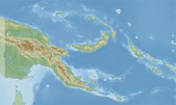 Solomon Sea | |
| Location | Oceania |
| Coordinates | 8°S 154°E |
| Type | Sea |
| Part of | Pacific Ocean |
| Basin countries | Papua New Guinea and Solomon Islands |
| Surface area | 720,000 km2 (280,000 sq mi) |
Extent
The International Hydrographic Organization defines the limits of the Solomon Sea as follows:[1]
On the Northwest. By the Southeast limit of Bismarck Sea [A line from the Southern point of New Ireland along the parallel of 4°50' South to the coast of New Britain, along its Northern coast and thence a line from its Western extreme through the Northern point of Umboi Island to Teliata Point, New Guinea (5°55′S 147°24′E)].
On the Northeast. By a line from the Southern point of New Ireland to the North point of Buka Island, through this island to the Northwest point of Bougainville Island, along the Southern coasts of Bougainville, Choisel [Choiseul], Ysabel [Santa Isabel], Malaita and San Cristobal [Makira] Islands.
On the South. The Northern limit of the Coral Sea between San Cristobal Island, the Solomon Islands, and Gado-Gadoa Island, off the Southeast extreme of New Guinea [Gado-Gadoa Island near its Southeastern extreme (10°38′S 150°34′E), down this meridian to the 100 fathom line and thence along the Southern edges of Uluma (Suckling) Reef and those extending to the Eastward as far as the Southeast point of Lawik Reef (11°43.5′S 153°56.5′E) off Tagula Island [Vanatinai], thence a line to the Southern extreme of Rennell Island and from its Eastern point to Cape Surville, the Eastern extreme of San Cristobal Island].
On the Southwest. By the coast of New Guinea and a line from its Southeasternmost point through the Louisiade Archipelago to Rossel Island.
Deepest point
The Solomon Sea roughly corresponds with the Solomon Sea Plate, a tectonic feature,[citation needed] and includes the New Britain Trench, and reaches its maximum depth at 29,988 feet (9,140 m) below sea level in the Planet Deep.[2]
References
- "Limits of Oceans and Seas, 3rd edition" (PDF). International Hydrographic Organization. 1953. Retrieved 28 December 2020.
- "Solomon Sea". Encyclopædia Britannica. Retrieved 23 March 2021.
External links
- Map of the Solomon Sea. at the Library of Congress Web Archives (archived 2006-10-21)
| Authority control |
|
|---|
На других языках
- [en] Solomon Sea
[es] Mar de Salomón
El mar de Salomón es un mar abierto localizado en el suroeste del océano Pacífico, delimitado por la costa suroriental de la isla de Nueva Guinea, al oeste; por las islas del archipiélago de Bismarck, al norte; por las Islas Salomón, de las que recibe su nombre, al este; y por el archipiélago Luisiadas, en la prolongación de la punta del sudeste de Nueva Guinea, al sur, por donde se abre al mar de Coral. Comunica al noroeste y al norte, a ambos lados de la isla de Nueva Bretaña, con el mar de Bismarck.[ru] Соломоново море
Соломоново море (англ. Solomon Sea) — межостровное море Тихого океана, расположенное между Соломоновыми островами, Новой Британией и Новой Гвинеей.Другой контент может иметь иную лицензию. Перед использованием материалов сайта WikiSort.org внимательно изучите правила лицензирования конкретных элементов наполнения сайта.
WikiSort.org - проект по пересортировке и дополнению контента Википедии