geo.wikisort.org - Sea
The Ionian Sea (Greek: Ιόνιο Πέλαγος, Iónio Pélagos [iˈonio ˈpelaɣos]; Italian: Mar Ionio [mar ˈjɔːnjo]; Albanian: Deti Jon [dɛti jɔn]) is an elongated bay of the Mediterranean Sea. It is connected to the Adriatic Sea to the north, and is bounded by Southern Italy, including Calabria, Sicily, and the Salento peninsula to the west, southern Albania (and western Apulia, Italy) to the north, and the west coast of Greece, including the Peloponnese.
| Ionian Sea | |
|---|---|
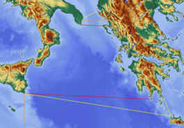 Boundaries of Ionian Sea: red lines define border per International Hydrographic Organization | |
| Location | Southern Europe |
| Coordinates | 38°N 19°E |
| Type | Sea |
| Primary outflows | Mediterranean Sea |
| Basin countries | Albania, Greece, and Italy |
| Islands | List of islands in the Ionian Sea |
| Settlements | Igoumenitsa, Parga, Preveza, Astakos, Patras, Kerkyra, Lefkada, Argostoli, Zakynthos, Kyparissia, Pylos, Kalamata, Himarë, Sarandë, Syracuse, Catania, Taormina, Messina, Taranto |


All major islands in the sea, which are located in the east of the sea, belong to Greece. They are collectively named the Ionian Islands, the main ones being Corfu, Kefalonia, Zakynthos, Lefkada, and Ithaca.
There are ferry routes between Patras and Igoumenitsa, Greece, and Brindisi and Ancona, Italy, that cross the east and north of the Ionian Sea, and from Piraeus westward. Calypso Deep, the deepest point in the Mediterranean at 5,109 m (16,762 ft), is in the Ionian Sea, at 36°34′N 21°8′E.[1][2] The sea is one of the most seismically active areas in the world.
Etymology
The name Ionian comes from the Greek word Ionion (Ἰόνιον). Its etymology is unknown.[3] Ancient Greek writers, especially Aeschylus, linked it to the myth of Io. In ancient Greek the adjective Ionios (Ἰόνιος) was used as an epithet for the sea because Io swam across it.[4][5][6] According to the Oxford Classical Dictionary, the name may derive from Ionians who sailed to the West.[7] There were also narratives about other eponymic legendary figures;[8] according to one version, Ionius was a son of Adrias (eponymic for the Adriatic Sea); according to another, Ionius was a son of Dyrrhachus.[9] When Dyrrhachus was attacked by his own brothers, Heracles, who was passing through the area, came to his aid, but in the fight the hero killed his ally's son by mistake. The body was cast into the water, and thereafter was called the Ionian Sea.[9]
Geography
Extent
The International Hydrographic Organization defines the limits of the Ionian Sea as follows:[10]
- On the North. A line running from the mouth of the Butrinto River (39°44'N) in Albania, to Cape Karagol in Corfu (39°45'N), along the North Coast of Corfu to Cape Kephali (39°45'N) and from thence to Cape Santa Maria di Leuca in Italy.
- On the East. From the mouth of the Butrinto River in Albania down the coast of the mainland to Cape Matapan.
- On the South. A line from Cape Matapan to Cape Passero, the Southern point of Sicily.
- On the West. The East coast of Sicily and the Southeast coast of Italy to Cape Santa Maria di Leuca.
Places


From south to north in the west, then north to south in the east:
- Syracuse, port, W
- Catania, port, W
- Messina, port, W
- Taranto, port N
- Himara, small port, NE
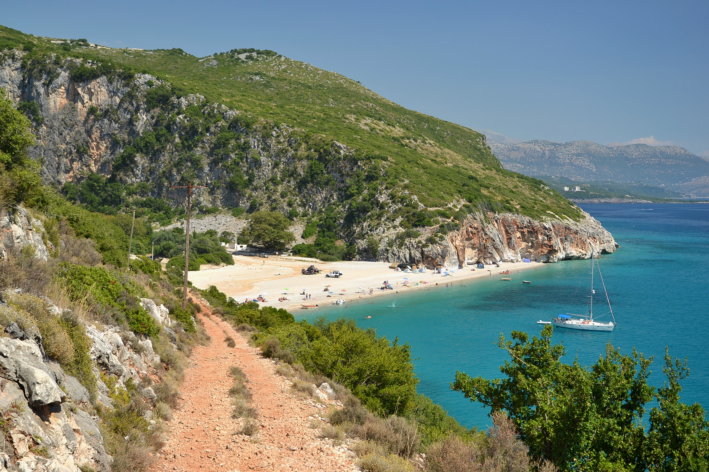
- Saranda, port and a beach, NE
- Kerkyra, port, E
- Igoumenitsa, port, E
- Parga, small port, E
- Preveza, port, E
- Astakos, port, E
- Argostoli, port, E
- Patra, port, E
- Kyparissia, port, E
- Pylos, port, E
- Methoni, small port and a beach
- Ionian Islands
Gulfs and straits
- Strait of Messina, W
- Gulf of Catania, W
- Gulf of Augusta, W
- Gulf of Taranto, NW
- Gulf of Squillace, NW
- Ambracian Gulf, E
- Gulf of Patras, connecting the Gulf of Corinth, ESE
- Gulf of Kyparissia, SE
- Messenian Gulf, SE
- Laconian Gulf, ESE
Islands
Islets
- Antikythera
- Antipaxi
- Arkoudi
- Atokos
- Kalamos
- Kastos
- Ksamil Islands
- Kravia
- Kythros
- Lazareto (Ithaca)
- Lazaretto (Corfu)
- Meganisi
- Navtilos
- Pontikonisi
- Proti
- Sphacteria
- Skorpios
- Sparti (Lefkada)
- Strofades
- Vido
History
This section needs expansion. You can help by adding to it. (November 2020) |
The Sea was the location of the famous naval battle between Octavian and Marc Antony known as The Battle of Actium, a war fought in 31 BC,[11] and is also famous for the hero from Ancient Greek mythology named Odysseus, who was from the island of Ithaca.[12]
See also
- Calypso Deep
References
- Gade, Martin (March 15, 2008). "The European Marginal and Enclosed Seas: An Overview". In Barale, Vittorio (ed.). Remote Sensing of the European Seas. Springer Science+Business Media. pp. 3–22. ISBN 978-1-4020-6771-6. LCCN 2007942178. Retrieved August 28, 2009.
- "NCMR - MAP". National Observatory of Athens. Archived from the original on August 28, 2009. Retrieved April 5, 2018.
- Babiniotis, Lexiko tis Neoellinikis Glossas.
- Jakub Pigoń (18 December 2008). The Children of Herodotus: Greek and Roman Historiography and Related Genres. Cambridge Scholars Publishing. p. 114. ISBN 978-1-4438-0251-2.
- LSJ, A Greek-English Lexicon s.v. Ἰόνιος.
- John Freely (30 April 2008). The Ionian Islands: Corfu, Cephalonia and Beyond. I.B.Tauris. p. 10. ISBN 978-0-85771-828-0.
- John Keahey (15 July 2014). A Sweet and Glorious Land: Revisiting the Ionian Sea. St. Martin's Press. p. 116. ISBN 978-1-4668-7603-3.
- Charles Anthon (1869). A Classical Dictionary Containing an Account of the Principal Proper Names Mentioned in Ancient Authors [and Intended to Elucidate All the Important Points Connected with the Geography, History, Biography, Mythology, and Fine Arts of the Greeks and Romans: Together with an Account of Coins, Weights, and Measures, with Tabular Values of the Same]. Harper [& Brothers]. p. 679.
- Gocha R. Tsetskhladze (2008). Greek Colonisation: An Account of Greek Colonies and Other Settlements Overseas. BRILL. p. 157. ISBN 978-90-04-15576-3.
- Limits of Oceans and Seas (PDF) (3rd ed.). Organisation hydrographique internationale. 1953. Archived from the original (PDF) on October 8, 2011. Retrieved 28 December 2020.
- "Battle of Actium | ancient Roman history | Britannica".
- "Odysseus | Myth, Significance, Trojan War, & Odyssey | Britannica".
External links
Marginal seas of the Atlantic Ocean | |
|---|---|
| Basins |
|
| Bays |
|
| Channels | |
| Gulfs | |
| Seas |
|
Ancient Greece | |||||||||||||||||||||||||
|---|---|---|---|---|---|---|---|---|---|---|---|---|---|---|---|---|---|---|---|---|---|---|---|---|---|
| |||||||||||||||||||||||||
| |||||||||||||||||||||||||
| |||||||||||||||||||||||||
| |||||||||||||||||||||||||
| |||||||||||||||||||||||||
| |||||||||||||||||||||||||
| |||||||||||||||||||||||||
| |||||||||||||||||||||||||

Authority control | |
|---|---|
| General | |
| National libraries | |
На других языках
- [en] Ionian Sea
[ru] Ионическое море
Иони́ческое мо́ре[1] (др.-греч. Ἰόνιον Πέλαγος, лат. mare Ionium, греч. Ιόνιο Πέλαγος, итал. mar Ionio, алб. Deti Jon) — часть Средиземного моря между Балканским и Апеннинским полуостровами и островами Крит и Сицилия[2]. Через пролив Отранто соединяется с Адриатическим морем, а через Мессинский пролив — с Тирренским морем. Омывает берега Южной Италии (области Сицилия, Калабрия, Базиликата и Апулия), Албании (префектура Влёра) и Греции (административные округа Ионические острова, Эпир, Западная Греция, Центральная Греция, Аттика, Пелопоннес и Крит).Другой контент может иметь иную лицензию. Перед использованием материалов сайта WikiSort.org внимательно изучите правила лицензирования конкретных элементов наполнения сайта.
WikiSort.org - проект по пересортировке и дополнению контента Википедии