geo.wikisort.org - Sea
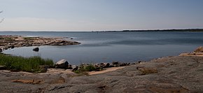
The Åland Sea (or the Sea of Åland; Swedish: Ålands hav, Finnish: Ahvenanmeri) is a waterway in the southern Gulf of Bothnia, between Åland and Sweden. It connects the Bothnian Sea with the Baltic Sea proper. The western part of the basin is in Swedish territorial waters while the eastern part is in Finnish territorial waters.


The Åland Sea has two sub-basins. The main basin is the Åland Sea proper, also called the northern Åland Sea basin. In the south, there is the smaller Lågskär Deep, also called the Lågskär Basin or the southern Åland Sea basin. The narrowest part on the northern edge of the basin is named the Southern Quark or South Kvarken (Swedish: Södra Kvarken, Finnish: Ahvenanrauma). The trench running on the bottom of the Sea of Åland contains the second-deepest spot of the Baltic Sea, at a depth of 301 meters, which is second only to Landsort Deep. The mean depth of Åland Sea is 75 m, area 5,477 km2 and its volume is 411 km³.[1] The Archipelago Sea and the Åland Sea regulate water exchange between Gulf of Bothnia and Baltic Proper.
Many ferries moving between Finland and Sweden cross the Sea of Åland.[2]
The official English Language name of the sea area as defined by the Baltic Marine Environment Commission HELCOM, is "Åland Sea".[3] The HELCOM nomenclature is also referenced by the International Council for the Exploration of the Sea (ICES).[4] The same name is also used in scientific literature.[5] Some other sources also use the name "Sea of Åland" in English.
References
- Leppäranta, M. and Myrberg, K. Physical oceanography of the Baltic Sea. Springer Verlag. ISBN 978-3-540-79703-6.
{{cite book}}: CS1 maint: multiple names: authors list (link) - Lasse Jansson (19 June 2014). "Vad hände sen med de gamla färjorna" (in Swedish). Aftonbladet. Retrieved 30 January 2016.
- "HELCOM Assessment Strategy" (PDF). HELCOM. Retrieved 17 December 2021.
- "ICES Maps". International Council for the Exploration of Seas. Retrieved 17 December 2021.
- Leppäranta, M. and Myrberg, K. Physical oceanography of the Baltic Sea. Springer Verlag. ISBN 978-3-540-79703-6.
{{cite book}}: CS1 maint: multiple names: authors list (link)
External links
![]() Media related to Sea of Åland at Wikimedia Commons
Media related to Sea of Åland at Wikimedia Commons
На других языках
- [en] Sea of Åland
[es] Mar de Åland
El mar de Åland (en finés, Ahvenanmeri; en sueco, Ålands hav) es un mar intracontinental del mar Báltico, concretamente del golfo de Botnia. Se sitúa entre el archipiélago de Åland al este, y la costa occidental de Suecia, al oeste, y el mar de Botnia al norte. Su profundidad varía: de 200 a 300 metros en el norte, algo menos en el sur y de 70 a 80 metros entre ambos.[ru] Аландское море
Аландское море (фин. Ahvenanmeri, швед. Ålands hav, координаты 60°01′ с. ш. 19°13′ в. д.HGЯO) — условное название для водного региона, расположенного в Ботническом заливе, между материковой Швецией и Аландскими островами. Это море соединяет Ботнический залив с Балтийским морем. Наибольшая глубина в Аландском море — 301 метр. Аландское море служит важным коммерческим путём между Швецией и Финляндией, по нему налажено несколько паромных путей. Численность населения, проживающего вокруг Аландского моря — 67 700 человек, что в среднем составляет 677 чел/км²[1].Другой контент может иметь иную лицензию. Перед использованием материалов сайта WikiSort.org внимательно изучите правила лицензирования конкретных элементов наполнения сайта.
WikiSort.org - проект по пересортировке и дополнению контента Википедии
