geo.wikisort.org - Sea
The East China Sea is an arm of the Western Pacific Ocean, located directly offshore from East China. It covers an area of roughly 1,249,000 square kilometers (482,000 sq mi). The sea’s northern extension between mainland China and the Korean Peninsula is the Yellow Sea, separated by an imaginary line between the eastern tip of Qidong at the Yangtze River estuary and the southwestern tip of South Korea's Jeju Island.
| East China Sea | |||||||||||||||||||||||||||||
|---|---|---|---|---|---|---|---|---|---|---|---|---|---|---|---|---|---|---|---|---|---|---|---|---|---|---|---|---|---|
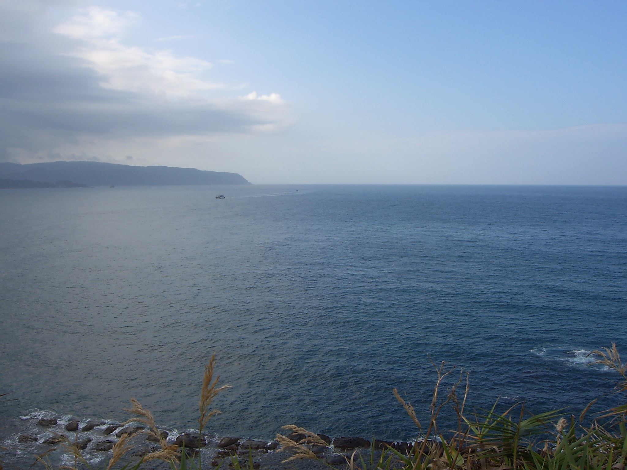
 The East China Sea, showing surrounding regions, islands, and seas | |||||||||||||||||||||||||||||
| Chinese name | |||||||||||||||||||||||||||||
| Simplified Chinese | 东海 东中国海 | ||||||||||||||||||||||||||||
| Traditional Chinese | 東海 東中國海 | ||||||||||||||||||||||||||||
| |||||||||||||||||||||||||||||
| Vietnamese name | |||||||||||||||||||||||||||||
| Vietnamese alphabet | Biển Hoa Đông | ||||||||||||||||||||||||||||
| Hán-Nôm | 𣷷華東 | ||||||||||||||||||||||||||||
| Korean name | |||||||||||||||||||||||||||||
| Hangul | 동중국해 | ||||||||||||||||||||||||||||
| Hanja | 東中國海 | ||||||||||||||||||||||||||||
| |||||||||||||||||||||||||||||
| Japanese name | |||||||||||||||||||||||||||||
| Kanji | 東シナ海 (since 2004) 東支那海 (1913–2004) | ||||||||||||||||||||||||||||
| Kana | ひがしシナかい | ||||||||||||||||||||||||||||
| |||||||||||||||||||||||||||||
The East China Sea is bounded in the east and southeast by the middle portion of the first island chain off the eastern Eurasian continental mainland, including the Japanese island of Kyushu and the Ryukyu Islands, and in the south by the island of Taiwan. It connects with the Sea of Japan in the northeast through the Korea Strait, the South China Sea in the southwest via the Taiwan Strait, and the Philippine Sea in the southeast via gaps between the various Ryukyu Islands (e.g. Tokara Strait and Miyako Strait).
Most of the East China Sea is shallow, with almost three-fourths of it being less than 200 metres (660 ft) deep, its average depth being 350 metres (1,150 ft), while the maximum depth, reached in the Okinawa Trough, is 2,716 metres (8,911 ft).[1]
The East China Sea is shared among China, Japan, Taiwan and South Korea.
Geography
The East China Sea is an arm of the Pacific Ocean and covers an area of roughly 770,000 square kilometers (300,000 sq mi).[2] It is bounded on the east by Kyūshū and the Ryukyu Islands of Japan, on the south by the South China Sea, and on the west by the Asian continent. It connects with the Sea of Japan through the Korea Strait; it opens in the north to the Yellow Sea.
Countries with borders on the sea (clockwise from north) include: South Korea, Japan, Taiwan and China.
Extent
The International Hydrographic Organization defines the limits of the "Eastern China Sea (Tung Hai)" as follows:[3]
- On the South.
- The Northern limit of the South China Sea [From Fuki Kaku the North point of Formosa to Kiushan Tao (Turnabout Island) on to the South point of Haitan Tao (25°25' N) and thence Westward on the parallel of 25°24' North to the coast of Fukien], thence from Santyo the Northeastern point of Formosa to the West point of Yonakuni Island and thence to Haderuma Sima (24°03′ N, 123°47′ E).
- On the East.
- From Haderuma Sima a line including the Miyako Retto to the East point of Miyako Sima and thence to Okinan Kaku, the Southern extremity of Okinawa Sima through this island to Ada-Ko Sima (Sidmouth Island) on to the East point of Kikai Sima (28°20' N) through Tanegra Sima (30°30' N) to the North point thereof and on to Hi-Saki (31°17' N) in Kyusyu.
- On the North.
- From Nomo Saki (32°35' N) in Kyusyu to the South point of Hukae Sima (Goto Retto) and on through this island to Ose Saki (Cape Goto) and to Hunan Kan, the South point of Saisyu To (Quelpart), through this island to its Western extreme and thence along the parallel of 33°17' North to the mainland.
- On the West.
- The mainland of China.
- On the South.
Rivers
The Yangtze River (Chang Jiang) is the largest river flowing into the East China Sea.
Islands and reefs

- Senkaku Islands (Japanese) or Diaoyu Islands (Chinese), or Diaoyutai (Taiwanese). Disputed.[4]
- Tong Island
There is a cluster of submerged reefs in the northern East China Sea. These include:
- Socotra Rock, also called Suyan Rock or Ieodo, a subject of an EEZ dispute between the People's Republic of China and South Korea.
- Hupijiao Rock (虎皮礁)
- Yajiao Rock (鴨礁)
Nomenclature
The sea is called the East Sea in Chinese (東海; Dōng Hǎi), and is one of the Four Seas of Chinese literature. There are three other seas, one for each of the four cardinal directions.[5]
Until World War II, the sea was referred to as 東支那海 (Higashi Shina Kai; "East Shina Sea") in Japanese. In 2004, official documents of the Japanese Foreign Ministry and other departments switched to the name 東シナ海 (pronounced the same), which has become the standard usage in Japan.
Common usage in Indonesia refers to the sea as Laut Cina Timur (East China Sea). This name was used officially by the Indonesian government until 2014, when Indonesia switched usage from the word Cina to Tiongkok instead; since then, the name Laut Tiongkok Timur become standard usage in Indonesia. Despite this, many Indonesian media outlets and publications continue to use the former sea name.
History
Whaling
American whaleships cruised for right whales in the sea between 1849 and 1892.[6]
EEZ disputes
There are disputes between the China] (PRC), Japan, Taiwan, and South Korea over the extent of their respective exclusive economic zones (EEZ).[7][page needed]
The dispute between the PRC and Japan concerns the different application of the 1982 United Nations Convention on the Law of the Sea (UNCLOS), which both nations have ratified.[8] China and Japan both claim 200 nautical miles EEZ rights, but the East China Sea width is only 360 nautical miles.[9] China proposed the application of UNCLOS, considering the natural prolongation of its continental shelf, advocating that the EEZ extends as far as the Okinawa Trough.[10][11] Its Ministry of Foreign Affairs has stated that "the natural prolongation of the continental shelf of China in the East China Sea extends to the Okinawa Trough and beyond 200 nautical miles from the baselines from which the breadth of the territorial sea of China is measured,"[10] which is applicable to the relevant UNCLOS provisions that support China's right to the natural shelf.[10][11] In 2012, China presented a submission under the UNCLOS concerning the outer limits of the continental shelf to the UN.[12] However, Japan claims about 40,000 square kilometers part of this territory as its own EEZ because it is within 200 nautical miles (370 km) from its coast, and thus proposed the Median line division of the EEZ.[9][13]
In 1995, the People's Republic of China (PRC) discovered an undersea natural gas field in the East China Sea, namely the Chunxiao gas field,[14] which lies within the Chinese EEZ while Japan believes it is connected to other possible reserves beyond the median line.[15] Japan has objected to PRC development of natural gas resources in the East China Sea near the area where the two countries Exclusive Economic Zone (EEZ) claims overlap. The specific development in dispute is the PRC's drilling in the Chunxiao gas field, which is located in undisputed areas on China's side, three or four miles (6 km) west of the median line proposed by Japan. Japan maintains that although the Chunxiao gas field rigs are on the PRC side of a median line that Tokyo regards as the two sides' sea boundary, they may tap into a field that stretches underground into the disputed area.[16] Japan therefore seeks a share in the natural gas resources. The gas fields in the Xihu Sag area in the East China Sea (Canxue, Baoyunting, Chunxiao, Duanqiao, Wuyunting, and Tianwaitian) are estimated to hold proven reserves of 364 BCF of natural gas.[17] Commercial operations began 2006. In June 2008, both sides agreed to jointly develop the Chunxiao gas fields,[16] but they have never been able to agree on how to execute the plan.[18]
Rounds of disputes about island ownership in the East China Sea have triggered both official and civilian protests between China and Japan.[19]
The dispute between PRC and South Korea concerns Socotra Rock, a submerged reef on which South Korea has constructed the Ieodo Ocean Research Station. While neither country claims the rock as territory, the PRC has objected to Korean activities there as a breach of its EEZ rights.
Navy of the People's Republic of China (PRC)
In their sphere of naval operations along their littoral (in the East and South China Seas), China today possesses more naval vessels than those of the US Navy.[20] US Presidents Barack Obama and Donald Trump have given priority to US naval operations, under the US Indo-Pacific Command, to expand its sphere of influence in the Pacific Ocean, to counter China's growing strength, and to be ready for any unforeseen challenges in the future.[21]
Military activities
Taiwan, Japan, China, and South Korea all conduct military exercises in the East China Sea.
East China Sea in astronomy
Possibly, East China Sea (Donghai in Chinese) is represented with the star Eta Serpentis in asterism Left Wall, Heavenly Market enclosure (see Chinese constellation).[22]
See also
- Geography of China
- Xihu Trough
- Ryukyu Islands
- Ryukyu Kingdom
- Okinawa Trough
- Senkaku Islands (Diaoyutai Islands in Taiwanese, Diaoyu Islands in Chinese)
- Philippine Sea
- Sea of Japan
- South China Sea
References
- LaFond, Eugene C. "East China Sea sea, Pacific Ocean".
- "中华人民共和国版图" (in Chinese (China)). Retrieved 8 October 2022.
- "Limits of Oceans and Seas" (PDF) (3rd ed.). Monaco: International Hydrographic Organization. 1953. p. 33. Special Publication No. 23. Archived from the original (PDF) on 8 October 2011. Retrieved 28 December 2020.
- "Long-Simmering Tensions Flare Over Disputed Senkaku Islands in East China Sea". VOA. Retrieved 11 July 2022.
- Chang, Chun-shu (2007). The Rise of the Chinese Empire: Nation, State, and Imperialism in Early China, ca. 1600 B.C. – A.D. 8. University of Michigan Press. pp. 263–264. ISBN 978-0-472-11533-4.
- Ocmulgee, of Holmes Hole, 10 Feb – 27 March 1849, Old Dartmouth Historical Society (ODHS); Covington, of Warren, 26 Feb – 21 March 1854, Nicholson Whaling Collection (NWC); Florida, of Fairhaven, 15 Mar – 7 April 1860, in Old Whaling Family (Williams, 1964); John and Winthrop, of San Francisco, 22 Feb – 31 March 1890, ODHS; Cape Horn Pigeon, of New Bedford, 18 Feb – 14 April 1892, Kendall Whaling Museum (KWM).
- Manicom, J. (2014). Bridging Troubled Waters: China, Japan, and Maritime Order in the East China Sea. Bridging Troubled Waters. Georgetown University Press. ISBN 978-1-62616-035-4. Retrieved 27 July 2022.
- Koo, Min Gyo (2009). Island Disputes and Maritime Regime Building in East Asia. Springer. pp. 182–183. ISBN 9781441962232.
- "Senkaku/Diaoyutai Islands". Globalsecurity.org.
- Wang, Yuanyuan (2012). "China to submit outer limits of continental shelf in East China Sea to UN". Xinhua. Archived from the original on 5 November 2012.
- Guo, Rongxing (2006). Territorial disputes and resource management: A global handbook. New York: Nova Science Pub Inc. p. 104. ISBN 9781600214455.
- Yu, Runze (2012). "China reports to UN outer limits of continental shelf in E. China Sea". SINA English. Archived from the original on 14 November 2013.
- "Diplomatic Bluebook 2006" (PDF). Ministry of Foreign Affairs of Japan. p. 43. Archived from the original (PDF) on 18 March 2013.
- Kim, Sun Pyo (2004). Maritime delimitation and interim arrangements in North East Asia. The Hague: M. Nijhoff. pp. 285. ISBN 9789004136694.
- Bush, Richard C. (2010). The perils of proximity: China-Japan security relations. Washington, D.C.: Brookings Institution Press. p. 76. ISBN 9780815704744.
- Fackler, Martin (19 June 2008). "China and Japan in Deal Over Contested Gas Fields". The New York Times.
- "EIA Country Analysis Briefs, East China Sea". eia.gov. Energy Information Administration. March 2008. Archived from the original on 20 September 2012.
- Lavelle, Marianne; Smith, Jeff (26 October 2012). "Why Are China and Japan Sparring Over Eight Tiny, Uninhabited Islands?". nationalgeographic.com. National Geographic Society.
- "Chinese, Japanese Stage Protests Over East China Sea Islands". voanews.com. Voice of America. Archived from the original on 15 April 2012. Retrieved 21 October 2010.
- Mizokami, Kyle (20 May 2019). "China Now Has More Warships Than the U.S." Popular Mechanics. Retrieved 26 June 2019.
- Ryan, Browne (30 May 2018). "US rebrands Pacific command amid tensions with China". CNN. Retrieved 30 May 2018.
- 天文教育資訊網 [Activities of Exhibition and Education in Astronomy]. aeea.nmns.edu.tw (in Chinese). Activities of Exhibition and Education in Astronomy. 23 June 2006. Retrieved 19 October 2012.
Further reading
- Kim, Suk Kyoon (July 2012). "China and Japan Maritime Disputes in the East China Sea: A Note on Recent Developments". Ocean Development & International Law. 43 (3): 296–308. doi:10.1080/00908320.2012.698931. ISSN 0090-8320. S2CID 153379773.
- McDevitt, Michael (1 March 2014). "The East China Sea: The Place Where Sino–U.S. Conflict Could Occur". American Foreign Policy Interests. 36 (2): 100–110. doi:10.1080/10803920.2014.905357. ISSN 1080-3920. S2CID 154013282.
- Manicom, James (2014). Bridging Troubled Waters: China, Japan, and Maritime Order in the East China Sea. Georgetown University Press. ISBN 9781626160361. Retrieved 13 August 2019.
- Medcalf, Rory. (2020) Indo-Pacific Empire: China, America and the contest for the world's pivotal region (2020) excerpt
- Nakano, Ryoko (14 March 2016). "The Sino–Japanese territorial dispute and threat perception in power transition". The Pacific Review. 29 (2): 165–186. doi:10.1080/09512748.2015.1013493. ISSN 0951-2748. S2CID 153459475.
- Peterson, Alexander (October 2009). "Sino-Japanese Cooperation in the East China Sea: A Lasting Arrangement". Cornell International Law Journal. 42 (3): 441–474. ISSN 0010-8812. Retrieved 13 August 2019.
- the United States. Congress. (2014). Maritime Sovereignty in the East and South China Seas: Joint Hearing before the Subcommittee on Seapower and Projection Forces of the Committee on Armed Services Meeting Jointly with the Subcommittee on Asia and the Pacific of the Committee on Foreign Affairs (Serial No. 113-137), House of Representatives, One Hundred Thirteenth Congress, Second Session, Hearing held January 14, 2014
- Valencia, Mark J. (2014). "The East China Sea Disputes: History, Status, and Ways Forward" (PDF). Asian Perspective. 38 (2): 183–218. doi:10.1353/apr.2014.0008. ISSN 2288-2871. S2CID 153772075. Retrieved 13 August 2019.
- Zou, Keyuan (2013). Law of the Sea in East Asia: Issues and Prospects. Routledge. ISBN 9781134267644. Retrieved 13 August 2019.
External links
- Rising Powers Quarterly Volume 3, Issue 2, Aug. 2018, special issue on "The "Indo-Pacific" - Regional Dynamics in the 21st Century's New Geopolitical Center of Gravity"
- Kosuke Takahashi. Gas and oil rivalry in the East China Sea Asia Times Online. 27 July 2004.
- Oil and gas in troubled waters The Economist. 6 October 2005.
- J Sean Curtin. Stakes rise in Japan, China gas dispute Asia Times Online. 19 October 2005.
- Chinese Suyan Rock community
- Alexander M. Peterson's 2009 Note in the Cornell International Law Journal detailing the dispute, clarifying the legal impact of the 2008 Sino-Japanese arrangement to cooperate in the East China Sea, and proposing increased Sino-Japanese cooperation.
- China, Japan and the Energy Quest in the East China Sea by Amrita Jash, IPP Review (Singapore). 29 August 2017.
Seas of China | |
|---|---|
Authority control | |
|---|---|
| General | |
| National libraries | |
На других языках
- [en] East China Sea
[ru] Восточно-Китайское море
Восто́чно-Кита́йское мо́ре[2][3] (кит. трад. 東海, упр. 东海, пиньинь Dōng Hǎi, палл. Дунхай[3], дословно — «восточное море»; кор. 동중국해, яп. 東シナ海[источник не указан 884 дня]) — полузамкнутое море на западе северной части Тихого океана, располагается между побережьем Восточной Азии (Китай) и островами Рюкю, Кюсю (Япония) и Тайвань (Китайская Республика)[1][2].Другой контент может иметь иную лицензию. Перед использованием материалов сайта WikiSort.org внимательно изучите правила лицензирования конкретных элементов наполнения сайта.
WikiSort.org - проект по пересортировке и дополнению контента Википедии