geo.wikisort.org - Sea
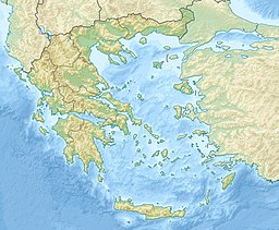
The Messenian Gulf (Greek: Μεσσηνιακός Κόλπος, Messiniakós Kólpos) is a sea that is part of the Ionian Sea. The gulf is circumscribed by the southern coasts of Messenia and the southwestern coast of the Mani peninsula in Laconia. Its bounds are Venetiko Island to the west and Cape Tainaron to the southeast. The western shores are mostly low-lying, fertile and well-developed, while the eastern shore is dominated by the southern foothills of the Taygetos and comparatively rocky and inaccessible, with few settlements.
This article does not cite any sources. (December 2009) |
| Messenian Gulf | |
|---|---|
 View of the Messenian Gulf | |
| Location | Southeast Europe |
| Coordinates | 36°50′N 22°4′E |
| Type | Gulf |
| Primary inflows | Mediterranean Sea |
| Basin countries | Greece |
| Max. length | 72 km (45 mi) |
| Max. width | 42 km (26 mi) (min) |
| Max. depth | 2,310 m (7,580 ft) |
The Pamisos River flows into the gulf near the port city of Kalamata, which is the gulf's major urban centre.
Places by the gulf
- Koroni - west
- Longa - west
- Petalidi - northwest
- Messini - northwest
- Kalamata - northeast
- Kardamyli - east
- Stoupa - east
- Agios Nikolaos - east
- Trahila - southeast
- Areopoli - southeast
- Gerolimenas - southeast
External links
 Media related to Messenian Gulf at Wikimedia Commons
На других языках
- [en] Messenian Gulf
[ru] Месиниакос
Месиниако́с[1][2] (Месси́нский зали́в[3], Мессенский[4][5][6], греч. Μεσσηνιακός κόλπος), также Коронский[4][5], Коронейский[5][6], Асинейский[5][6], в прошлом — Каламатский залив — залив в Ионическом море, на восточном побережье полуострова Пелопоннес.Текст в блоке "Читать" взят с сайта "Википедия" и доступен по лицензии Creative Commons Attribution-ShareAlike; в отдельных случаях могут действовать дополнительные условия.
Другой контент может иметь иную лицензию. Перед использованием материалов сайта WikiSort.org внимательно изучите правила лицензирования конкретных элементов наполнения сайта.
Другой контент может иметь иную лицензию. Перед использованием материалов сайта WikiSort.org внимательно изучите правила лицензирования конкретных элементов наполнения сайта.
2019-2025
WikiSort.org - проект по пересортировке и дополнению контента Википедии
WikiSort.org - проект по пересортировке и дополнению контента Википедии
