geo.wikisort.org - Island
Umboi (also named Rooke or Siassi) is a volcanic island between the mainland of Papua New Guinea and the island of New Britain. It is separated from New Britain by the Dampier Strait and Huon Peninsula, and New Guinea by the Vitiaz Strait. It has an elevation of 1,335 metres (4,380 feet).
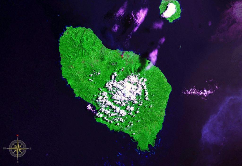
 Space Shuttle image of Umboi Island (north to upper right). | |
 Umboi Island | |
| Geography | |
|---|---|
| Coordinates | 5°32′S 147°52′E |
| Archipelago | Bismarck Archipelago |
| Highest elevation | 1,335 m (4380 ft) |
| Highest point | Mount Talo |
| Administration | |
Papua New Guinea | |
| Province | Morobe Province |
Languages are Papuan Kobai; and Austronesian: Mbula, Karanai, and Saveng languages.
The Siassi Archipelago lies off the southeast coast of Umboi Island (a total of 18 islands, only seven are inhabited). During the mid-1920s, the population of the Siassi Islands was a little over 700 people. It had more than doubled (to almost 1700 people) by the early 1960s, and then decreased to a little more than 1600 people by the early 1980s. The Siassi support themselves through traditional trade based on a barter system; they are important middlemen who deliver pigs, pots and wooden bowls by sea in their canoes.[1]
See also
References
- "Umboi". Global Volcanism Program. Smithsonian Institution. Retrieved 2021-06-25.
Authority control | |
|---|---|
| General |
|
| Other | |
This Morobe Province geography article is a stub. You can help Wikipedia by expanding it. |
На других языках
[de] Umboi
Umboi (deutsch veraltet: Ruk Insel[1] bzw. englisch Rook Island[2]) ist eine Vulkaninsel in der Morobe Province von Papua-Neuguinea. Sie liegt zwischen dem Festland von Neuguinea und der Insel Neubritannien und gehört zum Distrikt Tewai-Siassi. In den 1850er Jahren fanden auf der Insel die ersten christlichen Missionsversuche im heutigen Papua-Neuguinea überhaupt statt.- [en] Umboi Island
[fr] Umboi
Umboi est une île volcanique de Papouasie-Nouvelle-Guinée, dont le sommet le plus élevé est placé à 1 548 m.[it] Umboi
Umboi (nota anche come Rooke o Siassi) è un'isola vulcanica di Papua Nuova Guinea.[ru] Умбой
Умбой (англ. Umboi Island) — вулканический остров в Тихом океане у северного берега государства Папуа — Новой Гвинеи. Административно входит в состав провинции Моробе региона Момасе.Другой контент может иметь иную лицензию. Перед использованием материалов сайта WikiSort.org внимательно изучите правила лицензирования конкретных элементов наполнения сайта.
WikiSort.org - проект по пересортировке и дополнению контента Википедии