geo.wikisort.org - Island
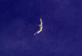
Ritter Island is a small crescent-shaped volcanic island 100 kilometres (62 mi) north-east of New Guinea, situated between Umboi Island and Sakar Island.
| Ritter Island | |
|---|---|
 Ritter Island in 2004 | |
| Highest point | |
| Elevation | 140 m (460 ft) |
| Prominence | 140 m (460 ft) |
| Coordinates | 5°31′S 148°07′E |
| Geography | |
| Location | Papua New Guinea |
| Geology | |
| Mountain type | Stratovolcano |
| Last eruption | May 2007 |
There are several recorded eruptions of this basaltic-andesitic stratovolcano prior to a spectacular lateral collapse which took place in 1888. Before that event, it was a circular conical island about 780 metres (2,560 ft) high.[1]
1888 eruption
At about 5:30 am local time on 13 March 1888 a large portion of the island, containing perhaps 5 km3 (1.2 cu mi) of material slid into the sea during a relatively minor, possibly VEI 2,[2] phreatic eruption. Eyewitnesses at Finschhafen, 100 km (62 mi) to the south, heard explosions and observed an almost imperceptible ash fall.[3] Tsunamis 12–15 metres (40–50 ft) high were generated by the collapse and devastated nearby islands and the adjacent New Guinea coast killing around 3000 people.[4]
The collapse left a 140-metre (460 ft) high, 1,900-metre (6,200 ft) long crescent-shaped island with a steep west-facing escarpment. At least two small eruptions have occurred offshore since 1888, one in 1972 and another in 1974, which have resulted in the construction of a small submarine edifice within the collapse scar.[3]
See also
- List of volcanic eruption deaths
- List of volcanoes in Papua New Guinea
References
- "Ritter Island". Global Volcanism Program. Smithsonian Institution. Retrieved 2009-04-28.
- "Ritter Island: Eruptive History". Global Volcanism Program. Smithsonian Institution. Retrieved 2009-04-28.
- Ward, S.N. & Day, S. (2003). "Ritter Island Volcano—lateral collapse and the tsunami of 1888" (PDF). Geophysical Journal International. 154 (3): 891–902. Bibcode:2003GeoJI.154..891W. doi:10.1046/j.1365-246X.2003.02016.x. Retrieved 2007-06-11.
- Ritter Island at Volcano World
На других языках
[de] Ritter-Insel
Die Ritter-Insel (bis 1880 auch Volcano Island) ist eine kleine halbmondförmige vulkanische Insel 100 km nordöstlich von Neuguinea, benannt nach dem deutschen Geographen Carl Ritter. Sie befindet sich zwischen den Siassi-Inseln Umboi und Sakar und gehört zu Papua-Neuguinea.- [en] Ritter Island
[fr] Ritter (île)
Ritter, en anglais Ritter Island, est une île volcanique de Papouasie-Nouvelle-Guinée. En forme de croissant, elle se trouve à environ cent kilomètres au nord-est de la Nouvelle-Guinée, entre l'île Umboi, l'île Sakar et la Nouvelle-Bretagne, dans le détroit de Dampier.[it] Ritter (isola)
L'isola di Riitter è un'isola vulcanica della Papua Nuova Guinea, che si trova in mezzo alle isole di Umboi, Sakar e Nuova BritanniaДругой контент может иметь иную лицензию. Перед использованием материалов сайта WikiSort.org внимательно изучите правила лицензирования конкретных элементов наполнения сайта.
WikiSort.org - проект по пересортировке и дополнению контента Википедии