geo.wikisort.org - Insel
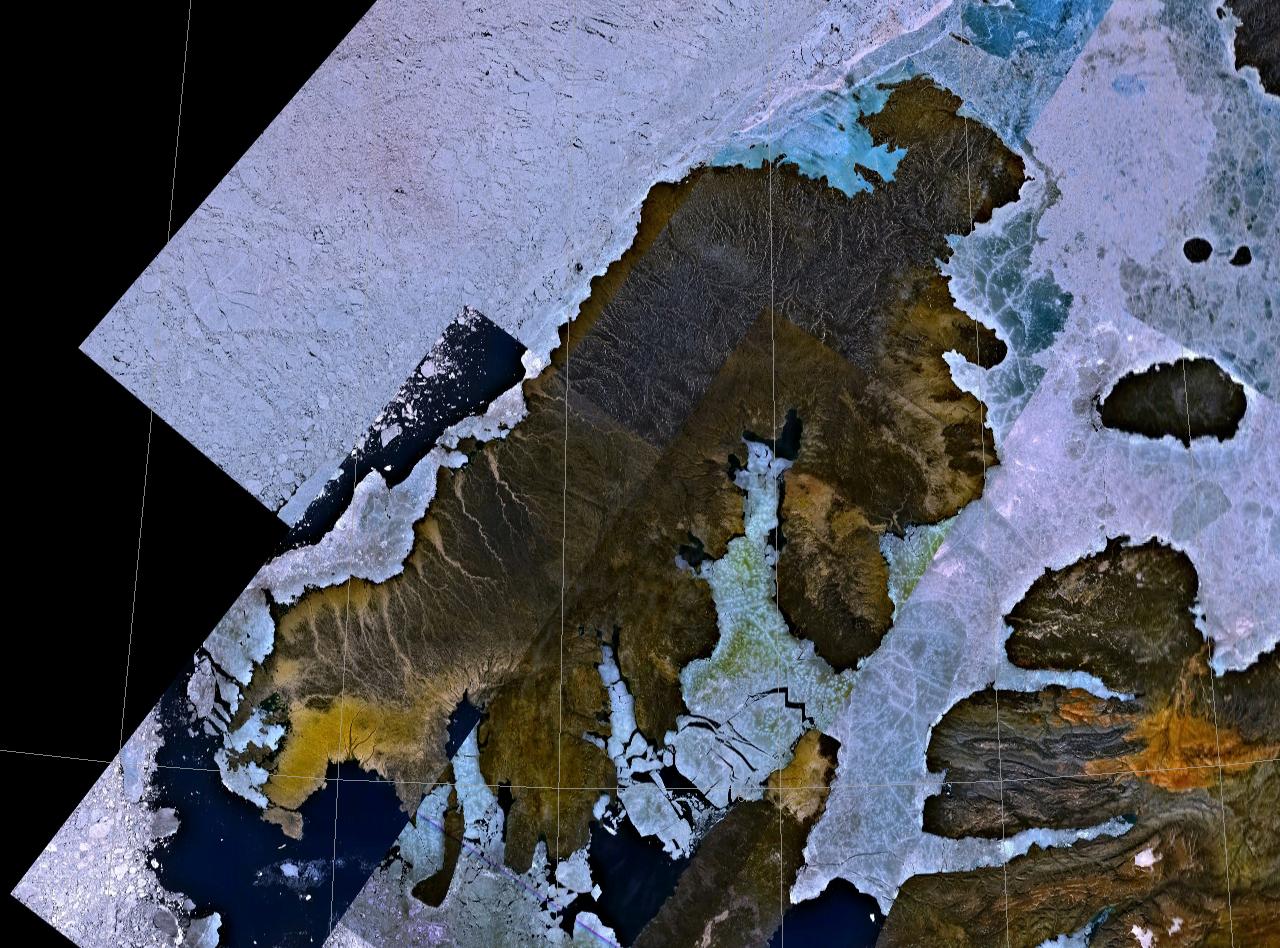
Die Prince Patrick Island ist die westlichste Insel der Königin-Elisabeth-Inseln und liegt in den Nordwest-Territorien Kanadas. Die unbewohnte Insel ist 240 km lang, 30–80 km breit und nur 150–200 m hoch. Sie hat eine Fläche von 15.848 km²[1] und nimmt damit unter den größten Inseln Kanadas Platz 14, unter den größten Inseln der Erde Platz 55 ein.
| Prince Patrick Island | |
|---|---|
 | |
| Gewässer | Arktischer Ozean |
| Inselgruppe | Königin-Elisabeth-Inseln |
| Geographische Lage | 76° 38′ N, 119° 51′ W |
 | |
| Länge | 240 km |
| Breite | 80 km |
| Fläche | 15.848 km² |
| Höchste Erhebung | (unbenannt) 279 m |
| Einwohner | unbewohnt |
| Hauptort | (Mould Bay) |
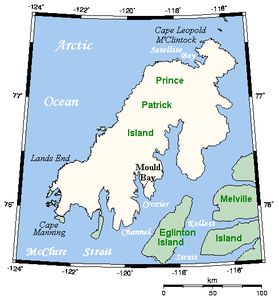 | |
Von Melville Island im Südosten ist sie durch die Kellett-Straße und die Fitzwilliam-Straße getrennt, von der Banksinsel im Süden durch die McClure-Straße.
Sie wurde 1853 unabhängig voneinander von George Frederick Mecham (1828–1858) und Francis Leopold McClintock entdeckt und erforscht. Benannt wurde sie nach Prince Arthur William Patrick, von 1911 bis 1916 Generalgouverneur von Kanada.
Mould Bay
Mould Bay ist eine (bis 1995 bemannte, heute automatische) kanadische Wetterstation auf der Insel und liegt auf 76° 15′ nördlicher Breite und 119° 30′ westlicher Länge.
Farquharson et al. veröffentlichten 2019 einen wissenschaftlichen Artikel über den Rückgang des Permafrostbodens an drei Messstationen, darunter die Wetterstation Mould Bay, in der kanadischen Hocharktis zwischen 2003 und 2017.[2] Den Autoren zufolge sackte der Boden an der Wetterstation im untersuchten Zeitraum um rund 90 Zentimeter ab. Der Grund für diese Entwicklung scheint das Antauen des Dauerfrostbodens zu sein; die Permafrosttafel verschiebt sich durch die gehäuft auftretenden überdurchschnittlich warmen Sommer zu immer größeren Tiefen, da der sommerliche Auftauboden eine begrenzte Wärmepufferkapazität aufweist und so den Dauerfrostboden schlecht gegenüber steigenden Temperaturen isoliert.[2]
Weblinks
Einzelnachweise
- The Atlas of Canada – Queen Elizabeth Islands (Memento vom 22. Januar 2013 im Internet Archive) (englisch)
- Louise M. Farquharson, Vladimir E. Romanovsky, William L. Cable, Donald A. Walker, Steven Kokelj, Dimitry Nicolsk: Climate change drives widespread and rapid thermokarst development in very cold permafrost in the Canadian High Arctic. In: Geophysical Research Letters. Juni 2019, doi:10.1029/2019GL082187.
На других языках
- [de] Prince Patrick Island
[en] Prince Patrick Island
A member of the Arctic Archipelago, Prince Patrick Island is the westernmost of the Queen Elizabeth Islands in the Northwest Territories of Canada, lying northwest of Melville Island. The area of Prince Patrick Island is 15,848 km2 (6,119 sq mi),[1] making it the 55th largest island in the world and Canada's 14th largest island. It has historically been icebound all year, making it one of the least accessible parts of Canada. Located at the entrance of the M'Clure Strait, Prince Patrick Island is uninhabited.[es] Isla del Príncipe Patrick
La isla del Príncipe Patrick es isla más occidental del archipiélago de las islas de la Reina Isabel. Administrativamente, pertenece a los Territorios del Noroeste, Canadá.[fr] Île du Prince-Patrick
L’île du Prince-Patrick, située dans le passage du Nord-Ouest, est l’île la plus occidentale des îles de la Reine-Élisabeth, dans l'archipel arctique canadien. Son littoral nord-ouest borde directement l'océan Arctique. L'île appartient aux Territoires du Nord-Ouest, un territoire du Canada. Elle a été explorée pour la première fois en 1853, puis nommée en l’honneur du prince Arthur William Patrick, duc de Connaught, qui était gouverneur général du Canada de 1911 à 1916. La superficie de l’île est de 15 848 km2, faisant d'elle la 55e plus grande île au monde et la 14e plus grande île du Canada. Elle se trouve dans une zone sismique. Elle est inhabitée.[it] Isola del Principe Patrizio
L’isola del Principe Patrizio[1] (in inglese Prince Patrick Island) appartiene all'arcipelago artico canadese, ed è la più occidentale delle isole Regina Elisabetta nel territorio canadese dei Territori del Nord-Ovest. L'isola ha una superficie di 15.848 km², il che la rende la 55ª isola più grande del mondo e la 14ª del Canada. È coperta dai ghiacci per tutto l'anno, il che la rende una delle regioni più inaccessibili del Canada.[ru] Принс-Патрик
Принс-Патрик (англ. Prince Patrick Island) — остров в составе Канадского Арктического архипелага, принадлежит Канаде, самый западный из группы островов Королевы Елизаветы, относится к Северо-западным территориям Канады. Остров Принс-Патрик необитаем (2012).Другой контент может иметь иную лицензию. Перед использованием материалов сайта WikiSort.org внимательно изучите правила лицензирования конкретных элементов наполнения сайта.
WikiSort.org - проект по пересортировке и дополнению контента Википедии