geo.wikisort.org - Island
Alexander Island, which is also known as Alexander I Island, Alexander I Land, Alexander Land, Alexander I Archipelago, and Zemlja Alexandra I, is the largest island of Antarctica. It lies in the Bellingshausen Sea west of Palmer Land, Antarctic Peninsula from which it is separated by Marguerite Bay and George VI Sound. The George VI Ice Shelf entirely fills George VI Sound and connects Alexander Island to Palmer Land. The island partly surrounds Wilkins Sound, which lies to its west.[1] Alexander Island is about 390 kilometres (240 mi) long in a north–south direction, 80 kilometres (50 mi) wide in the north, and 240 kilometres (150 mi) wide in the south.[2] Alexander Island is the second-largest uninhabited island in the world, after Devon Island.
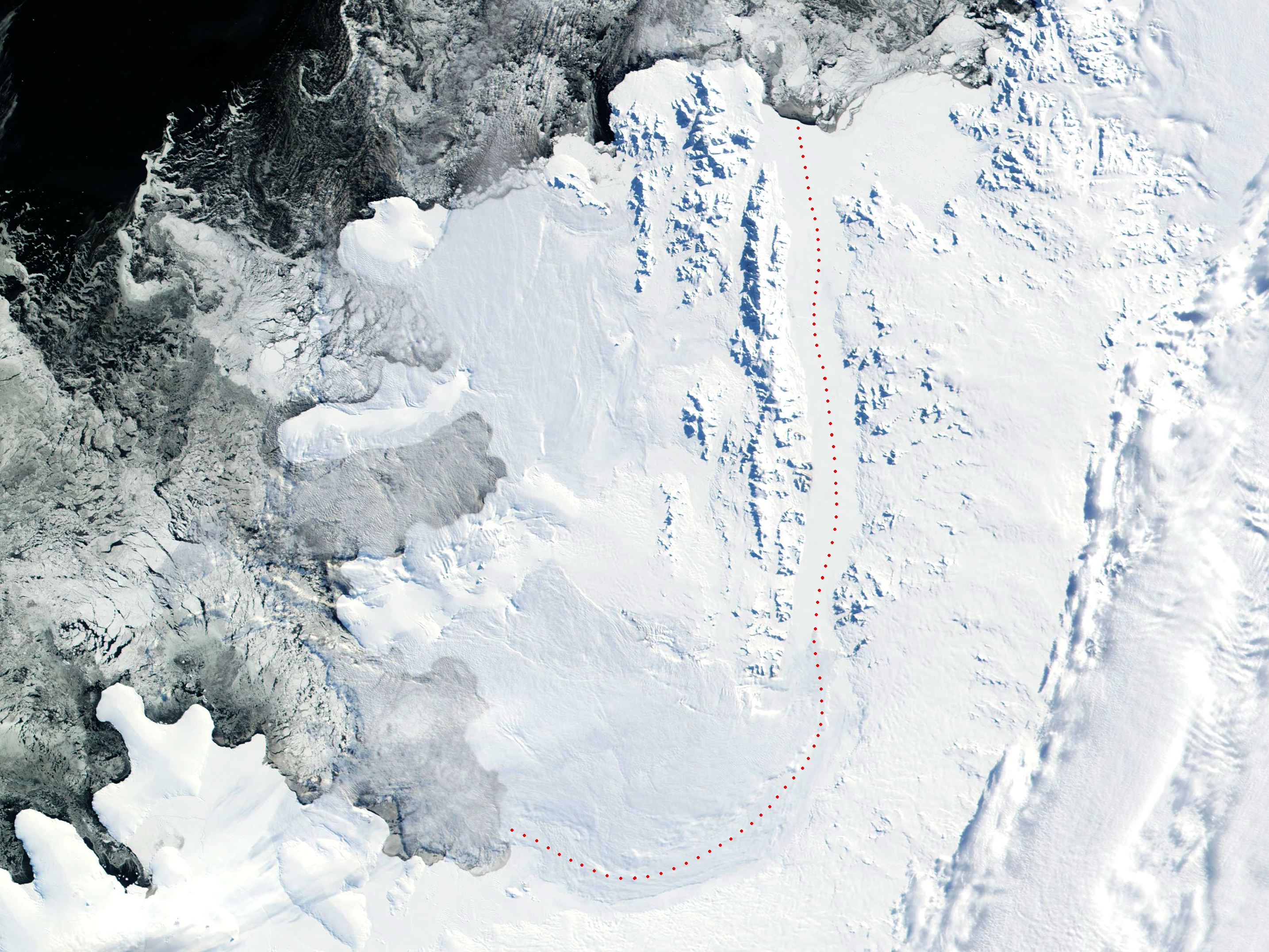
 Alexander Island shown within Antarctica | |
 Alexander Island | |
| Geography | |
|---|---|
| Location | Antarctica |
| Coordinates | 71°00′S 70°00′W |
| Area | 49,070 km2 (18,950 sq mi) |
| Area rank | 28th |
| Length | 390 km (242 mi) |
| Width | 80 km (50 mi) |
| Highest elevation | 2,987 m (9800 ft) |
| Highest point | Mount Stephenson |
| Administration | |
| Administered under the Antarctic Treaty System | |
| Demographics | |
| Population | 0 |
History
Alexander Island was discovered on January 28, 1821, by a Russian expedition under Fabian Gottlieb von Bellingshausen, who named it Alexander I Land for the reigning Tsar Alexander I of Russia.
What, in fact, is an island, was believed to be part of the Antarctic mainland until 1940. Its insular nature was proven in December 1940, by a two-person sledge party composed of Finn Ronne and Carl Eklund of the United States Antarctic Service.[2][3] In the 1950s, a British base administered as part of the British Antarctic Territory was constructed as Fossil Bluff (Base KG).[4]
The island was claimed by the United Kingdom in 1908 as part of the British Antarctic Territory. Territorial claims have also been set by both Chile (in 1940) and Argentina (in 1942).[5] Currently, under the Antarctic Treaty no claim has been officially recognized. The island contains the British Fossil Bluff meteorological centre and refuelling base.[6]
Geography

The surface of Alexander Island is predominantly ice-covered. There exist some exposed nunataks and a few ice-free areas of significant size, including Ablation Point Massif. The nunataks are the peaks of north–south trending mountain ranges and hills. They include the Colbert, Havre, Lassus, Rouen, Sofia University, and Walton Mountains, the Staccato Peaks, the Lully Foothills, the Finlandia Foothills, the Elgar Uplands, and the Douglas Range. These mountains, peaks, hills, and uplands are surrounded by a permanent ice sheet, which consists of glaciers that flow off of Alexander Island. These glaciers flow west into the Bach and Wilkins Ice Shelves and Bellingshausen Sea, and east into the George VI Ice Shelf. The George VI Ice Shelf is fed by both by outlet glaciers from the ice cap on Palmer Land and Alexander Island.[1][2][7]
Another notable feature of Alexander Island is Hodgson Lake. Hodgson Lake is a former subglacial lake that has emerged from under an ice sheet that had covered it. Hodgson Lake is 2 km (1.2 mi) long by 1.5 km (0.93 mi), and has a 93.4 m (306 ft) deep water column that lies sealed beneath a 3.6 to 4.0 m (11.8 to 13.1 ft) thick perennial lake ice.
The northern side of Hodgson Lake is bounded by the Saturn Glacier, which flows east into George VI Sound, while the southern side of Hodgson Lake is bounded by the northern face of Citadel Bastion. During the Last Glacial Maximum, Hodgson Lake was covered by the ice sheet at least 470 m (1,540 ft) thick.
This ice sheet started thinning about 13,500 years ago. It retreated and left Hodgson Lake covered by perennial ice sometime before 11,000 years ago. This lake has been covered by perennial ice since that time.[8][9]
Other features on the island include Damocles Point[10] and Mount Tyrrell.
Brahms Inlet
Brahms Inlet (71°28′S 73°41′W) is an ice-filled inlet, 25 nautical miles (46 km) long and 6 nautical miles (11 km) wide, indenting the north side of Beethoven Peninsula on Alexander Island between Harris Peninsula and Derocher Peninsula, while the headland Mazza Point lies immediately northeast of the inlet and Mount Grieg lies immediately southeast of the base of Brahms Inlet. It was observed from the air and first mapped by the Ronne Antarctic Research Expedition (RARE), 1947–48, and re-mapped from the RARE air photos by Derek J.H. Searle of the Falkland Islands Dependencies Survey in 1960. It was named by the UK Antarctic Place-Names Committee after Johannes Brahms, the German composer.[11]
Harris Peninsula
Harris Peninsula (71°31′S 74°6′W) is a broad snow-covered peninsula surmounted by Mount Lee, between Verdi Inlet and Brahms Inlet on the north side of the Beethoven Peninsula, located in the southwest portion of Alexander Island, Antarctica. It is one of eight peninsulas of Alexander Island. It was photographed from the air by the RARE, 1947–48, and mapped from these photographs by D. Searle of the Falkland Islands Dependencies Survey, 1960. It was named by the Advisory Committee on Antarctic Names for Commander Michael J. Harris, U.S. Navy, Commanding Officer of Squadron VXE-6, from May 1982 to May 1983.[12]
Lyadov Glacier
Lyadov Glacier (71°32′00″S 73°45′00″W) is a glacier flowing east-northeast from Harris Peninsula, Alexander Island, into Brahms Inlet. It was named by the USSR Academy of Sciences in 1987 after Anatoly Lyadov (1855–1914), a Russian composer.
Geology


According to Hole, "The geology of Alexander Island can be attributed mainly to processes associated with the subduction of proto-Pacific oceanic crust along the western margin of the Antarctic Peninsula, from latest Triassic to Late Tertiary times." The LeMay Group accretionary prism complex, along with plutonic and volcanic rocks, are prevalent along the western portion of the island. The LeMay Group consists of variably-deformed and metamorphosed sedimentary and igneous rocks. Although it is dominated by deformed arkosic sedimentary rocks, it includes turbiditic greywackes, black mudstones, and conglomerates. The 4 kilometers (2.5 miles) thick Upper Jurassic to Lower Cretaceous Fossil Bluff Group sedimentary rocks outcrop as a 250 kilometers (160 miles) long by 30 kilometers (19 miles) wide belt along the eastern coast. This Fossil Bluff Group consists of a basal deep-marine assemblage 2,200 meters (7,200 feet) thick, overlain by a mudstone assemblage up to 950 meters (3,120 feet) thick, followed by a shallow-marine assemblage of coarsening upward sandstones. Alkali basalts erupted after the cessation of subduction. These range in age from the tephrites at Mount Pinafore (5.5–7.6 Ma), to the basanites at Rothschild Island (5.5 Ma) and Hornpipe Heights (2.5 Ma), to the alkali and olivine basalts on Beethoven Peninsula (<1-2.5 Ma).[13][14][15][16][17][18][19][20]
The LeMay Range Fault trends N-S, parallel to the George VI Sound, and the Fossil Bluff Formation is downfaulted to the east of this fault against the LeMay Group. Sand dykes are found against this fault zone and in many other parts of the Fossil Bay Formation. Fossils within the Fossil Bluff Formation include ammonites, belemnites, bivalves, and serpulids.[16]
See also
- Adelaide Island
- Argentine Antarctica
- British Antarctic Territory
- Chilean Antarctic Territory
- Composite Antarctic Gazetteer
- Geology of the Antarctic Peninsula
- List of Antarctic islands south of 60° S
- List of Bulgarian toponyms in Antarctica
- Peel Cirque
- Scarab Bluff
- SCAR
- Territorial claims in Antarctica
- Witt Bluff
![]() Islands portal
Islands portal
![]() Geography portal
Geography portal
References
- Stewart, J. (2011) Antarctic An Encyclopedia McFarland & Company Inc, New York. 1776 pp. ISBN 9780786435906.
- U.S. Geological Survey Geographic Names Information System: Alexander Island
- Siple, Paul (1963). "Obituary: Carl R. Eklund, 1909–1962" (PDF). Arctic. Arctic Institute of North America. 16 (2): 147–148. doi:10.14430/arctic3531. Retrieved 19 January 2013.
- HANDLIST OF METEOROLOGY RECORDS FROM BRITISH ANTARCTIC RESEARCH STATIONS. British Antarctic Survey Archives Service (2010)
- "Alexander Island". Encyclopædia Britannica. 20 July 1998. Retrieved 20 January 2015.
- Mills, William (2003). Exploring Polar Frontiers: A Historical Encyclopedia (1 ed.). p. 9. ISBN 1-57607-422-6. Retrieved 20 January 2015.
- Smith, James A.; Bentley, Michael J.; Hodgson, Dominic A.; Cook, Alison J. (2007). "George VI Ice Shelf: Past history, present behaviour and potential mechanisms for future collapse". Antarctic Science. 19 (1): 131–142. Bibcode:2007AntSc..19..131S. doi:10.1017/S0954102007000193. S2CID 128840101.
- Hodgson, Dominic A.; Roberts, Stephen J.; Bentley, Michael J.; Smith, James A.; Johnson, Joanne S.; Verleyen, Elie; Vyverman, Wim; Hodson, Andy J.; Leng, Melanie J.; Cziferszky, Andreas; Fox, Adrian J.; Sanderson, David C.W. (2009). "Exploring former subglacial Hodgson Lake, Antarctica Paper I: Site description, geomorphology and limnology". Quaternary Science Reviews. 28 (23–24): 2295–2309. Bibcode:2009QSRv...28.2295H. doi:10.1016/j.quascirev.2009.04.011.
- Hodgson, Dominic A.; Roberts, Stephen J.; Bentley, Michael J.; Carmichael, Emma L.; Smith, James A.; Verleyen, Elie; Vyverman, Wim; Geissler, Paul; Leng, Melanie J.; Sanderson, David C.W. (2009). "Exploring former subglacial Hodgson Lake, Antarctica. Paper II: Palaeolimnology". Quaternary Science Reviews. 28 (23–24): 2310–2325. Bibcode:2009QSRv...28.2310H. doi:10.1016/j.quascirev.2009.04.014.
-
 This article incorporates public domain material from the United States Geological Survey document: "Alexander Island". (content from the Geographic Names Information System)
 - "Brahms Inlet". Geographic Names Information System. United States Geological Survey, United States Department of the Interior. Retrieved 15 August 2011.
- "Harris Peninsula". Geographic Names Information System. United States Geological Survey, United States Department of the Interior. Retrieved 24 May 2012.
- Hole, M.J.; Smellie, J.L.; Marriner, G.F. (1991). Thomson, M.R.A.; Crame, J.A.; Thomson, J.W. (eds.). Geochemistry and tectonic setting of Cenozoic alkalne basalts from Alexander Island, Antarctic Peninsula, in Geological Evolution of Antarctica. Cambridge: Cambridge University Press. pp. 521–522. ISBN 9780521372664.
- Butterworth, P.J.; Macdonald, D.I.M. (1991). Thomson, M.R.A.; Crame, J.A.; Thomson, J.W. (eds.). Basin shallowing from the Mesozoic Fossil Bluff Group of Alexander Island and its regional tectonic significance, in Geological Evolution of Antarctica. Cambridge: Cambridge University Press. pp. 449–453. ISBN 9780521372664.
- Tranter, T.H. (1991). Thomson, M.R.A.; Crame, J.A.; Thomson, J.W. (eds.). Accretion and subduction processes along the Pacific margin of Gondwana, central Alexander Island, in Geological Evolution of Antarctica. Cambridge: Cambridge University Press. pp. 437–441. ISBN 9780521372664.
- Nell, P.A.R.; Storey, B.B. (1991). Thomson, M.R.A.; Crame, J.A.; Thomson, J.W. (eds.). Strike-slip tectonics within the Antarctic Peninsula fore-arc, in Geological Evolution of Antarctica. Cambridge: Cambridge University Press. pp. 443–448. ISBN 9780521372664.
- Macdonald, D.I.M. and P.J. Butterworth (1990) "The stratigraphy, setting and hydrocarbon potential of the Mesozoic sedimentary basins of the Antarctic Peninsula." in B. John, ed., pp. 101–125. Antarctica as an exploration frontier; hydrocarbon potential, geology, and hazards. AAPG Studies in Geology. vol. 31 American Association of Petroleum Geologists, Tulsa, Oklahoma. doi:10.1306/St31524C8
- MacDonald; Leat; Doubleday; Kelly (1999). "On the origin of fore-arc basins: New evidence of formation by rifting from the Jurassic of Alexander Island, Antarctica". Terra Nova. 11 (4): 186–193. Bibcode:1999TeNov..11..186M. doi:10.1046/j.1365-3121.1999.00244.x. S2CID 128675340.
- Vaughan, Alan P. M.; Storey, Bryan C. (2000). "The eastern Palmer Land shear zone: A new terrane accretion model for the Mesozoic development of the Antarctic Peninsula". Journal of the Geological Society. 157 (6): 1243–1256. Bibcode:2000JGSoc.157.1243V. doi:10.1144/jgs.157.6.1243. S2CID 128496050.
- McCarron, J. J.; Smellie, J. L. (1998). "Tectonic implications of fore-arc magmatism and generation of high-magnesian andesites: Alexander Island, Antarctica". Journal of the Geological Society. 155 (2): 269–280. Bibcode:1998JGSoc.155..269M. doi:10.1144/gsjgs.155.2.0269. S2CID 129620018.
- This article incorporates public domain material from the United States Geological Survey document: "Brahms Inlet". (content from the Geographic Names Information System)
- This article incorporates public domain material from the United States Geological Survey document: "Harris Peninsula". (content from the Geographic Names Information System)
- This article incorporates public domain material from the United States Geological Survey document: "Liadov Glacier". (content from the Geographic Names Information System)
Antarctica | ||||||||
|---|---|---|---|---|---|---|---|---|
| Geography |
|  | ||||||
| History |
| |||||||
| Politics |
| |||||||
| Society |
| |||||||
| Famous explorers |
| |||||||
| ||||||||
| 100,000 km2 (39,000 sq mi) and greater |
| |
|---|---|---|
| 20,000–99,999 km2 (7,722–38,610 sq mi) |
| |
Authority control | |
|---|---|
| General |
|
| National libraries | |
На других языках
[de] Alexander-I.-Insel
Die Alexander-I.-Insel (analog zum Englischen auch Alexanderinsel genannt) ist mit etwa 49.000 km² Fläche die größte Insel der Antarktis. Sie liegt vor der Westküste der Antarktischen Halbinsel in der Bellingshausensee und erstreckt sich über etwa 378 km Länge und 200 km Breite. Ihre Küstenlänge beträgt etwa 2185 km. Die Insel ist durch das Schelfeis des George-VI-Sunds mit dem Kontinent Antarktis verbunden und daher auf Satellitenfotos nur schwer als Insel zu erkennen. Tatsächlich liegt sie nur ca. 20 km vor der antarktischen Küste, von der sie durch den George-VI-Sund getrennt wird. Das Klima auf der Alexander-I.-Insel ist entsprechend ihrer geografischen Lage polar und sie ist praktisch vollständig vereist.- [en] Alexander Island
[es] Isla Alejandro I
La isla Alejandro I es una gran isla de la Antártida ubicada al sureste del mar de Bellingshausen y suroeste de la península Antártica (costas Rymill y English), de la que está separada por la bahía Margarita y el canal Sarmiento (denominado canal Jorge VI por Inglaterra), casi todo el año cubierto por hielo permanente por la barrera de hielo Sarmiento. Tiene forma de cucharón y unos 440 kilómetros entre sus extremos norte y sur, y unos 250 kilómetros de ancho. Su área de 43 250 km² la convierten en la mayor isla de la Antártida, la mayor de las islas de las Antillas del Sur y la 28ª isla del mundo.[fr] Île Alexandre-Ier
L'île Alexandre-Ier, appelée aussi île ou terre Alexandre, est la plus grande île de l'Antarctique.[it] Isola Alessandro I
L'isola Alessandro I è la più grande isola dell'Antartide, con un'area di 49070 km². È situata nel mare di Bellingshausen, ad ovest della penisola Antartica, dalla quale è separata dalla baia Margherita e dal canale di Giorgio VI, ed è collegata alla costa antartica soltanto da una piattaforma di ghiaccio.[ru] Земля Александра I
Земля Александра I (Остров Александра I) — крупнейший остров Антарктики, площадью 43 250 км². Он расположен в море Беллинсгаузена к западу от Земли Палмера, Антарктического полуострова, от которого он отделён заливом Маргариты[en] и проливом Георга VI. Шельфовый ледник Георга VI[en] полностью заполняет пролив Георга VI и соединяет Землю Александра I с Землёй Палмера. Остров частично окружён проливом Уилкинса[en], который расположен к западу от него[1]. Земля Александра I имеет длину около 390 километров (240 миль) в направлении север-юг, 80 километров (50 миль) в ширину на севере и 240 километров (150 миль) в ширину на юге[2]. Земля Александра I является вторым по величине необитаемым островом в мире после острова Девон.Другой контент может иметь иную лицензию. Перед использованием материалов сайта WikiSort.org внимательно изучите правила лицензирования конкретных элементов наполнения сайта.
WikiSort.org - проект по пересортировке и дополнению контента Википедии