geo.wikisort.org - Mountains
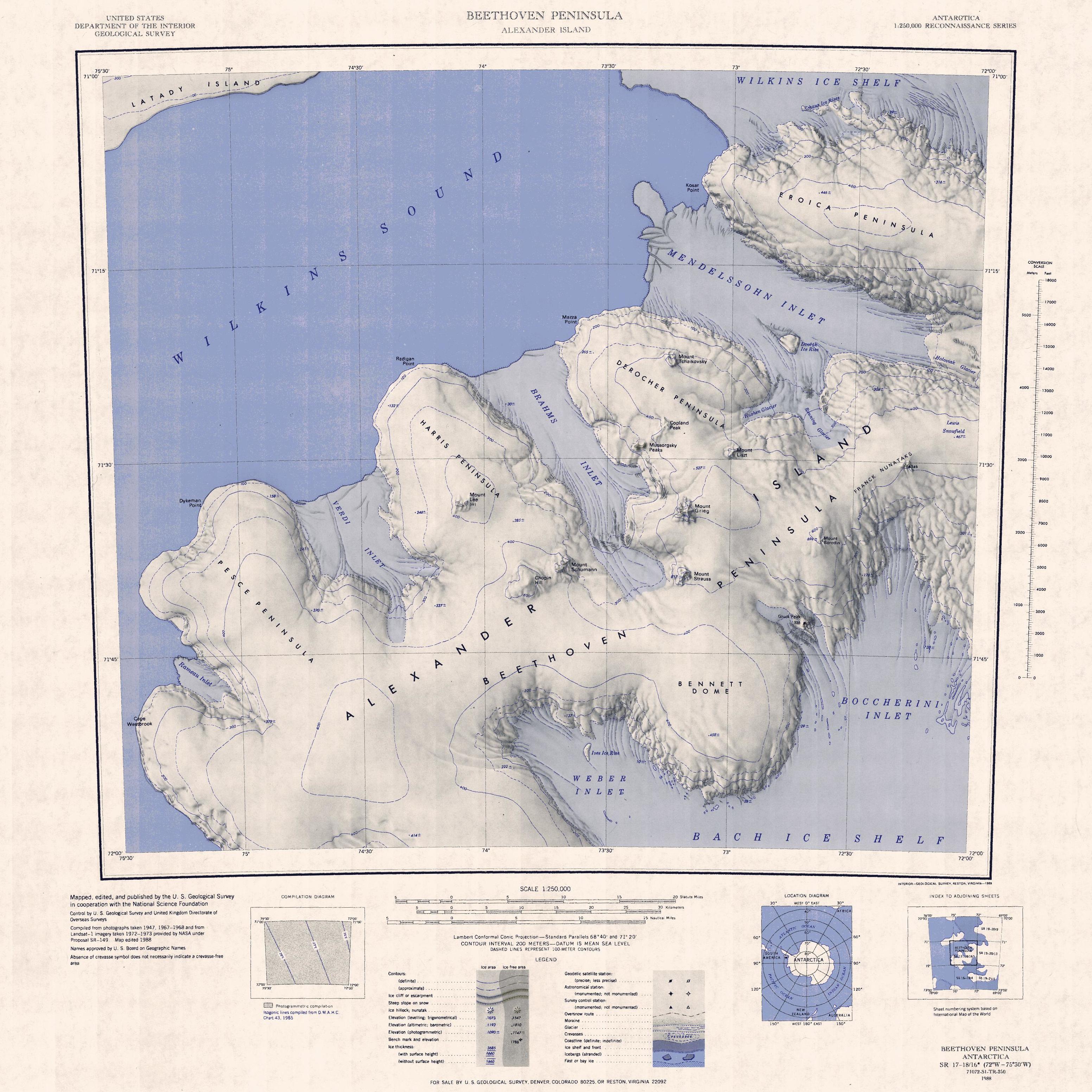
Mount Grieg is a snow-covered mountain, rising to about 800 metres (2,600 ft), with a rock-exposed west face, overlooking the southeast part of Brahms Inlet and is situated on the base of the Derocher Peninsula, on the north side of the Beethoven Peninsula in the southwest part of Alexander Island, Antarctica. A number of mountains in this vicinity first appear on maps by the Ronne Antarctic Research Expedition (RARE), 1947–48. This mountain, apparently one of these, was mapped from RARE air photos by Derek J.H. Searle of the Falkland Islands Dependencies Survey in 1960, and was remapped by the United States Geological Survey, 1988. It was named by the UK Antarctic Place-Names Committee after Edvard Grieg, the Norwegian composer.[1]
See also
Further reading
- J.L. SMELLIE, Lithostratigraphy of Miocene-Recent, alkaline volcanic fields in the Antarctic Peninsula and eastern Ellsworth Land, Antarctic Science 71 (3): 362-378 (1999)
References
- "Grieg, Mount". Geographic Names Information System. United States Geological Survey, United States Department of the Interior. Retrieved 7 May 2012.
![]() This article incorporates public domain material from the United States Geological Survey document: "Grieg, Mount". (content from the Geographic Names Information System)
This article incorporates public domain material from the United States Geological Survey document: "Grieg, Mount". (content from the Geographic Names Information System)
This Alexander Island location article is a stub. You can help Wikipedia by expanding it. |
На других языках
[de] Mount Grieg
Mount Grieg ist ein verschneiter und rund 800 m hoher Berg im Südwesten der westantarktischen Alexander-I.-Insel. Er ragt mit Felsvorsprüngen an seiner Westflanke oberhalb des südöstlichen Teils des Brahms Inlet auf der Beethoven-Halbinsel auf.- [en] Mount Grieg
[fr] Mont Grieg
Le mont Grieg est une montagne recouverte de neige s'élevant à environ 800 m d'altitude, avec une face rocheuse exposée à l'ouest, située sur le côté nord de la péninsule Beethoven, dans la partie sud-ouest de l'île Alexander-Ier, en Antarctique. Un certain nombre de montagnes de cette zone sont d'abord cartographiées d'après des photographies aériennes prises pendant l'expédition Ronne (1947–48) par D. Searle du Falkland Islands Dependencies Survey puis par l'United States Geological Survey en 1988.Другой контент может иметь иную лицензию. Перед использованием материалов сайта WikiSort.org внимательно изучите правила лицензирования конкретных элементов наполнения сайта.
WikiSort.org - проект по пересортировке и дополнению контента Википедии