geo.wikisort.org - Mountains
The La Sal Mountains or La Sal Range are a mountain range located in Grand and San Juan counties in the U.S. state of Utah, along the border with Colorado. The range rises above and southeast of Moab and north of the town of La Sal. This range is part of the Manti-La Sal National Forest and the southern Rocky Mountains. The maximum elevation is at Mount Peale, reaching 12,721 feet (3,877 m) above sea level.
| La Sal Mountains | |
|---|---|
 La Sal Mountains as seen from Arches National Park | |
| Highest point | |
| Peak | Mount Peale |
| Elevation | 12,721 ft (3,877 m) |
| Coordinates | 38°26′19″N 109°13′45″W |
| Geography | |
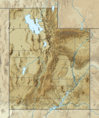 Location of the La Sal Range within Utah | |
| Country | United States |
| State | Utah |
| Range coordinates | 38°26′56″N 109°14′28″W |
| Parent range | Rocky Mountains |
The range contains three clusters of peaks separated by passes. The peaks span a distance of about 10 miles (16 km). The name of the range dates to Spanish times, when the Sierra La Sal (meaning the "Salt Mountains") was a prominent landmark on the Old Spanish Trail between Santa Fe and Los Angeles.
Geology

The range formed due to intrusion of igneous rocks and subsequent erosion of the surrounding less-resistant sedimentary rocks. The most abundant igneous rocks are porphyritic, with phenocrysts of hornblende and plagioclase: these rocks are called diorite in some accounts but trachyte in at least one other source. Syenite, some containing the unusual mineral nosean, makes up a few percent of the igneous rocks present. Some igneous intrusions have the shapes of laccoliths. The ages of these igneous rocks fall between 25 and 28 million years. The magmas were emplaced into sedimentary rocks with ages from Permian to Cretaceous.
The La Sal Mountains rise high over the surrounding Colorado Plateau. Two other ranges on the Plateau, the Abajo Mountains and the Henry Mountains, formed around igneous intrusions of about the same age. Yet other nearby ranges, such as the Carrizo Mountains and Ute Mountain, formed about otherwise similar intrusions emplaced about 70 million years ago. The formation of these igneous rocks in two distinct time intervals has attracted the interest of scientists seeking explanations for magma production below relatively stable parts of the Earth's crust.

Peaks of the La Sal Mountains

| peak name | feet/meter |
|---|---|
| Mount Peale | 12,721 feet (3,877 m) |
| Mount Mellenthin | 12,645 feet (3,854 m) |
| Mount Tukuhnikivatz | 12,482 feet (3,805 m) |
| Mount Waas | 12,331 feet (3,758 m) |
| Manns Peak | 12,272 feet (3,741 m) |
| Mount Laurel | 12,271 feet (3,740 m) |
| Mount Tomasaki | 12,239 feet (3,730 m) |
| Pilot Mountain | 12,200 feet (3,719 m) |
| Green Mountain | 12,163 feet (3,707 m) |
| Little Tuk | 12,048 feet (3,672 m) |
| Castle Peak | 12,044 feet (3,671 m) |
| La Sal Peak | 12,001 feet (3,658 m) |
See also
- Geyser Pass
References
Jules D. Friedman and A. Curtis Huffman Jr., Coordinators, Laccolith Complexes of Southeastern Utah: Time of Emplacement and Tectonic Setting—Workshop Proceedings, United States Geological Survey Bulletin 2158, 292 pages, 1998. http://pubs.usgs.gov/bul/b2158/B2158.pdf
External links
Authority control | |
|---|---|
| General |
|
| National libraries | |
На других языках
[de] La Sal Mountains
Die La Sal Mountains, auch La Sal Range, sind eine Gebirgskette im Südosten des US-Bundesstaates Utah in den Countys San Juan und Grand. Das Gebirge liegt im Manti-La Sal National Forest und ist Teil des Colorado-Plateaus. Die höchste Erhebung ist der 3877 m hohe Mount Peale neben neun weiteren Dreitausendern. Im August des Jahres 1776 entdeckten Teilnehmer der Dominguez-Escalante-Expedition am Horizont die aus der Wüste aufragenden weißen, schneebedeckten Gipfel. Da sie sich nicht vorstellen konnte, in diesem heißen, unwirtlichen Gebiet Schnee zu finden, hielten sie die weißen Kuppen für reines Salz und nannten den Gebirgszug Sierra de la Sal, also Salzige Berge. Im Jahr 1899 führte der deutsche Forscher Carl Purpus eine Expedition in die La Sal Mountains und erforschte die bis dahin noch weitgehend unbekannte Kakteenflora dieser Region.- [en] La Sal Mountains
[fr] Montagnes La Sal
Les montagnes La Sal (en anglais : La Sal Mountains ou La Sal Range) sont un massif montagneux qui s'élève à 3 877 m dans l'État de l'Utah, aux États-Unis.Другой контент может иметь иную лицензию. Перед использованием материалов сайта WikiSort.org внимательно изучите правила лицензирования конкретных элементов наполнения сайта.
WikiSort.org - проект по пересортировке и дополнению контента Википедии