geo.wikisort.org - Mountains
Naomi Peak, or Mount Naomi, is the highest peak in the Bear River Range in northern Utah and southern Idaho, United States.[4]
| Naomi Peak | |
|---|---|
 Naomi Peak, August 2016 | |
| Highest point | |
| Elevation | 9,983 ft (3,043 m) NAVD 88[1] |
| Prominence | 3,159 ft (963 m)[2] |
| Listing | Utah county high points 24th[3] |
| Coordinates | 41°54′41″N 111°40′31″W[1] |
| Geography | |
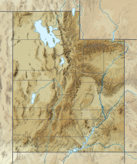 Cache County, Utah, U.S. | |
| Parent range | Bear River Mountains |
Description
The summit is located northeast of Logan, in the Mount Naomi Wilderness of the Wasatch-Cache National Forest. Several trails from the north, east, and south converge at Mount Naomi. The most traveled trail (approximately 3.3 miles (5.3 km) one way) is likely the one that starts at the Tony Grove Lake parking area just east of Naomi Peak. The road leading in to Tony Grove from U.S. Route 89 is entirely paved and easily accessible in the summer months.
See also
References
- "White". NGS data sheet. U.S. National Geodetic Survey. Retrieved 2013-01-24.
- "Naomi Peak, Utah". Peakbagger.com. Retrieved 2013-01-24.
- "Utah County High Points". Peakbagger.com. Retrieved 2016-04-23.
- U.S. Geological Survey Geographic Names Information System: Naomi Peak
External links
Wikimedia Commons has media related to Naomi Peak.
- Naomi Peak. SummitPost.
This article about a location in Utah is a stub. You can help Wikipedia by expanding it. |
Текст в блоке "Читать" взят с сайта "Википедия" и доступен по лицензии Creative Commons Attribution-ShareAlike; в отдельных случаях могут действовать дополнительные условия.
Другой контент может иметь иную лицензию. Перед использованием материалов сайта WikiSort.org внимательно изучите правила лицензирования конкретных элементов наполнения сайта.
Другой контент может иметь иную лицензию. Перед использованием материалов сайта WikiSort.org внимательно изучите правила лицензирования конкретных элементов наполнения сайта.
2019-2026
WikiSort.org - проект по пересортировке и дополнению контента Википедии
WikiSort.org - проект по пересортировке и дополнению контента Википедии